
Lower Wekiva River Preserve State Park
| Lower Wekiva River Preserve State Park | |
|---|---|
IUCN category V (protected landscape/seascape) | |
  | |
| Location | Lake and Seminole counties, Florida, United States |
| Nearest city | Sanford, Florida |
| Coordinates | 28°52′01″N 81°22′05″W / 28.86694°N 81.36806°W |
| Area | 18,000 acres (7,300 ha) |
| Governing body | Florida Department of Environmental Protection |
Lower Florida State Park located on six miles (10 km) of the St. Johns River in Lake and Seminole counties. The park forms a wildlife corridor to the Ocala National Forest along the Wekiva and St. Johns Rivers.

Fauna
Among the wildlife of the park are black bears, river otters, alligators, wood storks, and sandhill cranes.
The park
There are two sections to the park, north and south. The northern section's entrance is in
S.R. 46 nine miles (14 km) west of Sanford, provides access to 5,000 acres (2,000 ha) of the park. There is no horseback riding
in this part of the park.
Neither section provides water access. Although canoeists can travel the Wekiva River through the park, they must launch from outside.
Recreational activities
Activities include equestrian camping,
biking, canoeing, hiking, and wildlife viewing. Amenities include horse stalls
and corrals and 18 miles (29 km) of multiuse trails.
Hours
Florida state parks are open between 8 a.m. and sundown every day of the year (including holidays).
Gallery
-
 Park sign on SR 46
 -
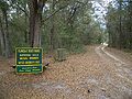 Path into the park, off SR 46


References and external links
- Lower Wekiva River Preserve State Park at Florida State Parks
- Lower Wekiva River State Preserve at State Parks
- Lower Wekiva River State Preserve at Absolutely Florida
- Lower Wekiva River State Preserve at Wildernet