
Lumbini Province
Lumbini Province
Lumbini Pradesh | |
|---|---|
| - transcription(s) | |
| • Nepali | लुम्बिनी प्रदेश Lumbinī pradēśa |
      From Top left to right Eastern Rukum, Ranighat Palace in Palpa, Bageshwori Temple and a Bengal tiger at Bardiya National Park | |
 Seal | |
 Location of Lumbini Province | |
Divisions of Lumbini | |
| Coordinates: 27°39′33.13″N 83°26′18.3″E / 27.6592028°N 83.438417°E | |
GDP | 5 billion USD |
| GDP rank | 3rd |
| Website | http://ocmcm.p5.gov.np/ |

Lumbini Province (
Lumbini borders Gandaki Province and Karnali Province to the north, Sudurpashchim Province to the west, and Uttar Pradesh and Bihar of India to the south. Lumbini's capital, Deukhuri, is near the geographic center of the province; it is a small town which is currently being developed to meet the prerequisite of a provincial capital. The major cities in the province are Butwal and Siddharthanagar in Rupandehi district, Nepalgunj in Banke district, Tansen in Palpa district, and Ghorahi and Tulsipur in Dang district.
Etymology
The Lumbini province is named after the holy
History
Pre-history
The Churiya range linked with the
Shakya-era
As per the Buddhist tradition, Queen
When King Devanampriya Priyadarsin had been anointed twenty years, he came himself and worshipped (this spot) because the
Buddha Shakyamuniwas born here. (He) both caused to be made a stone bearing a horse and caused a stone pillar to be set up, (in order to show) that the Blessed One was born here. (He) made the village of Lumbini free of taxes, and paying (only) an eighth share (of the produce).
According to the
After the death of
on 23 May 1996.Reign of Ashoka the Great

Emperor
In dedication to the two
Medieval Period
During the medieval period after the 11th century,

After the late 13th century, Khasa kingdom disintegrated into numerous principalities each with its own ruler. In the 18th century, King Prithvi Narayan Shah, born from the marriage of king Nara Bhupal Shah of the Gorkha Kingdom and Queen Kaushalyavati Devi, the princess of the Palpa kingdom; set out on a conquest to unify the region into modern Nepal.
Modern history
Anglo-Nepalese War
The
Battle of Jit Gadhi


After the Kingdom of Nepal outright refused the proposal of British East India Company which wanted to claim its sovereignty in the territories of Butwal and Sheoraj, General John Sullivan Wood of the East India Company led an offensive column to the fort of Jit Gadhi in January 1815 AD. The frontier fort, which was surrounded by dense forest and situated on the west bank of the river Tinau on a primary route to Tansen, was being held by Nepalese Colonel Ujir Singh Thapa - the nephew of Nepalese Prime Minister Mukhtiyar Bhimsen Thapa.
Although low in number and acutely inferior in firepower, the strong resistance put forward by Colonel Ujir Singh Thapa thwarted the incursion of the British forces into Nepal twice in January 1815 and April 1815. The battle established Colonel Thapa as a national military hero and forced the English troops to withdraw.[15]
Historical Districts
During the Rana regime, the region was politically divided into administrative districts Butwal, Palpa, Deukhuri, Sallyana, Banke, Bardiya and Pyuthan.
Geography
Lumbini, with an area of 22,288 square kilometers (8,605.44 sq. mi) covers about 15.1% of the country's total area. Lumbini Province is almost the size of US state of New Jersey. The province extends 150 km (93 mi) north to south and about 300 km (186 mi) east to west at its maximum width. It shares 413.14 km (256 mi) of border with India (states of Bihar and Uttar Pradesh).[16]
The Province is geographically bordered with Gandaki Province to the east and north, by Karnali province to the north and west, by Sudurpaschim Province to the west and by India to the south. There are three ecological regions of Mountains, Hills and Terai; each occupying 3.1%, 69.3% and 27.6% of the province respectively.[17]
Land Utilization in Lumbini
| Ecological regions | Percentage of territory |
|---|---|
| Mountains | 3.1% |
| Hills | 69.3% |
| Terai (plain) | 27.6% |
Climate
Lumbini has a humid subtropical climate and experiences four seasons. The winter in January and February is followed by summer between March and May and the monsoon season between June and September.[18] In winter, it's sunny and mild, pleasantly warm during the day but cool at night, sometimes even cold. The average temperature in January is around 15 °C (59 °F). But the northern parts of the province get colder and can experience snowfall. By March, the temperature rises considerably and it begins to be hot, while from April to June it's scorching hot, and highs can reach or exceed 40 °C (104 °F) in southern plains.
In June, the summer monsoon arrives, characterized by heavy rains, in the form of downpours and thunderstorms. The monsoon arrives first in the east, in early June, while in the west it comes in the middle of the month or so. The temperature decreases, with the maximum dropping to around 32 °C (90 °F) in July and August, but the humidity increases, making the heat muggy. The rains are heavy, especially in July and August, when they exceed 300 millimeters (12 inches) per month, but in certain areas at the foot of the mountains, they can exceed 600 mm (23.5 in) per month.[19] The monsoon starts to withdraw by early October in the west, and about a week later in the east. The weather returns to be sunny, and even though October is still a hot month, the humidity decreases, and the night temperature becomes a bit cooler.
| Location | August
(°F) |
August
(°C) |
January
(°F) |
January
(°C) |
Annual
Precipitation (mm/in) |
|---|---|---|---|---|---|
| Butwal | 79 | 26.1 | 55.6 | 13.1 | 1827.2/71.9 |
| Gulariya | 84.4 | 29.1 | 59.4 | 15.2 | 1503.7/59.2 |
| Nepalgunj | 84.4 | 29.1 | 59.5 | 15.3 | 1302.1/51.3 |
| Siddharthanagar | 79.7 | 29 | 55.4 | 15.9 | 1762.7/69.4 |
| Sitganga | 75.6 | 24.2 | 51.8 | 11 | 1633.2/64.3 |
| Tansen | 76.8 | 24.9 | 53.4 | 11.9 | 1949.3/76.7 |
| Tulsipur | 79.7 | 26.5 | 55.4 | 13 | 1495.4/58.9 |
Valleys
Dang-Deukhuri
Dang and Deukhuri valleys, 10 km apart, are located in the
The elevations of Dang and Deukhuri valleys are 700 meters and 300 meters from sea level respectively. Late
Other small valleys of the province are located in districts like Arghakhanchi (Rapti), Palpa (Rampur), Gulmi (Simaltari), Pyuthan (Darban and Bajipur).[23]
Forests

About 15% of the total land is covered in protected forest in the province.
| Districts | Forest (%) | Area (ha.th.) |
|---|---|---|
| Arghakhanchi | 59.69 | 73.96 |
| Banke | 62.70 | 117.91 |
| Bardiya | 56.82 | 113.69 |
| Dang | 65.60 | 200.72 |
| Gulmi | 41.83 | 46.34 |
| Kapilvastu | 36.92 | 60.97 |
Parasi
|
81.30 | 22 |
| Palpa | 56.62 | 82.77 |
| Pyuthan | 48.95 | 64.67 |
| Rolpa | 52.82 | 99.60 |
| Rukum | 39.39 | 66.25 |
| Rupandehi | 19.54 | 25.51 |
| Total | 50.43 | 974.38 |
Mountains
Being the only mountain district of Lumbini province, most of the prominent peaks of the province lie in Eastern Rukum District along the Dhaulagiri range.[25] The tallest mountain of Lumbini Province in Eastern Rukum, Putha Himchuli also known as Mount Dhaulagiri VII, has an altitude of 7,246 meters and is one of the popular trekking peak of the Dhaulagiri region.[26] The mountain was first ascended jointly by British explorer J.O.M Roberts and Nepalese climber Ang Nyima Sherpa in 1954.[27] Mount Sisne I remained an unclimbed summit until 2013, and the first successful ascent was made by a mountaineering team led by Man Bahadur Khatri.[28]


| S/N | Mountains | Elevation
(meters) |
District | Range | Additional
Information |
|---|---|---|---|---|---|
| 1 | Mount Putha I | 7,246 | Eastern Rukum District | Dhaulagiri Range | 95th highest in the world.
Date of first ascent: 1954 AD |
| 2 | Mount Putha II (Putha shoulder) | 6,598 | Eastern Rukum District | Dhaulagiri Range | |
| 3 | Mount Dogari (South) | 6,315 | Eastern Rukum District | Dhaulagiri Range | |
| 4 | Mount Samjang | 5,924 | Eastern Rukum District | Dhaulagiri Range | |
| 5 | Hiunchuli Patan | 5,916 | Eastern Rukum District | Dhaulagiri Range | |
| 6 | Mount Nimku | 5,864 | Eastern Rukum District | Dhaulagiri Range | |
| 7 | Mount Sisne II | 5,854 | Eastern Rukum District | Dhaulagiri Range | |
| 8 | Mount Sisne I | 5,849 | Eastern Rukum District | Dhaulagiri Range | Date of first ascent:
26 May 2021 AD[30] |
Protected areas
_female_and_juvenile.jpg)
Three regions of the province have been designated as protected; two national parks in the
Lakes and Rivers
With a multi-altitudinal variation in regional landscape stretching from high mountains in the north, to the hills in the middle and to the plains of the south; Lumbini province has 97 lakes with the plains of

One of the five sacred rivers of
Another river called
Demographics
In 2021 Lumbini had a census population of 5,122,078 with 1,141,902 households.[35]
Ethnicity
The province is very ethnically diverse. The largest group is the Magar with 14.58% of the population. The second largest is Tharu with 14.30%. The Chhetri (14.24%), Hill Brahmin (11.27%), Kami (6.01%), Damai (1.93%), Kurmi(1.73%), Musalman (6.93%), Yadav (4.01%), Chamar (2.01%), 1.[36]
Religion
The majority of population in the province practices Hinduism, followed by Islam, Buddhism and Christianity. Among these, almost 90% of the people identify themselves as Hindus and 7% identify themselves as Muslims, 3% as Buddhists and 1% as Christians. Often cited as an example of social harmony, the majority population of Hindus and Muslims of Lumbini and the surrounding villages have safeguarded and promoted the Buddhist heritage sites together in unison.[37]
Religion in Lumbini
Language
Nepali is the most spoken language of the province, but is also a home to Tharu community and 'Tharu language' with 600,000 speakers. The province also has many speakers of Bhojpuri, Awadhi, Sanskrit and Magar languages.[38]
The
| Languages | Percentage Speakers | Number of Speakers |
|---|---|---|
| Nepali | 50.09% | 2,273,980 |
| Tharu | 13.3% | 595,304 |
Bhojpuri
|
11.4% | 508,630 |
Awadhi
|
11.2% | 497,701 |
| Sanskrit | 5.1% | 228,371 |
| Magar | 4.6% | 204,034 |
| Maithili | 1.2% | 54,135 |
| Nepal Bhasa | 0.6% | 27,413 |
| Gurung | 0.4% | 19,520 |
| Other | 1.3% | 56,097 |
Administrative subdivisions

Districts
Districts in Nepal are the second level of administrative divisions after
After the state's reconstruction of administrative divisions,
| Districts | Nepali | Headquarters | Area (km2.) | Population (2011)[42] | Official Website |
|---|---|---|---|---|---|
| Kapilvastu District | कपिलवस्तु जिल्ला | Taulihawa
|
1,738 | 571,936 | [1] |
Parasi District
|
परासी जिल्ला | Ramgram
|
634.88 | 321,058 | [2] |
| Rupandehi District | रुपन्देही जिल्ला | Siddharthanagar | 1,360 | 880,196 | [3] |
| Arghakhanchi District | अर्घाखाँची जिल्ला | Sandhikharka | 1,193 | 197,632 | [4] |
| Gulmi District | गुल्मी जिल्ला | Tamghas | 1,149 | 280,160 | [5] |
| Palpa District | पाल्पा जिल्ला | Tansen | 1,373 | 261,180 | [6] |
| Dang District | दाङ देउखुरी जिल्ला | Ghorahi | 2,955 | 552,583 | [7] |
| Pyuthan District | प्युठान जिल्ला | Pyuthan | 1,309 | 228,102 | [8] |
| Rolpa District | रोल्पा जिल्ला | Liwang | 1,879 | 224,506 | [9] |
Eastern Rukum District
|
पूर्वी रूकुम जिल्ला | Rukumkot | 1,161.13 | 53,018 | [10] |
| Banke District | बाँके जिल्ला | Nepalganj | 2,337 | 491,313 | [11] |
| Bardiya District | बर्दिया जिल्ला | Gulariya
|
2,025 | 426,576 | [12] |
| Lumbini Province | लुम्बिनी प्रदेश | Deukhuri | 22,288 km2 | 4,499,272 | [13] |
Municipality
Cities and villages are governed by municipalities in Nepal. A district may have one or more municipalities. Lumbini has two types of municipalities.
- Urban Municipality (Urban Municipality has three levels):
- Metropolitan city (Mahanagarpalika)
- Sub-metropolitan city (Upa-mahanagarpalika) and
- Municipality (Nagarpalika)
- Rural Municipality (Gaunpalika)
The government of Nepal has set out a minimum criteria to meet city and towns. These criteria include a certain population, infrastructure and revenues.
| Rank | District | Pop. | Rank | District | Pop. | ||||
|---|---|---|---|---|---|---|---|---|---|
.jpg) Ghorahi |
1 | Ghorahi | Dang | 156,164 | 11 | Shivaraj | Kapilvastu | 66,781 |  Nepalgunj  Butwal |
| 2 | Tulsipur | Dang | 141,528 | 12 | Gulariya | Bardiya | 66,679 | ||
| 3 | Nepalgunj | Banke | 138,951 | 13 | Buddhabhumi | Kapilvastu | 64,949 | ||
| 4 | Butwal | Rupandehi | 138,741 | 14 | Siddharthanagar | Rupandehi | 63,483 | ||
| 5 | Tilottama | Rupandehi | 100,149 | 15 | Krishnanagar | Kapilvastu | 65,602 | ||
| 6 | Kapilvastu | Kapilvastu | 76,394 | 16 | Rajapur | Bardiya | 59,553 | ||
| 7 | Banganga | Kapilvastu | 75,242 | 17 | Ramgram |
Parasi |
59,455 | ||
| 8 | Lumbini Sanskritik | Rupandehi | 72,497 | 18 | Bansgadhi | Bardiya | 55,875 | ||
| 9 | Kohalpur | Banke | 70,647 | 19 | Sainamaina | Rupandehi | 55,822 | ||
| 10 | Barbardiya | Bardiya | 68,012 | 20 | Sunwal | Parasi |
55,424 | ||
Government
The Governor acts as the head of the province, while the Chief Minister is the head of the provincial government. The Chief Judge of the Tulsipur High Court is the head of the judiciary.[43] The Speaker of the Assembly is Purna Bahadur Gharti.[44] Umakanta Jha is the first Governor of Lumbini Province.[45] Current Governor Dharma Nath Yadav was appointed on 4 November 2019 by the President of Nepal.[46]
Provincial Assembly
| Party | Parliamentary party leader | Seats[47] | |
|---|---|---|---|
CPN (UML)
|
Lila Giri | 29 | |
| Nepali Congress | Dilli Bahadur Chaudhary | 27 | |
CPN (Maoist Centre)
|
Jokh Bahadur Mahara | 10 | |
| Nagrik Unmukti Party | Dharma Bahadur Chaudhary | 4 | |
| Rastriya Prajatantra Party | Ashish Kumar Chaudhary | 4 | |
| Janamat Party | Chandrakesh Gupta | 3 | |
| Loktantrik Samajwadi Party | Santosh Kumar Pandeya | 3 | |
| People's Socialist Party | 3 | ||
CPN (Unified Socialist)
|
1 | ||
| Rastriya Janamorcha | 1 | ||
| Independent | 2 | ||
| Total | 87 | ||

Economy
As of 2021, Lumbini Province is the 2nd fastest growing province in Nepal after Bagmati Province and is third out of the seven provinces in terms of its contribution to the GDP (14% as of 2021).[48] The two major custom points of Nepal, Nepalganj and Siddharthanagar (Bhairahawa) are situated in the south of the province, and are major transit zones of trade and transport through India.[49] The rapidly expanding cities in Lumbini province, Butwal and Siddharthanagar in Rupandehi District, Ghorahi and Tulsipur in Dang District, and Nepalgunj and Kohalpur in Banke District are major industrial centers.[50]
Ranking 2nd in the number of banks and financial institutions in Nepal after Bagmati Province;[51] several projects have been launched in the province to boost economic growth. Construction of the Gautam Buddha International Airport, upgrade of the Nepalgunj Airport into an international airport as per the 20-years master plan, establishment of industrial units in Special economic zone, and the opening of new hotels are expected to spur further economic growth in the province.[52][53] The national pride projects which have been initiated in the province include:[51]
| Project | Investment (NPR) |
|---|---|
| Sikta Irrigation Project | 25.2 Billion |
| Babai Irrigation Project | 18 Billion |
| Bheri-Babai Diversion Multipurpose Project (including Karnali Province) | 33 Billion |
| Gautam Buddha International Airport | 6 Billion |
| Lumbini Development Trust | 7.5 Billion |
| Electricity Transmission Project (including Bagmati Province) | 61 Billion |
| North-South (Karnali) Highway (including Karnali Province) | 4.1 Billion |
Agriculture
The province has both temperate and tropical climates and is diverse in terms of agriculture crop production potentialities. The province is best suited for agriculture production with five core terai districts, one inner terai, and 6 other hill districts. The land is very fertile and a good source of irrigation prevails. Sikta Irrigation Project and Babai Diversion and Irrigation project have benefited the agricultural production. The major crops are paddy, mustard, wheat, maize, sugarcane, vegetables, potato, lentils and cotton.[54] Lumbini is self-sufficient in milk, cereal crops and pulses.
| Land use | Percentage | Area (Hectares) |
|---|---|---|
| Arable land | 45.5% | 404,541 |
| Temporary Crops | 44.9% | 398,849 |
| Permanent crops | 5% | 44,388 |
| Woodland/Forest | 0.9% | 8,343 |
| Meadows/Pasture | 0.6% | 5,561 |
| Temporary Fallow | 0.5% | 4,389 |
| Temporary Meadows | 0.2% | 1,303 |
| Pondes | 0.1% | 828 |
| Other | 2.4% | 21,017 |
Industry
Lumbini province ranks 2nd in the country after Bagmati Province in the share of small, cottage and micro-level industries numbering 81,164 that create an estimated 493,686 employment.[48] The province also ranks 2nd nationally, after Bagmati, in the share of manufacturing industry output.[56] By 2021, there were 16,549 registered companies in the province. In addition, tourism industry is a massively growing industry in Lumbini province, welcoming the largest numbers of tourists in Nepal from about 113 countries worldwide.[57][58]
Two of the prime industrial estates of Nepal in Lumbini Province - Nepalgunj industrial estate (district), the oldest industrial estate of the province, was established in 1973 AD and Butwal industrial estate was established in 1975 AD. Combined, the two industrial estates have about a hundred industries in the zone and are a significant source of revenue of the country. Post-promulgation of the
Tourism
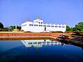
Lumbini
The ancient ruins of complex structures have been conserved in the area including the Shakya tank – the remains within the Mayadevi Temple with brick structures and cross-wall system that have been dated from the 3rd century BC,

-
 Royal Thai monastery
 -
 South Korean Stupa
 -
 Sri Lankan Temple
 -
 German monastery
 -
 Austrian monastery
 -
 Chinese Monastery


_-_Lumbini_Development_Zone_-_Lumbini_-_Nepal_(13848651175).jpg)


-
 Ruins within Maya Devi Temple complex
 -
 Sacred Pond adjacent to Temple
 -
 Little Buddha Statue
 -
 World Peace Stupa gate


Kapilvastu
Widely attributed as the hometown of
-
 Ruins of ancient Kapilavastu at Tilaurakot
 -
 Kakusandha BuddhaAshoka Pillar
 -
 Koṇāgamana BuddhaAshoka Pillar

.jpg)
.JPG)
Ramagrama
After the death of
Dhaulagiri circuit

The Dhaulagiri circuit in Eastern Rukum encompasses the Dhaulagiri mountain range of the northern Lumbini Province. The Dhaulagiri mountain range extends from the northwest to the northeast of Eastern Rukum district and then continues eastward to its tallest peak at Dhaulagiri I. Putha Hiunchuli (Dhaulagiri VII), one of the most popular 7,000-metre mountains, was first climbed by British explorer J. O. M. Roberts and Sherpa Ang Nyima in 1954.[27]
The West Dhaulagiri circuit is a tourist trekking circuit close to the Dhaulagiri mountain range and
National Parks
Bardiya National Park is the largest national park in the lowland Terai, covering 968 square kilometres. It was established in 1976 to protect the representative ecosystem, habitats of tigers and their prey species. As a beautiful, unspoiled wilderness of sal forest, grassland, and alluvial washes cut by the many fingers of the Karnali River, it is a popular tourist destination, offering elephant rides and wilderness sight-seeing of Gangetic dolphins, tigers, rhinos and elephants.
In 1997, a buffer zone of 327 square kilometres surrounding the park was declared, consisting of forests and private lands. The buffer zone is jointly managed by the local communities and the park and community development and resource management is carried out jointly.[65]
The Babai valley, which is rich in biodiversity, was added to the park in 1984. The zone has wooded grassland and riverine forest and its water is home to Gharial crocodile. More than 30 different mammals, 513 species of birds and several species of snakes, lizard and fishes have been recorded in the park area.[66]


-
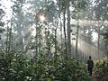 Forest trees of Bardiya National Park
 -
 Banke National Park
 -
 Deers at Bardiya National Park


Banke National Park, adjacent to the Bardiya National Park with the coherent protected area of 1,518 km2 (586 sq mi), represents the Tiger Conservation Unit (TCU). The national park was established in 2010 and is a protected area of tiger and four-horned antelopes. The park extends over 550 square kilometers in Banke district of the province. Banke National Park is connected with Bardiya National Park in the west and wildlife sanctuary and forests of India in the south. The protected zone is an important component of Terai Arc Landscape (TAL) that provides habitat for tigers. The park has eight ecosystem types: Sal forest, deciduous Riverine forest, savannahs and grasslands, mixed hardwood forest, flood plain community, Bhabar and foothills of Chure range. It is home to 124 plants, 34 mammals, more than 300 birds, 24 reptiles, 7 amphibians and 58 fish species. Under the National Parks and Wildlife Conservation Act 1973, 3 species of mammals (tiger, striped hyaena, four-horned antelope), 4 species of birds (giant hornbill, black stork, Bengal florican, and lesser florican) and 2 species of reptiles (gharial crocodile and python) are protected in the park.[67]
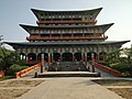
Cultural Heritage
Religious sites
The culture of the province has been shaped by multi-religious and multi-ethnic demography as well as the historical development of the Indian sub-continent.
Further popular Hindu sites in Dang district include

Within and around
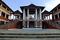
Rani Mahal
After being forced to drop his royal titles,
Infrastructure
.jpg)
Education
As per the 2021 census, Lumbini's literacy rate was above the national average at 78.1%, the national average being 76.2%.[75] The breakdown of the data showed that the male literacy stood at 85.2% while female literacy stood at 71.7% in the province. District-wise, Palpa and Dang were the best performers with literacy rate of 83.7% and 81.4% respectively, followed by Rupandehi at 81.2%. Nationally, Palpa was also among the top five districts of Nepal with highest literacy rate alongside Kathmandu, Lalitpur, Bhaktapur and Kaski.[76]
By 2014,
Universities
- Nepal Sanskrit University
- Rapti Academy of Health Sciences
- Lumbini Bauddha University
Health

According to the National Demographic Health Survey (NDHS) 2016, the Province's Neonatal Mortality (per 1000 live births) stands at 30 and Infant mortality rate (per 1000 live births) stands at 42, both of which are higher than the national average of 21 and 32 respectively. The province has 670 public health facilities, including four hub hospitals, 18 hospitals, two regional medical stores, 31 primary health care centers, 570 health posts, 27 urban health centers, 15 community health units and 9 other health facilities.[80]
Communication
In Lumbini province, 49.2% of the population have radio access and followed by 30.4% have access to TV, and only 1.3% have access to the internet. Similarly, 4.4% of the population have access to landline telephone, while 65.8% have access to mobile phone. There are three major cell phone providers in Lumbini Province. They are Nepal Doorsanchar Company Limited (NTC), Ncell Axiata Limited (NCELL) and Smart Cell. The coverage of Smart Cell providers is only in 5 districts.
There are 66 newspaper channels in Lumbini Province with national, provincial, and local outreach. As per the classification, some of the top-ranking newspapers are Gorachya Dainik, Dainik Nepalgunj, and Mechikali Sandesh Dainik. There are a total of 63 radio stations in the province, such as Radio Lumbini, Radio Tulsipur, Bheri F.M., etc.[81]
Energy

91% of the population has access to electricity in the province. Of the 12 districts in Lumbini Province,


Transportation
Roadways
Transportation routes in Lumbini evolved since ![]() H01. Lumbini has two major routes,
H01. Lumbini has two major routes, ![]() H01 and
H01 and ![]() H10 both intersecting in Butwal. 8,931 km of road is constructed in the Province. Out of which 5,293 km is blacktopped.
H10 both intersecting in Butwal. 8,931 km of road is constructed in the Province. Out of which 5,293 km is blacktopped.
All 12 districts of the province are connected via blacktopped roads. Major highways of the province are as follows:
- Mahendra Highway: Mahendra Highway(
 H01) traverses districts of Bardiya, Banke, Dang, Kapilvastu, Rupandehi, Parasi latitudinally. It connects to Bagmati to east and Sudurpaschim to the west.
 - Ratna Highway: Ratna Highway (
 H12) to Karnali Province. It starts at Nepal- India border in Nepalgunj and terminates at Birendranagar, Surkhet. The highway transition into the Karnali Highway system from the point it terminates.
 - Rapti Highway: Rapti Highway (
 H11) starts from Ameliya, Dang and terminates at Musikot West Rukum. This highway makes hilly regions of Rolpa, Salyan West Rukum and east Rukum accessible.
 - Siddhartha Highway: Siddhartha Highway(
 H10) highway starts at Nepal-India Border in Siddharthanagar and terminates at Prithivi chowk, Pokhara. The major settlements on the highway are Siddharthanagar, Butwal, Tansen, Waling, Putalibazar, Syangja and Pokhara.
Air Travel
Gautam Buddha International Airport, Nepalgunj Airport and Dang Airport are major airstrips in the province. Nepalgunj Airport, Nepal's second most busiest airport after Tribhuwan International Airport, is being upgraded to an international airport as per the 20 year master plan.[53] Being mostly flat land air travel isn't preferable but Nepalgunj Airport serves as hub for most of the airports in Karnali Province and Sudurpaschim Province and is a transit point for tourists heading to Lake Manasarovar and Mount Kailash in Tibet.[89][90] New airports are under construction in Resunga (Gulmi District) and Sandhikharka (Arghakhanchi District).[91][92]
-
 Nepalgunj Airport is Nepal's second-most busiest airport after TIA
 -
 Lumbini hosts Nepal's second international airport - Gautam Buddha International Airport


See also
- List of provinces of Nepal
- List of districts of Nepal
- List of mayors of municipalities in Nepal
- List of districts of Lumbini Province
References
- ^ a b c "Lumbini, the Birthplace of the Lord Buddha | Silk Roads Programme". UNESCO. Archived from the original on 11 November 2021. Retrieved 11 November 2021.
- ^ "It's official now: Dang is capital of Province 5, renamed as Lumbini". OnlineKhabar. 6 October 2020. Archived from the original on 21 January 2021. Retrieved 6 October 2020.
- ^ "Province 5 to be named Lumbini, Dang's Deukhuri permanent capital". MyRepública. Archived from the original on 27 November 2020. Retrieved 6 October 2020.
- ^ "Province 5 named Lumbini Province after 79/83 votes". AjakoNepal. Archived from the original on 17 November 2021. Retrieved 6 October 2020.
- ^ a b Pandey, R.N. (1987). "Paleo environment & pre-history of Nepal". CNAS:Tribhuvan University. 14: 116.
- ^ JSTOR 597919.
- ^ "Lumbini, Where I was Born – Lumbini Museum". Archived from the original on 12 November 2021. Retrieved 12 November 2021.
- ISBN 978-81-89182-70-0. Archivedfrom the original on 11 November 2021. Retrieved 11 November 2021.
- ^ a b "Buddha's Mamaghar". ECS NEPAL. Archived from the original on 12 November 2021. Retrieved 12 November 2021.
- ^ a b "Ramagrama, the relic stupa of Lord Buddha". UNESCO World Heritage Centre. Archived from the original on 20 June 2018. Retrieved 12 November 2021.
- ^ a b "Lumbini Development Trust- Birthplace of Buddha, Historical Place of Nepal, The World Heritage SiteLumbini Development Trust". lumbinidevtrust.gov.np. Archived from the original on 16 January 2021. Retrieved 12 November 2021.
- ^ "Ian Alsop: The Metal Sculpture of the Khasa Mallas". asianart.com. Archived from the original on 12 November 2021. Retrieved 12 November 2021.
- ^ "King Ripumalla – ruler of the Khasa Malla kingdom". tibetmuseum.app. Archived from the original on 12 November 2021. Retrieved 12 November 2021.
- ^ Tucci, Giuseppe (1956). Preliminary report on two scientific expeditions in Nepal.
- ^ a b "Nepali Military Academy | नेपाली सैनिक प्रतिष्ठान". nma.nepalarmy.mil.np. Retrieved 11 March 2023.
- ^ Shrestha, SI Arjun. "Introduction". lumbini.nepalpolice.gov.np. Archived from the original on 26 November 2020. Retrieved 12 January 2021.
- ^ "Plan For Development Of State 5". GorakhaPatra. Retrieved 17 November 2021.
- ^ "Department of Hydrology and Meteorology". dhm.gov.np. Archived from the original on 17 December 2020. Retrieved 2 January 2021.
- ^ "Nepal climate: average weather, temperature, precipitation, best time". climatestotravel.com. Archived from the original on 14 November 2017. Retrieved 2 January 2021.
- ^ "Nepal Travel Weather Averages (Weatherbase)". Weatherbase. Archived from the original on 30 September 2020. Retrieved 28 April 2018.
- ^ Yoshida, Kohki (1 January 2011). "Lithostratigraphy and structures of the Siwaliks rocks in the southern part of Dang and its surrounding area, Southwestern Nepal".
{{cite journal}}: Cite journal requires|journal=(help) - ISBN 978-1-119-05547-1.
- ^ Shrestha, Surendra; Shah, Surendra. Inventory of Valleys in Nepal (Report). Minister of Irrigation Groundwater Resources Development Board, Nepal. Archived from the original on 17 November 2021. Retrieved 26 October 2020.
- ^ "Ministry of Forests and Environment". mofe.gov.np. Archived from the original on 29 October 2020. Retrieved 26 October 2020.
- ^ "NMA Peak Profile Search". nepalhimalpeakprofile.org. Archived from the original on 13 August 2021. Retrieved 13 August 2021.
- ^ Adventure, Makalu. "Putha Hiunchuli / Himchuli Expedition - Mt. Dhaulagiri VII". Makalu Adventure. Retrieved 7 February 2022.
- ^ a b "Putha Hiunchuli Climbing". asianhikingteam.com. Archived from the original on 19 October 2021. Retrieved 19 October 2021.
- ^ "Sisne". nepalhimalpeakprofile.org. Retrieved 7 February 2022.
- ^ "Nepal Himal Peak Profile". nepalhimalpeakprofile.org. Archived from the original on 13 August 2021. Retrieved 18 August 2021.
- ^ "Sisne". nepalhimalpeakprofile.org. Archived from the original on 18 August 2021. Retrieved 18 August 2021.
- ^ "DNPWC". Department of National Parks and Wildlife Conservation. Retrieved 25 March 2023.
- ^ "Lumbini Province – National Lake Conservation Development Committee (NLCDC)". Retrieved 25 March 2023.
- ^ Singh, P. (2016). "Flood and its relationship to developmental activities in Rapti river basin, Gorakhpur". International Journal of Scientific & Innovative Research Studies: 26–35.
- ^ "The Five Rivers of the Buddhists". ccbs.ntu.edu.tw. Retrieved 25 March 2023.
- ^ "Nepal: Administrative Division (Provinces and Districts) – Population Statistics, Charts and Map". citypopulation.de. Archived from the original on 27 September 2020. Retrieved 29 October 2020.
- ^ "NID | Overview". nepalmap.org. Archived from the original on 26 October 2020. Retrieved 24 October 2020.
- ^ "Lumbini Development Trust- Birthplace of Buddha, Historical Place of Nepal, The World Heritage SiteLumbini Development Trust". lumbinidevtrust.gov.np. Retrieved 12 March 2023.
- ^ a b "NepalMap profile: Province No. 5". NepalMap. Archived from the original on 16 October 2020. Retrieved 14 October 2020.
- ^ "सरकारी कामकाजको भाषाका आधारहरूको निर्धारण तथा भाषासम्बन्धी सिफारिसहरू (पञ्चवर्षीय प्रतिवेदन- साराांश) २०७८" (PDF). Language Commission. Archived (PDF) from the original on 6 September 2021. Retrieved 28 October 2021.
- ^ "स्थानिय तह". 103.69.124.141. Archived from the original on 31 August 2018. Retrieved 27 April 2018.
- ^ "Govt decides to divide parts of Rukum and Nawalparasi". kathmandupost.com. Archived from the original on 17 November 2021. Retrieved 1 January 2021.
- ^ 2011 Census District Level Detail Report Archived 2 September 2018 at the Wayback Machine, Central Bureau of Statistics.
- ^ "High Courts get their chief judges". Archived from the original on 23 March 2018. Retrieved 27 April 2018.
- ^ "Yadav, Gharti sworn in as speakers". kathmandupost.com. Archived from the original on 17 November 2021. Retrieved 1 January 2021.
- ^ "Government finalises provinces' governors and temporary headquarters | NepaleKhabar.com". nepaleKhabar. 17 January 2018. Archived from the original on 15 November 2020. Retrieved 1 January 2021.
- ^ "Who is who: These are new governors of Nepal's seven provinces". OnlineKhabar English News. 5 November 2019. Archived from the original on 28 June 2021. Retrieved 1 January 2021.
- ^ "लुम्बिनी प्रदेशमा २९ सिटसहित एमाले सबैभन्दा ठूलो दल". ekantipur.com (in Nepali). Retrieved 6 December 2022.
- ^ a b Economic Survey 2020/2021. Government of Nepal, Ministry of Finance. 2021. pp. 214–222.
- ^ "Plan For Development Of State 5". GorakhaPatra. Archived from the original on 16 November 2021. Retrieved 16 November 2021.
- ^ "NRB Study Shows Lumbini has High Potential in Agriculture, Tourism, and Industries". newbusinessage.com. Archived from the original on 16 November 2021. Retrieved 16 November 2021.
- ^ a b Economic Activity Research-First Half Yearly Report(2077/78 BS) (in Nepali). Central Bank of Nepal. 2021. pp. 35–36.
- ^ "Airport construction triggers hotel boom in Rupandehi". kathmandupost.com. Archived from the original on 24 February 2021. Retrieved 29 October 2020.
- ^ a b "Upgrading of Nepalgunj airport looks 20 years ahead". GorakhaPatra. Retrieved 7 December 2021.
- ^ "कृषि विभाग". doanepal.gov.np. Archived from the original on 22 January 2021. Retrieved 4 January 2021.
- ^ "NepalMap profile: Province No. 5". NepalMap. Archived from the original on 16 October 2020. Retrieved 24 October 2020.
- ^ "Economic survey of Nepal 2022/2023". Economic survey of Ministry of Finance, Government of Nepal.
- ^ a b Sansar, Nepali (6 January 2020). "Lumbini Tourist Arrivals Reach 1.5 Million in 2019". Nepali Sansar. Archived from the original on 25 May 2021. Retrieved 25 May 2021.
- ^ HABIB, MOHAMMAD. "1.3m tourists from 113 nations visit Lumbini". My Republica. Retrieved 28 December 2021.
- ^ "Industrial District Management Limited". www.idm.org.np. Retrieved 7 February 2022.
- ^ RSS. "Govt decides to establish an industrial estate in Dang". My Republica. Retrieved 7 February 2022.
- ^ "Lumbini, the Birthplace of the Lord Buddha". UNESCO World Heritage Centre. Archived from the original on 9 September 2020. Retrieved 12 November 2021.
- ^ "Lumbini Development Trust- Birthplace of Buddha, Historical Place of Nepal, The World Heritage SiteLumbini Development Trust". lumbinidevtrust.gov.np. Archived from the original on 12 November 2021. Retrieved 12 November 2021.
- ^ "Tilaurakot, the archaeological remains of ancient Shakya Kingdom". UNESCO World Heritage Centre. Archived from the original on 20 June 2018. Retrieved 17 November 2021.
- ^ "DNPWC". Department of National Parks and Wildlife Conservation. Archived from the original on 18 February 2020. Retrieved 19 October 2021.
- ^ "DNPWC". Department of National Parks and Wildlife Conservation. Archived from the original on 18 February 2020. Retrieved 16 November 2021.
- ^ "Home". bardianationalpark.gov.np. Archived from the original on 16 November 2021. Retrieved 16 November 2021.
- ^ "Biodiversity". Banke National Park. Archived from the original on 16 November 2021. Retrieved 16 November 2021.
- ^ Bouillier, Veronique. "The Nepalese State and Gorakhnathi Yogis: The case of the former kingdoms of Dang valley: 18-19th centuries".
{{cite journal}}: Cite journal requires|journal=(help) - ^ "GBIA". airports.caanepal.gov.np. Retrieved 24 March 2023.
- ^ Basnet, Devendra. "Trishul turns Dang temple into tourist spot". My City. Archived from the original on 17 November 2021. Retrieved 12 November 2021.
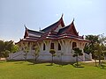
- ^ Sammohan, Aayush (1 October 2019). "Bageshwori Temple - Wonders of Nepal - Best travel blog". Wonders of Nepal. Retrieved 24 March 2023.
- ^ "National Muslim Commission". 16 April 2019. Archived from the original on 16 April 2019. Retrieved 24 March 2023.
- ^ Centre, UNESCO World Heritage. "Lumbini, the Birthplace of the Lord Buddha". UNESCO World Heritage Centre. Retrieved 25 March 2023.
- ^ "Rani Mahal | Tansen Municipality". www.tansenmun.gov.np. Retrieved 25 March 2023.
- ^ "literacy | national housing_census year results". censusnepal.cbs.gov.np. Retrieved 21 July 2023.
- ^ "literacy | national housing_census year results". censusnepal.cbs.gov.np. Retrieved 21 July 2023.
- ^ "Government deadline for total literacy likely to be pushed yet again". kathmandupost.com. Archived from the original on 5 March 2021. Retrieved 9 November 2021.
- ^ "Mustang declared 'fully literate district'". kathmandupost.com. Archived from the original on 17 November 2021. Retrieved 9 November 2021.
- ^ "Total Literate Districts of Nepal". Gyan Park › A Genuine Resource. Archived from the original on 17 November 2021. Retrieved 9 November 2021.
- ^ "WHO Nepal COVID-19 Profile 2020: Lumbini Province – Nepal". ReliefWeb. 25 May 2021. Archived from the original on 25 May 2021. Retrieved 25 May 2021.
- ^ "WHO Nepal COVID-19 Profile 2020: Lumbini Province – Nepal". ReliefWeb. 25 May 2021. Archived from the original on 25 May 2021. Retrieved 25 May 2021.
- ^ Republica. "Over 86 percent households have now access to electricity through national grid". My Republica. Archived from the original on 17 November 2021. Retrieved 29 October 2020.
- ^ "Ministry of Finance – Government of Nepal". mof.gov.np. Archived from the original on 27 October 2020. Retrieved 24 October 2020.
- ^ "Butwal Solar Power Project (8.5 MW) Connected To National Transmission Line". Investopaper. Archived from the original on 7 November 2020. Retrieved 31 October 2020.
- ^ Sen, Sandeep (30 October 2019). "Nepal's second longest bridge construction completes". The Himalayan Times. Archived from the original on 12 November 2021. Retrieved 12 November 2021.
- ^ Pariyar, Binod. "Survey begins for Mechi-Mahakali Electric Railway". My Republica. Archived from the original on 9 November 2021. Retrieved 29 October 2020.
- ^ "At upcoming talks, Nepal and China to discuss Kathmandu-Pokhara-Lumbini railways". kathmandupost.com. Archived from the original on 9 August 2020. Retrieved 29 October 2020.
- ^ "India willing to expedite Kathmandu-Raxaul railway project". Khabarhub. 28 August 2020. Archived from the original on 19 December 2020. Retrieved 29 October 2020.
- ISSN 0971-751X. Retrieved 7 December 2021.
- ^ "Nepalgunj Airport faces flight pressure after the beginning of Mansarovar season". Nepal24Hours.com - 'Integration Through Media'. 20 May 2019. Retrieved 7 December 2021.
- ^ "Arghakhanchi airport construction project initiates". Aviation Nepal. 14 December 2017. Archived from the original on 6 March 2021. Retrieved 26 October 2020.
- ^ "Reshunga Airport to see its runway blacktopped". Aviation Nepal. 28 April 2019. Archived from the original on 9 November 2021. Retrieved 26 October 2020.
Places adjacent to Lumbini Province | ||||||||||||||||
|---|---|---|---|---|---|---|---|---|---|---|---|---|---|---|---|---|
| ||||||||||||||||