Müritz National Park
| Müritz National Park | |
|---|---|
| Müritz-Nationalpark | |
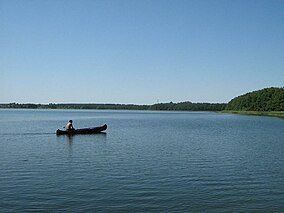
 Käbelicksee, Müritz National Park | |
| Location | |
| Nearest city | Neustrelitz, Waren |
| Coordinates | 53°26′22″N 12°50′12″E / 53.43944°N 12.83667°E |
| Area | 318 km2 (123 sq mi) |
| Established | October 1, 1990 |
The Müritz National Park (
World Heritage List in 2011 as an extension of the Primeval Beech Forests of Europe site because of their unspoilt nature and testimony to the ecological history of Europe since the Last Glacial Period.[1]
Geography
The National Park is divided into two separated areas, Müritz and Serrahn. or meadows.
Lake Müritz has an area of 118 km2, but only its eastern shore is part of the National Park. The towns of Waren and Neustrelitz are the closest towns. There are about 100 lakes in Müritz National Park, including Bullowsee, and many more smaller waterbodies, runs, ditches and brooks. The Havel rises in the Müritz section, close to the water divide between the Baltic and the North Sea
.
Fauna and flora
Notable animals in the park include the
teal, garganey and little stint
.
In addition to the unspoiled nature in general, a lot of open common juniper stands can be found in the national park. They were formerly used for cattle grazing.
References
- ^ "Ancient and Primeval Beech Forests of the Carpathians and Other Regions of Europe". UNESCO World Heritage Centre. United Nations Educational, Scientific, and Cultural Organization. Retrieved 3 September 2022.
- ^ "UNESCO Weltnaturerbe "Alte Buchenwälder Deutschlands"". Nationalparkamt Müritz. Archived from the original on 2015-04-02. Retrieved 2015-03-19.
External links
Wikimedia Commons has media related to Müritz-Nationalpark.
- Official site (in German and English)
