Madhyamaheshwar
| Madhyamaheshwar | |
|---|---|
Pandavas , according to legend | |
| Completed | unknown |
Madhyamaheshwar (
Legend

Several folk legends exist surrounding the Garhwal region, Shiva and the creation of the Panch Kedar temples.
One folklore relates to the
Not finding Shiva in Varanasi, the Pandavas went to
A variant of the tale credits Bhima of not only catching the bull, but also stopping it from disappearing. Consequently, the bull was torn asunder into five parts and appeared at five locations in the
After completing the pilgrimage of Shiva's
The temple
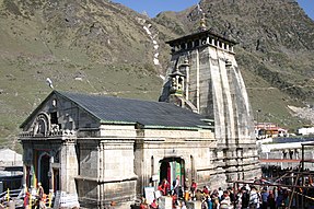
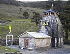
The temple in the North-Indian Himalayan style of architecture, is situated in a lush meadow, just below a high ridge. The older, so-called 'Vriddh-Madmaheshwar', temple is a tiny blackened shrine on the ridge, which looks straight up at the Chaukhamba Mountain peaks. In the current temple, a navel-shaped Shiva-
Worship

The water from the temple precincts is considered so highly sacred that even a few drops are stated to be adequate for ablution. The worship at this temple starts with a specified time period from the beginning of the summer months after the winter and lasts until October/November from start of the winter season when the temple precincts are not accessible due to snow conditions. During the winter period, the symbolic idol of the god is shifted with religious formalities to Ukhimath for continued worship. Priests at this temple, as in many other temples in the state, are from
Geography

The temple is in a green valley surrounded by snow peaks of
Access

The best time to visit the temple is from April to September. It is advised to visit before the month of October to avoid harsh weather conditions. Total trek length to cover all the five temples of Panch Kedar is about 170 km (105.6 mi) (including road travel up to Gaurikund), involving 16 days of effort. The trek starts from Gauri Kund, from which there are views of the Himalayan range of hills and the broader Garhwal region, comparable to the Alps.
The trekking is undertaken during two seasons; three months during summer and two months after the monsoon season, as during the rest of the period, except Rudranath, the other four Panch Kedar temples are inaccessible due to snow cover
Madyamaheswar temple is located in the Rudraprayag district of Uttarakhand. The temple is not directly connected by road. The last motrable place on the route of Madyamaheswar is Ransi village. After Kund ( near Ukhimath), the Kedarnath route divides into two parts: one goes to Gaurikund and another goes to Madyamaheswar.The Madyamaheswar route goes to Ukhimath, and after Ukhimath, one road goes to Tungnath and another goes to Madyamaheswar. Rishikesh is the entry point to the pilgrim centres of Garhwal Himalayas and is connected by train to the rest of the country. The nearest airport is Jolly Grant at a distance of 18 km (11.2 mi) from Rishikesh, closer to Dehradun, which connects to other destinations in India. The temple is at a distance of 244 km (151.6 mi) from the airport and 227 km (141.1 mi) from Rishikesh, the rail head. From Rishikesh to Kalimath the road distance is 196 km (121.8 mi). Alternatively, Madhmaheshwar shrine could be reached from Mansoona, Buruwa and Uniyana, via Ukhimath. From Ukhimath, the route passes through Mansoona(7 km), Buruwa(4 km), Ransi (3 km) then Goundar (9 km), Bantoli (2 km) and further 10 km steep climb via Khatra Khal, Maikhumbachatti and kunchatti reach the temple [2]
The base of the trek is Aktolidhar/Ransi which is 22-24 kilometres away from Ukhimath. From there the trekking way starts. After 6 kilometres is Goundar village a small chatti, with a place to stay where there are 3 lodges to stay. After 2 km lies Bantoli, the point of confluence of Saraswati Ganga and Morkhanda Ganga then it's called Madhyamaheshwar ganga Or Madhu ganga. Then comes Khatara, Nanu, Maikhambachatti, Kunchatti and then comes Madhyamaheswar. The proper trekking distance is 16-18 kilometres from Aktolidhar/Ransi.
Gaundhar and Kalimath are two important places on the route to Madhyamaheshwar. Kalimath (1,463 m (4,799.9 ft)) in particular, is of importance for the large number of pilgrims who visit the place for spiritual comfort and hence it is called the Sidh Peeth (Spiritual center). Kalimath is famous for the temples to goddesses
time is of special significance at this place when much large devotees visit the place.References
- ^ "Gaundar · Uttarakhand 246439". Gaundar · Uttarakhand 246439. Retrieved 9 April 2022.
- ^ a b c d "Panch Kedar: Madmaheshwar". Shri Badrinath -Shri Kedarnath Temple Committee. 2006. Retrieved 16 July 2009.
- ^ )
- ^ a b "Panch Kedar Yatra". Archived from the original on 24 May 2011. Retrieved 5 July 2009.
- ISBN 9788185880167.
- ^ "Panch Kedar". Archived from the original on 31 August 2009. Retrieved 15 July 2009.
- ISBN 978-81-89449-03-2. Retrieved 24 July 2009.
- ISBN 978-81-7533-081-8.
- ^ )
External links
- [https://books.google.com/books?id=L4knycWWbqgC&pg=PA77&dq=Tungnath&lr=&ei=QDthSriJMoOulASOraWoDg Panch Kedar, trek map, page 78


