
Madison, Florida
Madison, Florida | ||
|---|---|---|
FIPS code 12-42425[6] | | |
| GNIS feature ID | 0286274[4] | |
| Website | www | |
Madison is a city in and the county seat of Madison County, on the central northern border of Florida, United States.[7] The population was 2,912 at the 2020 census.[5]
History
The territory now known as Madison County was ruled at various times by
Racial violence of whites against blacks increased after the Reconstruction era, reaching a peak near the turn of the 20th century. The following African Americans were lynched in Madison: Savage and James in 1882,[8] Charles Martin, 1 February 1899; both James Denson and his stepson, 7 January 1901; and an unidentified man, 9 February 1906.[9]
Geography

Madison is located slightly east of the center of Madison County at 30°28′N 83°25′W / 30.467°N 83.417°W (30.466, –83.415).[10] U.S. Route 90 passes through the center of town, leading west 56 miles (90 km) to Tallahassee, the state capital, and southeast 52 miles (84 km) to Lake City. Interstate 10 passes 4 miles (6 km) to the south of Madison with access from exits 251 and 258.
According to the United States Census Bureau, the city has a total area of 2.7 square miles (7.0 km2), of which 0.05 square miles (0.13 km2), or 1.93%, are water.[3]
Climate
The climate for the City of Madison is characterized by hot, humid summers and generally mild to cool winters. According to the

| Climate data for Madison, Florida, 1991–2020 normals, extremes 1892–2017 | |||||||||||||
|---|---|---|---|---|---|---|---|---|---|---|---|---|---|
| Month | Jan | Feb | Mar | Apr | May | Jun | Jul | Aug | Sep | Oct | Nov | Dec | Year |
| Record high °F (°C) | 88 (31) |
87 (31) |
99 (37) |
96 (36) |
103 (39) |
106 (41) |
106 (41) |
103 (39) |
101 (38) |
98 (37) |
91 (33) |
89 (32) |
106 (41) |
| Mean maximum °F (°C) | 77.6 (25.3) |
80.3 (26.8) |
84.9 (29.4) |
88.8 (31.6) |
93.4 (34.1) |
97.4 (36.3) |
97.3 (36.3) |
97.2 (36.2) |
94.2 (34.6) |
90.0 (32.2) |
83.9 (28.8) |
79.3 (26.3) |
99.4 (37.4) |
| Mean daily maximum °F (°C) | 63.0 (17.2) |
67.0 (19.4) |
73.4 (23.0) |
79.2 (26.2) |
85.8 (29.9) |
89.7 (32.1) |
90.9 (32.7) |
90.6 (32.6) |
87.0 (30.6) |
80.5 (26.9) |
71.7 (22.1) |
65.5 (18.6) |
78.7 (25.9) |
| Daily mean °F (°C) | 51.6 (10.9) |
55.3 (12.9) |
60.9 (16.1) |
67.0 (19.4) |
74.1 (23.4) |
79.6 (26.4) |
81.2 (27.3) |
81.1 (27.3) |
77.5 (25.3) |
69.3 (20.7) |
60.1 (15.6) |
54.3 (12.4) |
67.7 (19.8) |
| Mean daily minimum °F (°C) | 40.2 (4.6) |
43.6 (6.4) |
48.4 (9.1) |
54.8 (12.7) |
62.4 (16.9) |
69.5 (20.8) |
71.5 (21.9) |
71.6 (22.0) |
67.9 (19.9) |
58.1 (14.5) |
48.6 (9.2) |
43.0 (6.1) |
56.7 (13.7) |
| Mean minimum °F (°C) | 23.8 (−4.6) |
26.6 (−3.0) |
31.8 (−0.1) |
38.9 (3.8) |
50.3 (10.2) |
61.5 (16.4) |
66.3 (19.1) |
66.0 (18.9) |
56.7 (13.7) |
41.6 (5.3) |
32.1 (0.1) |
25.3 (−3.7) |
19.8 (−6.8) |
| Record low °F (°C) | 5 (−15) |
14 (−10) |
19 (−7) |
33 (1) |
43 (6) |
52 (11) |
61 (16) |
58 (14) |
42 (6) |
30 (−1) |
16 (−9) |
7 (−14) |
5 (−15) |
| Average precipitation inches (mm) | 4.92 (125) |
3.84 (98) |
5.06 (129) |
2.91 (74) |
2.66 (68) |
7.62 (194) |
6.17 (157) |
6.57 (167) |
3.96 (101) |
3.29 (84) |
2.32 (59) |
3.45 (88) |
52.77 (1,340) |
| Average precipitation days (≥ 0.01 in) | 9.0 | 7.9 | 7.4 | 6.2 | 6.1 | 11.6 | 12.8 | 12.9 | 8.4 | 4.8 | 5.2 | 7.4 | 99.7 |
| Source: NOAA (mean maxima/minima 1981–2010)[12][13] | |||||||||||||
Demographics
| Census | Pop. | Note | %± |
|---|---|---|---|
| 1860 | 423 | — | |
| 1870 | 924 | 118.4% | |
| 1880 | 756 | −18.2% | |
| 1890 | 781 | 3.3% | |
| 1900 | 849 | 8.7% | |
| 1910 | 1,560 | 83.7% | |
| 1920 | 1,952 | 25.1% | |
| 1930 | 2,189 | 12.1% | |
| 1940 | 2,730 | 24.7% | |
| 1950 | 3,150 | 15.4% | |
| 1960 | 3,239 | 2.8% | |
| 1970 | 3,737 | 15.4% | |
| 1980 | 3,487 | −6.7% | |
| 1990 | 3,345 | −4.1% | |
| 2000 | 3,061 | −8.5% | |
| 2010 | 2,843 | −7.1% | |
| 2020 | 2,912 | 2.4% | |
| U.S. Decennial Census[14] | |||
2010 and 2020 census
| Race | Pop 2010[15] | Pop 2020[16] | % 2010 | % 2020 |
|---|---|---|---|---|
White (NH)
|
863 | 840 | 30.36% | 28.85% |
Black or African American (NH)
|
1,869 | 1,849 | 65.74% | 63.50% |
Alaska Native (NH)
|
11 | 13 | 0.39% | 0.45% |
| Asian (NH) | 19 | 12 | 0.67% | 0.41% |
Native Hawaiian (NH)
|
0 | 0 | 0.00% | 0.00% |
Some other race (NH)
|
1 | 4 | 0.04% | 0.14% |
| Two or more races/Multiracial (NH) | 41 | 82 | 1.44% | 2.82% |
| Hispanic or Latino (any race) | 39 | 112 | 1.37% | 3.85% |
| Total | 2,843 | 2,912 |
As of the 2020 United States census, there were 2,912 people, 1,101 households, and 556 families residing in the city.[17]
As of the 2010 United States census, there were 2,843 people, 1,237 households, and 696 families residing in the city.[18]
2000 census
As of the
In 2000, there were 1,227 households, out of which 30.8% had children under the age of 18 living with them, 31.6% were married couples living together, 27.2% had a female householder with no husband present, and 37.7% were non-families. 33.0% of all households were made up of individuals, and 16.2% had someone living alone who was 65 years of age or older. The average household size was 2.44 and the average family size was 3.13.
In 2000, in the city, the population was spread out, with 29.1% under the age of 18, 10.7% from 18 to 24, 24.9% from 25 to 44, 19.0% from 45 to 64, and 16.3% who were 65 years of age or older. The median age was 32 years. For every 100 females, there were 83.4 males. For every 100 females age 18 and over, there were 77.6 males.
In 2000, the median income for a household in the city was $17,656, and the median income for a family was $22,988. Males had a median income of $24,101 versus $23,750 for females. The
Government
Madison has the city manager-council form of government. City commissioners are elected from districts and serve for four years. The commission appoints the city manager and city clerk; a mayor-commissioner serves a one-year term. The City of Madison has a 14 officer police department, and a 9 firefighter fire department.
The 2008–2009
Education
Madison is served by two campuses of the
North Florida College provides post-secondary instruction for six counties (Hamilton, Jefferson, Lafayette, Madison, Suwannee, and Taylor). In addition, St. Leo University provides university instruction at the junior-senior level.
-
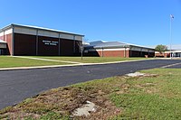
 Madison County Central School
 -


Media
Area newspapers published by Greene Publishing are Madison County Carrier and The Madison Enterprise Recorder.
Transportation
Madison is served by Madison Shuttle, a bus route operated by Big Bend Transit.[19]
Freight service is provided by the
Notable people
- NFLrunning back
- MLBplayer
- Geno Hayes, NFL linebacker
- Colin Kelly, World War II hero
- Scott Kelly, politician
- Jacobbi McDaniel, NFL defensive tackle
- Scott Phillips, drummer for the band Creed
- Jesse Solomon, NFL linebacker
- Chris Thompson, NFL running back
- Ernest Thomas, one of the Groveland Four, killed by a sheriff's posse in Madison in July 1949, exonerated in 2021
- Don Williams, NASCARstock car driver
References
- ^ a b "Our History". City of Madison. Retrieved September 5, 2020.
- ^ "FLORIDA CITIES BY INCORPORATION YEAR" (PDF). Florida League of Cities.
- ^ a b "2022 U.S. Gazetteer Files: Florida". United States Census Bureau. Retrieved December 14, 2022.
- ^ a b U.S. Geological Survey Geographic Names Information System: Madison, Florida
- ^ a b "P1. Race – Madison city, Florida: 2020 DEC Redistricting Data (PL 94-171)". U.S. Census Bureau. Retrieved December 14, 2022.
- ^ a b "U.S. Census website". United States Census Bureau. Retrieved January 31, 2008.
- ^ "Find a County". National Association of Counties. Retrieved June 7, 2011.
- ^ Congress, United States (1889). "Congressional Record: Proceedings and Debates of the ... Congress".
- ^ David Mark Greaves, "View From Here: Never Forget -(The Lynching List)", 3 February 2012; accessed 19 March 2018
- ^ "US Gazetteer files: 2010, 2000, and 1990". United States Census Bureau. February 12, 2011. Retrieved April 23, 2011.
- ^ Climate Summary for Madison, Florida
- ^ "NOWData - NOAA Online Weather Data". National Oceanic and Atmospheric Administration. Retrieved June 24, 2021.
- ^ "Summary of Monthly Normals 1991-2020". National Oceanic and Atmospheric Administration. Retrieved June 24, 2021.
- US Census Bureau.
- ^ "P2 HISPANIC OR LATINO, AND NOT HISPANIC OR LATINO BY RACE - 2010: DEC Redistricting Data (PL 94-171) - Madison city, Florida". United States Census Bureau.
- ^ "P2 HISPANIC OR LATINO, AND NOT HISPANIC OR LATINO BY RACE - 2020: DEC Redistricting Data (PL 94-171) - Madison city, Florida". United States Census Bureau.
- ^ "S1101 HOUSEHOLDS AND FAMILIES - 2020: Madison city, Florida". United States Census Bureau.
- ^ "S1101 HOUSEHOLDS AND FAMILIES - 2010: Madison city, Florida". United States Census Bureau.
- ^ "Big Bend Transit | COORDINATED TRANSPORTATION SYSTEM OF MADISON COUNTY". www.bigbendtransit.org. Retrieved January 31, 2019.
External links
- Official website
- Greater Madison County Chamber of Commerce
- Madison County, Florida tourism site
- Madison Enterprise-Recorder newspaper that serves Madison, Florida is available in full-text with images in Florida Digital Newspaper Library
Municipalities and communities of Madison County, Florida, United States | ||
|---|---|---|
| City |  | |
| Towns | ||
| Unincorporated communities | ||
| ||
| International | |
|---|---|
| National | |