
Main (river)
| Main | |
|---|---|
 The Main River in Würzburg | |
 Position of the Main in Germany | |
| Location | |
| Country | Germany |
| Physical characteristics | |
| Source | |
| • location | Upper Franconia |
| • coordinates | 50°5′11″N 11°23′54″E / 50.08639°N 11.39833°E |
| • elevation | 895 metres (at Weissmainquelle) |
| Mouth | |
• location | Rhine |
• coordinates | 49°59′40″N 8°17′36″E / 49.99444°N 8.29333°E |
• elevation | 83 m (272 ft) |
| Length | 524.9 km (326.2 mi) [1] |
| Basin size | 27,208 km2 (10,505 sq mi) [1] |
| Discharge | |
| • average | 200 m3/s (7,100 cu ft/s) |
| Basin features | |
| Progression | Rhine→ North Sea |
The Main (German pronunciation: are close to the confluence.
The largest cities on the Main are
Geography
The Main flows through the north and north-west of the state of Bavaria then across southern Hesse; against the latter it demarcates a third state, Baden-Württemberg, east and west of Wertheim am Main, the northernmost town of that state.
The upper end of its
The Main begins near
The name Main originates from Latin Moenis, Moenus or Menus. It is not related to the name of the city Mainz (Latin: Mogontiacum or Moguntiacum).
The Main is navigable for shipping from its mouth at the Rhine close to Mainz for 396 km (246 mi) to
Weirs and locks

There are 34 weirs and locks along the 380 km navigable portion of the Main, from the confluence with the Regnitz near Bamberg, to the Rhine.[4]
- No.: Number of the lock (from upstream to downstream).
- Name: Name of the lock.
- Location: City or town where the lock is located.
- Year built: Year when the lock was put into operation (replacement dates are also listed where applicable).
- Main-km: Location on the Main, measured from the 0 km stone in Mainz-Kostheim. The reference point is the center of the lock or lock group.
- Distance between locks: length in km of impoundment (between adjacent locks).
- Altitude: height in meters above mean sea level of the upper water at normal levels.
- Height: Height of the dam in meters (the height of the Kostheim lock depends on the water level of the Rhine).
- Lock length: Usable length of the lock chamber in meters.
- Lock width: Usable width of the lock chamber in meters.
| No. | Name | Location | Year built | Main-km | Distance between locks (km) | Altitude (m) | Height (m) | Lock length (m) | Lock width (m) |
|---|---|---|---|---|---|---|---|---|---|
| 1 | Viereth | Viereth-Trunstadt | 1925 | 380.699 | 230.86 | 6.00 | 289.80 | 12.00 | |
| 2 | Limbach | Eltmann | 1951 | 367.176 | 13.523 | 224.86 | 5.36 | 299.10 | 12.00 |
| 3 | Knetzgau | Knetzgau (Haßfurt) | 1958 | 359.781 | 7.395 | 219.50 | 4.24 | 298.85 | 12.00 |
| 4 | Ottendorf | Gädheim | 1962 | 345.263 | 14.518 | 215.26 | 7.59 | 301.60 | 12.00 |
| 5 | Schweinfurt | Schweinfurt | 1963 | 332.037 | 13.226 | 207.67 | 4.67 | 300.60 | 12.00 |
| 6 | Garstadt | Bergrheinfeld | 1956 | 323.503 | 8.534 | 203.00 | 4.69 | 299.75 | 12.00 |
| 7 | Wipfeld | Wipfeld | 1950 | 316.289 | 7.214 | 198.31 | 4.31 | 300.15 | 12.00 |
| 8 | Gerlachshausen mit Volkach | Volkach (Schwarzach am Main) | 1957 | 300.506 | 15.783 | 194.00 | 6.30 | 300.00 | 12.00 |
| 9 | Dettelbach | Dettelbach | 1959 | 295.398 | 5.108 | 187.70 | 5.50 | 299.35 | 12.00 |
| 10 | Kitzingen | Kitzingen | 1956 | 283.979 | 11.419 | 182.20 | 3.66 | 299.80 | 12.00 |
| 11 | Marktbreit | Marktbreit (Frickenhausen am Main) | 1955 | 275.681 | 8.298 | 178.54 | 3.31 | 296.40 | 12.00 |
| 12 | Goßmannsdorf | Ochsenfurt | 1952 | 269.028 | 6.653 | 175.23 | 3.40 | 296.90 | 12.00 |
| 13 | Randersacker | Würzburg (Randersacker) | 1950 | 258.885 | 10.143 | 171.83 | 3.30 | 299.60 | 12.00 |
| 14 | Würzburg | Würzburg | 1954 | 252.512 | 6.373 | 168.53 | 2.75 | 293.10 | 12.00 |
| 15 | Erlabrunn | Erlabrunn (Thüngersheim) | 1935 | 241.204 | 11.308 | 165.78 | 4.15 | 299.20 | 12.00 |
| 16 | Himmelstadt | Himmelstadt | 1939 | 232.290 | 8.914 | 161.63 | 4.30 | 299.50 | 12.00 |
| 17 | Harrbach | Karlstadt (Gemünden am Main) | 1939 | 219.466 | 12.824 | 157.33 | 4.90 | 299.45 | 12.00 |
| 18 | Steinbach | Lohr am Main | 1939 | 200.673 | 18.793 | 152.43 | 5.14 | 299.10 | 12.00 |
| 19 | Rothenfels | Rothenfels (Marktheidenfeld) | 1937 | 185.887 | 14.786 | 147.29 | 5.26 | 298.45 | 12.00 |
| 20 | Lengfurt | Triefenstein | 1937 | 174.508 | 11.379 | 142.03 | 3.99 | 300.08 | 11.98 |
| 21 | Eichel | Wertheim | 1937 | 160.467 | 14.041 | 138.04 | 4.50 | 299.92 | 12.00 |
| 22 | Faulbach | Wertheim (Faulbach) | 1935 | 147.065 | 13.402 | 133.54 | 4.51 | 299.80 | 12.10 |
| 23 | Freudenberg | Collenberg (Freudenberg) | 1934 | 133.948 | 13.117 | 129.03 | 4.51 | 300.00 | 12.00 |
| 24 | Heubach | Großheubach (Miltenberg) | 1932 | 122.360 | 11.588 | 124.52 | 4.00 | 300.00 | 12.00 |
| 25 | Klingenberg | Klingenberg am Main | 1930 | 113.050 | 9.310 | 120.52 | 4.00 | 300.71 | 12.05 |
| 26 | Wallstadt | Kleinwallstadt (Großwallstadt) | 1930 | 101.203 | 11.847 | 116.52 | 4.00 | 299.93 | 12.00 |
| 27 | Obernau | Niedernberg (Aschaffenburg) | 1930 | 92.909 | 8.294 | 112.52 | 4.01 | 299.18 | 12.00 |
| 28 | Kleinostheim | Kleinostheim (Stockstadt am Main) | 1920 1972 |
77.905 | 15.004 | 108.51 | 6.80 | 298.36 298.22 |
12.04 12.02 |
| 29 | Krotzenburg | Hainburg (Großkrotzenburg) | 1920 1983 |
63.850 | 14.055 | 101.71 | 2.74 | 302.30 300.01 |
12.00 12.00 |
| 30 | Mühlheim (formerly Kesselstadt) |
Maintal (Mühlheim am Main) | 1920 1980 |
53.185 | 10.385 | 98.97 | 3.77 | 299.90 | 12.04 |
| 31 | Offenbach | Frankfurt am Main (Offenbach am Main ) |
1901 1957 |
38.514 | 14.671 | 95.20 | 3.18 | 344.03 230.07 |
12.09 13.05 |
| 32 | Griesheim | Frankfurt am Main |
1934 | 28.687 | 9.827 | 92.02 | 4.49 | 344.05 344.38 |
12.00 15.00 |
| 33 | Eddersheim | Hattersheim am Main (Kelsterbach) | 1934 | 15.551 | 13.136 | 87.53 | 3.61 | 345.46 344.26 |
12.05 15.05 |
| 34 | Kostheim | Hochheim am Main (Ginsheim-Gustavsburg) | 1886 1934 |
3.209 | 12.342 | 83.92 | 2.36 (MW Rhine) |
341.90 339.02 |
15.00 Door: 12.00 Chamber: 20.00 |
Hydroelectric power generation
Most of the weirs or dams along the Main also have turbines for power generation.
- No.: Number of the dam/weir (from upstream to downstream).
- Name: Name of the dam/weir.
- Height: Height of the dam/weir in meters (the height of the Kostheim dam depends on the water level of the Rhine).
- Power: Maximum power generation capacity in megawatts.
- Turbines: Type and number of turbines.
- Operator: Operator of the hydroelectric plant.
| No. | Name | Height (m) | Power (MW) | Turbines | Operator |
|---|---|---|---|---|---|
| 1 | Viereth | 6.00 | 6.20 | Francis(3), Kaplan(1) | E.ON Wasserkraft |
| 2 | Limbach | 5.36 | 3.70 | Kaplan(2) | E.ON Wasserkraft |
| 3 | Knetzgau | 4.24 | 2.90 | Kaplan(2) | E.ON Wasserkraft |
| 4 | Ottendorf | 7.59 | 6.30 | Kaplan(2) | E.ON Wasserkraft |
| 5 | Schweinfurt | 4.67 | 3.80 | Kaplan(2) | E.ON Wasserkraft |
| 6 | Garstadt | 4.69 | 3.90 | Kaplan(2) | E.ON Wasserkraft |
| 7 | Wipfeld | 4.31 | 2.90 | Kaplan(2) | E.ON Wasserkraft |
| 8 | Gerlachshausen mit Volkach | 6.30 | 3.90 | Kaplan(2) | E.ON Wasserkraft |
| 9 | Dettelbach | 5.50 | 4.20 | Kaplan(2) | E.ON Wasserkraft |
| 10 | Kitzingen | 3.66 | 3.00 | Kaplan(2) | E.ON Wasserkraft |
| 11 | Marktbreit | 3.31 | 2.10 | Kaplan(2) | E.ON Wasserkraft |
| 12 | Goßmannsdorf | 3.40 | 2.00 | Kaplan(2) | E.ON Wasserkraft |
| 13 | Randersacker | 3.30 | 2.00 | Kaplan(2) | E.ON Wasserkraft |
| 14 | Würzburg | 2.75 | 0.90 | Kaplan(3) | E.ON Wasserkraft |
| 15 | Erlabrunn | 4.15 | 2.70 | Kaplan(1) | E.ON Wasserkraft |
| 16 | Himmelstadt | 4.30 | 2.50 | Kaplan(1) | E.ON Wasserkraft |
| 17 | Harrbach | 4.90 | 3.00 | Kaplan(2) | E.ON Wasserkraft |
| 18 | Steinbach | 5.14 | 4.20 | Kaplan(2) | E.ON Wasserkraft |
| 19 | Rothenfels | 5.26 | 4.20 | Kaplan(2) | E.ON Wasserkraft |
| 20 | Lengfurt | 3.99 | 2.60 | E.ON Wasserkraft | |
| 21 | Eichel | 4.50 | 3.10 | E.ON Wasserkraft | |
| 22 | Faulbach | 4.51 | 4.10 | E.ON Wasserkraft | |
| 23 | Freudenberg | 4.51 | 4.30 | E.ON Wasserkraft | |
| 24 | Heubach | 4.00 | 3.40 | E.ON Wasserkraft | |
| 25 | Klingenberg | 4.00 | 3.00 | E.ON Wasserkraft | |
| 26 | Wallstadt | 4.00 | 3.40 | E.ON Wasserkraft | |
| 27 | Obernau | 4.01 | 3.20 | E.ON Wasserkraft | |
| 28 | Kleinostheim | 6.80 | 9.70 | E.ON Wasserkraft | |
| 29 | Krotzenburg | 2.74 | — | ||
| 30 | Mühlheim | 3.77 | 4.80 | E.ON Wasserkraft | |
| 31 | Offenbach | 3.18 | 4.10 | E.ON Wasserkraft | |
| 32 | Griesheim | 4.49 | 4.90 | Kaplan(3) | Wasser- und Schifffahrtsamt Aschaffenburg |
| 33 | Eddersheim | 3.61 | 3.84 | Kaplan(3) | Wasser- und Schifffahrtsamt Aschaffenburg |
| 34 | Kostheim | 2.36 | 4.9 | Kaplan Pit-Rohrturbinen(2) | WKW Staustufe Kostheim/Main GmbH & Co. KG (Gebaut und Betrieben von Stadtwerke Ulm/Neu-Ulm) |
Tributaries

Tributaries from source to mouth:
|
Left |
Right
|
-
 The Main in Frankfurt at night
 -
 Main in Offenbach am Main
 -
 Confluence into the Rhine at Mainz-Kostheim


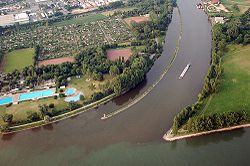
Ports and municipalities
Around Frankfurt are several large inland ports. Because the river is rather narrow on many of the upper reaches, navigation with larger vessels and push convoys requires great skill.
The largest cities along the Main are
The river has gained enormous importance as a vital part of European "Corridor VII", the inland waterway link from the North Sea to the Black Sea.[5]
Main line
In a historical and political sense, the Main line is referred to as the northern border of
The river course also corresponds with the Speyer line isogloss between Central and Upper German dialects, sometimes mocked as Weißwurstäquator.[6][7]
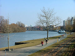
Recreation
The
Sights
See also
- Krassach (River)
Notes and references
- Footnotes
- ^ The Bavarian authorities define the source of the White Main as the source of the Main itself, although the sources of the Red Main and the Franconian Rezat are actually further from the Rhine.
- Citations
- ^ a b Complete table of the Bavarian Waterbody Register by the Bavarian State Office for the Environment (xls, 10.3 MB)
- ^ "Main River | river, Germany". Encyclopedia Britannica. Retrieved 2021-02-04.
- S2CID 16401687.
- ^ "Daten und Fakten" [Facts and figures] (in German). Wasser- und Schifffahrtsdirektion Süd. June 2003. Archived from the original on 13 June 2013. Retrieved 7 June 2009.
- ^ "NoorderSoft Waterways Database". Retrieved 2007-10-24.
- ISBN 978-1-317-64053-0.
- ISBN 978-1-136-59537-0.
- ^ "Main-Radweg". Archived from the original on 7 November 2019. Retrieved 23 April 2013.
Bibliography
- Haus der Bayerischen Geschichte (ed.), Main und Meer - Porträt eines Flusses. Exhibition Catalogue to the Bayerische Landesausstellung 2013 (German). WBG. ISBN 978-3-534-00010-4.
External links
- Main River Website on the River Main by the Tourist Board of Franconia. (in English)
- . Collier's New Encyclopedia. 1921.
- . . 1914.
- There is literature about Main (river) in the Hessian Bibliography
- Water levels of Bavarian rivers
- Wasser- und Schifffahrtsdirektion Süd
- Main Cycleway
- Historical map of the Main confluence at Steinenhausen from BayernAtlas

| International | |
|---|---|
| National | |
| Geographic | |