
Malabar District
| Malabar district | |||||||||||||||||||||||||||||||||||||
|---|---|---|---|---|---|---|---|---|---|---|---|---|---|---|---|---|---|---|---|---|---|---|---|---|---|---|---|---|---|---|---|---|---|---|---|---|---|
Calicut | |||||||||||||||||||||||||||||||||||||
| Area | |||||||||||||||||||||||||||||||||||||
• 1951 | 15,027[1] km2 (5,802 sq mi) | ||||||||||||||||||||||||||||||||||||
| Population | |||||||||||||||||||||||||||||||||||||
• 1951 | 4,758,842[1] | ||||||||||||||||||||||||||||||||||||
| Government | |||||||||||||||||||||||||||||||||||||
District collector | |||||||||||||||||||||||||||||||||||||
| History | |||||||||||||||||||||||||||||||||||||
• Territories ceded by Tipu Sultan attached to Bombay Presidency | 1792 | ||||||||||||||||||||||||||||||||||||
• Divided into North Malabar and South Malabar | 1793 | ||||||||||||||||||||||||||||||||||||
• Attached to Madras Presidency | 1800 | ||||||||||||||||||||||||||||||||||||
• Reorganisation of Taluks | 1860 | ||||||||||||||||||||||||||||||||||||
| 1877 | |||||||||||||||||||||||||||||||||||||
• Became part of Madras State | 1950 | ||||||||||||||||||||||||||||||||||||
| 1956 | |||||||||||||||||||||||||||||||||||||
| 1956 | |||||||||||||||||||||||||||||||||||||
| |||||||||||||||||||||||||||||||||||||
Malabar District, also known as Malayalam District,
The district included the present-day districts of
The city of


The district lay between the
All the major pre-independence political parties of Kerala such as the INC and CPI started their functioning in Kerala at Malabar District as a part of the freedom struggle. KPCC was formed in 1921 at Ottapalam, on the bank of river Bharathappuzha.[13] In July 1937, a clandestine meeting of the CSP, which was the political party formed by socialists of Congress, was held at Calicut.[14] The CPI in Kerala was formed on 31 December 1939 with the Pinarayi Conference, held near Thalassery.[15] It was the erstwhile leaders of Congress Socialist Party, such as P. Krishna Pillai, K. Damodaran, E. M. S. Namboodiripad, who formed the CPI branch in Kerala.
Etymology
Until the arrival of
History

South Malabar


Ancient era
The ancient maritime port of
Early Middle Ages
Three inscriptions those date back to 932 CE, those were found from
Rise of Kozhikode
In the 14th century, Kozhikode conquered larger parts of central Kerala after the seize of Tirunavaya region from Valluvanad, which were under the control of the king of Perumbadappu Swaroopam (Cochin). The ruler of Perumpadappu was forced to shift his capital (c. CE 1405) further south from Kodungallur to Kochi. In the 15th century, the status of Cochin was reduced to a vassal state of Kozhikode, thus leading to the emergence of Kozhikode as the most powerful kingdom in medieval Malabar Coast.[3]
During the 15th century Kalaripayattu was important in the history of Malabar, where some warriors lived, most notably puthooram veettil Aromal Chekavar and his sister Unniyarcha, chieftains of martial arts.[34][35][36]
At the peak of their reign, the
The Kingdom of Cochin used to adopt members from Kingdom of Tanur in the medieval period.[3] Being home to the prominent figures like Thunchaththu Ezhuthachan, Poonthanam Nambudiri, Melpathur Narayana Bhattathiri, Kunchan Nambiar, and Zainuddin Makhdoom II, South Malabar was the cultural capital of medieval Kerala. The Kerala school of astronomy and mathematics flourished between the 14th and 16th centuries. In attempting to solve astronomical problems, the Kerala school independently created a number of important mathematics concepts, including series expansion for trigonometric functions.[49][50] The Kerala School of Astronomy and Mathematics was based at Vettathunadu (Tirur region) of South Malabar.[49]
Kozhikode, Tanur, and Ponnani were the three major port cities in South Malabar region, while the minor trading ports included Beypore, Parappanangadi, and Chaliyam.[44] The coastal Kingdom of Tanur, the Kingdom of Valluvanad in inland, and Palakkad in the hilly region formed other major kingdoms in South Malabar region in the medieval period.[44] Marthanda Varma, the founder of Travancore, belongs to Parappanad royal family. In 1664, the municipality of Fort Kochi was established by Dutch Malabar, making it the first municipality in Indian subcontinent, which got dissolved when the Dutch authority got weaker in the 18th century.[51]
North Malabar


Ancient era
Early Middle Ages
Ezhimala kingdom was succeeded by
An
Late Middle Ages
_(14593177119).jpg)
Until the 16th century CE, the
In 1761, the British captured Mahé, and the settlement was handed over to the ruler of Kadathanadu.[64] The British restored Mahé to the French as a part of the 1763 Treaty of Paris.[64] In 1779, the Anglo-French war broke out, resulting in the French loss of Mahé.[64] In 1783, the British agreed to restore to the French their settlements in India, and Mahé was handed over to the French in 1785.[64]
In conjunction with her sister city,
were two major coastal towns in North Malabar region besides Kannur and Thalassery.Portuguese influences
.jpg)
The maritime
The ruler of the
The Portuguese took advantage of the rivalry between the Zamorin and the King of Kochi allied with Kochi. When
Under Mysore Sultans


In 1757, to check the invasion of the
Colonial period
Tipu ultimately ceded the Malabar district and


According to William Logan, the Taluks of Malabar could be subdivided on the basis of the feudal lords who ruled them before as given below:
Chirakkal Taluk
The Amsoms included in Chirakkal Taluk was classified into two divisions of Kolathunadu and Randathara (also called Poyanadu). There were 44 Amsoms in the Taluk.[2]
Kolathunadu
- Payyannur
- Vellur
- Karivellur
- Korom
- Eramam
- Kuttur (Payyanur)
- Kuttiyeri
- Chuzhali
- Kanhileri
- Kalliad
- Malapattam
- Koyyam
- Kurumathur
- Taliparamba
- Pattuvam
- Ezhome
- Cheruthazham
- Kunhimangalam
- Madayi
- Matool
- Cherukunnu
- Kannapuram
- Irinave
- Pappinisseri
- Kalliasseri
- Morazha
- Kayaralam
- Kuttiattoor
- Maniyoor
- Munderi
- Cheleri
- Kannadiparamba
- Chirakkal
- Azhikode
- Puzhathi
- Elayavoor[2]
Randathara
Randathara was also called Poyanadu due to the belief that it was the place from where the Cheraman Perumal took his final departure on the journey to Mecca. It was originally a part of Kolathunadu, but was treated as a different Nadu.[2] It consisted of the following 7 Amsoms:
- Edakkad
- Chembilode
- Iriveri
- Makreri
- Anjarakkandy
- Mavilayi
- Muzhappilangad[2]
Kottayam Taluk
The Amsoms included in Kottayam Taluk was classified into four divisions- The English Settlement at Tellicherry and Dharmapattanam Islands, Iruvazhinadu, Kurangott Nayar Nadu, and Kottayam. There were 28 Amsoms in the Taluk.[2]
The English Settlement at Tellicherry and Dharmapattanam Islands

It was a part of the ancient Kolathunadu. Later it became a part of the Arakkal kingdom and Kingdom of Mysore. The island of Dharmapattanam was claimed by all of the Kolattu Rajas, Kottayam Rajas, and Arakkal Bibi.[2] The English had settled here and started a factory here. It consisted of the following 4 Amsoms:
- Dharmadam
- Thalassery
- Mailanjanmam
- Thiruvangad[2]
Iruvazhinadu
It was also under the Kolathunadu earlier. When the English factory was established at Thalassery, Iruvazhinadu was held by six families of Nambiars - Kunnummal, Chandroth, Kizhakkedath, Kampurath, Narangozhi, and Kariyad Nambiars. Kurangott Nayar's possession also probably formed part of the original territory of Iruvazhinadu.[2] It consisted of the following 6 Amsoms:
- Panoor
- Puthur
- Thrippangottur
- Panniyannur
- Peringalam
- Kariyad[2]
Kurangott Nayar Nadu
It laid between the English settlement at Thalassery and the French settlement at Mahe.[2] It consisted of the following two Amsoms.
- Olavilam
- Kallayi[2]
Kottayam
It was also earlier a part of Kolathunadu. The Kottayam Rajas (also known as Puranattu Rajas in the meaning of foreign Kshatriya caste) received their territory from the Kolattu Rajas. Pazhassi Raja was a Kottayam Raja.[2] It consisted of the following 16 Amsoms.
- Koodali
- Pattannur
- Chavassery
- Veliyambra
- Muzhakkunnu
- Gannavam
- Manathana
- Kannavam
- Sivapuram
- Pazhassi
- Kandamkunnu
- Paduvilayi
- Pinarayi
- Nettur
- Kadirur
- Kottayam[2]
Wynad Taluk
The Amsoms included in Wynad Taluk was classified into three divisions- North Wynad, South Wynad, and Southeast Wynad. There were 16 Amsoms in the Taluk.[87] Wynad was a separate Revenue Division within Malabar District until 1924.[12]
Wynad was ruled by various kingdoms including Kutumbiyas,
North Wynad
It consisted of the following 7 Amsoms:
- Periya
- Edavaka
- Thondernad
- Porunnanore
- Nalloornad
- Ellurnad
- Kuppathod[87]
South Wynad
It consisted of the following 6 Amsoms:
Southeast Wynad
It was the regions included in the Gudalur and Pandalur Taluks of present Nilgiris district. Southeast Wynad was a part of Malabar District until 31 March 1877, when it was transferred to the neighbouring Nilgiris district due to the heavy population of Malabar and the small area of Nilgiris.[87] It consisted of the following 3 Amsoms.
- Munnanad
- Nambalakode
- Cherankode[87]
Kurumbranad Taluk

The Amsoms included in Kurumbranad Taluk was classified into five divisions- Kadathanad, Payyormala, Payanad, Kurumbranad, and Thamarassery (Some Amsoms of Kurumbranad and Thamarassery were included in the Kozhikode Taluk). There were 57 Amsoms in the Taluk.[2]
Kadathanad
It was also part of the Kolathunadu earlier. It formed a major portion of the Thekkalankur (Southern Regent), or the second headquarters of the Kolattiri Rajas. When the English company settled at Thalassery, Kadathanad was under the ancestors of the Kadathanad Rajas, who was then called Bavnores of Badagara.[2] It consisted of the following 31 Amsoms:
- Azhiyur
- Muttungal
- Chorode
- Eramala
- Karthikappalli
- Purameri
- Edacheri
- Iringannur
- Thuneri
- Vellur
- Parakkadavu
- Chekkiad
- Valayam
- Velliyode
- Kunnummal
- Kavilumpara
- Kuttiadi
- Velom
- Cherapuram
- Kottappally
- Ayancheri
- Katameri
- Kuttipuram
- Kummangod
- Ponmeri
- Arakkilad
- Vatakara
- Memunda
- Palayad
- Puduppanam
- Maniyur
- Thiruvallur[2]
Payyormala
It was under the control of the
- Palery
- Cheruvannur
- Meppayur
- Perambra
- Karayad
- Iringath[2]
Payanadu
It was dependent on the
- Keezhariyur
- Moodadi
- Pallikkara
- Meladi
- Viyyur
- Arikkulam
- Melur
- Chemancheri
- Thiruvangoor[2]
Kurumbranad
It was subjected to the Kurumbranad family, which was connected with the Kingdom of Kottayam.[2] It consisted of the following 9 Amsoms in Kurumbranad and Kozhikode Taluks:
- Kottur
- Trikkuttisseri
- Naduvannur
- Kavumthara
- Iyyad
- Panangad
- Nediyanad
- Kizhakkoth
- Madavoor[2]
Thamarassery
It was also subjected to the Kottayam Rajas.[2] It consisted of the following 9 Amsoms in Kurumbranad and Kozhikode Taluks:
Kozhikode Taluk
The Amsoms included in Kozhikode Taluk was classified into three divisions- Polanad, Beypore (Northern Parappanad), and Puzhavayi. There were 41 Amsoms in the Taluk.[2] (As stated earlier, a part of Kurumbranad and Thamarasseri historical divisions of Kurumbranad Taluk was also included in the Kozhikode Taluk.)
Polanad
Polanad was ruled by the Porlathiri Rajas before the conquest of
- Elathur
- Thalakkulathur
- Makkada
- Chathamangalam
- Kunnamangalam
- Thamarassery
- Kuruvattur
- Padinyattumuri
- Karannur
- Edakkad
- Kacheri
- Nagaram
- Kasaba
- Valayanad
- Kottooli
- Chevayur
- Mayanad
- Kovoor
- Perumanna
- Peruvayal
- Iringallur
- Olavanna[2]
Beypore (Northern Parappanad)
Puzhavayi
It was ruled by its own
- Kedavur
- Thiruvambady
- Puthur
- Neeleswaram
- Koduvally
- Kanniparamba
- Chuloor
- Manashery
- Pannikode[2]
Ernad Taluk

The Amsoms included in Ernad Taluk was classified into four divisions- Parappur (Southern Parappanad), Ramanad, Cheranad, and Eranad. There were 52 Amsoms in the Taluk.[2] (A part of Cheranad division was under Ponnani Taluk).
Parappur (Southern Parappanad)
Southern
- Pazhanchannur
- Mannur
- Tenhipalam
- Neduva
- Vallikunnu
- Parappanangadi
- Nannambra[2]
Ramanad
Ramanad was directly ruled by the
- Nallur
- Azhinjilam
- Cherukavu
- Karad
- Karumarakkad
- Karippur
- Chelembra[2]
Cheranad
Cheranad was also directly ruled by the
- Vadakkumpuram
- Valiyakunnu
- Kattipparuthi
- Athavanad
- Ummathoor
- Irimbiliyam
- Parudur
- Olakara
- Trikkulam
- Koduvayur
- Vengara
- Kannamangalam
- Oorakam-Melmuri
- Puthur
- Kottakkal
- Indiannur
- Valakkulam[2]
Eranad
It consisted of the following 26 Amsoms:
- Mappram
- Cheekkode
- Urangattiri
- Mampad
- Nilambur
- Porur
- Wandoor
- Thiruvali
- Trikkalangode
- Karakunnu
- Iruvetti
- Kavanoor
- Chengara
- Puliyakode
- Kuzhimanna
- Kolathur
- Nediyiruppu
- Keezhmuri
- Melmuri
- Arimbra
- Valluvambram
- Irumbuzhi
- Manjeri
- Payyanad
- Elankur
- Ponmala[2]
Walluvanad Taluk

The Amsoms included in Walluvanad Taluk was classified into four divisions- Vellatiri (Walluvanad proper), Walluvanad, Nedunganad, and Kavalappara. There were 64 Amsoms in the Taluk.[2]
Vellatiri (Walluvanad Proper)
Vellatiri (Walluvanad Proper) was the sole remaining territory of the
- Kodur
- Kuruva
- Mankada-Pallipuram
- Mankada
- Valambur
- Karyavattam
- Nenmini
- Melattur
- Vettattur
- Kottoppadam
- Arakurissi
- Tachampara
- Arakkuparamba
- Chethallur
- Angadipuram
- Perinthalmanna
- Puzhakkattiri
- Pang
- Kolathur
- Kuruvambalam
- Pulamantol
- Elamkulam
- Anamangad
- Paral
- Chembrassery
- Pandikkad[2]
Walluvanad
The Amsoms in this division was comparatively later acquisition by the
- Tuvvur
- Thiruvizhamkunnu
- Thenkara
- Kumaramputhur
- Karimpuzha
- Thachchanattukara
- Aliparamba[2]
Nedunganad
Nedunganad had been under the
- Elambulassery
- Vellinezhi
- Sreekrishnapuram
- Kadampazhipuram
- Kalladikode
- Vadakkumpuram
- Moothedath Madamba
- Thrikkadeeri
- Chalavara
- Cherpulassery
- Naduvattam-Karalmanna
- Kulukkallur
- Chundambatta
- Vilayur
- Pulasseri
- Naduvattam
- Muthuthala
- Perumudiyoor
- Nethirimangalam
- Pallippuram
- Kalladipatta
- Vallapuzha
- Kothakurssi
- Eledath Madamba
- Chunangad
- Mulanjur
- Perur[2]
Kavalappara
- Mundakkottukurissi
- Panamanna
- Koonathara
- Karakkad
- Kuzhappalli
- Mundamuka[2]
Ponnani Taluk

The Amsoms included in Ponnani Taluk was classified into three divisions- Vettathunad, Koottanad, Chavakkad, and the Island of Chetvai . There were 73 Amsoms in the Taluk.[2]
Vettathunad

Vettathunad, also known as the
- Pariyapuram
- Rayirimangalam
- Ozhur
- Ponmundam
- Tanalur
- Niramaruthur
- Trikkandiyur
- Iringavoor
- Klari
- Kalpakanchery
- Melmuri
- Ananthavoor
- Kanmanam
- Thalakkad
- Vettom
- Pachattiri
- Mangalam
- Chennara
- Triprangode
- Pallipuram
- Purathur[2]
Koottanad
.jpg)
The second home of the
- Thavanur
- Kalady
- Kodanad
- Melattur
- Chekkod
- Anakkara
- Keezhmuri
- Pothanur
- Eswaramangalam
- Pallaprom
- Ponnani
- Kanjiramukku
- Edappal
- Vattamkulam
- Kumaranellur
- Kothachira
- Nagalassery
- Thirumittacode
- Othalur
- Kappur
- Alamkod
- Pallikkara
- Eramangalam
- Vayilathur[2]
Chavakkad
Chavakkad had been under the suzerainty of the
The Island of Chetvai
The Island of Chetvai had been earlier under the suzerainty of the
Palghat Taluk
The Amsoms included in Palghat Taluk was classified into three divisions- Palghat, Temmalapuram, and Naduvattam. There were 56 Amsoms in the Taluk.[2]
Palghat
Palghat was ruled by the Palghat Rajas. Sometime previously to 1757, the
- Cheraya
- Kongad
- Mundur
- Kavilpad
- Akathethara
- Puthussery
- Elappully
- Polpully
- Pallatheri
- Puthur
- Koppam
- Yakkara
- Vadakkanthara
- Kodunthirapalli
- Edathara
- Kizhakkumpuram
- Thadukkassery
- Mathur
- Pallanchathanur
- Kannadi
- Kinassery
- Thiruvalathur
- Palathully[2]
Temmalapuram
Temmalapuram consisted of the following 10 Amsoms:
- Chulanur
- Vadakkethara
- Kattusseri
- Kavasseri
- Tarur
- Kannanurpattola
- Ayakkad
- Mangalam
- Vadakkencherry
- Chittilamchery[2]
Naduvattam
Naduvattam was originally under the Palghat Raja. Later the
- Kottayi
- Mankara
- Kuthanur
- Kuzhalmannam
- Vilayanchathanur
- Thenkurissi
- Thannissery
- Peruvemba
- Koduvayur
- Kakkayur
- Vilayannur
- Manjalur
- Erimayur
- Kunissery
- Pallavur
- Kudallur
- Pallassena
- Vadavannur
- Kizhakkethara
- Padinjarethara
- Vattekkad
- Panangattiri
- Muthalamada[2]
Exceptional Nadus (1887)

The Exceptional Nadus included the British colonies which were included in the Malabar District, those were detached from the mainland Taluks of Malabar District by land or sea.[2]
Cannanore and Laccadive Islands
These islands were the territory of Arakkal kingdom outside the town of Kannur.[2] They remained in Malabar district until the formation of the state of Kerala in 1956. It consisted of the following 5 inhabited islands of Lakshadweep:[2]
The uninhabited island of Bangaram was also a part.
Dutch settlements at Cochin (Fort Cochin Taluk)

In 1814, the Dutch settlements at Fort Kochi region of present Kochi city was ceded to East India Company.[2] They were attached to the Malabar District.[2] They remained in the district until the formation of the state of Kerala in 1956. The settlement consisted of the town and fort of Kochi. It was the erstwhile municipality of Fort Kochi. In 1664, the municipality of Fort Kochi was established by Dutch Malabar, making it the first municipality in Indian subcontinent, which got dissolved when the Dutch authority got weaker in the 18th century.[51] It consisted of the following gardens or Pattams:[2]
- Tumboli Pattam
- Kattoor Pattam
- Athazhakkad Pattam
- Manakodathu Pattam
- Antony Fernandez Pattam
- Thekkepurupunkara Pattam
- Mundamveli Pattam
- Domingo Fernandez Palakkal Pattam
- Santiago Pattam
- Thaiveppu Pattam
- Belicho Rodriguez Pattam
- Saint Louis Pattam
- Duart Lemos Pattam
- Hendrick Silva Pattam
- Ramanthuruth Pattam
- Sondikalguvankure Pattam
- Palliport Hospital Parambu[2]
The Dutch settlement at Thangacherry and the English Settlement at Anjengo

Those were the British colonies surrounded by the Kingdom of
Political and social movements
The district was the venue for many of the Mappila revolts (uprisings against the British East India Company in Kerala) between 1792 and 1921. It is estimated that there were about 830 riots, large and small, during this period. Muttichira revolt, Mannur revolt, Cherur revolt, Manjeri revolt, Wandoor revolt, Kolathur revolt, Ponnani revolt, and Thrikkalur revolt are some important revolts during this period. During 1841-1921 there were more than 86 revolutions against the British officials alone.[91] East India Company made an arrangement to collect revenue through Zamorin. However, a revolt under the leadership of Manjeri Athan Gurukkal took place opposing it in 1849.[92]
The Malabar district political conference of
The cities/towns of

The rebels won to establish self-rule in the region for about six months. However, less than six months after the declaration of autonomy, the British managed to recapture it, and put it under the direct control of British Army Commander-in-Chief Chief Rawlson, General Barnett Stuart, Intelligence Chief Maurice Williams, and Police General Armitage. Many of the important British military regiments including Dorset, Karen, Yenier, Linston, Rajputana, Gorkha, Garwale, and Chin Kutchin reached Malabar for the reannexation of the South Malabar.[102] The Wagon tragedy (1921) is still a saddening memory of the Malabar rebellion, where 64 prisoners died on 20 November 1921.[103] The prisoners had been taken into custody following the Mappila Rebellion in various parts of the district. Their deaths through apparent negligence generated sympathy for Indian independence movement.
Post-Independence
After the Indian independence, Madras Presidency was reorganized into Madras state, which was divided along linguistic lines on 1 November 1956, when Malabar District was merged with erstwhile
.Geography


Malabar district, also known as the Malayalam district, bears its name from the hilly nature of many areas in the district.
- Malabar Proper extending north to south along the coast, a distance of around 240 kilometers, and lying between N. Lat 10° 15′ and 12° 18′ N and E.Long. 75° 14′ and 76° 56′.
- A group of nineteen isolated bits of territory lying scattered, fifteen of them in the native state of Cochin and the remaining four in those of Travancore, but all of them near the coastline. These isolated bits of territory form the taluk of British Cochin.
- Two other detached bits of land, the Tangasseri and the Anchuthengu, within the Travancore.
- Four inhabited and ten uninhabited Androth, and Kalpeni.
- The solitary island of Minicoy.
The
The largest three rivers in Malabar District were, Bharathappuzha (River Ponnani), Chaliyar, Kadalundippuzha, all of them flowing through South Malabar. Valapattanam River was the largest river in North Malabar region which empties into Arabian Sea near Kannur. Two rivers flowed eastwards in the district - Kabini River in Wynad Taluk and Bhavani River in the high hills of the Walluvanad Taluk. Both of them were tributaries of the River Kaveri.[1] Other rivers in the district were west-flowing which flows into the Arabian Sea. Coastal backwaters like Kavvayi and Biyyam were also there. The important west-flowing rivers included Valapattanam River in Chirakkal Taluk, Anjarakandi River in Kottayam Taluk, Mahé River and Kuttiadi River in Kurumbranad Taluk, Chaliyar in Ernad Taluk, Kadalundi River in Ernad and Walluvanad Taluks, and Bharathappuzha in Ponnani and Palghat Taluks.[1] Other rivers were Kottoor, Irikkur, Vannathi, Pazhayangadi, Perumba, Kuppam, Kuttikol, and Kavvayi in Chirakkal Taluk, Bavali and Iritti in Kottayam Taluk (Bavali flows through Wynad too), Korapuzha in Kurumbranad and Kozhikode Taluks, Panamarampuzha and Manantoddy River in Wynad Taluk, Kallayi, Irittuzhi, Irungi, and Mukkam in Kozhikode Taluk, Thuthapuzha in Ponnani and Walluvanad Taluks, Olipuzha and Siruvani in Walluvanad Taluk, and Kalpathipuzha, Yakkarapuzha, and Gayathripuzha in Palghat Taluk.[1]
Administrative divisions
Malabar district had 5 revenue divisions namely, Thalassery (Tellicherry), Kozhikode (Calicut), Malappuram, Palakkad (Palghat), and Fort Cochin and 10 Taluks within them.
Thalassery Revenue Division
Headquartered at Thalassery[1]
Taluks
- Chirakkal (Area:1,750 square kilometres (677 sq mi); Headquarters:Chirakkal), now Kannur
- Kottayam (Area:1,270 square kilometres (489 sq mi); Headquarters:Kottayam), now Thalassery
- Wayanad (Area:2,130 square kilometres (821 sq mi); Headquarters:Mananthavady)[1]
Kozhikode Revenue Division
Taluks
- Kurumbranad (Area:1,310 square kilometres (505 sq mi); Headquarters:),now Vatakara
- Kozhikode & Laccadive Islands (Area:980 square kilometres (379 sq mi); Headquarters:Kozhikode)
(Laccadive islands were a separate Taluk under British rule. Later it merged with Kozhikode Taluk.)
Malappuram Revenue Division
Headquartered at Malappuram[1]
Taluks
- Ernad (Area:2,540 square kilometres (979 sq mi); Headquarters:Manjeri)
- Valluvanad (Area:2,280 square kilometres (882 sq mi); Headquarters:), now Perinthalmanna[1]
Palakkad Revenue Division
Taluks
- Ponnani (Area:1,100 square kilometres (426 sq mi); Headquarters:Ponnani)
- Palakkad (Area:1,670 square kilometres (643 sq mi); Headquarters:Palakkad)[1]
Fort Cochin Revenue Division
Headquartered at
- Cochin (Area:5.2 square kilometres (2 sq mi); Headquarters:Cochin)[1]
Demography
Native castes in the erstwhile Malabar District include
| Year | Pop. | ±% p.a. |
|---|---|---|
| 1871 | 2,261,250 | — |
| 1881 | 2,365,035 | +0.45% |
| 1891 | 2,652,565 | +1.15% |
| 1901 | 2,800,555 | +0.54% |
| 1911 | 3,015,119 | +0.74% |
| 1921 | 3,098,871 | +0.27% |
| 1931 | 3,533,944 | +1.32% |
| 1941 | 3,929,425 | +1.07% |
| 1951 | 4,758,842 | +1.93% |
| Source:[105] | ||
Religion in Malabar District (1951)[106]
| Religion | 1871[107] | 1951[106] | |
| 1 | Hinduism | 72.43%[107] | 63.25%[106] |
|---|---|---|---|
| 2 | Islam | 25.72%[107] | 33.49%[106] |
| 3 | Christianity | 1.43%[107] | 3.24%[106] |
Among various Hindu castes,
Malabar Manual states that the royal family of Parappanad belonged to Kshatriya caste, from where members for Travancore royal family were usually selected.[108] The rulers of the Kingdom of Kottayam (Thalassery) also belonged to Kshatriyas.[108] Ambalavasi population was higher in South Malabar, compared to that in North Malabar.[108]
Nambudiri Brahmins, who had the highest position in caste system, were mainly concentrated around the river Bharathappuzha, mainly in the Taluks of Valluvanad and Ponnani, in South Malabar.[108] According to 1881 Census, more than 50% of all Nambudiris in Malabar were settled in Valluvanad and Ponnani taluks.[108] Nearly 90% of the Nambudiris of Malabar were from South Malabar, while North Malabar contributed only around 10%.[108] Kozhikode and Eranad came next to Valluvanad and Ponnani in Namboodiri population.[108] Azhvanchery Thamprakkal, who were the head of all Namboodiri of Kerala belong to Athavanad in erstwhile Ponnani taluk.[108] There were some Iyer Brahmins in Palghat Taluk and Tuluva Brahmins in North Malabar.[108]
Cherumar/Cheramar population was comparatively higher in the erstwhile Taluk of Cheranad (merged with Eranad and Ponnani in the 1860s) and its surroundings.[108] Nearly 70% of all Cherumars of Malabar District in 1857 census were from the Taluks of Eranad, Valluvanad, Ponnani, and Palakkad.[108] William Logan notes in his Malabar Manual that a larger number of Cherumar caste converted into Islam in the Taluks of Eranad, Ponnani, and Valluvanad during 1871–1881, comparing the census reports of 1871 and 1881.[108]
Muslim population was higher in
Fort Cochin Taluk had the highest
The Talukwise area and population of Malabar district as of
| # | Taluk | Area (in sq.miles) |
Population |
|---|---|---|---|
| Thalassery Division | |||
| 1 | Chirakkal (Kannur) | 688 | 534,890 |
| 2 | Kottayam (Thalassery) | 484 | 369,580 |
| 3 | Wayanad (Mananthavady) | 821 | 169,280 |
| Kozhikode Division | |||
| 4 | Kurumbranad (Vatakara) | 506 | 554,091 |
| 5 | Kozhikode & Laccadive Islands | 380 | 530,364 |
| Malappuram Division | |||
| 6 | Eranad (Manjeri) | 978 | 614,283 |
| 7 | Valluvanad (Perinthalmanna) | 873 | 573,457 |
| Palakkad Division | |||
| 8 | Ponnani | 427 | 793,805 |
| 9 | Palakkad | 643 | 585,651 |
| Fort Cochin Division | |||
| 10 | Fort Cochin | 2 | 32,941 |
| Total | 5,802 | 4,758,842 | |
Towns and Types
Although there were several settlements across Malabar district during the Madras Presidency or Pre-Independence era, only a handful were officially considered as 'Towns'. Those were
Abbreviations
| M: Municipality: | Towns with a local governing body constituted under Madras Town Improvement Act of 1865. |
| T: Non Municipal Town: | Towns without a governing body, listed in Madras District Records. |
| C: Cantonment | Towns with a Military base in Madras Presidency. |
| A.C: Administrative Center: | Towns supporting administrative headquarters of higher order. |
| City/Town | Year Declared |
Type | Taluk | Revenue Division | Population |
|---|---|---|---|---|---|
| Pre-Independence / Late 1800s | (1881) | ||||
| Kozhikode | 1866 | M, C, AC | Kozhikode | Kozhikode | 57,085 |
| Palakkad | 1866 | M, AC | Palghat | Palghat | 36,339 |
| Thalassery | 1866 | M, AC | Kottayam | Tellicherry | 26,410 |
| Kannur | 1866 | M, C | Chirakkal | Tellicherry | 26,386 |
| Fort Kochi | 1866 | M, AC | Fort Cochin | Fort Cochin | 15,698 |
| Early 1900s | (1901) | ||||
| Badagara | 1902 | T | Kurumbranad | Kozhikode | 11,319 |
| Ponnani | 1902 | T | Ponnani | Palghat | 10,562 |
| Malappuram | 1904 | T, C, AC | Ernad | Malappuram | 9,216 |
| Tanur | 1912 | T | Ponnani | Palghat | 8,409 |
| Mid 1900s | (1941) | ||||
| Pandalayini (Koyilandy) |
1941 | T | Kurumbranad | Kozhikode | 12,713 |
| Feroke | 1941 | T | Ernad | Malappuram | 6,249 |
| Manjeri | 1941 | T | Ernad | Malappuram | 5,547 |
| Trikkandiyur (Tirur) |
1941 | T | Ponnani | Palghat | 9,489 |
1951 Census of India
The settlements with a population of more than 50,000 were considered as cities and those had between 10,000 and 50,000 were considered as towns.
| City/Town | Taluk | Population (1951) |
|---|---|---|
| Cities | ||
| Kozhikode | Kozhikode | 158,724 |
| Palakkad | Palghat | 69,504 |
| Towns | ||
| Kannur | Chirakkal | 42,431 |
| Thalassery | Kottayam | 40,040 |
| Fort Kochi | Fort Cochin | 29,881 |
| Panthalayini (Koyilandy) | Kurumbranad | 29,001 |
| Ponnani | Ponnani | 23,606 |
| Ottapalam | Walluvanad | 22,695 |
| Badagara | Kurumbranad | 20,964 |
| Feroke | Ernad | 19,463 |
| Tanur | Ponnani | 17,888 |
| Trikkandiyur (Tirur) | Ponnani | 11,830 |
| Shoranur | Walluvanad | 11,596 |
| Manjeri | Ernad | 10,357 |
| Total | 507,975 | |
Local bodies
At the time of
| Abbreviations | ||
| T: TOWN | ||
|---|---|---|
| It maybe either a Municipal Town or a Non-Municipal Town. The settlements exceeding a population of 10,000 and had some sort of economic importance were considered as towns according to 1951 Census of India[115]
| ||
| C: CITY | ||
| The Municipalities exceeding a population of 50,000 and had larger economic importance were treated as cities according to 1951 Census of India[115]
| ||
| TELLICHERRY DIVISION | ||
| Chirakkal Taluk (10)[115] | ||
| Cannanore Municipality (T) | ||
| 1. Payyanur | 2. Karivellur-Peralam | 3. Ramanthali |
| 4. Cheruthazham-Kunhimangalam | 5. Azhikode | 6. Pappinisseri |
| 7. Kankole | 8. Baliapatam | 9. Chirakkal |
| 10. Puzhathi | ||
| Kottayam Taluk (15)[115] | ||
| Tellicherry Municipality (T) | ||
| 11. Panoor
|
12. Kuthuparamba | 13. Kadirur |
| 14. Kariyad | 15. Dharmadom | 16. Kottayam |
| 17. Eranholi | 18. Eruvatty | 19. Peringalam |
| 20. Pinarayi | 21. Pathiriyad | 22. Olavilam |
| 23. Vadakkumpad | 24. Menapram | 25. Kodiyeri |
| Wynad Taluk (8)[115] | ||
| 26. Thavinhal | 27. Manantoddy | 28. Thirunelly |
| 29. Kalpetta | 30. Vythiri | 31. Meppadi |
| 32. Kidanganad | 33. Vellamunda | |
| KOZHIKODE DIVISION | ||
| Kurumbranad Taluk (14)[115] | ||
| 34. Badagara (T) | 35. Cheruvannur | 36. Unnikulam |
| 37. Eramala | 38. Balussery | 39. Edacheri |
| 40. Kunnummakkara | 41. Meppayur | 42. Villiappally |
| 43. Nadapuram | 44. Chorode | 45. Panthalayani (Koyilandy) (T) |
| 46. Veloor | 47. Karthikappalli | |
| Kozhikode Taluk (3)[115] | ||
| Kozhikode Municipality (C) | ||
| 48. Beypore | 49. Thamarassery | 50. Koduvally |
| MALAPPURAM DIVISION | ||
| Ernad Taluk (5)[115] | ||
| 51. Nilambur | 52. Nediyiruppu | 53. Manjeri (T) |
| 54. Kondotty | 55. Kottakkal | |
| Walluvanad Taluk (10)[115] | ||
| 56. Shoranur (T) | 57. Ottapalam (T) | 58. Pattambi |
| 59. Thiruvegappura | 60. Perinthalmanna | 61. Cherpulassery |
| 62. Perur | 63. Kuruvattoor | 64. Vaniyamkulam |
| 65. Karakkad | ||
| PALGHAT DIVISION | ||
| Ponnani Taluk (21)[115] | ||
| 66. Ponnani (T) | 67. Kalpakanchery | 68. Trikkandiyur (Tirur) (T) |
| 69. Tanur Nagaram | 70. Tanur (T) | 71. Ozhur |
| 72. Andathode | 73. Vadakkekad | 74. Attupuram |
| 75. Vylathur | 76. Veliyankode | 77. Ayiroor |
| 78. Maranchery | 79. Kottapadi | 80. Chavakkad |
| 81. Chittaattukara | 82. Elavally | 83. Pavaratty |
| 84. Kundazhiyur | 85. Venkitangu | 86. Engandiyur |
| Palghat Taluk (14)[115] | ||
| Palghat Municipality (C) | ||
| 87. Peringottukurissi | 88. Kottayi | 89. Tholanur |
| 90. Vadakkencherry | 91. Kizhakkancherry | 92. Kollengode |
| 93. Vadavannur | 94. Pallassana
|
95. Koduvayur |
| 96. Thenur | 97. Elappully | 98. Kattusseri |
| 99. Paruthipully | 100. Mankara | |
| FORT COCHIN DIVISION | ||
| Fort Cochin Taluk (0)[115] | ||
| Fort Cochin Municipality (T) | ||
Politics
Representatives from Malabar to Madras State
- In C. Rajagopalachari Ministry: 1) Kongattil Raman Menon (1937–39), 2) C. J. Varkey, Chunkath(1939)
- In Prakasam Ministry: 1) R. Raghavamenon (1946–47)
- In Ramaswami Reddyar Ministry: 1) Kozhippurathu Madhavamenon (1947–49)
- In P. S. Kumaraswami Ministry: 1) Kozhippurathu Madhavamenon (1949–52)
- In C. Rajagopalachari Ministry: 1) K. P. Kuttikrishnan Nair (1952–54) Kalladi Unnikammu Sahib
1951–52 Indian general election
In the first election to the Lok Sabha conducted under the provisions of the Indian Constitution after Independence, Malabar district had five constituencies, Kannur, Thalassery, Kozhikode, Malappuram and Ponnani.[116]
| Constituency | Winner | Party | Runner-up | Party | |||
|---|---|---|---|---|---|---|---|
| 1 | Kannur
|
A. K. Gopalan | CPI | C.K.K Govindan Nayar | INC | ||
| K.S.Subramania Iyer | IND
|
||||||
| 2 | Thalassery
|
Nettur P. Damodaran | KMPP | P. Kunhiraman | INC | ||
| P.M.V Kunhiraman Nambiar | SP | ||||||
| 3 | Kozhikode
|
Achuthan Damodaran Menon | KMPP | Ummar Koya Parappil | INC | ||
| Ramakrislina Naick,R.N. Ruhur | IND
|
||||||
| 4 | Malappuram
|
B. Pocker Sahib Bahadur | IUML | T.V. Chathukutty Nair | INC | ||
| Kumhali Karikedan | CPI | ||||||
| 5 | Ponnani
|
K. Kelappan | KMPP | Karunakara Menon | INC | ||
| Vella Eacharan Iyyani | INC | Massan Gani | IND
|
||||
1952 Madras Legislative Assembly election
25 State Legislative Assembly constituencies were allotted from the Malabar District to the
| Constituency | Winner | Party | Runner-up | Party | |||
|---|---|---|---|---|---|---|---|
| 1 | Nattika
|
Gopalakrishnan | CPI | Raman | INC | ||
| 2 | Ponnani
|
N. Gopala Menon | INC | K. C. Sankarann | INC | ||
| E. T. Kunhan | CPI | A. C. Raman | KMPP | ||||
| 3 | Tirur
|
K. Uppi Saheb | IUML | K. Ahmad Kutty | INC | ||
| 4 | Thrithala
|
K. B. Menon | SP | P. K. Moideen Kutty | INC | ||
| 5 | Perinthalmanna
|
Kunhimahamad Shafee Kallingal | IUML | P. Ahmad Kutty Sadhu | CPI | ||
| 6 | Mannarkkad
|
K. C. Gopalanunni | IND
|
Kurikal Ahmed | IND
|
||
| 7 | Pattambi
|
V. Sankara Narayana Menon | KMPP | A. Ramachandra Nedungadi | INC | ||
| 8 | Ottapalam
|
M. Narayana Kurup | KMPP | C. P. Madhavan Nair | INC | ||
| 9 | Palakkad
|
K. Ramakrishnan | IND
|
P. Vasu Menon | INC | ||
| 10 | Alathur
|
K. Krishnan | CPI | Y. R. Ramanatha Iyer | IND
|
||
| O. Koran | KMPP | E. Eacharan | INC | ||||
| 11 | Malappuram
|
Miniyadam Chadayan | IUML | Karupadata Ibrahim | INC | ||
| Mohammad Haje Seethi | IUML | Kallayan Kunhambu | INC | ||||
| 12 | Kottakkal
|
Chakkeeri Ahmad Kutty
|
IUML | Kunjunni Nedumgadi, Ezhuthassan Kalathil | INC | ||
| 13 | Kozhikode | K. P. Kutty Krishnan Nair | INC | E. M. S. Namboodiripad | CPI | ||
| 14 | Chevayur | A. Appu | INC | Ayyadhan Balagopalan | KMPP | ||
| 15 | Wayanad | Manyangode Padmanabha Gounder | SP | Kozhipurath Madhava Menon | INC | ||
| Chomadi Velukkan | SP | Veliyan Nocharamooyal | INC | ||||
| 16 | Koyilandy
|
Chemmaratha Kunhriramakurup | KMPP | Anantapuram Patinhare Madam Vasudevan Nair | INC | ||
| 17 | Perambra
|
Kunhiram Kidavu Polloyil | KMPP | Kalandankutty, Puthiyottil | INC | ||
| 18 | Vadakara
|
Moidu Keloth | SP | Ayatathil Chathu | INC | ||
| 19 | Nadapuram
|
E. K. Sankara Varma Raja | INC | K. Thacharakandy | CPI | ||
| 20 | Thalassery
|
C. H. M. Kanaran | CPI | K. P. M. Raghavan Nair | INC | ||
| 21 | Kuthuparamba
|
Krishna Iyer | IND
|
Harindranabham, Kalliyat Thazhathuveethil | SP | ||
| 22 | Mattanur
|
Madhavan Nambiar, Kallorath | CPI | Subbarao | INC | ||
| 23 | Kannur
|
Kariath Sreedharan | KMPP | Pamban Madhavan | INC | ||
| 24 | Taliparamba
|
T. C. Narayanan Nambiar | CPI | V. V. Damodaran Nayanar | INC | ||
| 25 | Payyanur
|
K. P. Gopalan | CPI | Vivekananda Devappa Sernoy | INC | ||
Malabar Cuisine


The Malabar cuisine depicts it culture and heritage. It is famous for
Another speciality is banana chips, which are made crisp and wafer-thin. Other popular dishes include seafood preparations (prawns, mussels, mackerel) . Vegetarian fare includes the sadya.
Malabar cuisine is a blend of traditional
The Malabar version of
The snacks include
However, the newer generation is more inclined towards to Chinese and American food. Chinese food is very popular among the locals.
Notable people from Malabar
Modern day taluks and islands in erstwhile Malabar
| District | Taluk/Island |
|---|---|
| Kasaragod district | Kasaragod |
Manjeshwaram
| |
| Hosdurg | |
| Vellarikundu | |
| Kannur district | Taliparamba |
| Kannur | |
Payyanur
| |
| Thalassery | |
| Iritty | |
| Wayanad district | Mananthavady |
Sulthan Bathery
| |
Vythiri (Kalpetta )
| |
| Kozhikode district | Vatakara |
| Koyilandy | |
| Kozhikode | |
| Thamarassery | |
| Nilgiris district | Gudalur |
| Pandalur | |
| Malappuram district | Tirurangadi |
Eranad (Manjeri )
| |
| Nilambur | |
| Perinthalmanna | |
| Kondotty | |
| Tirur | |
| Ponnani | |
| Palakkad district | Mannarkkad |
Ottappalam
| |
| Palakkad | |
| Pattambi | |
| Alathur | |
| Chittur | |
| Thrissur district | Chavakkad |
| Kodungallur (parts) | |
| Ernakulam district | Fort Kochi |
| Lakshadweep | Agatti |
| Andrott | |
| Bangaram | |
| Kalpeni | |
| Kavaratti | |
| Minicoy |
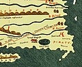
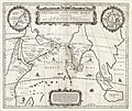
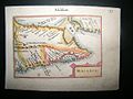
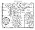
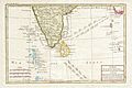
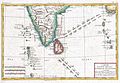
Historical maps
-
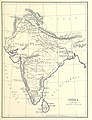
 Malabar Coast around AD 1st century CE
 -
 Major ports in 1st century CE according to the Periplus of the Erythraean Sea
 -
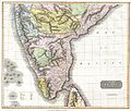
 Malabar Coast around AD 300 (4th century CE)
 -
 Zamorin of Calicut's empire in 1498
 -
 Malabar Coast in Portuguese India (16th century CE)
 -
 Malabar Coast in the early 17th century (1600–1618)
 -
 A horizontal Malabar Coast miniature map by Abraham Ortelius, Antwerp, c.1580, from the Epitome Theatri Orteliani; *a reprint by Petrus Bertius, 1630*; and *another Bertius version*, Amsterdam, c.1600-18
 -
 Malabar in 1652 (Malabar Coast is highlighted separately on the right side)
 -
 Calicutis marked in large letters).
 -
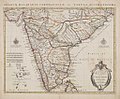 A map in which the entire western coast of India is termed as Malabar Coast (drawn in the mid-18th century CE)
 -
 Kaart van Zuid-India Nova tabula terrarum Cucan, Canara, Malabaria, Madura, & Coromandella, cum parte septentrionali insulae Ceylon, in mari Indico Orientali edente Hadriano Relando (titel op object)
 -
 A rare map of India and Ceylon issued in 1733 by the Homann Heirs.
 -
 A map of South India drawn by Emanuel Bowen (1744)
 -
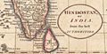
 Indian Subcontinentin 1760
 -
 Rigobert Bonne's 1770 decorative map of southern India.
 -
 1775 maritime map or nautical chart of southern India and Ceylon by Jean-Baptiste d'Après de Mannevillette.
 -
 Historical map of South India, Sri Lanka, the Maldives, the Nicobar Islands, Myanmar, the Malabar Coast, the Coromandel Coast, the Andaman Islands (1780)
 -
 1780 map of southern India by the French cartographer Rigobert Bonne.
 -
 Rigobert Bonne and G. Raynal's 1780 map of Southern India.
 -
 South India in 1782
 -
 Political state of South India just after Third Anglo-Mysore War which ended in 1792.
 -
 South India in 1794
 -
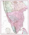 A Map of the Peninsula of India from the 19th Degree North Latitude to Cape Comorin, just after the Fourth Anglo-Mysore War which ended in 1799
 -
 1800 Faden Rennell Wall Map of India - Geographicus - India
 -
 India in 1804
 -
 1804 German Edition of the Rennel Map of India - Geographicus
 -
 South India in 1808
 -
 1808 Smith Map of India - Geographicus - India
 -
 1814 Thomson Map of India - Geographicus - India
 -
 India in General Karte von Vorderindien zur Übersicht der Hauptverhältnisse (1836)
 -
 1838 Wyld Wall Map of India (Hindostan or British India) - Geographicus - India
 -
 South India in 1843
 -
 Southern division of South India in 1843
 -
 Calicutis marked)
 -
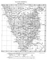
 Map of Madras Presidency in taken from Text-book of Indian History: Geographical Notes, Genealogical Tables, Examination Questions (1880)
 -
 India in 1887 with cattle breeds based on the travels of Robert Wallace.
 -

-
 1891 Map of India (Outlines of Geography for the use of lower and middle forms of schools and of candidates for the Army Preliminary Examinations)
 -
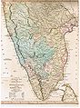
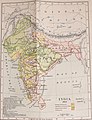
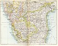
 Malabar Coast in 1893
 -
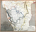
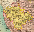
 North Malabar in 1893 (On the southwestern end of the map)
 -
 Geology Gazetter map of Malabar in 1897
 -

-
 Image taken from page 1381 of La Terra, trattato popolare di geografia universale
 -
 North Malabar in 1909 (On the southwestern end of the map)
 -
 Malabar Coast in 1911 (On the southwestern region of the map)
 -
 Map ofSouth Indian Railway, printed by Hoe and Coat the 'Premier Press', Madras, 1913
 -
 1932 map of Malabar Coast

_in_Antiquity_-_Geographicus_-_ErythraeanSea-jansson-1658.jpg)


_-_AM_-_71694.jpg)
,_NG-501-71.jpg)


,_the_Maldives,_and_the_Indian_Ocean_-_Geographicus_-_IndiaSouth-bonne-1770.jpg)


_-_Geographicus_-_India-wyld-1838.jpg)


.jpg)
.jpg)


.jpg)
%27_(11245509775).jpg)

.jpg)


See also
- Zamorin
- Arakkal kingdom
- Kingdom of Mysore
- Dutch Malabar
- Treaty of Seringapatam
- Pazhassi Raja
- William Logan (author)
- North Malabar
- South Malabar
- Malabar pepper
- Kerala
- Lakshadweep
- Kozhikode district
- Wayanad district
- Nilgiris district
- Kannur district
- Kasaragod district
- Malappuram district
- Palakkad district
- Thrissur district
- Fort Kochi
- Kolathunadu
- Kingdom of Valluvanad
- Kingdom of Tanur
- Travancore
- Kingdom of Cochin
- Travancore-Cochin
- States Reorganisation Act, 1956
References
- ^ a b c d e f g h i j k l m n o p q r s t u v w x y z aa ab ac 1951 census handbook - Malabar district (PDF). Chennai: Government of Madras. 1953. pp. 1–2. Archived (PDF) from the original on 26 June 2021. Retrieved 27 September 2020.
- ^ ISBN 9788120604476.
- ^ ISBN 9788126415786. Archivedfrom the original on 19 April 2022. Retrieved 25 November 2020.
- ^ Chisholm, Hugh, ed. (1911). . Encyclopædia Britannica. Vol. 17 (11th ed.). Cambridge University Press. p. 452.
- ^ Superintendent of Census Operations, Madras (1956). Abstract of 1951 Census Tables for Madras State (PDF). Madras: Government of Madras. p. 6. Archived (PDF) from the original on 3 October 2021. Retrieved 24 November 2020.
- ^ a b C.A., Innes (1908). Madras District Gazetteers: Malabar and Anjengo. Government Press, Madras. p. 416. Retrieved 11 January 2020.
- ^ a b "The States Reorganisation Act, 1956" (PDF). legislative.gov.in. Government of India. Archived (PDF) from the original on 31 August 2021. Retrieved 9 June 2021.
- ^ M. K. Devassy (1965). 1961 Census Handbook- Cannanore District (PDF). Directorate of Census Operations, Kerala and The Union Territory of Laccadive, Minicoy, and Amindivi Islands. Archived (PDF) from the original on 9 May 2022. Retrieved 9 June 2021.
- ^ M. K. Devassy (1965). 1961 Census Handbook- Kozhikode District (PDF). Directorate of Census Operations, Kerala and The Union Territory of Laccadive, Minicoy, and Amindivi Islands. Archived (PDF) from the original on 26 June 2021. Retrieved 19 December 2020.
- ^ M. K. Devassy (1965). 1961 Census Handbook- Palghat District (PDF). Directorate of Census Operations, Kerala and The Union Territory of Laccadive, Minicoy, and Amindivi Islands. Archived (PDF) from the original on 30 August 2021. Retrieved 9 June 2021.
- ^ Pamela Nightingale, ‘Jonathan Duncan (bap. 1756, d. 1811)’, Oxford Dictionary of National Biography, Oxford University Press, 2004; online edn, May 2009
- ^ a b c Boag, GT (1933). The Madras Presidency (1881-1931) (PDF). Madras: Government of Madras. p. 9. Archived (PDF) from the original on 9 June 2021. Retrieved 9 June 2021.
- ^ "KPCC marks a milestone tomorrow". The Hindu. 21 April 2017. Archived from the original on 9 May 2022. Retrieved 21 April 2017.
- ^ Thiruvananthapuram, R. KRISHNAKUMAR in (26 August 2004). "A man and a movement". Frontline. Archived from the original on 23 April 2022. Retrieved 6 April 2021.
- ^ "Founders". CPIM Kerala. Archived from the original on 8 December 2020. Retrieved 6 April 2021.
- ^ ISBN 9788126415885. Archivedfrom the original on 13 November 2021. Retrieved 19 July 2020.
- ^ J. Sturrock (1894). "Madras District Manuals - South Canara (Volume-I)". Madras Government Press.
- ^ V. Nagam Aiya (1906). The Travancore State Manual. Travancore Government Press.
- ^ C. A. Innes and F. B. Evans, Malabar and Anjengo, volume 1, Madras District Gazetteers (Madras: Government Press, 1915), p. 2.
- ^ M. T. Narayanan, Agrarian Relations in Late Medieval Malabar (New Delhi: Northern Book Centre, 2003), xvi–xvii.
- ^ Mohammad, K.M. "Arab relations with Malabar Coast from 9th to 16th centuries" Proceedings of the Indian History Congress. Vol. 60 (1999), pp. 226–34.
- ISBN 978-81-206-0446-9.
- ^ M. Vijayanunni (1983). 1981 Census Handbook- Wayanad District (Part-A&B) (PDF). Directorate of Census Operations, Kerala. Archived (PDF) from the original on 26 June 2021. Retrieved 4 June 2021.
- ^ Coastal Histories: Society and Ecology in Pre-modern India, Yogesh Sharma, Primus Books 2010
- ^ Subramanian, T. S (28 January 2007). "Roman connection in Tamil Nadu". The Hindu. Archived from the original on 19 September 2013. Retrieved 28 October 2011.
- ^ Gurukkal, R., & Whittaker, D. (2001). In search of Muziris. Journal of Roman Archaeology, 14, 334-350.
- ^ A. Shreedhara Menon, A Survey of Kerala History
- ^ According to Pliny the Elder, goods from India were sold in the Empire at 100 times their original purchase price. See [1]
- ^ Bostock, John (1855). "26 (Voyages to India)". Pliny the Elder, The Natural History. London: Taylor and Francis.
- ^ Indicopleustes, Cosmas (1897). Christian Topography. 11. United Kingdom: The Tertullian Project. pp. 358–373.
- ^ Das, Santosh Kumar (2006). The Economic History of Ancient India. Genesis Publishing Pvt Ltd. p. 301.
- ^ a b Narayanan, M. G. S. Perumals of Kerala: Brahmin Oligarchy and Ritual Monarchy Perumāḷs of Kerala. Thrissur (Kerala): CosmoBooks, 2013. 438-42.
- ^ DCHB Malapuram 2011 Part-B
- ISBN 9788126003655.
- ISBN 978-81-264-3782-5. Retrieved 10 October 2021.
- ISBN 9780190992071.
- ISBN 978-81-264-1588-5. Archivedfrom the original on 13 November 2021. Retrieved 19 July 2020.
- ^ a b The Portuguese, Indian Ocean and European Bridgeheads 1500–1800. Festschrift in Honour of Prof. K. S. Mathew (2001). Edited by: Pius Malekandathil and T. Jamal Mohammed. Fundacoa Oriente. Institute for Research in Social Sciences and Humanities of MESHAR (Kerala)
- ^ DC Books, Kottayam (2007), A. Sreedhara Menon, A Survey of Kerala History
- ISBN 9788176481700.
- ^ കോളേജ്, എം സി വസിഷ്ഠ് അസോസിയേറ്റ് പ്രൊഫസർ ചരിത്രവിഭാഗം മലബാർ ക്രിസ്ത്യൻ. "കോഴിക്കോട്ടുകാർ മറന്നുപോയ രാരിച്ചൻ മൂപ്പൻ". Mathrubhumi. Archived from the original on 9 July 2021. Retrieved 15 September 2022.
- ^ Varier, M. R. Raghava. "Documents of Investiture Ceremonies" in K. K. N. Kurup, Edit., "India's Naval Traditions". Northern Book Centre, New Delhi, 1997
- ^ a b c d e K. V. Krishna Iyer, Zamorins of Calicut: From the earliest times to AD 1806. Calicut: Norman Printing Bureau, 1938.
- ^ Ibn Battuta, H. A. R. Gibb (1994). The Travels of Ibn Battuta A.D. 1325-1354. Vol. IV. London.
{{cite book}}: CS1 maint: location missing publisher (link) - ISBN 974-8496-78-3
- ^ Varthema, Ludovico di, The Travels of Ludovico di Varthema, A.D.1503–08, translated from the original 1510 Italian ed. by John Winter Jones, Hakluyt Society, London
- ^ Gangadharan. M., The Land of Malabar: The Book of Barbosa (2000), Vol II, M.G. University, Kottayam.
- ^ JSTOR 2690896.
- S2CID 68570164,
One example I can give you relates to the Indian Mādhava's demonstration, in about 1400 A.D., of the infinite power series of trigonometrical functions using geometrical and algebraic arguments. When this was first described in English by Charles Whish, in the 1830s, it was heralded as the Indians' discovery of the calculus. This claim and Mādhava's achievements were ignored by Western historians, presumably at first because they could not admit that an Indian discovered the calculus, but later because no one read anymore the Transactions of the Royal Asiatic Society, in which Whish's article was published. The matter resurfaced in the 1950s, and now we have the Sanskrit texts properly edited, and we understand the clever way that Mādhava derived the series without the calculus, but many historians still find it impossible to conceive of the problem and its solution in terms of anything other than the calculus and proclaim that the calculus is what Mādhava found. In this case, the elegance and brilliance of Mādhava's mathematics are being distorted as they are buried under the current mathematical solution to a problem to which he discovered an alternate and powerful solution.
- ^ a b M K Sunil Kumar (26 September 2017). "50 years on, Kochi still has a long way to go". The Times of India. Archived from the original on 2 June 2021. Retrieved 1 June 2021.
- ISBN 9788126415786.
- ^ District Census Handbook, Kasaragod (2011) (PDF). Thiruvananthapuram: Directorate of Census Operation, Kerala. p. 9. Archived (PDF) from the original on 10 March 2022. Retrieved 5 June 2021.
- ^ a b Government of India (2014–15). District Census Handbook – Wayanad (Part-B) 2011 (PDF). Directorate of Census Operations, Kerala. Archived (PDF) from the original on 8 March 2022. Retrieved 5 June 2021.
- ^ Ayinapalli, Aiyappan (1982). The Personality of Kerala. Department of Publications, University of Kerala. p. 162. Retrieved 27 July 2018.
A very powerful and warlike section of the Bants of Tulunad was known as Kola bari. It is reasonable to suggest that the Kola dynasty was part of the Kola lineages of Tulunad.
- ISBN 978-8126415885. Archivedfrom the original on 13 November 2021. Retrieved 19 July 2020.
- ^ Narayanan, M. G. S. Perumāḷs of Kerala. Thrissur (Kerala): CosmoBooks, 2013. 483.
- ^ Charles Alexander Innes (1908). Madras District Gazetteers Malabar (Volume-I). Madras Government Press. pp. 423–424.
- ^ a b S. Muhammad Hussain Nainar (1942). Tuhfat-al-Mujahidin: An Historical Work in The Arabic Language. University of Madras.
- ^ M. Vijayanunni. 1981 Census Handbook- Kasaragod District (PDF). Directorate of Census Operations, Kerala. Archived (PDF) from the original on 6 December 2021. Retrieved 5 June 2021.
- ^ The Hindu staff reporter (21 November 2011). "Neeleswaram fete to showcase its heritage". The Hindu. Archived from the original on 30 April 2022. Retrieved 24 November 2016.
- ^ "Arakkal royal family". Archived from the original on 5 June 2012.
- ISBN 978-81-206-1524-3. Archivedfrom the original on 29 April 2019. Retrieved 27 February 2021.
- ^ a b c d "History of Mahé". Archived from the original on 30 December 2013. Retrieved 19 April 2021.
- ISBN 978-1-56836-249-6.
- ISBN 978-90-5702-453-5. Retrieved 11 November 2007.
- ISBN 978-0-521-26931-5.
- ISBN 978-1-932705-54-6. Retrieved 9 August 2012.
- ^ "Kollam Mayor inspects Tangasseri Fort". The Hindu. 1 February 2007. Archived from the original on 23 November 2016. Retrieved 9 September 2019.
- ISBN 978-81-7211-083-3. Retrieved 9 August 2012.
- ISBN 9781857433180. Retrieved 18 November 2012.
- ^ World States Men: Indian Princes Princely states of India Archived 13 January 2013 at the Wayback Machine
- ^ V. V., Haridas. "King court and culture in medieval Kerala – The Zamorins of Calicut (AD 1200 to AD 1767)". [2] Archived 13 September 2021 at the Wayback Machine Unpublished PhD Thesis. Mangalore University
- ^ Madrass District Gazetteers, The Nilgiris. By W. Francic. Madras 1908 Pages 90-104
- ^ Report of the Administration of Mysore 1863-64. British Parliament Library
- ISBN 978-0-7141-2424-7. Retrieved 18 November 2012.
- ISBN 978-81-317-5830-4. Retrieved 18 November 2012.
- ^ The Edinburgh Gazetteer. Longman, Rees, Orme, Brown, and Green. 1827. pp. 63–. Retrieved 18 November 2012.
- ^ Dharma Kumar (1965). Land and Caste in South India: Agricultural Labor in the Madras Presidency During the Nineteenth Century. CUP Archive. pp. 87–. GGKEY:T72DPF9AZDK. Retrieved 18 November 2012.
- ISBN 978-81-7017-034-1. Retrieved 18 November 2012.
- ^ C.A., Innes (1908). Madras District Gazetteers: Malabar and Anjengo. Government Press, Madras. p. 373. Retrieved 30 September 2020.
- ^ L.K.A.Iyer, The Mysore Tribes and caste Archived 11 April 2023 at the Wayback Machine. Vol.III, A Mittal Publish. Page.279, Google Books
- ISBN 9788182201675. Archivedfrom the original on 11 April 2023. Retrieved 30 September 2022.
- ^ L.Krishna Anandha Krishna Iyer(Divan Bahadur) The Cochin Tribes and Caste Archived 7 April 2023 at the Wayback Machine Vol.1. Johnson Reprint Corporation, 1962. Page. 278, Google Books
- ^ Iyer, L. K. Anantha Krishna (1909). The Cochin tribes and castes vol.I. Higginbotham, Madras.
- ISBN 9788170992110. Archivedfrom the original on 2 October 2021. Retrieved 13 December 2020.
- ^ a b c d e f Logan, William (1887). Malabar Manual (Volume-2). Madras: PRINTED BY R. HILL, AT THE GOVERNMENT PRESS.
- ^ Ayyappan, A. (1992). The Paniyas: An Ex-slave Tribe of South India. The University of Michigan: Institute of Social Research and Applied Anthropology. pp. 20, 28–29, 80. Archived from the original on 22 July 2021. Retrieved 29 November 2020.
- ^ Kurup, Dr. K K N (2008). Jain society of Wayanad, Sri Ananthanatha Swami Kshetram, Kalpetta, Platinum Jubilee souvenir. p. 45.
- ^ Rice, B. Lewis (1902). Epigraphica Carnatica (PDF). Mangalore: Government of India. pp. 24, 28, 32. Archived (PDF) from the original on 20 April 2016. Retrieved 29 November 2020.
- ^ K. Madhavan Nair, 'Malayalathile Mappila Lahala,' Mathrubhumi, 24 March 1923.
- ^ "History of Malappuram" (PDF). censusindia.gov.in. Archived (PDF) from the original on 27 November 2019. Retrieved 17 April 2020.
- ^ "The 1920 political conference at Manjeri". Deccan Chronicle. 29 June 2016. Archived from the original on 18 July 2020. Retrieved 18 July 2020.
- ^ Malabar Desiyathayude Idapedalukal. Dr. M. T. Ansari. DC Books
- ^ R. H. Hitch cock, 1983 Peasant revolt in Malabar, History of Malabar Rebellion 1921.
- ^ Madras Mail 17 September 1921, p 8
- ^ ‘particularly strong evidence of the molding influence of British power structures lies in the rebels constant use of British titles to authority such as Assistant Inspector, Collector, Governor, Viceroy and (less conclusively) King’ The Moplah Rebellion and Its Genesis 184
- ^ ‘The rebel kists’, martial law, tolls, passports and, perhaps, the concept of a Pax Mappila, are to all appearances traceable to the British empire in India as a prototype’ The Moplah Rebellion and Its Genesis, Peoples Publishing House, 1987, 183
- ^ C. Gopalan Nair. Moplah Rebellion, 1921. p. 78. Retrieved 4 October 2020.
He issued passports to persons wishing to get outside his kingdom
- ^ F. B. Evans, ‘Notes on the Moplah Rebellion’, 27 March 1922, p 12.
- ^ (Tottenham, G. F. R., ‘Summary of the Important Events of the Rebellion,’ in Tottenham, Mapilla Rebellion) 1921 dated Sept 15 no 367
- ^ Home (Pol) Department, Government of India, File No. 241/XVI,/1922, Telegram Section, p.3, TNA
- ^ Panikkar, K. N., Against Lord and State: Religion and Peasant Uprisings in Malabar 1836-1921
- ^ "Mineral Resources in Kerala". Archived from the original on 7 May 2021. Retrieved 2 June 2021.
- ^ Official Administration of the Madras Presidency, Pg 327
- ^ a b c d e f g h i 1951 census handbook - Malabar district (PDF). Chennai: Government of Madras. 1953. Archived (PDF) from the original on 26 June 2021. Retrieved 27 September 2020.
- ^ a b c d e Cornish, W. R. (1874). Report on the Census of Madras Presidency - 1871 (PDF). Madras: Government of Madras. Archived (PDF) from the original on 9 June 2021. Retrieved 9 June 2021.
- ^ a b c d e f g h i j k l m n o p q r s t u v w x y William Logan (1887). Malabar Manual (Volume-I). Madras Government Press.
- ^ a b c J. Sturrock (1894). Madras District Manuals - South Canara (Volume-I). Madras Government Press.
- ^ a b c Presidency, Madras (India (1915). Madras District Gazetteers, Statistical Appendix For Malabar District (Vol.2 ed.). Madras: The Superintendent, Government Press. p. 20. Archived from the original on 27 March 2023. Retrieved 2 December 2020.
- ^ "CHRONOLOGICAL LIST OF CENTRAL ACTS (Updated up to 17-10-2014)". Lawmin.nic.in. Archived from the original on 7 January 2018. Retrieved 7 August 2016.
- ^ a b McIver, Lewis; Stokes, G. (1883). Imperial Census of 1881 Operations and Results in the Presidency of Madras ((Vol II) ed.). Madras: E.Keys at the Government Press. p. 444. Archived from the original on 27 March 2023. Retrieved 5 December 2020.
- ^ a b HENRY FROWDE, M.A., Imperial Gazetteer of India (1908–1909). Imperial Gazetteer of India (New ed.). Oxford: Clarendon Press. Archived from the original on 16 December 2008. Retrieved 2 December 2020.
- ^ Devassy, M. K. (1965). District Census Handbook (2) - Kozhikode (1961) (PDF). Ernakulam: Government of Kerala. pp. 11–17 (Part-B). Archived (PDF) from the original on 26 June 2021. Retrieved 19 December 2020.
- ^ a b c d e f g h i j k l m n o p q Rajabhushanam, D. S. (1963). Statistical Atlas of the Madras State (1951) (PDF). Madras (Chennai): Director of Statistics, Government of Madras. pp. 635–637. Archived (PDF) from the original on 10 May 2021. Retrieved 10 May 2021.
- ^ Report on the First General Elections in India, 1951-1952 (Vol.II ed.). Election Commission. 1955. pp. 54–55. Retrieved 18 December 2020.
- ^ a b c d e f g Sabhnani, Dhara Vora (14 June 2019). "Straight from the Malabar Coast". The Hindu. Archived from the original on 20 November 2021. Retrieved 26 January 2021.
- ^ "Thalassery Chicken Biriyani". The Take It Easy Chef. 23 June 2017. Archived from the original on 20 November 2021. Retrieved 13 May 2021.
- ^ "Calicut Chicken Biryani Recipe | Kerala Style Chicken Biryani Recipe | South Indian Chicken Biryani".
- ^ "Chicken and rosewater biryani recipe". BBC Food. Archived from the original on 26 November 2021. Retrieved 13 May 2021.
- ^ a b Kurian, Shijo (2 July 2014). "Flavours unlimited from the Malabar coast". The Hindu. Archived from the original on 20 November 2021. Retrieved 26 January 2021.
- ^ "Arikkadukka - Spicy Stuffed Mussels". Faces Places and Plates. 30 June 2020. Archived from the original on 4 April 2022. Retrieved 13 May 2021.
Further reading
- S. Muhammad Hussain Nainar (1942), Tuhfat-al-Mujahidin: An Historical Work in The Arabic Language, University of Madras (The English translation of Tuhfat Ul Mujahideen)
- K. V. Krishna Iyer (1938), Zamorins of Calicut: From the earliest times to AD 1806, Norman Printing Bureau, Kozhikode
- William Logan (1887), Malabar Manual (Volume-I), Madras Government Press
- William Logan (1887), Malabar Manual (Volume-II), Madras Government Press
- Charles Alexander Innes (1908), Madras District Gazetteers Malabar (Volume-I), Madras Government Press
- Charles Alexander Innes (1915), Madras District Gazetteers Malabar (Volume-II), Madras Government Press
- Government of Madras (1953), 1951 Census Handbook- Malabar District (PDF), Madras Government Press
- J. I. Arputhanathan (1955), South Kanara, The Nilgiris, Malabar and Coimbatore Districts (Village-wise Mother-tongue Data for Bilingual or Multilingual Taluks) (PDF), Madras Government Press
- Rajabhushanam, D. S. (1963), Statistical Atlas of the Madras State (1951) (PDF), Madras (Chennai): Director of Statistics, Government of Madras
- M. K. Devassy (1965), 1961 Census Handbook- Cannanore District (PDF), Directorate of Census Operations, Kerala and The Union Territory of Laccadive, Minicoy, and Amindivi Islands
- M. K. Devassy (1965), 1961 Census Handbook- Kozhikode District (PDF), Directorate of Census Operations, Kerala and The Union Territory of Laccadive, Minicoy, and Amindivi Islands
- M. K. Devassy (1965), 1961 Census Handbook- Palghat District (PDF), Directorate of Census Operations, Kerala and The Union Territory of Laccadive, Minicoy, and Amindivi Islands
- M. K. Devassy (1967), Census of India - 1961 (Kerala) (PDF), Directorate of Census Operations, Kerala and The Union Territory of Laccadive, Minicoy, and Amindivi Islands
| Proposed states |
|  |
|---|---|---|
| Proposed union territories |
| |