
Malakal
Malakal | |
|---|---|
UTC+2 (CAT ) |
Malakal is a city in South Sudan, serving as the capital of Upper Nile State, South Sudan, along the White Nile River. It also serves as the headquarter of Malakal county and it used to be the headquarter of Upper Nile Region from the 1970s to the late 1990s.
Geography
The city of Malakal is located along the White Nile,
This location lies approximately 650 kilometres (400 mi), by road, directly north of
History
Historically, Malakal was known as the former Sobat District. The Malakal town started as a tiny District administrative unit which later expanded into a big town becoming the capital city of the Upper Nile State (since 2020). It was also the capital of the defunct Eastern Nile State and Central Upper Nile State During the
Beginning in 2013, Malakal has been the site of numerous battles between government
On October 14, 2016, an assault occurred on many government positions in Malakal], leaving 56 Agwelek assailants killed.[6][7]
Education
The Upper Nile University was founded in 1991.[2]
St. Iwanga Catholic School
Malakia Primary School[1]
Places of worship
Among the
Climate
Like other parts of the
Malakal receives 731.6 millimetres (28.80 in) of rain over 68.0 precipitation days, with a distinct wet and dry season like all of South Sudan. December and January receive no precipitation at all, and almost no rain falls from November to March. August, the wettest month, receives 163.4 millimetres (6.43 in) of rainfall on average. August also has 14.9 precipitation days, which is the most of any month. Humidity is much higher in the wet season than the dry season, with February having a humidity at just 25% and August having a humidity at 80%. Malakal receives 2778.7 hours of sunshine annually on average, with the sunshine being distributed fairly evenly across the year, although it is lower during the wet season. December receives the most sunshine, while July receives the least.
| Climate data for Malakal | |||||||||||||
|---|---|---|---|---|---|---|---|---|---|---|---|---|---|
| Month | Jan | Feb | Mar | Apr | May | Jun | Jul | Aug | Sep | Oct | Nov | Dec | Year |
| Record high °C (°F) | 41.7 (107.1) |
43.0 (109.4) |
44.4 (111.9) |
43.7 (110.7) |
42.5 (108.5) |
39.5 (103.1) |
38.0 (100.4) |
36.7 (98.1) |
37.8 (100.0) |
39.5 (103.1) |
40.0 (104.0) |
40.5 (104.9) |
44.4 (111.9) |
| Mean daily maximum °C (°F) | 34.9 (94.8) |
36.8 (98.2) |
38.7 (101.7) |
38.8 (101.8) |
35.9 (96.6) |
33.1 (91.6) |
31.1 (88.0) |
30.9 (87.6) |
31.9 (89.4) |
33.6 (92.5) |
35.1 (95.2) |
35.0 (95.0) |
34.7 (94.5) |
| Daily mean °C (°F) | 26.7 (80.1) |
28.5 (83.3) |
30.9 (87.6) |
31.5 (88.7) |
29.8 (85.6) |
27.7 (81.9) |
26.5 (79.7) |
26.3 (79.3) |
26.9 (80.4) |
27.7 (81.9) |
27.5 (81.5) |
26.8 (80.2) |
28.1 (82.6) |
| Mean daily minimum °C (°F) | 18.5 (65.3) |
20.1 (68.2) |
23.0 (73.4) |
24.2 (75.6) |
23.7 (74.7) |
22.4 (72.3) |
21.8 (71.2) |
21.7 (71.1) |
21.9 (71.4) |
21.9 (71.4) |
19.9 (67.8) |
18.6 (65.5) |
21.5 (70.7) |
| Record low °C (°F) | 11.4 (52.5) |
10.0 (50.0) |
16.4 (61.5) |
16.5 (61.7) |
17.5 (63.5) |
17.6 (63.7) |
17.0 (62.6) |
17.0 (62.6) |
18.0 (64.4) |
15.0 (59.0) |
14.0 (57.2) |
12.2 (54.0) |
10.0 (50.0) |
| Average precipitation mm (inches) | 0.0 (0.0) |
0.2 (0.01) |
6.9 (0.27) |
19.9 (0.78) |
86.1 (3.39) |
103.4 (4.07) |
146.8 (5.78) |
163.4 (6.43) |
124.4 (4.90) |
75.6 (2.98) |
4.9 (0.19) |
0.0 (0.0) |
731.6 (28.80) |
| Average precipitation days (≥ 0.1 mm) | 0.0 | 0.1 | 1.0 | 2.1 | 7.0 | 10.0 | 13.9 | 14.9 | 10.9 | 7.3 | 0.8 | 0.0 | 68.0 |
| Average relative humidity (%)
|
30 | 25 | 29 | 40 | 59 | 70 | 78 | 80 | 78 | 72 | 49 | 35 | 54 |
| Mean monthly sunshine hours | 294.5 | 263.2 | 260.4 | 261.0 | 229.4 | 168.0 | 151.9 | 170.5 | 177.0 | 223.2 | 282.0 | 297.6 | 2,778.7 |
| Mean daily sunshine hours | 9.5 | 9.4 | 8.4 | 8.7 | 7.4 | 5.6 | 4.9 | 5.5 | 5.9 | 7.2 | 9.4 | 9.6 | 7.6 |
| Percent possible sunshine | 82 | 80 | 70 | 70 | 58 | 43 | 39 | 43 | 48 | 61 | 81 | 85 | 63 |
| Source: NOAA[9] | |||||||||||||

Transportation
A major road linking Malakal with the town of Kurmuk at the border with Ethiopia is under repairs and renovations to asphalt surface. The road is expected to be ready for commissioning by May 2013.[10] The city of Malakal is also served by
Newspapers
Malakal has very limited newspapers circulated in hardcopy form. However, the Juba-based 'Citizen' is widely read around the town. In the eve of Independence day on July 9, 2011, The Upper Nile Times online newspaper was launched. The website for this online digital newspaper is no longer active.
Population
As of 2005[update] the population of Malakal was estimated at 129,620.
| Year | Population[13] |
|---|---|
| 1983 | 33,750 |
| 1993 | 72,000 |
| 2005 | 129,620 |
| 2008 | 126,500 |
| 2010 | 139,450 |
Notable people
- Abuk Payiti Ayik, has represented Malakal in the Southern Sudan Legislative Assembly and the National Legislative Assembly
- Aguil Chut-Deng, revolutionary and activist
- Nahid Gabrallah, human rights activist
- Sayed Abdel Gadir, boxer
Gallery
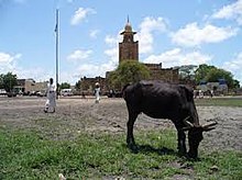
Malakal town -
 Malakal center
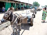
 -
 Malakal locals, 1936
 -
 Trucks of the Force Publique (Belgian-Congolese colonial army) parked at Malakal during World War II
 -
 Kenya Commercial Bank in Malakal town
 -


.jpg)


See also
References
- ^ a b "Shilluk Fight For Dinka Take-Over Of Malakal: S. Sudan Legislators Warn Of War Over Land Disputes In Upper Nile State". Africans Press. 10 February 2016. Retrieved 14 August 2016.
- ^ a b "Juba". www.britannica.com. 2024-02-01. Retrieved 2019-07-07.
- ^ "Distance between Juba () (Airport) and Malakal () (Airport) (Sudan)". Distancecalculator.globefeed.com. Retrieved 2014-02-15.
- ^ "South Sudan Troops Recapture Malakal From Rebels - News". The Wall Street Journal. 2014-03-20. Retrieved 2014-05-24.
- ^ Franks, Tim (24 October 2015). "Malakal: The city that vanished in South Sudan". BBC News. Retrieved 24 November 2015.
- ^ "Fighting around South Sudan town of Malakal kills 56: government". Reuters. Retrieved 2023-08-01.
- ^ "Over 50 killed near South Sudan oil-rich town: army". Sudan Tribune. Retrieved 2023-08-01.
- ^ Britannica, South Sudan, britannica.com, USA, accessed on September 8, 2019
- ^ "Malakal Climate Normals 1961–1990". National Oceanic and Atmospheric Administration. Retrieved January 24, 2015.
- ^ "Contractors rush for South Sudan contracts - News". Theeastafrican.co.ke. 2013-09-21. Retrieved 2014-02-15.
- ^ "Google Drive Viewer". Retrieved 2014-02-15.
- ^ "Malakal's water woes | The Window". Imeechan.com. Retrieved 2014-02-15.
- ^ a b [1] [dead link]
External links
- Location of Malakal At Google Maps
- Malakal Vocational Training Centre.
- The Gateway to the Shilluk People of Malakal.
+[2].

| International | |
|---|---|
| National | |