
Malieveld
52°05′08″N 4°19′11″E / 52.0855°N 4.3198°E
You can help expand this article with text translated from the corresponding article in Dutch. (June 2019) Click [show] for important translation instructions.
|
| Malieveld | |
|---|---|
Urban open space | |
| Location | Haagse Hout, The Hague, Netherlands |
| Coordinates | 52°05′08″N 4°19′11″E / 52.0855°N 4.3198°E |
| Area | 13.9 hectares (34 acres)[1] |
| Managed by | Staatsbosbeheer |
 | |
| Name | Malieveld and surroundings |
| Designated | 27 November 1972 |
Malieveld (Dutch pronunciation:
Gallery
-
 Royalist rally in 1918
 -
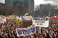 Student protest in 2011
 -
 Occupy protest in 2011
 -
 Veterans' Day in 2015

.jpg)

.jpg)
See also
References
Wikimedia Commons has media related to Malieveld.
- ^ "Den Haag - Malieveld". Waarneming.nl (in Dutch). Retrieved 17 June 2019.
- ^ "Malieveld". DenHaag.com. Retrieved 17 June 2019.
| Authority control databases: Geographic |
|---|