
Manistique, Michigan
Manistique, Michigan | ||
|---|---|---|
FIPS code 26-50760[2] | | |
| GNIS feature ID | 1620685[3] | |
| Website | Official website | |
Manistique (/mænɪstik/ man-iss-TEEK) is the only city and county seat of Schoolcraft County in the U.S. state of Michigan.[4] As of the 2020 census, the city population was 2,828.[5]
The city borders the adjacent Manistique Township, but the two are administered independently. The city lies on the north shore of Lake Michigan at the mouth of the Manistique River, which forms a natural harbor that has been improved with breakwaters, dredging, and the Manistique East Breakwater Light. The city is named after the river.[6] The economy depends heavily on tourism from Lake Michigan, as well as nearby Indian Lake State Park and Palms Book State Park.
Nickname
Manistique is nicknamed "The Emerald City." It is believed to be named for the emerald green waters of the nearby Kitch-iti-kipi spring, the largest spring in the state of Michigan. The Manistique Area Schools athletic teams are referred to as the "Emeralds." Several local businesses include "Emerald City" in their names.
History
.jpg)
.jpg)
Originally named Eastport, Manistique replaced Onota as the county seat.[7] Eastport was the name of the post office, but was not used for the community.[8] Manistique was incorporated as a village in 1883[8] and as a city in 1901 by the state legislature. With the river originally spelled Monistique, a spelling error in the city charter led to its current spelling.[8][6]
Geography
According to the United States Census Bureau, the city has a total area of 3.51 square miles (9.09 km2), of which 3.19 square miles (8.26 km2) is land and 0.32 square miles (0.83 km2) is water.[9]
Climate
This
| Climate data for Manistique WWTP, Michigan (1991–2020 normals, extremes 1896–present) | |||||||||||||
|---|---|---|---|---|---|---|---|---|---|---|---|---|---|
| Month | Jan | Feb | Mar | Apr | May | Jun | Jul | Aug | Sep | Oct | Nov | Dec | Year |
| Record high °F (°C) | 47 (8) |
61 (16) |
72 (22) |
80 (27) |
87 (31) |
96 (36) |
97 (36) |
101 (38) |
92 (33) |
84 (29) |
68 (20) |
58 (14) |
101 (38) |
| Mean daily maximum °F (°C) | 25.1 (−3.8) |
27.3 (−2.6) |
35.0 (1.7) |
45.4 (7.4) |
57.1 (13.9) |
67.2 (19.6) |
73.0 (22.8) |
73.5 (23.1) |
66.0 (18.9) |
53.3 (11.8) |
40.9 (4.9) |
31.0 (−0.6) |
49.6 (9.8) |
| Daily mean °F (°C) | 17.8 (−7.9) |
19.0 (−7.2) |
26.9 (−2.8) |
37.7 (3.2) |
49.0 (9.4) |
59.1 (15.1) |
64.8 (18.2) |
64.8 (18.2) |
57.8 (14.3) |
45.9 (7.7) |
34.5 (1.4) |
24.6 (−4.1) |
41.8 (5.4) |
| Mean daily minimum °F (°C) | 10.4 (−12.0) |
10.7 (−11.8) |
18.7 (−7.4) |
29.9 (−1.2) |
40.9 (4.9) |
51.0 (10.6) |
56.6 (13.7) |
56.2 (13.4) |
49.5 (9.7) |
38.6 (3.7) |
28.2 (−2.1) |
18.1 (−7.7) |
34.1 (1.2) |
| Record low °F (°C) | −25 (−32) |
−33 (−36) |
−31 (−35) |
−7 (−22) |
19 (−7) |
27 (−3) |
32 (0) |
31 (−1) |
19 (−7) |
17 (−8) |
−6 (−21) |
−25 (−32) |
−33 (−36) |
| Average precipitation inches (mm) | 1.70 (43) |
1.37 (35) |
1.85 (47) |
2.84 (72) |
2.98 (76) |
3.22 (82) |
3.43 (87) |
3.10 (79) |
3.75 (95) |
3.98 (101) |
2.62 (67) |
2.42 (61) |
33.26 (845) |
| Source: | |||||||||||||
Demographics
| Census | Pop. | Note | %± |
|---|---|---|---|
| 1880 | 693 | — | |
| 1890 | 2,940 | 324.2% | |
| 1900 | 4,126 | 40.3% | |
| 1910 | 4,722 | 14.4% | |
| 1920 | 6,380 | 35.1% | |
| 1930 | 5,198 | −18.5% | |
| 1940 | 5,399 | 3.9% | |
| 1950 | 5,086 | −5.8% | |
| 1960 | 4,875 | −4.1% | |
| 1970 | 4,324 | −11.3% | |
| 1980 | 3,962 | −8.4% | |
| 1990 | 3,456 | −12.8% | |
| 2000 | 3,583 | 3.7% | |
| 2010 | 3,097 | −13.6% | |
| 2020 | 2,828 | −8.7% | |
| Source: Census Bureau. Census 1880, 1970, 1980, 1990, 2000, 2010. | |||
As of the
There were 1,193 households, of which 27.9% had children under the age of 18 living with them, 37.5% were married couples living together, 12.6% had a female householder with no husband present, 5.3% had a male householder with no wife present, and 44.7% were non-families. 40.3% of all households were made up of individuals, and 20.3% had someone living alone who was 65 years of age or older. The average household size was 2.15 and the average family size was 2.87.
The median age in the city was 43 years. 23% of residents were under the age of 18; 7.3% were between the ages of 18 and 24; 22.4% were from 25 to 44; 26.6% were from 45 to 64; and 20.6% were 65 years of age or older. The gender makeup of the city was 46.3% male and 53.7% female.
Infrastructure
Transportation
 US 2
US 2 M-94
M-94- Indian Trails provides daily intercity bus service between St. Ignace and Ironwood, Michigan.[13]
- Manistique is serviced by the Schoolcraft County Airport (KISQ)
Gallery
-
 Aerial view of Manistique showing Manistique River
 -
 The Historic Manistique Water Tower and Schoolcraft County Museum
 -

-
 Lake Michigan looking south from the Manistique Boardwalk


References
- ^ "2020 U.S. Gazetteer Files". United States Census Bureau. Retrieved May 21, 2022.
- ^ "U.S. Census website". United States Census Bureau. Retrieved 2008-01-31.
- ^ U.S. Geological Survey Geographic Names Information System: Manistique, Michigan
- ^ "Find a County". National Association of Counties. Retrieved 2011-06-07.
- ^ a b "U.S. Census website". United States Census Bureau. Retrieved 2012-11-25.
- ^ a b Sawyer, Alvah L. (2005) [1911]. "Chapter XX: Schoolcraft and Delta Counties". A history of the northern peninsula of Michigan and its people. Ann Arbor, Mich.: University of Michigan Library. pp. 351–353. Retrieved 2006-09-12.
- ^ "Schoolcraft County". History of the Upper Peninsula of Michigan. Ann Arbor, Mich.: University of Michigan Library. 2005 [1883]. p. 547. Retrieved 2006-09-12.
- ^ Newspapers.com.

- ^ "US Gazetteer files 2010". United States Census Bureau. Archived from the original on 2012-01-25. Retrieved 2012-11-25.
- ^ "Manistique, Michigan Köppen Climate Classification (Weatherbase)". Weatherbase.
- ^ "NowData - NOAA Online Weather Data". National Oceanic and Atmospheric Administration. Retrieved September 2, 2021.
- ^ "Station: Manistique WWTP, MI". U.S. Climate Normals 2020: U.S. Monthly Climate Normals (1991-2020). National Oceanic and Atmospheric Administration. Retrieved September 2, 2021.
- ^ "ST. IGNACE-SAULT STE. MARIE-IRONWOOD" (PDF). Indian Trails. January 15, 2013. Archived from the original (PDF) on July 4, 2014. Retrieved 2013-02-28.
Municipalities and communities of Schoolcraft County, Michigan, United States | ||
|---|---|---|
| City | 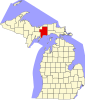 | |
| Civil townships | ||
| Unincorporated communities | ||
| Indian reservation | ||
| Footnotes | ‡This populated place also has portions in an adjacent county or counties | |
| ||
| International | |
|---|---|
| National | |
| Other | |