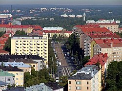
Mannerheimintie
This article needs additional citations for verification. (March 2014) |


Mannerheimintie (Swedish: Mannerheimvägen), named after the Finnish military leader and statesman Carl Gustaf Emil Mannerheim, is the main street and boulevard of Helsinki, Finland. It was originally named Heikinkatu (Swedish: Henriksgatan), after Robert Henrik Rehbinder on the first part up to the current Kiasma Art museum and Turuntie after that, but was renamed after the Winter War. The change of name was also a reference to Mannerheim's victory parade along the road during the Finnish Civil War (1918), after German forces, allied with Mannerheim's Finnish forces, had retaken the city.[1]
The street begins at
. (Geographically, the highway only ends in central Tampere, as a small street called Kalevan Puistotie.)Many famous buildings are located on, or near, Mannerheimintie. These include the
There are many landmark sculptures by Mannerheimintie. These include the Three Smiths Statue and the Statue of Mannerheim near Kiasma.
There are only two streets running across Mannerheimintie: Nordenskiöldinkatu overground, and Tilkanvierto below it as an underpass. There are many other streets connecting with Mannerheimintie, but all of them either end at Mannerheimintie or continue across it under a different name.
See also
- Hakamäentie
- Tampere Highway
- Vihdintie
- Paasikiven–Kekkosentie
References
- ^ "MANNERHEIM - War of Independence - The Great Parade, 16 May, 1918". www.mannerheim.fi.
60°10′08″N 024°56′24″E / 60.16889°N 24.94000°E
