
Mare Crisium
Coordinates 17°00′N 59°06′E / 17.0°N 59.1°E | | |
| Diameter | 556 km (345 mi)[1] | |
|---|---|---|
Mare Crisium /ˈkrɪsiəm/ (Latin crisium, the "Sea of Crises") is a lunar mare located in the Moon's Crisium basin, just northeast of Mare Tranquillitatis. Mare Crisium is a basin of Nectarian age.[2]
Characteristics
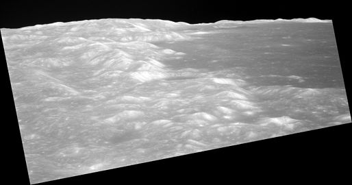
Mare Crisium is 556 km (345 mi) in diameter,[1] and 176,000 square kilometres (68,000 sq mi) in area. It has a very flat floor, with a ring of wrinkle ridges (dorsa) toward its outer boundaries. These are Dorsa Tetyaev, Dorsum Oppel, Dorsum Termier, and Dorsa Harker. The cape-like feature protruding into the southeast of the mare is Promontorium Agarum. On the western rim of the mare is the palimpsest Yerkes, and Lick to the southeast is similar. The crater Picard is located just to the east of Yerkes, and northwest of Picard are the craters Peirce and Swift. The ray system of the crater Proclus overlie the northwestern mare. Mare Anguis can be seen northeast of Mare Crisium.[3]
A
-
 Topographic map
 -
 Gravity map based onGRAIL


Names
Like most of the other maria on the Moon, Mare Crisium was named by
By the 17th century, Mare Crisium had acquired the name 'Caspian Sea', being labelled as such by
Observation and exploration
Mare Crisium is just visible from Earth with the naked eye as a small dark spot on the edge of the Moon's face.
It is the site of the crash-landing of Soviet Luna 15 probe in 1969. A soil sample from Mare Crisium was successfully brought to Earth on 22 August 1976 by the Soviet lunar mission Luna 24.[citation needed]
Views
-
 Location of Mare Crisium, as seen from the Earth
 -
 These are three views of northern Mare Crisium on the Moon, taken by the mapping camera of theCommand ModuleAmerica orbited the Moon.
 -


See also
References
- ^ a b "Mare Crisium". Gazetteer of Planetary Nomenclature. USGS Astrogeology Research Program.
- USGS Professional Paper 1348. By Don E. Wilhelms, John F. McCauley, and Newell J. Trask. U.S. Government Printing Office, Washington: 1987. Table 9-3.
- ^ "Mare Crisium". lunar.arc.nasa.gov. Archived from the original on March 15, 2002. Retrieved October 18, 2007.
- S2CID 40110502.
- ^ Ewen A. Whitaker, Mapping and Naming the Moon (Cambridge University Press, 1999), p.61.
- ^ a b Ewen A. Whitaker, Mapping and Naming the Moon (Cambridge University Press, 1999), p.7.
External links
- High resolution lunar overflight video by Seán Doran, based on LRO data, that passes near Mare Crisium (see album for more); a longer version that starts over the western margin of Mare Fecunditatis is on YouTube
| Authority control databases: National |
|---|