
Maritsa
| Maritsa Évros, Meriç | |
|---|---|
Rila Mountains , Bulgaria | |
| • elevation | 2,378 m (7,802 ft) |
Alexandroupoli | |
• coordinates | 40°43′50″N 26°2′6″E / 40.73056°N 26.03500°E |
| Length | 480 km (300 mi) |
| Basin size | 53,000 km2 (20,000 sq mi)[1] |
| Discharge | |
| • average | for mouth 234 m3/s (8,300 cu ft/s)[2] |

Maritsa or Maritza (
It has its origin in the
Names
The earliest known name of the river is Εύρος (Euros, Alcman, 7th–6th century BC).[4] Proto-Indo-European *h₁wérus and Ancient Greek εὐρύς meant "wide".[4] The Proto-Indo-European consonant cluster *-wr- shifted in Thracian to -br-, creating the Thracian name Ebros.[4] Thereafter, the river began to be known as Ἕβρος (Hébros) in Greek and Hebrus in Latin.[5] Rather than an origin as 'wide river', an alternative hypothesis is that is borrowed from Thracian ebros meaning 'splasher'.[6]
While the name Ἕβρος (Hébros) was used in Ancient Greek, the name Μαρίτσα (Maritsa) had become standard before the ancient form Ἕβρος was restituted in Modern Greek as Έβρος (now: Évros).[7] The name Maritsa may derive from a mountain near the mouth of the river known in antiquity as Μηρισός or Μήριζος, Latinized as Merit(h)us.[4][unreliable source?]
History
In 1371, the river was the site of the
After 1923, the river gained political significance as the modern border between Greece and Turkey. This was further bolstered by Greece joining the European Union in 1981 (and then the Schengen area), marking the river as an external boundary of the EU.
Since the 1990s, the river, as a natural barrier on the border between Turkey and Greece, has become a major route for
In February 2020, Turkey unilaterally opened its borders to Greece to allow refugees and migrants seeking refuge to reach the European Union, leading to the 2020 Greek–Turkish border crisis.[10][11] In May 2020, news emerged that Turkish forces occupied 16 acres (6.5 ha) of Greek territory, Melissokomeio, as shown on maps of 1923, following a change in the flow of the river.[12] These crises passed following the improvement in Greek-Turkish relations in 2023, however, illegal migration is still a major issue.
Tributaries


Starting from the river's source, significant tributaries of Maritsa include:
- Left tributaries:
- Right tributaries:
- Chepinska reka (near Septemvri)
- Vacha (near Stamboliyski)
- Chepelarska reka(near Sadovo)
- Harmanliyska reka (near Harmanli)
- Arda/Ardas (near Edirne)
- Erythropotamos/Luda reka (near Didymoteicho)
Floods


The lower course of the river Maritsa, where it forms the border between Greece and Turkey, is very vulnerable to flooding. For about 4 months every year, the low lands around the river are flooded. This causes significant economic damage (loss of agricultural production and damage to infrastructure), which is estimated at several hundreds million Euro.[13]
Recent large floods have taken place in 2006, 2007, 2014, with the largest flood taking place in 2021. Several causes have been proposed, including more rainfall due to climate change, deforestation in the Bulgarian part of the catchment area, increased land use in the flood plains and difficult communication between the three countries.[13]
Trivia
Maritsa Peak on Livingston Island in the South Shetland Islands, Antarctica is named after Maritsa River.
La Maritza is also a 1968 song written by Jean Renard and Pierre Delanoë and interpreted by Sylvie Vartan.
Hebrus Valles on Mars is named after this river.
The Bulgarian Maritsa motorway, which roughly follows the course of the river from Chirpan (where it branches out of the Trakia motorway) to the Turkish border at Kapitan Andreevo, is also named in honour of the river.
Gallery
-
-
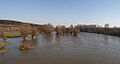
 View from the river, Edirne.
 -
 The river viewed from Turkey. Greek land visible on the right.
 -
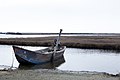 Boat on the delta.


Notes
- ^ a b "Preliminary Flood Risk Assessment" (in Greek). Ministry of Environment, Energy and Climate Change. p. 90. Archived from the original on 15 February 2020.
- ^ inweb.gr
- ^ Statistical Yearbook 2017, National Statistical Institute (Bulgaria), p. 17
- ^ ISBN 9789535172611.
- ISBN 9780968848708.)
{{cite book}}: CS1 maint: location missing publisher (link - OCLC 18925921.
- ^ Schramm, Gottfried (1981): Eroberer und Eingesessene. Geographische Lehnnamen als Zeugen der Geschichte Südosteuropas im ersten Jahrtausend n. Chr. Stuttgart: Hiersemann, pp.290f. Referenced in Carsten Peust, How Old Are the River Names of Europe?, Linguistik Online, 2015
- ^ Evros: The immigrants' gateway. PBS.org, May 16, 2011.
- S2CID 199438113.
- ^ Turkish police bolster Greek border to stop migrants' return. 6 March 2020.
- ^ Greece Defends Borders as Erdogan Opens the Gates: Live Updates. 1 March 2020.
- ^ "Athens lodges demarche with Ankara over Evros dispute". ekathimerini.com. 22 May 2020.
- ^ a b Environmental management of big riverine floods: the case of Evros River in Greece, Z. Nivolianitou, B. Synodinou
References
- "МАРИЦА (антично име: Хеброс, Хебър)". Българска енциклопедия А-Я (in Bulgarian). БАН, Труд, Сирма. 2002. OCLC 163361648.
| International | |
|---|---|
| National | |
| Geographic | |
| Other | |