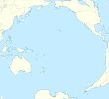
Mataveri International Airport
Mataveri International Airport Rapa Nui Airport | |||||||||||
|---|---|---|---|---|---|---|---|---|---|---|---|
AMSL 227 ft / 69 m | | ||||||||||
| Coordinates | 27°09′53″S 109°25′18″W / 27.16472°S 109.42167°W | ||||||||||
| Map | |||||||||||
| Runways | |||||||||||
| |||||||||||
Mataveri International Airport or Isla de Pascua Airport (
History
Scheduled services from the Chilean mainland started in 1967 with a monthly
The airport's single
Description
Due to the lack of diversion airports between Tahiti and South America except for Mataveri, Chilean aviation authorities prohibit more than one aircraft from being in the vicinity of Mataveri. Once an aircraft flying from South America passes the halfway point between South America and Easter Island, no other aircraft can be closer than its own halfway point until the first aircraft successfully lands on the island. This is because if an aircraft should have an accident that obstructs or closes the runway, the other aircraft would not be able to land, and should have been turned back to its airport of departure. [citation needed]
There is a hill adjacent to the eastern end of the runway. Approach and departures from either end of the runway are over the water.
Airlines and destinations
| Airlines | Destinations |
|---|---|
LATAM Chile | Santiago de Chile |
See also
- Extreme points of Earth
- Vandenberg Air Force Basein California.
- Transport in Chile
- List of airports in Chile
- Point Nemo
References
- ^ Oakley, T. (November 1993). "Instrument and Observing Methods – Report No. 56". World Meteorological Organization. p. 14. Archived from the original on 21 November 2021.
- ^ Airport information for Mataveri International Airport at Great Circle Mapper.
- ^ Mataveri Airport SkyVector
- ^ "Mataveri International Airport". Google Maps. Retrieved 10 December 2017.
- ^ Davies, Jason (3 October 2014). "World Airports Voronoi". Retrieved 3 October 2014.
- ^ ISBN 978-1861892829.
- ^ "Rapa Nui (Easter Island)" (PDF). Jurisdiction Project, Institute of Island Studies, University of Prince Edwards Island. 2007.
- ^ http://www.timetableimages.com, Jan. 1, 1970 UTA system timetable, LAN-Chile Santiago-Easter Island-Papeete flight schedules
- ^ Airline Timetable Images, Oct. 25, 1970 LAN-Chile system timetable
- ISBN 1-86189-282-9p. 220
- ^ http://www.timetableimages.com, Nov. 1, 1975 LAN-Chile system timetable
- ^ Airline Timetable Images, April 1993 LANChile system timetable
- ^ Airliners.net | Aviation Photography, Discussion Forums & News, photos of LAN Airlines Airbus A430 and Boeing 767-300ER aircraft at Easter Island.
- ^ "NASA and a Mystery : For Easter Island, a Frantic Year". Los Angeles Times. 11 February 1986. Retrieved 22 March 2018.
- ^ Anthony Boadle (17 August 1987). "Emergency space shuttle landing strip opened". United Press International.

