
McCracken County, Kentucky
McCracken County | |
|---|---|
UTC−5 (CDT) | |
| Congressional district | 1st |
| Website | mccrackencountyky |
McCracken County is a county located in the far west portion of U.S. state of Kentucky. As of the 2020 census, the population was 67,875.[1] The county seat and only municipality is Paducah.[2] McCracken County was the 78th county formed in the state, having been created in 1825.[3] It is part of the historic Jackson Purchase, territory sold by the Chickasaw people to General Andrew Jackson and Governor Isaac Shelby; this territory was located at the extreme western end of Kentucky.
Paducah developed based on its "River and Rail" traffic. Steamboats, barges, and the Illinois Central Railroad were the basis of the economy into the late 20th century. In the 1920s, the Illinois Central built the largest operating, and maintenance base in the world here.
McCracken County is the central county of the Paducah, KY-
History
McCracken County was founded in 1825 from Hickman County; it was named for Captain Virgil McCracken of Woodford County, Kentucky, who was killed in the Battle of Frenchtown in southeastern Michigan during the War of 1812.[4][5]
The Battle of Paducah occurred during the American Civil War in McCracken County on March 25, 1864. The skirmish between the Union and Confederate troops ended in a Confederate victory. A total of 140 men were killed during the battle.
In addition to having an economy influenced by river traffic, the county's economy was strengthened by construction of the railroad to Paducah. The railroads based operations and maintenance in Paducah, and the men in many families had careers as firemen, repairment, and related jobs.
Law and government
Federal
McCracken County makes up Kentucky's 1st congressional district and elects a representative to the US Congress.
State
In the
In the State Senate, all of McCracken County is represented by the 2nd District and its State Senator Danny Carroll (R).
County
The county is led by an elected County Judge Executive, Craig Clymer, and three commissioners elected from single-member districts.
Geography
According to the United States Census Bureau, the county has a total area of 268 square miles (690 km2), of which 249 square miles (640 km2) is land and 19 square miles (49 km2) (7.2%) is water.[6] The county's northern border with Illinois is formed by the Ohio River, and its northeastern border by the Tennessee River.
Adjacent counties
- Massac County, Illinois (north)
- Livingston County (northeast)
- Marshall County (east)
- Graves County (south)
- Carlisle County (southwest)
- Ballard County (west)
National protected area
Demographics
| Census | Pop. | Note | %± |
|---|---|---|---|
| 1830 | 1,297 | — | |
| 1840 | 4,745 | 265.8% | |
| 1850 | 6,067 | 27.9% | |
| 1860 | 10,360 | 70.8% | |
| 1870 | 13,988 | 35.0% | |
| 1880 | 16,262 | 16.3% | |
| 1890 | 21,051 | 29.4% | |
| 1900 | 28,733 | 36.5% | |
| 1910 | 35,064 | 22.0% | |
| 1920 | 37,246 | 6.2% | |
| 1930 | 46,271 | 24.2% | |
| 1940 | 48,534 | 4.9% | |
| 1950 | 49,137 | 1.2% | |
| 1960 | 57,306 | 16.6% | |
| 1970 | 58,281 | 1.7% | |
| 1980 | 61,310 | 5.2% | |
| 1990 | 62,879 | 2.6% | |
| 2000 | 65,514 | 4.2% | |
| 2010 | 65,565 | 0.1% | |
| 2020 | 67,875 | 3.5% | |
| 2023 (est.) | 67,428 | [7] | −0.7% |
| U.S. Decennial Census[8] 1790-1960[9] 1900-1990[10] 1990-2000[11] 2010-2020[1] | |||
As of the
There were 27,736 households, out of which 29.60% had children under the age of 18 living with them, 51.10% were married couples living together, 12.20% had a female householder with no husband present, and 33.50% were non-families. 29.70% of all households were made up of individuals, and 12.30% had someone living alone who was 65 years of age or older. The average household size was 2.31 and the average family size was 2.86.
In the county, the population was spread out, with 23.40% under the age of 18, 7.90% from 18 to 24, 28.10% from 25 to 44, 24.70% from 45 to 64, and 15.90% who were 65 years of age or older. The median age was 39 years. For every 100 females, there were 90.50 males. For every 100 females age 18 and over, there were 86.30 males.
The median income for a household in the county was $33,865, and the median income for a family was $42,513. Males had a median income of $36,417 versus $22,704 for females. The
Education
Public elementary and secondary education in the county is provided by two school districts:
- McCracken County Public Schools, which serves the entire county except for the bulk of the city of Paducah, served by:
- Paducah Public Schools
Several private schools also provide K-12 education. These institutions include the St. Mary System and Community Christian Academy.
Higher education is provided by
Communities
City
- Paducah (county seat)
Census-designated places
Unincorporated communities
- Camelia
- Cecil
- Cimota City
- Freemont
- Future City
- Grahamville
- Hardmoney
- Heath
- Hovekamp
- Krebs
- Lone Oak
- Maxon
- Melber (mostly in Graves County)
- Ragland
- Rossington
- Rudolph
- Saint Johns
- Sheehan Bridge
- West Paducah
Politics
| Year | Republican | Democratic | Third party | |||
|---|---|---|---|---|---|---|
| No. | % | No. | % | No. | % | |
| 2020 | 21,820 | 65.04% | 11,195 | 33.37% | 534 | 1.59% |
| 2016 | 20,774 | 66.36% | 9,134 | 29.18% | 1,399 | 4.47% |
| 2012 | 19,979 | 65.40% | 10,062 | 32.94% | 510 | 1.67% |
| 2008 | 19,043 | 61.92% | 11,285 | 36.69% | 426 | 1.39% |
| 2004 | 18,218 | 61.14% | 11,361 | 38.13% | 218 | 0.73% |
| 2000 | 14,745 | 55.25% | 11,412 | 42.76% | 532 | 1.99% |
| 1996 | 10,221 | 40.42% | 12,670 | 50.10% | 2,396 | 9.48% |
| 1992 | 10,657 | 39.25% | 13,341 | 49.13% | 3,155 | 11.62% |
| 1988 | 12,160 | 49.34% | 12,208 | 49.54% | 275 | 1.12% |
| 1984 | 12,903 | 50.08% | 12,535 | 48.65% | 327 | 1.27% |
| 1980 | 10,281 | 42.27% | 13,365 | 54.94% | 679 | 2.79% |
| 1976 | 6,997 | 30.84% | 14,956 | 65.92% | 734 | 3.24% |
| 1972 | 11,260 | 57.69% | 7,567 | 38.77% | 691 | 3.54% |
| 1968 | 5,887 | 27.33% | 9,741 | 45.21% | 5,916 | 27.46% |
| 1964 | 4,543 | 21.83% | 16,178 | 77.75% | 87 | 0.42% |
| 1960 | 9,689 | 43.59% | 12,539 | 56.41% | 0 | 0.00% |
| 1956 | 7,076 | 33.29% | 14,103 | 66.34% | 79 | 0.37% |
| 1952 | 6,051 | 32.93% | 12,302 | 66.95% | 22 | 0.12% |
| 1948 | 3,251 | 21.57% | 11,183 | 74.19% | 640 | 4.25% |
| 1944 | 4,190 | 27.71% | 10,846 | 71.73% | 84 | 0.56% |
| 1940 | 3,554 | 23.43% | 11,562 | 76.23% | 52 | 0.34% |
| 1936 | 3,160 | 22.85% | 10,557 | 76.33% | 113 | 0.82% |
| 1932 | 3,140 | 25.12% | 9,188 | 73.51% | 171 | 1.37% |
| 1928 | 7,368 | 56.93% | 5,535 | 42.76% | 40 | 0.31% |
| 1924 | 4,979 | 40.54% | 6,028 | 49.08% | 1,274 | 10.37% |
| 1920 | 6,085 | 40.89% | 8,496 | 57.10% | 299 | 2.01% |
| 1916 | 3,058 | 39.96% | 4,356 | 56.92% | 239 | 3.12% |
| 1912 | 1,308 | 22.62% | 2,948 | 50.99% | 1,526 | 26.39% |
See also
References
- ^ a b "State & County QuickFacts". United States Census Bureau. Retrieved June 30, 2022.
- ^ "Find a County". National Association of Counties. Archived from the original on May 31, 2011. Retrieved June 7, 2011.
- ISBN 9780722249208.
- ^ E., Kleber, John; Kentucky, University Press of; Policy, Institute for Regional Analysis and Public; Library, Camden-Carroll; University, Morehead State (2000). "The Kentucky Encyclopedia". www.kyenc.org. Retrieved July 4, 2018.
{{cite web}}:|last3=has generic name (help)CS1 maint: multiple names: authors list (link) - ^ The Register of the Kentucky State Historical Society, Volume 1. Kentucky State Historical Society. 1903. pp. 36.
- ^ "2010 Census Gazetteer Files". United States Census Bureau. August 22, 2012. Archived from the original on August 12, 2014. Retrieved August 17, 2014.
- ^ "Annual Estimates of the Resident Population for Counties: April 1, 2020 to July 1, 2023". United States Census Bureau. Retrieved March 14, 2024.
- ^ "U.S. Decennial Census". United States Census Bureau. Retrieved August 17, 2014.
- ^ "Historical Census Browser". University of Virginia Library. Retrieved August 17, 2014.
- ^ "Population of Counties by Decennial Census: 1900 to 1990". United States Census Bureau. Retrieved August 17, 2014.
- ^ "Census 2000 PHC-T-4. Ranking Tables for Counties: 1990 and 2000" (PDF). United States Census Bureau. Archived (PDF) from the original on October 9, 2022. Retrieved August 17, 2014.
- ^ "U.S. Census website". United States Census Bureau. Retrieved January 31, 2008.
- ^ Leip, David. "Dave Leip's Atlas of U.S. Presidential Elections". uselectionatlas.org. Retrieved July 4, 2018.
External links
Municipalities and communities of McCracken County, Kentucky, United States | ||
|---|---|---|
| City | 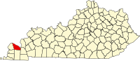 | |
| CDPs | ||
| Other communities | ||
| Footnotes | ‡This populated place also has portions in an adjacent county or counties | |
| ||
37°04′N 88°43′W / 37.06°N 88.72°W
| International | |
|---|---|
| National | |
| Other | |