
Mediterranean Sea
| Mediterranean Sea | |
|---|---|
 Map of the Mediterranean Sea | |
| Location | |
| Coordinates | 35°N 18°E / 35°N 18°E |
Primary inflows | Atlantic Ocean, Sea of Marmara, Nile, Ebro, Rhône, Chelif, Po |
| Basin countries | Coastal countries: |
| Surface area | 2,500,000 km2 (970,000 sq mi) |
| Average depth | 1,500 m (4,900 ft) |
| Max. depth | 5,109 m (16,762 ft) ±1 m (3 ft) |
| Water volume | 3,750,000 km3 (900,000 cu mi) |
| Residence time | 80–100 years[1] |
| Max. temperature | 28 °C (82 °F) |
| Min. temperature | 12 °C (54 °F) |
| Islands | 3300+ |
| Settlements | |
The Mediterranean Sea (
The Mediterranean Sea covers an area of about 2,500,000 km2 (970,000 sq mi),[2] representing 0.7% of the global ocean surface, but its connection to the Atlantic via the Strait of Gibraltar—the narrow strait that connects the Atlantic Ocean to the Mediterranean Sea and separates the Iberian Peninsula in Europe from Morocco in Africa—is only 14 km (9 mi) wide. The Mediterranean Sea encompasses a vast number of islands, some of them of volcanic origin. The two largest islands, in both area and population, are Sicily and Sardinia.
The Mediterranean Sea has an average depth of 1,500 m (4,900 ft) and the deepest recorded point is 5,109 m (16,762 ft) ±1 m (3 ft) in the Calypso Deep in the Ionian Sea. It lies between latitudes 30° and 46° N and longitudes 6° W and 36° E. Its west–east length, from the Strait of Gibraltar to the Gulf of Alexandretta, on the southeastern coast of Turkey, is about 4,000 kilometres (2,500 mi). The north–south length varies greatly between different shorelines and whether only straight routes are considered. Also including longitudinal changes, the shortest shipping route between the multinational Gulf of Trieste and the Libyan coastline of the Gulf of Sidra is about 1,900 kilometres (1,200 mi). The water temperatures are mild in winter and warm in summer and give name to the Mediterranean climate type due to the majority of precipitation falling in the cooler months. Its southern and eastern coastlines are lined with hot deserts not far inland, but the immediate coastline on all sides of the Mediterranean tends to have strong maritime moderation.
The sea was an important route for merchants and travellers of ancient times, facilitating trade and cultural exchange between the peoples of the region. The history of the Mediterranean region is crucial to understanding the origins and development of many modern societies. The Roman Empire maintained nautical hegemony over the sea for centuries and is the only state to have ever controlled all of its coast.
The countries surrounding the Mediterranean and its marginal seas in clockwise order are Spain, France, Monaco, Italy, Slovenia, Croatia, Bosnia and Herzegovina, Montenegro, Albania, Greece, Turkey, Syria, Lebanon, Israel, Palestine, Egypt, Libya, Tunisia, Algeria, and Morocco; Malta and Cyprus are island countries in the sea. In addition, Gibraltar, an overseas territory of the United Kingdom, is located on the coast of the Mediterranean. The drainage basin encompasses a large number of other countries, the Nile being the longest river ending in the Mediterranean Sea.[3]
Names and etymology


The
The Ancient Greeks called the Mediterranean simply ἡ θάλασσα (hē thálassa; "the Sea") or sometimes ἡ μεγάλη θάλασσα (hē megálē thálassa; "the Great Sea"), ἡ ἡμετέρα θάλασσα (hē hēmetérā thálassa; "Our Sea"), or ἡ θάλασσα ἡ καθ'ἡμᾶς (hē thálassa hē kath’hēmâs; "the sea around us").
The
The modern Greek name Μεσόγειος Θάλασσα (mesógeios; "inland") is a calque of the Latin name, from μέσος (mésos, "in the middle") and γήινος (gḗinos, "of the earth"), from γῆ (gê, "land, earth"). The original meaning may have been 'the sea in the middle of the earth', rather than 'the sea enclosed by land'.[7][8]
The
In Modern Standard Arabic, it is known as al-Baḥr [al-Abyaḍ] al-Mutawassiṭ (البحر [الأبيض] المتوسط) 'the [White] Middle Sea'. In Islamic and older Arabic literature, it was Baḥr al-Rūm(ī) (بحر الروم or بحر الرومي) 'the Sea of the Romans' or 'the Roman Sea'. At first, that name referred only to the eastern Mediterranean, but the term was later extended to the whole Mediterranean. Other Arabic names were Baḥr al-šām(ī) (بحر الشام) ("the Sea of Syria") and Baḥr al-Maghrib (بحرالمغرب) ("the Sea of the West").[12][6]
In
According to Johann Knobloch, in classical antiquity, cultures in the Levant used colours to refer to the cardinal points: black referred to the north (explaining the name Black Sea), yellow or blue to east, red to south (e.g., the Red Sea) and white to west. That would explain the Bulgarian Byalo More, the Turkish Akdeniz, and the Arab nomenclature described above, lit. "White Sea".[17]
History
Ancient civilizations


Major ancient civilizations were located around the Mediterranean. The sea provided routes for trade, colonization, and war, as well as food (from fishing and the gathering of other seafood) for numerous communities throughout the ages.
The most notable Mediterranean civilizations in classical antiquity were the
Following the
Middle Ages and empires
The Western Roman Empire collapsed around 476 AD. The east was again dominant as Roman power lived on in the Byzantine Empire formed in the 4th century from the eastern half of the Roman Empire. Though the Eastern Roman Empire would continue to hold almost all of the Mediterranean, another power arose in the 7th century, and with it the religion of Islam, which soon swept across from the east; at its greatest extent, the Arabs, under the Umayyads, controlled most of the Mediterranean region and left a lasting footprint on its eastern and southern shores.
The Arab invasions disrupted the trade relations between Western and Eastern Europe while disrupting trade routes with Eastern Asian Empires. This, however, had the indirect effect of promoting trade across the Caspian Sea. The export of grains from Egypt was re-routed towards the Eastern world. Products from East Asian empires, like silk and spices, were carried from Egypt to ports like Venice and Constantinople by sailors and Jewish merchants. The Viking raids further disrupted the trade in western Europe and brought it to a halt. However, the Norsemen developed the trade from Norway to the White Sea, while also trading in luxury goods from Spain and the Mediterranean. The Byzantines in the mid-8th century retook control of the area around the north-eastern part of the Mediterranean. Venetian ships from the 9th century armed themselves to counter the harassment by Arabs while concentrating trade of Asian goods in Venice.[20]

The
The
Europe started to revive, however, as more organized and centralized states began to form in the later Middle Ages after the Renaissance of the 12th century.
The
The development of oceanic shipping began to affect the entire Mediterranean. Once, most of the trade between Western Europe and the East was passing through the region, but after the 1490s the development of a sea route to the Indian Ocean allowed the importation of Asian spices and other goods through the Atlantic ports of western Europe.[26][27][28]
The sea remained strategically important. British mastery of
With the opening of the lockless Suez Canal in 1869, the flow of trade between Europe and Asia changed fundamentally. The fastest route now led through the Mediterranean towards East Africa and Asia. This led to a preference for the Mediterranean countries and their ports like Trieste with direct connections to Central and Eastern Europe experienced a rapid economic rise. In the 20th century, the 1st and 2nd World Wars as well as the Suez Crisis and the Cold War led to a shift of trade routes to the European northern ports, which changed again towards the southern ports through European integration, the activation of the Silk Road and free world trade.[30]
21st century and migrations

In 2013, the Maltese president described the Mediterranean Sea as a "cemetery" due to the large number of migrants who drowned there after their boats capsized.[31] European Parliament president Martin Schulz said in 2014 that Europe's migration policy "turned the Mediterranean into a graveyard", referring to the number of drowned refugees in the region as a direct result of the policies.[32] An Azerbaijani official described the sea as "a burial ground ... where people die".[33]
Following the
Italy was particularly affected by the
Geography
The Mediterranean Sea connects:
- to the Atlantic Ocean by the Strait of Gibraltar (known in Homer's writings as the "Pillars of Hercules") in the west
- to the Sea of Marmara and the Black Sea, by the Straits of the Dardanelles and the Bosporus respectively, in the east
The 163 km (101 mi) long artificial Suez Canal in the southeast connects the Mediterranean Sea to the Red Sea without ship lock, because the water level is essentially the same.[10][37]
The westernmost point of the Mediterranean is located at the transition from the
Large islands in the Mediterranean include:
- Naxos, and Andros in the Eastern Mediterranean
- Maltain the central Mediterranean
- Majorca, and Menorcain the Western Mediterranean
The Alpine arc, which also has a great meteorological impact on the Mediterranean area, touches the Mediterranean in the west in the area around Nice.
The typical Mediterranean climate has hot, dry summers and mild, rainy winters. Crops of the region include olives, grapes, oranges, tangerines, carobs and cork.
Marginal seas
.jpg)
_12._Es_Malvins.jpg)

The Mediterranean Sea includes 15
| Number | Sea | Area (km2) | Marginal countries and territories |
|---|---|---|---|
| 1 | Libyan Sea | 350,000 | Libya, Turkey, Greece, Malta, Italy |
| 2 | Levantine Sea | 320,000 | Akrotiri & Dhekelia
|
| 3 | Tyrrhenian Sea | 275,000 | Italy, France |
| 4 | Aegean Sea | 214,000 | Greece, Turkey |
| 5 | Icarian Sea | (Part of Aegean) | Greece |
| 6 | Myrtoan Sea | (Part of Aegean) | Greece |
| 7 | Thracian Sea | (Part of Aegean) | Greece, Turkey |
| 8 | Ionian Sea | 169,000 | Greece, Albania, Italy |
| 9 | Balearic Sea | 150,000 | Spain |
| 10 | Adriatic Sea | 138,000 | Albania, Bosnia and Herzegovina, Croatia, Italy, Montenegro, Slovenia |
| 11 | Sea of Sardinia | 120,000 | Italy, Spain |
| 12 | Sea of Crete | 95,000 (Part of Aegean) | Greece[39] |
| 13 | Ligurian Sea | 80,000 | Italy, France |
| 14 | Alboran Sea | 53,000 | Spain, Morocco, Algeria, Gibraltar |
| 15 | Sea of Marmara | 11,500 | Turkey |
| – | Other | ~500,000 | Consists of gulfs, straits, channels and other parts that do not have the name of a specific sea. |
| Total | Mediterranean Sea | ~2,500,000 |
- List of seas
- Category:Marginal seas of the Mediterranean
- Category:Gulfs of the Mediterranean
- Category:Straits of the Mediterranean Sea
- Category:Channels of the Mediterranean Sea
Note 1: The International Hydrographic Organization defines the area as generic Mediterranean Sea, in the Western Basin. It does not recognize the label Sea of Sardinia.[40]
Note 2:
Note 3: The Black Sea is not considered part of it.
Extent

The International Hydrographic Organization defines the limits of the Mediterranean Sea as follows:[40] Stretching from the Strait of Gibraltar in the west to the entrances to the Dardanelles and the Suez Canal in the east, the Mediterranean Sea is bounded by the coasts of Europe, Africa, and Asia and is divided into two deep basins:
- Western Basin:
- On the west: A line joining the extremities of Cape Trafalgar (Spain) and Cape Spartel (Africa)
- On the northeast: The west coast of Italy. In the Strait of Messina, a line joining the north extreme of Cape Paci (15°42′E) with Cape Peloro, the east extreme of the Island of Sicily. The north coast of Sicily
- On the east: A line joining Cape Lilibeo the western point of Sicily (37°47′N 12°22′E / 37.783°N 12.367°E), through the Adventure Bank to Cape Bon (Tunisia)
- Eastern Basin:
- On the west: The northeastern and eastern limits of the Western Basin
- On the northeast: A line joining Kum Kale (26°11′E) and Cape Helles, the western entrance to the Dardanelles
- On the southeast: The entrance to the Suez Canal
- On the east: The coasts of Lebanon, Syria, Israel, and Palestine (through the Gaza Strip)
Hydrography

The
Total annual precipitation is significantly higher on the European part of the Mediterranean basin, especially near the Alps (the 'water tower of Europe') and other high mountain ranges. As a consequence, the river discharges of the Rhône and Po are similar to that of the Nile, despite the latter having a much larger basin.[46] These are the only three rivers with an average discharge of over 1,000 m3/s (35,000 cu ft/s).[43] Among large natural fresh bodies of water are Lake Victoria (Nile basin), Lake Geneva (Rhône), and the Italian Lakes (Po). While the Mediterranean watershed is bordered by other river basins in Europe, it is essentially bordered by endorheic basins or deserts elsewhere.
The following countries are in the Mediterranean drainage basin while not having a coastline on the Mediterranean Sea:
- In Europe, through various rivers:[47] Andorra,[note 2] Bulgaria,[note 3] Kosovo,[note 4] North Macedonia,[note 5] San Marino,[note 6] Serbia,[note 7] and Switzerland.[note 8]
- In Africa, through the Nile:[50] Congo, Burundi, Eritrea, Ethiopia, Kenya, Rwanda, South Sudan, Sudan, Tanzania and Uganda.
Coastal countries

The following countries have a coastline on the Mediterranean Sea:
- Northern shore (from west to east): Spain, France, Monaco, Italy, Slovenia, Croatia, Bosnia and Herzegovina, Montenegro, Albania, Greece, Turkey.
- Eastern shore (from north to south): Turkey, Syria, Lebanon, Israel, Palestine, Egypt.
- Southern shore (from west to east): Morocco, Algeria, Tunisia, Libya, Egypt.
- Island nations: Malta, Cyprus.
Several other territories also border the Mediterranean Sea (from west to east):
- the British overseas territory of Gibraltar
- the Spanish autonomous cities of Ceuta and Melilla and nearby islands
- the Sovereign Base Areason Cyprus
- the Palestinian Gaza Strip
.jpg)


Exclusive economic zone
| Number | Country | Area (Km2) |
|---|---|---|
| 1 | 541,915 | |
| 2 | 493,708 | |
| 3 | 355,604 | |
| 4 | 260,000 | |
| 5 | 169,125 | |
| 6 | 128,843 | |
| 7 | 102,047 | |
| 8 | 98,088 | |
| 9 | 88,389 | |
| 10 | 72,195 | |
| 11 | 59,032 | |
| 12 | 55,542 | |
| 13 | 25,139 | |
| 14 | 19,265 | |
| 15 | 18,302 | |
| 16 | 13,691 | |
| 17 | 10,189 | |
| 18 | 7,745 | |
| 19 | 2,591 | |
| 20 | 288 | |
| 21 | 220 | |
| 22 | 50 | |
| 23 | 6.8 | |
| Total | Mediterranean Sea | 2,500,000 |
Coastline length
The
Coastal cities
Major cities (municipalities), with populations larger than 200,000 people, bordering the Mediterranean Sea include:
- Algeria: Algiers, Annaba, Oran
- Egypt: Alexandria, Damietta, Port Said
- France: Marseille, Toulon, Nice
- Greece: Athens, Thessaloniki, Patras, Heraklion
- Israel: Ashdod, Haifa, Netanya, Rishon LeZion, Tel Aviv
- Italy: Bari, Catania, Genoa, Messina, Naples, Palermo, Rome, Pescara, Taranto, Trieste, Venice
- Lebanon: Beirut, Tripoli
- Libya: Benghazi, Misrata, Tripoli, Zawiya, Zliten
- Malta: Valletta
- Morocco: Tétouan, Tangier
- Palestine: Gaza City
- Spain: Alicante, Almería, Badalona, Barcelona, Cartagena, Málaga, Palma de Mallorca, Valencia.
- Syria: Latakia, Tartus
- Tunisia: Sfax, Sousse, Tunis
- Turkey: Alanya, Antalya, Çanakkale, İskenderun, İzmir, Mersin
Subdivisions

The International Hydrographic Organization (IHO) divides the Mediterranean into a number of smaller waterbodies, each with their own designation (from west to east):[40]
- the Strait of Gibraltar
- the Alboran Sea, between Spain and Morocco
- the Balearic Sea, between mainland Spain and its Balearic Islands
- the Ligurian Sea between Corsica and Liguria (Italy)
- the Italian peninsula and Sicily
- the Ionian Sea between Italy, Albania and Greece
- the Adriatic Sea between Italy, Slovenia, Croatia, Bosnia and Herzegovina, Montenegro and Albania
- the Aegean Sea between Greece and Turkey
Other seas

Some other seas whose names have been in common use from the ancient times, or in the present:
- the Sea of Sardinia, between Sardinia and Balearic Islands, as a part of the Balearic Sea
- the
- the Libyan Sea between Libya and Crete
- In the Aegean Sea,
- the Thracian Sea in its north
- the Myrtoan Sea between the Cyclades and the Peloponnese
- the Sea of Crete north of Crete
- the Icarian Sea between Kos and Chios
- the Cilician Sea between Turkey and Cyprus
- the Levantine Sea at the eastern end of the Mediterranean
Many of these smaller seas feature in local myth and folklore and derive their names from such associations.
Other features


In addition to the seas, a number of gulfs and straits are recognised:
- the Saint George Bay in Beirut, Lebanon
- the Ras Ibn Hani cape in Latakia, Syria
- the Ras al-Bassit cape in northern Syria.
- the Minet el-Beida ("White Harbour") bay near ancient Ugarit, Syria
- the Strait of Gibraltar, connects the Atlantic Ocean to the Mediterranean Sea and separates Spain from Morocco
- the Bay of Algeciras, at the southern end of the Iberian Peninsula
- the Gulf of Corinth, an enclosed sea between the Ionian Sea and the Corinth Canal
- the Mount Pelionpeninsula
- the Mirtoan Sea
- the Thermaic Gulf, the gulf of Thessaloniki, located in the northern Greek region of Macedonia
- the Kvarner Gulf, Croatia
- the Gulf of Almeria, southeast of Spain
- the Gulf of Lion, south of France
- the Gulf of Valencia, east of Spain
- the Strait of Messina, between Sicily and Calabrian peninsula
- the Gulf of Genoa, northwestern Italy
- the Gulf of Venice, northeastern Italy
- the Gulf of Trieste, northeastern Italy
- the Gulf of Taranto, southern Italy
- the Gulf of Saint Euphemia, southern Italy, with the international airport nearby
- the Gulf of Salerno, southwestern Italy
- the Gulf of Gaeta, southwestern Italy
- the Gulf of Squillace, southern Italy
- the Strait of Otranto, between Italy and Albania
- the Gulf of Haifa, northern Israel
- the Gulf of Sidra, between Tripolitania (western Libya) and Cyrenaica (eastern Libya)
- the Strait of Sicily, between Sicily and Tunisia
- the Corsica Channel, between Corsicaand Italy
- the Strait of Bonifacio, between Sardinia and Corsica
- the Gulf of Antalya, between west and east shores of Antalya (Turkey)
- the Gulf of İskenderun, between İskenderun and Adana(Turkey)
- the Gulf of İzmir, in İzmir (Turkey)
- the Gulf of Fethiye, in Fethiye (Turkey)
- the Gulf of Kuşadası, in İzmir (Turkey)
- the Bay of Kotor, in south-western Montenegro and south-eastern Croatia
- the Malta Channel, between Sicily and Malta
- the Gozo Channel, between Malta Island and Gozo
Largest islands

_with_a_view_to_the_beach_and_the_lake_Stagno_di_Notteri_in_Sardinia,_Italy_(48402759012).jpg)
The Mediterranean Sea encompasses about 10,000 islands and islets, of which about 250 are permanently inhabited.[57] In the table below are listed the ten largest by size.
| Country | Island | Area in km2 | Population |
|---|---|---|---|
| Italy | Sicily | 25,460 | 5,048,995 |
| Italy | Sardinia | 23,821 | 1,672,804 |
| Cyprus | Cyprus | 9,251 | 1,088,503 |
| France | Corsica | 8,680 | 299,209 |
| Greece | Crete | 8,336 | 623,666 |
| Greece | Euboea | 3,655 | 218,000 |
| Spain | Majorca
|
3,640 | 869,067 |
| Greece | Lesbos | 1,632 | 90,643 |
| Greece | Rhodes | 1,400 | 117,007 |
| Greece | Chios | 842 | 51,936 |
Climate
Much of the Mediterranean coast enjoys a hot-summer Mediterranean climate. However, most of its southeastern coast has a hot desert climate, and much of Spain's eastern (Mediterranean) coast has a cold semi-arid climate, while most of Italy's northern (Adriatic) coast has a humid subtropical climate. Although they are rare, tropical cyclones occasionally form in the Mediterranean Sea, typically in September–November.
.png)
Sea temperature
| Jan | Feb | Mar | Apr | May | Jun | Jul | Aug | Sep | Oct | Nov | Dec | Year | |
|---|---|---|---|---|---|---|---|---|---|---|---|---|---|
| Málaga[58] | 16 | 15 | 16 | 16 | 18 | 20 | 22 | 23 | 22 | 20 | 18 | 17 | 18.6 |
| Barcelona[59] | 13 | 12 | 13 | 14 | 17 | 20 | 23 | 25 | 23 | 20 | 17 | 15 | 17.8 |
| Marseille[60] | 13 | 13 | 13 | 14 | 16 | 18 | 21 | 22 | 21 | 18 | 16 | 14 | 16.6 |
| Naples[61] | 15 | 14 | 14 | 15 | 18 | 22 | 25 | 27 | 25 | 22 | 19 | 16 | 19.3 |
| Malta[62] | 16 | 16 | 15 | 16 | 18 | 21 | 24 | 26 | 25 | 23 | 21 | 18 | 19.9 |
| Venice[63] | 11 | 10 | 11 | 13 | 18 | 22 | 25 | 26 | 23 | 20 | 16 | 14 | 17.4 |
| Athens[64] | 16 | 15 | 15 | 16 | 18 | 21 | 24 | 24 | 24 | 21 | 19 | 18 | 19.3 |
| Heraklion[65] | 16 | 15 | 15 | 16 | 19 | 22 | 24 | 25 | 24 | 22 | 20 | 18 | 19.7 |
| Antalya[66] | 17 | 17 | 16 | 17 | 21 | 24 | 27 | 29 | 27 | 25 | 22 | 19 | 21.8 |
| Limassol[67] | 18 | 17 | 17 | 18 | 20 | 24 | 26 | 28 | 27 | 25 | 22 | 19 | 21.7 |
| Mersin[68] | 18 | 17 | 17 | 18 | 21 | 25 | 28 | 29 | 28 | 25 | 22 | 19 | 22.3 |
| Tel Aviv[69] | 18 | 17 | 17 | 18 | 21 | 24 | 27 | 28 | 28 | 26 | 23 | 20 | 22.3 |
| Alexandria[70] | 18 | 17 | 17 | 18 | 20 | 23 | 25 | 26 | 26 | 25 | 22 | 20 | 21.4 |
Oceanography

Being nearly landlocked affects conditions in the Mediterranean Sea: for instance, tides are very limited as a result of the narrow connection with the Atlantic Ocean. The Mediterranean is characterised and immediately recognised by its deep blue colour.
The net water influx from the Atlantic Ocean is ca. 70,000 m3/s or 2.2×10¹² m3/a (7.8×10¹³ cu ft/a).[74] Without this Atlantic water, the sea level of the Mediterranean Sea would fall at a rate of about 1 m per year.[75]
In
General circulation
Other events affecting water circulation
Being a semi-enclosed basin, the Mediterranean experiences transitory events that can affect the water circulation on short time scales. In the mid-1990s, the Aegean Sea became the main area for deep water formation in the eastern Mediterranean after particularly cold winter conditions. This transitory switch in the origin of deep waters in the eastern Mediterranean was termed Eastern Mediterranean Transient (EMT) and had major consequences on water circulation of the Mediterranean.[79][80][81]
Another example of a transient event affecting the Mediterranean circulation is the periodic inversion of the North Ionian Gyre, which is an anticyclonic ocean gyre observed in the northern part of the Ionian Sea, off the Greek coast. The transition from anticyclonic to cyclonic rotation of this gyre changes the origin of the waters fueling it; when the circulation is anticyclonic (most common), the waters of the gyre originate from the Adriatic Sea. When the circulation is cyclonic, the waters originate from the Levantine Sea. These waters have different physical and chemical characteristics, and the periodic inversion of the North Ionian Gyre (called Bimodal Oscillating System or BiOS) changes the Mediterranean circulation and biogeochemistry around the Adriatic and Levantine regions.[82]
Climate change
Because of the short residence time of waters, the Mediterranean Sea is considered a hot spot for climate change effects.[83] Deep water temperatures have increased by 0.12 °C (0.22 °F) between 1959 and 1989.[84] According to climate projections, the Mediterranean Sea could become warmer. The decrease in precipitation over the region could lead to more evaporation ultimately increasing the Mediterranean Sea salinity.[83][85] Because of the changes in temperature and salinity, the Mediterranean Sea may become more stratified by the end of the 21st century, with notable consequences on water circulation and biogeochemistry. The stratification and warming have already led to the eastern Mediterranean to become a net source of CO2 to the atmosphere [86][87] notably during summer. This strong summer degassing, combined with the prolonged and pronounced stratification results in the formation of aragonite crystals abiotically in the water column.[88] The cumulative warming at the surface of the Mediterranean has a significant impact on the ecological system. Extreme warming has led to biodiversity loss[89] and presents an existential threat to some habitats [90] while making conditions more hospitable to invasive tropical species.[91]
Biogeochemistry
In spite of its great
There are steep gradients in nutrient concentrations, chlorophyll concentrations and primary productivity in the Mediterranean. Nutrient concentrations in the western part of the basin are about double the concentrations in the eastern basin. The
Primary productivity in the Mediterranean is also marked by an intense seasonal variability. In winter, the strong winds and precipitation over the basin generate vertical mixing, bringing nutrients from the deep waters to the surface, where phytoplankton can convert it into biomass.[94] However, in winter, light may be the limiting factor for primary productivity. Between March and April, spring offers the ideal trade-off between light intensity and nutrient concentrations in surface for a spring bloom to occur. In summer, high atmospheric temperatures lead to the warming of the surface waters. The resulting density difference virtually isolates the surface waters from the rest of the water column and nutrient exchanges are limited. As a consequence, primary productivity is very low between June and October.[95][93]
Oceanographic expeditions uncovered a characteristic feature of the Mediterranean Sea biogeochemistry: most of the chlorophyll production does not occur on the surface, but in sub-surface waters between 80 and 200 meters deep.[96] Another key characteristic of the Mediterranean is its high nitrogen-to-phosphorus ratio (N:P). Redfield demonstrated that most of the world's oceans have an average N:P ratio around 16. However, the Mediterranean Sea has an average N:P between 24 and 29, which translates a widespread phosphorus limitation.[clarification needed][97][98][99][100]
Because of its low productivity, plankton assemblages in the Mediterranean Sea are dominated by small organisms such as
Geology

The
Scientists estimate that the sea was last filled about 5.3 million years ago (mya) in less than two years by the Zanclean flood. Water poured in from the Atlantic Ocean through a newly breached gateway now called the Strait of Gibraltar at an estimated rate of about three orders of magnitude (one thousand times) larger than the current flow of the Amazon River.[105]
The Mediterranean Sea has an average depth of 1,500 m (4,900 ft) and the deepest recorded point is 5,267 m (17,280 ft) in the Calypso Deep in the Ionian Sea. The coastline extends for 46,000 km (29,000 mi). A shallow submarine ridge (the Strait of Sicily) between the island of Sicily and the coast of Tunisia divides the sea in two main subregions: the Western Mediterranean, with an area of about 850,000 km2 (330,000 mi2); and the Eastern Mediterranean, of about 1.65 million km2 (640,000 mi2). Coastal areas have submarine karst springs or vruljas, which discharge pressurised groundwater into the water from below the surface; the discharge water is usually fresh, and sometimes may be thermal.[106][107]
Tectonics and paleoenvironmental analysis
The Mediterranean basin and sea system were established by the ancient African-Arabian continent colliding with the
Messinian salinity crisis

During
After the initial drawdown[
Desiccation and exchanges of flora and fauna
The present-day Atlantic gateway, the
The almost complete enclosure of the Mediterranean basin has enabled the oceanic gateways to dominate seawater circulation and the environmental evolution of the sea and basin. Circulation patterns are also affected by several other factors—including climate, bathymetry, and water chemistry and temperature—which are interactive and can induce precipitation of
Today, evaporation of surface seawater (output) is more than the supply (input) of fresh water by precipitation and coastal drainage systems, causing the salinity of the Mediterranean to be much higher than that of the Atlantic—so much so that the saltier Mediterranean waters sink below the waters incoming from the Atlantic, causing a two-layer flow across the Strait of Gibraltar: that is, an outflow
Shift to a "Mediterranean climate"
The end of the
Paleoclimate
Because of its latitude and its landlocked position, the Mediterranean is especially sensitive to astronomically induced climatic variations, which are well documented in its sedimentary record. Since the Mediterranean is subject to the deposition of
Biodiversity

Unlike the vast multidirectional ocean currents in open oceans within their respective oceanic zones; biodiversity in the Mediterranean Sea is stable due to the subtle but strong locked nature of currents which is favourable to life, even the smallest macroscopic type of volcanic life form. The stable marine ecosystem of the Mediterranean Sea and sea temperature provides a nourishing environment for life in the deep sea to flourish while assuring a balanced aquatic ecosystem excluded from any external deep oceanic factors. It is estimated that there are more than 17,000 marine species in the Mediterranean Sea with generally higher marine biodiversity in coastal areas, continental shelves, and decreases with depth.[118]
As a result of the drying of the sea during the Messinian salinity crisis,[119] the marine biota of the Mediterranean are derived primarily from the Atlantic Ocean. The North Atlantic is considerably colder and more nutrient-rich than the Mediterranean, and the marine life of the Mediterranean has had to adapt to its differing conditions in the five million years since the basin was reflooded.
The
There was a resident population of orcas in the Mediterranean until the 1980s, when they went extinct, probably due to long-term PCB exposure. There are still annual sightings of orca vagrants.[120]
Environmental issues
For 4,000 years, human activity has transformed most parts of Mediterranean Europe, and the "humanisation of the landscape" overlapped with the appearance of the present Mediterranean climate.[121] The image of a simplistic, environmental determinist notion of a Mediterranean paradise on Earth in antiquity, which was destroyed by later civilisations, dates back to at least the 18th century and was for centuries fashionable in archaeological and historical circles. Based on a broad variety of methods, e.g. historical documents, analysis of trade relations, floodplain sediments, pollen, tree-ring and further archaeometric analyses and population studies, Alfred Thomas Grove's and Oliver Rackham's work on "The Nature of Mediterranean Europe" challenges this common wisdom of a Mediterranean Europe as a "Lost Eden", a formerly fertile and forested region, that had been progressively degraded and desertified by human mismanagement.[121] The belief stems more from the failure of the recent landscape to measure up to the imaginary past of the classics as idealised by artists, poets and scientists of the early modern Enlightenment.[121]
The historical evolution of climate, vegetation and landscape in southern Europe from prehistoric times to the present is much more complex and underwent various changes. For example, some of the deforestation had already taken place before the Roman age. While in the Roman age large enterprises such as the latifundia took effective care of forests and agriculture, the largest depopulation effects came with the end of the empire. Some[who?] assume that the major deforestation took place in modern times—the later usage patterns were also quite different e.g. in southern and northern Italy. Also, the climate has usually been unstable and there is evidence of various ancient and modern "Little Ice Ages",[122][page needed] and plant cover accommodated to various extremes and became resilient to various patterns of human activity.[121]
Human activity was therefore not the cause of climate change but followed it.[121] The wide ecological diversity typical of Mediterranean Europe is predominantly based on human behaviour, as it is and has been closely related to human usage patterns.[121] The diversity range[clarification needed] was enhanced by the widespread exchange and interaction of the longstanding and highly diverse local agriculture, intense transport and trade relations, and the interaction with settlements, pasture and other land use. The greatest human-induced changes, however, came after World War II, in line with the "1950s syndrome"[123] as rural populations throughout the region abandoned traditional subsistence economies. Grove and Rackham suggest that the locals left the traditional agricultural patterns and instead became scenery-setting agents[clarification needed] for tourism. This resulted in more uniform, large-scale formations[of what?].[121] Among further current important threats to Mediterranean landscapes are overdevelopment of coastal areas, abandonment of mountains and, as mentioned, the loss of variety via the reduction of traditional agricultural occupations.[121]
Natural hazards
.jpg)
The region has a variety of geological hazards, which have closely interacted with human activity and land use patterns. Among others, in the eastern Mediterranean, the
Vesuvius itself is regarded as quite dangerous due to a tendency towards explosive (
The large experience[
Invasive species

The opening of the
Invasive species have become a major component of the Mediterranean ecosystem and have serious impacts on the Mediterranean ecology, endangering a number of local and endemic Mediterranean species. A first look at some groups of marine species shows that over 70% of exotic decapods [130] and some 2/3 of exotic fishes [131] found in the Mediterranean are of Indo-Pacific origin, introduced from the Red Sea via the Suez Canal. This makes the Canal the first pathway of arrival of alien species into the Mediterranean. The impacts of some Lessepsian species have proven to be considerable, mainly in the Levantine basin of the Mediterranean, where they are replacing native species and becoming a familiar sight.
According to definitions by the
Arrival of new tropical Atlantic species
In recent decades, the arrival of exotic species from the tropical Atlantic has become noticeable. In many cases this reflects an expansion – favoured by a warming trend of sub-tropical Atlantic waters, and also by a fast-growing maritime traffic – of the natural range of species that now enter the Mediterranean through the Strait of Gibraltar. While not as intense as Lessepsian migration, the process is of importance and is therefore receiving increased levels of scientific coverage.[134]
Sea-level rise
By 2100 the overall level of the Mediterranean could rise between 3 and 61 cm (1.2 and 24.0 in) as a result of the
- Rising sea levels will submerge parts of Malta. Rising sea levels will also mean rising salt water levels in Malta's groundwater supply and reduce the availability of drinking water.[136]
- A 30 cm (12 in) rise in sea level would flood 200 square kilometres (77 sq mi) of the Nile Delta, displacing over 500,000 Egyptians.[137]
- Cyprus wetlands are also in danger of being destroyed by the rising temperatures and sea levels.[138]
Coastal ecosystems also appear to be threatened by
Pollution
Pollution in this region has been extremely high in recent years.[when?] The United Nations Environment Programme has estimated that 650,000,000 t (720,000,000 short tons) of sewage, 129,000 t (142,000 short tons) of mineral oil, 60,000 t (66,000 short tons) of mercury, 3,800 t (4,200 short tons) of lead and 36,000 t (40,000 short tons) of phosphates are dumped into the Mediterranean each year.[141] The Barcelona Convention aims to 'reduce pollution in the Mediterranean Sea and protect and improve the marine environment in the area, thereby contributing to its sustainable development.'[142] Many marine species have been almost wiped out because of the sea's pollution. One of them is the
Shipping

Some of the world's busiest shipping routes are in the Mediterranean Sea. In particular, the Maritime Silk Road from Asia and Africa leads through the Suez Canal directly into the Mediterranean Sea to its deep-water ports in
The discharge of chemical tank washings and oily wastes also represent a significant source of marine pollution. The Mediterranean Sea constitutes 0.7% of the global water surface and yet receives 17% of global marine oil pollution. It is estimated that every year between 100,000 t (98,000 long tons) and 150,000 t (150,000 long tons) of crude oil are deliberately released into the sea from shipping activities.

Approximately 370,000,000 t (360,000,000 long tons) of oil are transported annually in the Mediterranean Sea (more than 20% of the world total), with around 250–300 oil tankers crossing the sea every day. An important destination is the Port of Trieste, the starting point of the Transalpine Pipeline, which covers 40% of Germany's oil demand (100% of the federal states of Bavaria and Baden-Württemberg), 90% of Austria and 50% of the Czech Republic.[145] Accidental oil spills happen frequently with an average of 10 spills per year. A major oil spill could occur at any time in any part of the Mediterranean.[140]
Tourism

The coast of the Mediterranean has been used for tourism since ancient times, as the Roman villa buildings on the
Tourism is today one of the most important sources of income for many Mediterranean countries, despite the human-made geopolitical conflicts[
Tourism is a source of income for small coastal communities, including islands, independent of urban centres. However, tourism has also played a major role in the
Tourism often concentrates in areas of high natural wealth[clarification needed], causing a serious threat to the habitats of endangered species such as sea turtles and monk seals. Reductions in natural wealth may reduce the incentive for tourists to visit.[140]
Overfishing
Fish stock levels in the Mediterranean Sea are alarmingly low. The European Environment Agency says that more than 65% of all fish stocks in the region are outside safe biological limits and the United Nations Food and Agriculture Organisation, that some of the most important fisheries—such as
There are clear indications that catch size and quality have declined, often dramatically, and in many areas, larger and longer-lived species have disappeared entirely from commercial catches.
Large open-water fish like tuna have been a shared fisheries resource for thousands of years but the stocks are now dangerously low. In 1999, Greenpeace published a report revealing that the amount of bluefin tuna in the Mediterranean had decreased by over 80% in the previous 20 years and government scientists warn that without immediate action the stock will collapse.
Marine heatwaves
A study showed that climate change-related exceptional marine heatwaves in the Mediterranean Sea during 2015–2019 resulted in widespread mass sealife die-offs in five consecutive years.[150][151]
Gallery
-
 Europa Point, Gibraltar
 -
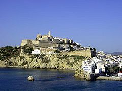 Old city ofIbiza Town, Spain
 -
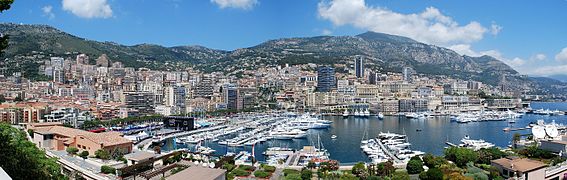 Panoramic view of La Condamine, Monaco
 -
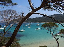 The beach of la Courtade in the Îles d'Hyères, France
 -
 Sardinia's south coast, Italy
 -
 Pretty Bay in Birżebbuġa, Malta
 -
 Panoramic view of Piran, Slovenia
 -
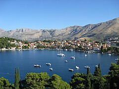 Panoramic view of Cavtat, Croatia
 -
 View of Neum, Bosnia and Herzegovina
 -
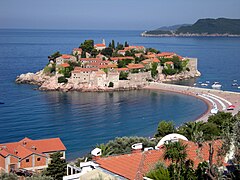 A view of Sveti Stefan, Montenegro
 -
 Ksamil Islands, Albania
 -
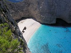 Navagio, Greece
 -
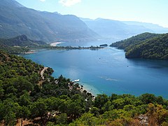 Ölüdeniz, Turquoise Coast, Turkey
 -
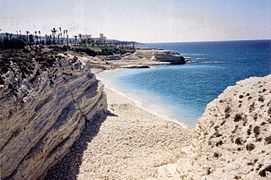
 Paphos, Cyprus
 -
 Burj Islam Beach, Latakia, Syria
 -
-
 A view of Haifa, Israel
 -
 Sunset at the Deir al-Balah beach, Gaza Strip
 -
 Coast of Alexandria, view From Bibliotheca Alexandrina, Egypt
 -
 Ras El Hilal sea caves, Libya
 -
 Beach of Hammamet, Tunisia
 -
 Les Aiguades near Béjaïa, Algeria
 -
 El Jebha, a port town in Morocco
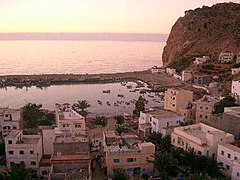


See also
- Aegean dispute – Series of controversies between Greece and Turkey over the Aegean Sea
- Atlantropa – Proposed engineering project to create new land within the Mediterranean Sea
- Babelmed, the site of the Mediterranean cultures
- Cyprus dispute– Dispute between Greek and Turkish Cypriots
- Cyprus–Turkey maritime zones dispute – Ongoing political dispute in the Mediterranean
- Eastern Mediterranean – Countries that are geographically located to the east of the Mediterranean Sea
- Euro-Mediterranean Parliamentary Assembly– Parliamentary assembly
- Exclusive economic zone of Greece
- Familial Mediterranean fever – Human disease
- History of the Mediterranean region – Historical development of the Mediterranean
- Holy League (1571) – alliance of European countries from 1571
- Libya–Turkey maritime deal– Maritime boundary treaty between Libya's GNA and Turkey
- List of islands in the Mediterranean
- List of Mediterranean countries
- Mediterranean diet – Diet inspired by the Mediterranean region
- Mediterranean forests, woodlands, and scrub – Habitat defined by the World Wide Fund for Nature
- Mediterranean Games – Multi-sport event of the Mediterranean countries
- Mediterranean race – Outdated grouping of human beings
- Mediterranean sea (oceanography)– Mostly enclosed sea with limited exchange with outer oceans
- Piri Reis – Turkish admiral and cartographer – Early cartographer of the Mediterranean
- Qattara Depression Project – Hydroelectric macro-engineering concept in Egypt
- Seto Inland Sea – Japanese Inland Sea – also known as the Japanese Mediterranean Sea
- Tyrrhenian Basin
- Union for the Mediterranean – Intergovernmental organization
Notes
- ^ Not including the area of the Mediterranean Sea
- ^ Through the Ebro
- ^ Through the Struma, Maritsa and Nestos, see Geography of Bulgaria#Hydrography
- ^ Through the Drin
- ^ Through the Drin and Vardar
- ^ Through the Marecchia[49]
- ^ Through the Struma
- ^ Through the Rhône, Po and Adige, see Hydrology of Switzerland
References
- ISBN 978-0-7637-5993-3.
- ^ Boxer, Baruch. "Mediterranean Sea". Encyclopædia Britannica. Archived from the original on 28 September 2023. Retrieved 23 October 2015.
- ^ "Nile River". Education | National Geographic Society. Archived from the original on 8 March 2023. Retrieved 12 March 2023.
- ISBN 978-2-87772-148-6.
- ISBN 1-60606-057-0, 2011, p. 133.
- ^ ISBN 1-78533-585-5, 2017, p. 80
- Liddell & Scott. Archived from the originalon 2 December 2009.
- ^ Oxford English Dictionary, 3rd ed, 2001, s.v.
- ^ Dehkhoda, Ali Akbar. ""دریای روم" entry". Parsi Wiki. Archived from the original on 22 May 2020. Retrieved 29 November 2019.
- ^ a b c Vella, Andrew P. (1985). "Mediterranean Malta" (PDF). Hyphen. 4 (5): 469–472. Archived from the original (PDF) on 29 March 2017.
- ^ Dehkhoda, Ali Akabar. ""دریای شام" entry". Parsi Wiki. Archived from the original on 22 May 2020. Retrieved 29 November 2019.
- ^ a b c "Baḥr al-Rūm" in Encyclopedia of Islam, 2nd ed
- ^ Diran Kélékian, Dictionnaire Turc-Français, Constantinople, 1911
- ^ Özhan Öztürk claims that in Old Turkish ak also means "west" and that Akdeniz hence means "West Sea" and that Karadeniz (Black Sea) means "North Sea". Özhan Öztürk. Pontus: Antik Çağ'dan Günümüze Karadeniz'in Etnik ve Siyasi Tarihi Genesis Yayınları. Ankara. 2011. pp. 5–9. Archived from the original on 15 September 2012.
{{cite book}}: CS1 maint: location missing publisher (link) - ^ "Archived copy". Archived from the original on 23 August 2023. Retrieved 22 August 2023.
{{cite web}}: CS1 maint: archived copy as title (link) - ^ "Archived copy". Archived from the original on 1 August 2020. Retrieved 22 August 2023.
{{cite web}}: CS1 maint: archived copy as title (link) - ^ Johann Knoblock. Sprache und Religion, Vol. 1 (Carl Winter Universitätsverlag, 1979), 18; cf. Schmitt, Rüdiger (1989). "Black Sea". Black – Encyclopaedia Iranica. Encyclopaedia Iranica, Vol. IV, Fasc. 3. pp. 310–313. Archived from the original on 5 February 2022. Retrieved 31 August 2018.
- ^ David Abulafia (2011). The Great Sea: A Human History of the Mediterranean. Oxford University Press.
- ^ Rappoport, S. (Doctor of Philosophy, Basel). History of Egypt (undated, early 20th century), Volume 12, Part B, Chapter V: "The Waterways of Egypt", pp. 248–257 (online). London: The Grolier Society.
- ISBN 978-1-317-35150-4.
- ISBN 978-0-521-78151-0. Archivedfrom the original on 1 January 2024. Retrieved 17 November 2020.
- ISBN 978-1-4051-1189-8.
- ISBN 978-1-135-94880-1. Archivedfrom the original on 1 January 2024. Retrieved 17 November 2020.
- ISBN 978-0-333-71966-4. Retrieved 17 January 2013.
- ^ "British Slaves on the Barbary Coast". BBC. Archived from the original on 8 February 2009. Retrieved 17 January 2013.
- ^ C.I. Gable – Constantinople Falls to the Ottoman Turks Archived 29 October 2014 at the Wayback Machine – Boglewood Timeline – 1998 – Retrieved 3 September 2011.
- ^ "History of the Ottoman Empire, an Islamic Nation where Jews Lived" Archived 18 October 2014 at the Wayback Machine – Sephardic Studies and Culture – Retrieved 3 September 2011.
- ^ Robert Guisepi – The Ottomans: From Frontier Warriors To Empire Builders[usurped] – 1992 – History World International – Retrieved 3 September 2011.
- ^ See: Brian Lavery "Nelson's Navy: The Ships, Men, and Organization, 1793–1815" (2013).
- ^ Mary Pelletier "A brief history of the Suez Canal" In: Apollo 3 July 2018; Harry de Wilt: Is One Belt, One Road a China crisis for North Sea main ports? in World Cargo News, 17. December 2019; Marcus Hernig: Die Renaissance der Seidenstraße (2018), pp 112; Hans Reis "Der Suezkanal – die wichtigste von Menschen geschaffene Wasserstrasse wurde vor 150 Jahren gebaut und war oft umkämpft" In: Neue Zürcher Zeitung 17 November 2019; Bernhard Simon: Can The New Silk Road Compete With The Maritime Silk Road? in The Maritime Executive, 1 January 2020.
- ^ "Migrant deaths prompt calls for EU action". Al Jazeera – English. 13 October 2013. Archived from the original on 14 March 2022. Retrieved 14 March 2022.
- ^ "Schulz: EU migrant policy 'turned Mediterranean into graveyard'". EUobserver. 24 October 2013. Archived from the original on 29 October 2014. Retrieved 12 December 2014.
- ^ "Novruz Mammadov: The Mediterranean become a burial ground". Archived from the original on 25 September 2015. Retrieved 4 May 2015.
- ^ "Over one million sea arrivals reach Europe in 2015". UNHCR – The UN Refugee Agency. 30 December 2015. Archived from the original on 24 December 2016. Retrieved 20 August 2016.
- ^ "What will Italy's new government mean for migrants?". The Local Italy. 21 May 2018. Archived from the original on 1 April 2019. Retrieved 6 July 2018.
- ^ "African migrants fear for future as Italy struggles with surge in arrivals". Reuters. 18 July 2017. Archived from the original on 2 April 2019. Retrieved 6 July 2018.
- ^ Harald Krachler "Alois Negrelli, der Suezkanalplaner" In: Wiener Zeitung 18 January 1999.
- ISSN 2071-1050.
- ^ "Sea of Crete | sea, Greece". Britannica. Archived from the original on 26 March 2023. Retrieved 28 November 2022.
- ^ a b c "Limits of Oceans and Seas, 3rd edition" (PDF). International Hydrographic Organization. 1953. Archived from the original (PDF) on 8 October 2011. Retrieved 28 December 2020.
- ISBN 978-0-12-391477-4. Archivedfrom the original on 1 January 2024. Retrieved 1 May 2022.
Geographically, the Mediterranean catchment is extremely large and heterogeneous, covering an area of approximately 5 millions km2. It extends from the equator, where the springs of the White Nile River are located, to the source of the Rhone River at approximately 48°N. In longitude, it spans about 40°, from the middle of the Iberian peninsula, at 4°W, towards southern Turkey and the Middle East coasts facing the Mediterranean Sea (35°E).
- ^ Poulos, Serafeim (2011). "An insight to the fluvial characteristics of the Mediterranean and Black Sea watersheds". Advances in the Research of Aquatic Environment. Springer Nature. p. 191.
The drainage basin of the Mediterranean Sea, accounting for some 4,184 103 km2 (including the R. Nile)
- ^ ISBN 978-2-9517181-5-9. Archivedfrom the original on 1 January 2024. Retrieved 1 May 2022.
A basin of varied geometry: Area of the entire Mediterranean Basin, including the whole of the Nile Basin = 4,562,480 km2; Area of the 'conventional' Mediterranean Basin (i.e. counting only part of the Nile Basin in Egypt) = 1,836,480 km2 [...] There are few rivers with an abundant flow. Only three rivers have a mean discharge of more than 1000 m3/s: the Nile (at Aswan), the Rhône and the Po.
- S2CID 247013753.
In the continents, the drainage basins discharging into the Mediterranean and Black seas are defined according to the global continental runoff pathways scheme (Oki and Sud 1998), and they cover 5.34 × 10⁶ and 2.43 × 10⁶ km2, respectively
- ISBN 978-0-470-72371-5. Archivedfrom the original on 1 January 2024. Retrieved 1 May 2022.
The highest point in the Nile basin is Mount Stanley (5109 m) in the Ruwenzori Mountain range between Lake Edward and Lake Albert
- ^ a b "The Mediterranean Marine and Coastal Environment: Hydrological and climatic setting". Mediterranean Action Plan of the United Nations Environment Programme (UNEP/MAP). Archived from the original on 24 October 2021. Retrieved 16 April 2022.
The Mediterranean is an area of transition between a temperate Europe with relatively abundant and consistent water resources, and the arid African and Arabian deserts that are very short of water.
- ^ a b "Drainage basin of the Mediterranean Sea". Our Waters: Joining Hands Across Borders: First Assessment of Transboundary Rivers, Lakes and Groundwaters. United Nations Economic Commission for Europe. 2007. pp. 154–181. Archived from the original on 15 April 2022. Retrieved 15 April 2022.
- ISBN 978-94-017-7206-8. Archivedfrom the original on 1 January 2024. Retrieved 15 April 2022.
The major geographic features characterizing the landscape are the Rhône-Saône valley, the Jura Mountains, the Molasse basin and the northwestern slopes of the Alps.
- ^ "San Marino". Encyclopædia Britannica. Archived from the original on 3 May 2015. Retrieved 22 April 2022.
- ^ "The Nile River Basin Initiative". RTI International. 23 May 2018. Archived from the original on 21 March 2022. Retrieved 14 March 2022.
The longest river in the world, the Nile spans 35 degrees of latitude, drains three million square kilometers of land (one-tenth of the total surface area of Africa), and runs through 11 countries whose combined population totals over 300 million people: Egypt, Ethiopia, Eritrea, Kenya, Rwanda, Burundi, Tanzania, Uganda, Sudan, South Sudan, and the Democratic Republic of the Congo. The Nile's primary water source, Lake Victoria, is the world's second-largest body of fresh water, and the Nile Delta in northern Egypt covers over 150 miles of the Mediterranean coastline.
- ^ Jonah 1:3 – "But Jonah rose up to flee unto Tarshish from the presence of the LORD, and went down to Joppa; and he found a ship going to Tarshish: so he paid the fare thereof, and went down into it, to go with them unto Tarshish [...]."
- ^ "Sea Around Us | Fisheries, Ecosystems and Biodiversity". seaaroundus.org. Archived from the original on 23 February 2016. Retrieved 15 September 2020.
- ^ "Sea Around Us | Fisheries, Ecosystems and Biodiversity". Archived from the original on 23 February 2016. Retrieved 27 November 2020.
- ^ "Mediterranean Sea | Facts, History, Islands, & Countries". Encyclopedia Britannica. Archived from the original on 28 September 2023. Retrieved 15 September 2020.
- ^ "The Mediterranean – a sea surrounded by land | WWF". Archived from the original on 7 September 2020. Retrieved 7 September 2020.
- ^ "The Mediterranean coast". FAO. Archived from the original on 7 September 2020. Retrieved 15 September 2020.
- ISBN 978-2-7099-2220-3. Archivedfrom the original on 1 January 2024. Retrieved 15 April 2022.
With about 10,000 islands and islets (approx. 250 inhabited by humans), the Mediterranean Sea can be considered as one of the largest archipelagos in the world.
- ^ Weather2Visit.com. "Malaga Climate: Monthly Weather Averages – Costa del Sol". Archived from the original on 4 November 2021. Retrieved 4 November 2021.
{{cite web}}: CS1 maint: numeric names: authors list (link) - ^ Weather2Travel.com. "Barcelona Climate: Monthly Weather Averages – Spain". Archived from the original on 18 July 2011. Retrieved 11 August 2010.
{{cite web}}: CS1 maint: numeric names: authors list (link) - ^ Weather2Travel.com. "Marseille Climate: Monthly Weather Averages – France". Archived from the original on 16 September 2010. Retrieved 11 August 2010.
{{cite web}}: CS1 maint: numeric names: authors list (link) - ^ Weather2Travel.com. "Naples Climate: Monthly Weather Averages – Neapolitan Riviera". Archived from the original on 31 May 2013. Retrieved 11 August 2010.
{{cite web}}: CS1 maint: numeric names: authors list (link) - ^ Weather2Travel.com. "Valletta Climate: Monthly Weather Averages – Malta – Malta". Archived from the original on 3 October 2010. Retrieved 11 August 2010.
{{cite web}}: CS1 maint: numeric names: authors list (link) - ^ Weather2Travel.com. "Venice Climate: Monthly Weather Averages – Venetian Riviera". Archived from the original on 16 June 2012. Retrieved 20 August 2012.
{{cite web}}: CS1 maint: numeric names: authors list (link) - ^ Weather2Travel.com. "Athens Climate: Monthly Weather Averages – Greece – Greece". Archived from the original on 27 May 2010. Retrieved 11 August 2010.
{{cite web}}: CS1 maint: numeric names: authors list (link) - ^ Weather2Travel.com. "Iraklion Climate: Monthly Weather Averages – Crete – Crete". Archived from the original on 26 October 2014. Retrieved 11 August 2010.
{{cite web}}: CS1 maint: numeric names: authors list (link) - ^ Weather2Travel.com. "Antalya: Monthly Weather Averages - Antalya Coast - Turkey". Archived from the original on 8 October 2020. Retrieved 5 October 2020.
{{cite web}}: CS1 maint: numeric names: authors list (link) - ^ Weather2Travel.com. "Limassol Climate: Monthly Weather Averages – Cyprus". Archived from the original on 29 May 2013. Retrieved 11 August 2010.
{{cite web}}: CS1 maint: numeric names: authors list (link) - ^ Seatemperature.org. "Mercin (alternate names - Mersin, Mersina, Mersine): Monthly Weather Averages - Turkey". Archived from the original on 8 October 2020. Retrieved 5 October 2020.
- ^ Weather2Travel.com. "Tel Aviv Climate: Monthly Weather Averages – Israel". Archived from the original on 27 May 2013. Retrieved 18 December 2010.
{{cite web}}: CS1 maint: numeric names: authors list (link) - ^ Seatemperature.org. "Alexandria Climate: Monthly Weather Averages – Egypt". Archived from the original on 8 March 2021. Retrieved 5 October 2020.
- ISBN 978-0-314-06339-7
- ^ Pinet 1996, p. 206.
- ^ .
- ^ Ludwig Ellenberg: Die Meerenge von Gibraltar – Küstenmorphologie zwischen Mittelmeer und Atlantik. In: Geographica Helvetica. Vol. 36, No. 3, 1981, pp. 109–120, doi:10.5194/gh-36-109-1981
- ^ Robert Hofrichter (ed.): Das Mittelmeer: Geschichte und Zukunft eines ökologisch sensiblen Raums, p. 530 Archived 22 November 2022 at the Wayback Machine
- ^ "Microsoft Word – ext_abstr_East_sea_workshop_TLM.doc" (PDF). Archived (PDF) from the original on 11 May 2011. Retrieved 23 April 2010.
- (PDF) from the original on 16 December 2019. Retrieved 5 July 2019.
- JSTOR 23452851.
- .
- .
- .
- ^ Civitarese, G., Gacic, M., Lipizer, M., and Borzelli, G. L. E. (2010). On the impact of the Bimodal Oscillating System (BiOS) on the biogeochemistry and biology of the Adriatic and Ionian Seas (Eastern Mediterranean). Biogeosciences, 7(12) : 3987–3997. WOS :000285574100006.
- ^ a b Giorgi, F. (2006). Climate change hot spots. Geophysical Research Letters, 33(8) :L08707. 15
- ^ Béthoux, J. P., Gentili, B., Raunet, J., and Tailliez, D. (1990). Warming trend in the western Mediterranean deep water. Nature, 347(6294) : 660–662.
- ^ Adloff, F., Somot, S., Sevault, F., Jordà, G., Aznar, R., Déqué, M., Herrmann, M., Marcos, M., Dubois, C., Padorno, E., Alvarez-Fanjul, E., and Gomis, D. (2015). Mediterranean Sea response to climate change in an ensemble of twenty-first century scenarios. Climate Dynamics, 45(9–10) : 2775–2802
- .
- ISSN 2296-7745.
- PMID 36153366.
- S2CID 108292968.
- .
- PMID 32612887.
- ^ Uitz, J., Stramski, D., Gentili, B., D'Ortenzio, F., and Claustre, H. (2012). Estimates of phytoplankton class-specific and total primary production in the Mediterranean Sea from satellite ocean color observations: primary production in the Mediterranean. Global Biogeochemical Cycles, 26(2)
- ^ a b Bosc, E., Bricaud, A., and Antoine, D. (2004). Seasonal and interannual variability in algal biomass and primary production in the Mediterranean Sea, as derived from 4 years of SeaWiFS observations : Mediterranean Sea Biomass and Production. Global Biogeochemical Cycles, 18(1).
- ^ Lebeaupin Brossier, C., Béranger, K., Deltel, C., and Drobinski, P. (2011). The Mediterranean response to different space–time resolution atmospheric forcings using perpetual mode sensitivity simulations. Ocean Modelling, 36(1–2) : 1–25
- ^ d'Ortenzio, F. and Ribera d'Alcalà, M. (2009). On the trophic regimes of the Mediterranean Sea: a satellite analysis. Biogeosciences, 6(2) : 139–148
- ^ Moutin, T., Van Wambeke, F., and Prieur, L. (2012). Introduction to the Biogeochemistry from the Oligo- trophic to the Ultraoligotrophic Mediterranean (BOUM) experiment. Biogeosciences, 9(10) : 3817–3825.
- ^ Berland, B., Bonin, D., and Maestrini, S. (1980). Azote ou phosphore ? Considérations sur le paradoxe nutritionnel de la mer méditerranée. Oceanologica Acta, 3(1) : 135–141
- ^ Béthoux, J. P., Morin, P., Madec, C., and Gentili, B. (1992). Phosphorus and nitrogen behaviour in the Mediterranean Sea. Deep Sea Research Part A. Oceanographic Research Papers, 39(9) : 1641–1654.
- ^ Kress, N. and Herut, B. (2001). Spatial and seasonal evolution of dissolved oxygen and nutrients in the Southern Levantine Basin (Eastern Mediterranean Sea) : chemical characterization of the water masses and inferences on the N : P ratios. Deep Sea Research Part I : Oceanographic Research Papers, 48(11) : 2347–2372
- ^ Krom, M. D., Thingstad, T. F., Brenner, S., Carbo, P., Drakopoulos, P., Fileman, T. W., Flaten, G. A. F., Groom, S., Herut, B., Kitidis, V., Kress, N., Law, C. S., Liddicoat, M. I., Mantoura, R. F. C., Pasternak, A., Pitta, P., Polychronaki, T., Psarra, S., Rassoulzadegan, F., Skjoldal, E. F., Spyres, G., Tanaka, T., Tselepides, A., Wassmann, P., Wexels Riser, C., Woodward, E. M. S., Zodiatis, G., and Zohary, T. (2005). Summary and overview of the CYCLOPS P addition Lagrangian experiment in the Eastern Mediterranean. Deep Sea Research Part II : Topical Studies in Oceanography, 52(22–23) : 3090–3108.
- ^ Sammartino, M., Di Cicco, A., Marullo, S., and Santoleri, R. (2015). Spatio-temporal variability of micro-, nano- and pico-phytoplankton in the Mediterranean Sea from satellite ocean colour data of SeaWiFS. Ocean Sciences, 11(5) : 759–778
- ^ Uitz, J., Stramski, D., Gentili, B., D'Ortenzio, F., and Claustre, H. (2012). Estimates of phytoplankton class-specific and total primary production in the Mediterranean Sea from satellite ocean color obser- vations : primary production in the mediterranean. Global Biogeochemical Cycles, 26(2)
- S2CID 52266741.
- ^ William Ryan (2008). "Modeling the magnitude and timing of evaporative drawdown during the Messinian salinity crisis" (PDF). Stratigraphy. 5 (3–4): 229. Archived from the original (PDF) on 4 March 2016. Retrieved 5 November 2014.
- S2CID 205218854.
- ISBN 978-3-540-61841-6. Archivedfrom the original on 1 January 2024. Retrieved 28 September 2020.
- (PDF) from the original on 4 March 2016. Retrieved 4 May 2012. (in Slovene)
- S2CID 134905445.
- ^ Briand, F. (ed.) (2008). The Messinian Salinity Crisis Mega-Deposits to Microbiology – A consensus report. CIESM Publishers, Paris, Monaco. 168 p.[1]
- ]
- S2CID 128771539.
- (PDF) from the original on 7 May 2021. Retrieved 19 May 2021.
- S2CID 34247931.
- S2CID 205227033.
- ISSN 1613-2580. (Abstract)
- ^ Politische Geographien Europas: Annäherungen an ein umstrittenes Konstrukt, Anke Strüver, LIT Verlag Münster, 2005, p. 43
- hdl:1874/19041. Archived from the original(PDF) on 24 July 2011. Retrieved 4 December 2009.
- ^ Coll, Marta, et al., "The biodiversity of the Mediterranean Sea: estimates, patterns, and threats". PLOS ONE 5.8, 2010.
- Hsu K.J., "When the Mediterranean Dried Up" Scientific American, Vol. 227, December 1972, p. 32
- ^ Carrington, Damian. "UK's last resident killer whales 'doomed to extinction'" Archived 20 February 2019 at the Wayback Machine, The Guardian, London, 14 January 2016. Retrieved 17 February 2019.
- ^ a b c d e f g h The Nature of Mediterranean Europe: An Ecological History, by Alfred Thomas Grove, Oliver Rackham, Yale University Press, 2003, review at Yale university press Archived 6 October 2014 at the Wayback Machine Nature of Mediterranean Europe: An Ecological History (review) Archived 6 October 2014 at the Wayback Machine, Brian M. Fagan, Journal of Interdisciplinary History, Volume 32, Number 3, Winter 2002, pp. 454–455
- ^ Jean M. Grove (2004). Little Ice Ages: Ancient and Modern. Taylor & Francis.
- ^ Christian Pfister (editor), Das 1950er Syndrom: Der Weg in die Konsumgesellschaft, Berne 1995
- ^ The wave that destroyed Atlantis Archived 1 May 2007 at the Wayback Machine Harvey Lilley, BBC News Online, 20 April 2007. Retrieved 21 April 2007.
- ^ Antonio Denti, "Super volcano", global danger, lurks near Pompeii Archived 2 June 2021 at the Wayback Machine, Reuters, 3 August 2012.
- .
- ^ McGuire, Bill (16 October 2003). "In the shadow of the volcano". The Guardian. Guardian News and Media Limited. Archived from the original on 12 November 2020. Retrieved 8 May 2010.
- ^ a b "Alle kennisdossiers van het Instituut Fysieke Veiligheid" (PDF). Archived from the original (PDF) on 5 February 2015. Retrieved 20 September 2014.
- ^ "Press corner". European Commission. Archived from the original on 25 August 2020. Retrieved 15 September 2020.
- ISBN 978-92-990003-2-8. Archivedfrom the original on 23 December 2022. Retrieved 2 January 2023.
- ^ "IUCN Guidelines for the Prevention of Biodiversity Loss Caused by Alien Invasive Species" (PDF). International Union for Conservation of Nature. 2000. Archived from the original (PDF) on 15 January 2009. Retrieved 11 August 2009.
- ^ "Egypt to deepen, widen Suez Canal after blockage". Al-Monitor. 21 May 2021. Archived from the original on 12 July 2022. Retrieved 12 July 2022.
- ^ Galil, B.S. and Zenetos, A. (2002). A sea change: exotics in the eastern Mediterranean Sea, in: Leppäkoski, E. et al. (2002). Invasive aquatic species of Europe: distribution, impacts and management. pp. 325–336.
- ^ Atlas of Exotic Fishes in the Mediterranean Sea. 2nd Edition. 2021. (Briand, Frederic, Ed.) CIESM Publishers, Paris, Monaco 366 p.[2] Archived 6 December 2022 at the Wayback Machine
- Science Daily. 3 March 2009. Archivedfrom the original on 23 June 2018. Retrieved 9 March 2018.
- ^ "Briny future for vulnerable Malta". BBC News. 4 April 2007. Archived from the original on 23 May 2021. Retrieved 23 November 2011.
- ^ "Egypt fertile Nile Delta falls prey to climate change". 28 January 2010. Archived from the original on 9 February 2011.
- ^ "Cyprus wetlands in danger of being destroyed by climate change". cyprus-mail.com. 8 November 2019. Archived from the original on 24 February 2021. Retrieved 8 November 2019.
- ^ Nicholls, R.J.; Klein, R.J.T. (2005). Climate change and coastal management on Europe's coast, in: Vermaat, J.E. et al. (Ed.) (2005). Managing European coasts: past, present and future. pp. 199–226.
- ^ a b c "Other threats in the Mediterranean | Greenpeace International". Greenpeace. Archived from the original on 16 April 2010. Retrieved 23 April 2010.
- ^ "Pollution in the Mediterranean Sea. Environmental issues". Explore Crete. Archived from the original on 13 January 2010. Retrieved 23 April 2010.
- ^ "EUROPA". Europa. Archived from the original on 9 April 2009. Retrieved 23 April 2010.
- ^ "Mediterranean Monk Seal Fact Files: Overview". Monachus-guardian.org. 5 May 1978. Archived from the original on 12 September 2019. Retrieved 23 April 2010.
- ^ "Marine Litter: An Analytical Overview" (PDF). United Nations Environment Programme. 2005. Archived from the original (PDF) on 17 July 2007. Retrieved 1 August 2008.
- ^ Thomas Fromm "Pipeline durch die Alpen: Alles im Fluss" In: Süddeutsche Zeitung, 26 December 2019.
- (PDF) from the original on 13 June 2021. Retrieved 8 September 2020.
- S2CID 240665765.
- ^ Rüdiger Hachtmann "Tourismus-Geschichte". (2007); Attilio Brilli "Quando viaggiare era un'arte. Il romanzo del grand tour." (1995).
- ^ "Sustainable tourism in the Mediterranean" (PDF). Archived (PDF) from the original on 1 March 2023. Retrieved 1 March 2023.
- ^ "Marine heatwave: Record sea temperatures seen in the Mediterranean could devastate marine life". interestingengineering.com. 20 August 2022. Archived from the original on 20 August 2022. Retrieved 21 August 2022.
- S2CID 250622761.
External links
- Dickson, Henry Newton (1911). . Encyclopædia Britannica. Vol. 18 (11th ed.). pp. 67–69.
- Mediterranean Sea Microorganisms: 180+ images of Foraminifera
- Eastern Mediterranean Sea Long Term Ecological Research Station