Meteorological history of Hurricane Ivan
U.S. Gulf Coast | |
Part of the 2004 Atlantic hurricane season | |
| History
Effects Other wikis |
The meteorological history of Hurricane Ivan, the longest tracked
Ivan quickly weakened due to dry air, but it gradually reorganized, passing just south of
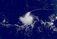
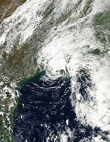
The remnant low of Ivan turned to the south and southwest, and after crossing Florida on September 21 it began to reacquire tropical characteristics. It became a tropical depression again on September 22 to the southeast of Louisiana, and Ivan reached winds of 60 mph (97 km/h) before weakening and moving ashore along southwestern Louisiana as a tropical depression; the circulation of Ivan dissipated after crossing into Texas on September 25. The cyclone broke several intensity records, and its duration was the tenth-longest on record for an Atlantic hurricane.
Formation and intensification

On August 31, a large
Upon being classified as a tropical cyclone, the depression was embedded within a deep easterly steering current provided by a
Tropical Storm Ivan gradually became better organized as wind shear decreased, and its outflow expanded in all quadrants. Satellite imagery late on September 3 depicted a well-defined curved band wrapping around much of the circulation.
While at major hurricane status, Ivan maintained very strong convection in its core with a well-defined eye. Operationally, the probability for further rapid strengthening was considered nearly nine times the average of a typical hurricane. Accordingly, Ivan was forecast to pass near
Caribbean Sea

Hurricane Ivan again reached Category 4 status as it entered the Caribbean Sea.[1] Subsequently, it underwent an eyewall replacement cycle,[15] and for about 18 hours the intensity remained constant as it paralleled the northern coast of Venezuela offshore. Another period of rapid deepening began late on September 8 as its motion turned to the west-northwest.[1] Hurricane Hunters recorded flight-level sustained winds of 180 mph (290 km/h) to the north and northeast of the eye, and a dropsonde about 630 feet (190 m) above the surface recorded winds of 200 mph (320 km/h) and an extrapolated pressure of 916 millibars (27.0 inHg).[16] Based on the reports, it is estimated Ivan attained Category 5 status at 0600 UTC on September 9, while located about 90 miles (140 km) north of Aruba.[1] At the time, the cyclone was forecast to strike southern Florida as a major hurricane.[16]
After maintaining Category 5 status for about 12 hours, Ivan began a steady weakening trend due to another eyewall replacement cycle until reaching winds of 140 mph (230 km/h) on September 10. Early next day, the hurricane reorganized as it reached winds just shy of Category 5 status. However, weakening occurred again due to an eyewall replacement cycle, and at 0330 UTC on September 11 Ivan passed 23 miles (37 km) south of

Shortly after peaking in intensity, the hurricane again weakened as it underwent an eyewall replacement cycle.
Gulf of Mexico and Alabama landfall

After entering the southern Gulf of Mexico, Hurricane Ivan weakened to Category 4 status by 0600 UTC on September 14. When Ivan entered the Gulf of Mexico, U.S.
Upon moving ashore, the National Hurricane Center expected the forward path of Ivan to be blocked, and accordingly forecast the hurricane to stall in the southern Appalachian Mountains before dissipating.[25] As the hurricane crossed Mobile Bay it turned to the north-northeast, and within twelve hours Ivan rapidly weakened to tropical storm status.[1] The circulation became less-defined,[26] and early on September 17, the cyclone deteriorated into a tropical depression over northeastern Alabama. Ivan accelerated to the northeast ahead of an approaching cold front, dropping heavy rainfall along its path and also producing a widespread tornado outbreak from Alabama through Maryland. Late on September 18, the remnants of Ivan transitioned into an extratropical low as it merged with the cold front over the Delmarva Peninsula.[1]
Redevelopment and demise

After becoming an extratropical low, the remnants of Ivan turned to the southeast and emerged into the Atlantic Ocean,[1] due to the building of an upper-level ridge to its east.[27] As an extratropical cyclone, Ivan remained identifiable in both surface and upper-level data, and the system turned south and southwestward over the subsequent days.[1] By September 20, the system was located off the east coast of Florida, producing scattered thunderstorms; unfavorable wind shear prevented tropical redevelopment, though forecasters indicated the possibility for more favorable conditions a few days later.[28] On September 21, the low crossed southern Florida and emerged into the Gulf of Mexico, and as it moved across the warm waters of the region, the low began to re-acquire tropical characteristics; the low-level circulation became increasingly better defined, and convection redeveloped over the center. Based on reports from Hurricane Hunters, it is estimated the low redeveloped into Tropical Depression Ivan late on September 22, while located about 175 miles (282 km) south-southeast of the mouth of the Mississippi River.[1]
In its first advisory on the re-developed cyclone, the National Hurricane Center classified the system Ivan "after considerable and sometimes animated in-house discussion of [its demise]... in the midst of a low-pressure and surface frontal system over the eastern United States... based primarily on the reasonable continuity observed in the analysis of the surface and low-level circulation."[29] Despite unfavorable shear and its disorganized cloud structure, the cyclone intensified to tropical storm status early on September 23, based on reports by Hurricane Hunters.[30] As an area of deep convection developed over the center, Ivan reached winds of 60 mph (97 km/h),[31] though the winds decreased as thunderstorm activity diminished.[32] Ivan weakened to a tropical depression at 0000 UTC on September 24, and two hours later it moved ashore near Holly Beach, Louisiana.[1] Initial computer models forecast the low-level circulation to turn southwestward and re-emerge into the Gulf of Mexico.[32] However, the storm rapidly weakened over land, and by 1200 UTC on September 24, Ivan degenerated into a remnant low pressure area over southeast Texas.[1] The low turned to the south[33] and the circulation dissipated early on September 25.[34] The remnant trough reached the northwestern Gulf of Mexico later that day, briefly producing scattered thunderstorms[35] before it diminished.[36]
Records
Reaching Category 3 status on the
Upon making its two landfalls in the United States, the hurricane spawned a total of 120 tornadoes,[1] which is the largest tornado outbreak associated with a tropical cyclone; this broke the previous record of 115 set by Hurricane Beulah in 1967.[39]
See also
References
- ^ a b c d e f g h i j k l m n o p q r s t u v w x y z aa ab Stacy Stewart (2004). "Hurricane Ivan Tropical Cyclone Report" (PDF). National Hurricane Center. Retrieved May 22, 2015.
- ^ Nelson (2004). "September 1 Tropical Weather Discussion". National Hurricane Center. Retrieved 2007-10-19.[permanent dead link]
- ^ Berg (2004). "September 1 Tropical Weather Discussion (2)". National Hurricane Center. Retrieved 2007-10-19.[permanent dead link]
- ^ Knabb and Pasch (2004). "Tropical Depression Nine Discussion One". National Hurricane Center. Retrieved 2007-10-19.
- ^ Franklin (2004). "Tropical Depression Nine Discussion Two". National Hurricane Center. Retrieved 2007-10-19.
- ^ Knabb and Pasch (2004). "Tropical Storm Ivan Discussion Five". National Hurricane Center. Retrieved 2007-10-19.
- ^ Pasch (2004). "Tropical Storm Ivan Discussion Eight". National Hurricane Center. Retrieved 2007-10-19.
- ^ Beven (2004). "Tropical Storm Ivan Discussion Ten". National Hurricane Center. Retrieved 2007-10-19.
- ^ Beven (2004). "Hurricane Ivan Discussion Ten". National Hurricane Center. Retrieved 2007-10-19.
- ^ Jarvinen and Hennon (2004). "Hurricane Ivan Discussion Fifteen". National Hurricane Center. Retrieved 2007-10-19.
- ^ Pasch (2004). "Hurricane Ivan Discussion Seventeen". National Hurricane Center. Retrieved 2007-10-19.
- ^ Lawrence and Hennon (2004). "Hurricane Ivan Discussion Nineteen". National Hurricane Center. Retrieved 2007-10-19.
- ^ Pasch (2004). "Hurricane Ivan Discussion Eighteen". National Hurricane Center. Retrieved 2007-10-19.
- ^ Stewart (2004). "Hurricane Ivan Discussion Twenty". National Hurricane Center. Retrieved 2007-10-19.
- ^ Stewart (2004). "Hurricane Ivan Discussion Twenty-Four". National Hurricane Center. Retrieved 2007-10-19.
- ^ a b c Stewart (2004). "Hurricane Ivan Discussion Twenty-Eight". National Hurricane Center. Retrieved 2007-10-19.
- ^ Avila (2004). "Hurricane Ivan Discussion Thirty-Seven". National Hurricane Center. Retrieved 2007-10-19.
- ^ Stewart (2004). "Hurricane Ivan Discussion Forty-One". National Hurricane Center. Retrieved 2007-10-20.
- ^ Pasch (2004). "Hurricane Ivan Discussion Forty-Seven". National Hurricane Center. Retrieved 2007-10-20.
- ^ Lucy Sherriff (August 5, 2005). "Hurricane Ivan prompts rogue wave rethink". The Register. Retrieved September 6, 2021.
- ^ "NRL Measures Record Wave During Hurricane Ivan - U.S. Naval Research Laboratory". www.nrl.navy.mil. February 17, 2017. Archived from the original on November 1, 2017. Retrieved March 26, 2018.
- ^ Franklin (2004). "Hurricane Ivan Discussion Forty-Nine". National Hurricane Center. Retrieved October 20, 2007.
- ^ Franklin (2004). "Hurricane Ivan Discussion Fifty". National Hurricane Center. Retrieved October 20, 2007.
- ^ Franklin (2004). "Hurricane Ivan Discussion Fifty-Three". National Hurricane Center. Retrieved October 20, 2007.
- ^ a b Pasch (2004). "Hurricane Ivan Discussion Fifty-Five". National Hurricane Center. Retrieved October 20, 2007.
- ^ Stewart (2004). "Tropical Depression Ivan Discussion Fifty-Nine". National Hurricane Center. Retrieved October 20, 2007.
- ^ Wallace (2004). "September 18 Tropical Weather Discussion". National Hurricane Center. Retrieved 2007-10-20.[permanent dead link]
- ^ Stewart (2004). "September 20 Tropical Weather Outlook". National Hurricane Center. Retrieved 2007-10-20.[permanent dead link]
- ^ Avila (2004). "Tropical Depression Ivan Special Discussion Sixty-Seven". National Hurricane Center. Retrieved 2007-10-20.
- ^ Avila (2004). "Tropical Storm Ivan Discussion Sixty-Eight". National Hurricane Center. Retrieved 2007-10-20.
- ^ Stewart (2004). "Tropical Storm Ivan Discussion Seventy". National Hurricane Center. Retrieved 2007-10-20.
- ^ a b Stewart (2004). "Tropical Storm Ivan Discussion Seventy-One". National Hurricane Center. Retrieved 2007-10-20.
- ^ Halbach (2004). "Public Advisory Number 76 for Remnant Low of Ivan". Hydrometeorological Prediction Center. Retrieved 2007-10-20.[dead link]
- ^ Halbach (2004). "Public Advisory Number 77 for Remnant Low of Ivan". Hydrometeorological Prediction Center. Retrieved 2007-10-20.[dead link]
- ^ Wallace (2004). "September 25 Tropical Weather Discussion". National Hurricane Center. Retrieved 2007-10-20.[permanent dead link]
- ^ MT (2004). "September 25 Tropical Weather Discussion (2)". National Hurricane Center. Retrieved 2007-10-20.[permanent dead link]
- ^ a b "Atlantic hurricane best track (HURDAT version 2)" (Database). United States National Hurricane Center. April 5, 2023. Retrieved April 18, 2024.
 This article incorporates text from this source, which is in the public domain.
- ^ World Meteorological Organization (2005). "Twenty-Seventh Session RA IV Hurricane Committee" (PDF). Archived from the original (PDF) on 2007-10-25. Retrieved 2007-11-24.
- ^ National Oceanic and Atmospheric Administration (2005). "NOAA Reports Record Number of Tornadoes in 2004". Science Daily. Retrieved 2007-11-24.

