
Metro Detroit
Metro Detroit
Detroit–Warren–Dearborn MSA Detroit–Warren–Ann Arbor CSA | |
|---|---|
.jpg) Downtown Detroit seen from Windsor, Ontario in November 2021 | |
| Country | United States |
| State | Michigan |
| Principal city | Detroit |
| Counties | |
| Area | |
| • Urban | 1,284.8 sq mi (3,328 km2) |
| • 947 | |
| Website | visitdetroit |
Metro Detroit is a major metropolitan area in the U.S. state of Michigan, consisting of the city of Detroit and over 200 municipalities in the surrounding area with its largest employer being Oakland County.[2] There are varied definitions of the area, including the official statistical areas designated by the Office of Management and Budget, a federal agency of the United States.
Metro Detroit is known for its automotive heritage, arts, entertainment, popular music, food, cultural diversity, and sports. The area includes a variety of natural landscapes, parks, and beaches, with a recreational coastline linking the Great Lakes. Metro Detroit also has one of the largest metropolitan economies in the U.S. with 17 Fortune 500 companies.
Definitions

The Detroit
The
Detroit–Warren–Dearborn Metropolitan Statistical Area
| County | Seat | 2021 Estimate | 2020 Census | Change | Area | Density |
|---|---|---|---|---|---|---|
| Wayne | Detroit
|
1,774,816 | 1,793,561 | −1.05% | 612.08 sq mi (1,585.3 km2) | 2,900/sq mi (1,120/km2) |
| Oakland | Pontiac | 1,270,017 | 1,274,395 | −0.34% | 867.66 sq mi (2,247.2 km2) | 1,464/sq mi (565/km2) |
| Macomb | Mt. Clemens
|
876,792 | 881,287 | −0.51% | 479.22 sq mi (1,241.2 km2) | 1,830/sq mi (706/km2) |
| Livingston | Howell | 195,014 | 193,866 | +0.59% | 565.25 sq mi (1,464.0 km2) | 345/sq mi (133/km2) |
| St. Clair | Port Huron | 160,053 | 160,383 | −0.21% | 721.17 sq mi (1,867.8 km2) | 222/sq mi (86/km2) |
| Lapeer | Lapeer | 88,513 | 88,619 | −0.12% | 643.01 sq mi (1,665.4 km2) | 138/sq mi (53/km2) |
| Total | 4,365,205 | 4,392,041 | −0.61% | 3,888.39 sq mi (10,070.9 km2) | 1,123/sq mi (433/km2) |
-
 Map of Wayne County highlighting City of Detroit (County seat) in red.
 -
 Map ofOakland County highlighting City of Pontiac(County seat) in red.
 -
 Map ofMacomb County highlighting City of Mount Clemens(County seat) in red.
 -
 Map of Livingston County highlighting City of Howell (County seat) in red.
 -
 Map of St. Clair County highlighting City of Port Huron (County seat) in red.
 -
 Map ofLapeer County highlighting City of Lapeer(County seat) in red.


The nine county area designated by the OMB as the Detroit–Warren–Ann Arbor
Detroit–Warren–Ann Arbor Combined Statistical Area
| Statistical Area | 2020 Census | 2010 Census | Change | Area | Density |
|---|---|---|---|---|---|
Detroit-Warren-Dearborn, MI Metropolitan Statistical Area
|
4,392,041 | 4,296,250 | +2.23% | 3,888 sq mi (10,070 km2) | 1,130/sq mi (436/km2) |
Flint, MI Metropolitan Statistical Area (Genesee County )
|
406,211 | 425,790 | −4.60% | 650 sq mi (1,700 km2) | 625/sq mi (241/km2) |
Ann Arbor, MI Metropolitan Statistical Area (Washtenaw County )
|
372,258 | 344,791 | +7.97% | 722 sq mi (1,870 km2) | 516/sq mi (199/km2) |
Monroe, MI Metropolitan Statistical Area (Monroe County )
|
154,809 | 152,021 | +1.83% | 722 sq mi (1,870 km2) | 214/sq mi (83/km2) |
Adrian, MI Micropolitan Statistical Area (Lenawee County )
|
99,423 | 99,892 | −0.47% | 761 sq mi (1,970 km2) | 131/sq mi (50/km2) |
| Total | 5,325,219 | 5,196,250 | +2.48% | 6,701 sq mi (17,360 km2) | 795/sq mi (307/km2) |
-

-
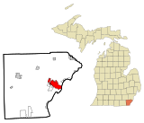
 Washtenaw County
 -
-
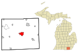 Lenawee County


With the adjacent city of
Conan Smith, a businessperson quoted in a 2012 article by The Ann Arbor News, stated the most significant reason Washtenaw County, including Ann Arbor, is not often included in definitions of Metro Detroit is that there is a "lack of affinity that Washtenaw County as a whole has with Wayne County and Detroit or Oakland County and Macomb".[8] Ann Arbor is nearly 43 miles by car from Downtown Detroit, and developed separately as a university city, with its own character. Smith said that county residents "just don't yet see ourselves as a natural part of that [Detroit] region, so I think it feels a little forced to a lot of people, and they're scared about it".[8]
(SE_MI).png)

Economy

Detroit and the surrounding region constitute a major center of commerce and global trade, most notably as home to America's 'Big Three' automobile companies: General Motors, Ford, and Chrysler. Detroit's six-county Metropolitan Statistical Area (MSA) has a population of about 4.3 million and a workforce of about 2.1 million.[9] In December 2017, the Department of Labor reported metropolitan Detroit's unemployment rate to be 4.2%.[10] The Detroit MSA had a Gross Metropolitan Product (GMP) of $252.7 billion as of September 2017.[11]


Firms in the region pursue
Metro Detroit is one of the leading health care economies in the U.S., according to a 2003 study measuring health care industry components, with the region's hospital sector ranked fourth in the nation.[12]
There are about four thousand factories in the area.[14] The domestic auto industry is primarily headquartered in Metro Detroit. The area is an important source of engineering job opportunities.[15] A rise in automated manufacturing using robotic technology has created related industries in the area.[16][17]
A 2004 Border Transportation Partnership study showed that 150,000 jobs in the Detroit–Windsor region and $13 billion in annual production depend on the city's international border crossing.[18]
In addition to property taxes, residents of the City of Detroit pay an income tax rate of 2.50%.[19]
Detroit automakers and local manufacturers have made significant restructurings in response to market competition. GM made its initial public offering (IPO) of stock in 2010, after bankruptcy, bailout, and restructuring by the federal government.[20] Domestic automakers reported significant profits in 2010, interpreted by some analysts as the beginning of an industry rebound and an economic recovery for the Detroit area.[21][22][23]
The region's nine-county area, with its population of 5.3 million, has a workforce of about 2.6 million and about 247,000 businesses.[24] Fourteen Fortune 500 companies are based in metropolitan Detroit.[25] In April 2015, the metropolitan Detroit unemployment rate was 5.1 percent, a rate lower than the New York, Los Angeles, Chicago and Atlanta metropolitan areas.[26]
Metro Detroit has made Michigan's economy a leader in information technology, biotechnology, and advanced manufacturing. Michigan ranks fourth nationally in high-tech employment with 568,000 high-tech workers, including 70,000 in the automotive industry.[27][28]

Michigan typically ranks second or third in overall

For 2010, the domestic automakers have reported significant profits indicating the beginning of rebound.[21][22][36][37][38]
Metro Detroit serves as the headquarters for the
Detroit is a major U.S. port
Metro Detroit is a prominent business center, with major commercial districts such as the
Tourism
Tourism is an important component of the region's culture and economy, comprising nine percent of the area's two million jobs.

Metro Detroit is a tourist destination that easily accommodates super-sized crowds to events such as the
Detroit's
The


Metro Detroit contains a number of shopping malls, including the upscale Somerset Collection in Troy, Great Lakes Crossing Outlets in Auburn Hills, and Twelve Oaks Mall in Novi, all of which are draws for tourists.
The region's leading attraction is The Henry Ford, located in the Detroit suburb of Dearborn; it is America's largest indoor-outdoor museum complex.[50][51]
The recent renovation of the
Demographics
|
| ||||||||||||||||||||||||||||||||||||||||||||||||||||||||||||||||||||||||||||||||||||||||||||||||||||||||||||||||||||||||||||||||||||||||||||||||||||||||||||||||||||||||||||||||
Metro Detroit is a six-county
The Detroit region is a ten-county
The Detroit–Windsor area, a commercial link straddling the Canada-U.S. border, has a total population of about 5,700,000.[54]
As of the
As of the 2010
In 1701, French officer
Today, the Detroit suburbs in
Metro Detroit has a sizeable population of
In the 2000s, 115 of the 185 cities and townships in Metro Detroit were more than 95% white. African Americans have also moved to the suburbs: in 2000 44% of the more than 240,000 suburban blacks lived in Inkster, Pontiac, Oak Park, and Southfield.[57]
Transportation
Airports
The largest airport in the area is
The other airports in the metropolitan area are:
- Ann Arbor Municipal Airport (ARB)
- Coleman A. Young International Airport (DET) (Detroit) - General aviation only
- Flint-Bishop International Airport(FNT) (Flint) - Commercial airport
- Oakland County International Airport (PTK) Waterford Township - Charter passenger facility
- St. Clair County International Airport (near Port Huron, Michigan) - An international airport on the Canada–US border.
- Selfridge Air National Guard Base (Mount Clemens) - Military airbase
- Willow Run Airport (YIP) (Ypsilanti) - Cargo, general aviation, charter passenger traffic
Transit systems
Bus service for the metropolitan area is provided jointly by the
Roads and freeways


The Metro Detroit area is linked by an advanced network of major roads and
Surface street navigation in Metro Detroit is commonly anchored by "mile roads", major east–west surface streets that are spaced at one-mile (1.6 km) intervals and increment as one travels north and away from the city center. Mile roads sometimes have two names, the numeric name (ex. 15 Mile Road) used in Macomb County and a local name (ex. Maple Road) used in Oakland County mostly.
Education
Colleges and universities
- Baker College — Auburn Hills and Royal Oak
- Detroit and Howell
- Detroit
- Concordia University Ann Arbor — Ann Arbor
- Cranbrook Academy of Art — Bloomfield Hills
- Detroit and Warren
- Dorsey College — Dearborn, Madison Heights, Roseville, Wayne and Woodhaven
- Eastern Michigan University — Ypsilanti
- Henry Ford College — Dearborn
- Kettering University — Flint
- Lawrence Technological University — Southfield
- Clinton Township
- Madonna University — Livonia
- Michigan State University Management Education Center — Troy
- Monroe County Community College — Monroe
- Mott Community College — Flint
- Northwood University — Midland
- Oakland Community College — Auburn Hills, Farmington Hills, Highland Lakes, Royal Oak and Southfield
- Oakland University — Auburn Hills and Rochester Hills
- Rochester College — Rochester
- Saint Clair County Community College — Port Huron
- St. Clair College — Windsor, Ontario
- Schoolcraft College — Livonia
- Specs Howard School of Media Arts — Southfield
- Detroit
- Orchard Lake
- Detroit
- University of Michigan — Ann Arbor
- University of Michigan–Dearborn — Dearborn
- University of Michigan–Flint — Flint
- University of Windsor — Windsor, Ontario
- Walsh College — Troy
- Washtenaw Community College — Ann Arbor
- Detroit
- Detroit
Crime
The principal City of Detroit has struggled with high crime for decades. About half of all murders in Michigan in 2015 occurred in Detroit.[59][60] Since 2013, the FBI has reported a 26% decrease in property crimes and a 27% decrease in violent crimes.[61]
Sports
Professional sports has a major fan following in Metro Detroit. The area is home to many sports teams, including seven professional teams in five major sports. The area's several universities field teams in a variety of sports.
The
Area codes
Metro Detroit is served by nine telephone area codes (six not including Windsor). The 313 area code, which used to encompass all of Southeast Michigan, is today confined exclusively to the City of Detroit and several neighboring Wayne County suburbs.
- The area code overlaymostly serve Oakland County.
- Macomb County is largely served by 586.
- Genesee, St. Clair, and Lapeer counties, eastern Livingston County, and part of northern Oakland County are covered by 810.
- Washtenaw, Monroe, and most of the Wayne County suburbs are in the 734 area.
- The Windsor area (and most of southwestern Ontario) is served by an overlay complex of three codes — 519, 226, and 548.
References
- ^ "Total Gross Domestic Product for Detroit-Warren-Dearborn, MI (MSA)". fred.stlouisfed.org.
- ^ "Establishment employment and wages fourth quarter 2022". Bureau of Labor Statistics. Retrieved July 13, 2023.
- ^ "List of 2020 Census Urban Areas". United States Census Bureau. Retrieved December 30, 2022.
- ^ Detroit Metro Convention & Visitors Bureau Archived 2012-03-12 at the Wayback Machine
- ^ "Revised Delineations of Metropolitan Statistical Areas, Micropolitan Statistical Areas, and Combined Statistical Areas, and Guidance on Uses of the Delineations of These Areas" (PDF). OMB BULLETIN NO. 13-01. Executive Office of the President, Office of Management and Budget. Archived (PDF) from the original on 21 January 2017. Retrieved 4 April 2014.
- ^ Statistics Canada . Retrieved on August 2, 2016.
- ^ a b Cities located close to Detroit.Time and Date world clock distances. Retrieved on September 2, 2007.
- ^ a b Stanton, Ryan J. "Conan Smith: Why Ann Arbor doesn't see itself as part of Metro Detroit - and why it should," The Ann Arbor News. 30 May 2012. Retrieved on November 9, 2013.
- ^ Michigan Department of Labor and Economic Growth. Retrieved June 14, 2012.
- ^ "Local Area Unemployment Statistics". Local Area Unemployment Statistics. Bureau of Labor & Statistics. Retrieved February 13, 2018.
- ^ "Total Gross Domestic Product for Detroit-Warren-Dearborn, MI (MSA)". Federal Reserve Bank of St. Louis. January 2001. Retrieved February 14, 2018.
- ^ Devol, Ross C. and Rob Koepp (August 2003).America's Health Care Economy.Miliken Institute. Retrieved on November 6, 2011. Archived February 7, 2012, at the Wayback Machine
- ^ a b Mink, Randy, and Karen Mink (July 2001).Detroit Turns 300 - Detroit 300 Festival. Travel America, World Publishing Co., Gale Group.
- ^ World Book Inc., Volume 5. 2008.
- ^ Automation Alley Technology Industry Report (2011 Edition). Anderson Economic Group. Retrieved August 14, 2011. Archived July 5, 2015, at the Wayback Machine
- ^ Walsh, Tom (August 29, 2009).FIRST Robotics Detroit Regional Competition. Detroit Free Press.
- ^ "Army to create jobs in Warren expansion", Detroit Free Press., 21 August 2009
- ^ Detroit Regional Chamber (2006) "Detroit/Windsor Border Update: Part I-Detroit River International Crossing Study". Archived from the original on May 6, 2008. Retrieved 2007-03-14. Retrieved on April 8, 2007.
- ^ "FAQS – City of Detroit | www.detroitmi.gov". Archived from the original on August 2, 2010. Retrieved May 3, 2010.
- ^ Baldwin, Clare, and Soyoung Kim (November 17, 2010). GM IPO raises $20.1 billion.Reuters. Retrieved on February 11, 2013.
- ^ a b Schroeder, Robert (July 30, 2010).Obama says U.S. auto industry on rebound. Wall Street Journal. Retrieved on September 9, 2010.
- ^ a b GM posts profit, CEO Whitacre to retire.CNN Money. Retrieved on September 18, 2010.
- ^ Oosting, Jonathan (December 1, 2010). Brookings: Metro Detroit economy on 'road to full recovery'.Mlive. Retrieved July 17, 2011.
- ^ Regional Profile Archived 2007-02-03 at the Wayback Machine Detroit Regional Chamber. Retrieved on June 17, 2009.
- ^ Mlive.com. Fortune 500: GM, Ford, Dow among top Michigan companies for 2014. Retrieved February 7, 2015.
- ^ Bureau of Labor Statistics. Unemployment rates for metropolitan areas. U.S. Department of Labor. Retrieved February 7, 2015.
- ^ MEDC (2009).Michigan: High Technology Focus, State of Michigan. Retrieved on June 17, 2009.
- ^ Metro Detroit, Michigan score high in biotech VC rankings. Metromode 12-17-2009. Retrieved on July 14, 2010.
- ^ MEDC,(2009).Michigan Advantage Archived 2009-03-21 at the Wayback Machine State of Michigan. Retrieved on June 17, 2009.
- ^ NSF 01-320 (2001)."R&D Spending is Highly Concentrated in a Small Number of States", National Science Foundation
- ^ Mark Arend (January 2012)."Where the high tech jobs are", Site Selection magazine.
- ^ "Michigan Cities". Encyclopædia Britannica Online. Archived from the original on September 19, 2010. Retrieved December 26, 2008.
[Detroit] is the automobile capital of the world
- ^ "SAE World Congress convenes in Detroit". Archived from the original on February 10, 2007. Retrieved December 26, 2008.
- ^ Lawrence, Peter (2009).Interview with Michigan's Governor Archived 2008-11-20 at the Wayback Machine, Corporate Design Foundation. Retrieved on May 2, 2009. "Michigan is known as the world's automotive center."
- ^ Alliance of Automobile Manufacturers (2006).From the 2003 Study "Contributions of the Automotive Industry to the U.S. Economy" University of Michigan and the Center for Automotive Research Archived 2004-04-02 at the Wayback Machine Autoalliance.com
- ^ Shoenberger, Robert (May 25, 2010).Rebounding auto industry boosts Shiloh Industries' second-quarter sales, profit. Cleveland.com. Retrieved on September 18, 2010.
- ^ Cwiek, Sarah (November 30, 2010).$43 billion in federal tax revenue. [dead link]
- ^ Eisenstein, Paul A. (April 2012). "Assessment of tax revenue generated by the auto industry" (PDF). Center for Automotive research. Archived from the original (PDF) on November 8, 2012. Retrieved December 2, 2012.
- ^ Why MITA will be a success Archived 2007-08-15 at the Wayback Machine.Michigan International Trade Association. Retrieved on September 3, 2007. "Detroit is the most active commercial port of entry in the USA." "Greater Detroit is the number one exporting region among 310 defined metropolitan areas (CMSA) in the U.S."
- ^ Regional Advantages for International Business Archived 2007-09-25 at the Wayback Machine. World Trade Center Detroit Windsor. Retrieved on September 3, 2007.
- ^ Why doesn't Michigan have toll roads?.Michigan Department of Transportation. Retrieved on September 5, 2007. "A system of toll free highways has been viewed as important to commerce, industry, tourism, and general economic development."
- ^ Detroit Regional Chamber (2006) Detroit/Windsor Border Update: Part I-Detroit River International Crossing Study Archived 2006-03-21 at the Wayback Machine
- ^ "Annual Report on Research, Scholarship and Creative Activity at the University of Michigan FY2006" (PDF). UM Research. January 18, 2007. Archived from the original (PDF) on 2007-09-25. Retrieved 2007-11-14.
- ^ Grad profiles. Wayne State. Retrieved on October 27, 2008.
- ^ "Colliers International Market report, 2006" (PDF). Archived from the original (PDF) on 2007-09-27. Retrieved 2006-12-27.
- ^ The Urban Markets Initiative, Brookings Institution Metropolitan Policy Program The Social Compact, Inc. University of Michigan Graduate Real Estate Program (October 2006).Downtown Detroit In Focus: A Profile of Market Opportunity Archived 2011-09-18 at the Wayback Machine. Downtown Detroit Partnership. Retrieved on July 14, 2010.
- ^ "Detroit: Economy Major Industries and Commercial Activity". Advameg, Inc. Retrieved 2008-06-12.
- ^ Metro Detroit Convention and Visitors Bureau statistics Archived 2006-12-28 at the Wayback Machine
- ^ "Fifth Third Bank rocks the Winter Blast", Michigan Chronicle.(March 14, 2006).
- ^ America's Story, Explore the States: Michigan (2006). Henry Ford Museum and Greenfield Village Archived 2009-10-14 at the Wayback Machine Library of Congress
- ^ State of Michigan: MI Kids (2006).Henry Ford Museum and Greenfield Village Archived 2010-12-07 at the Wayback Machine
- ^ Audi, Tamara (September 26, 2007). "What Happens In Detroit", The Wall Street Journal, B6. "But the market at issue, as MGM Mirage sees it, includes a 300-mile radius of potential overnight clients across the region,"
- ^ a b "Explore Census Data". US Census Bureau. Retrieved 12 October 2021.
- ^ World Agglomerations Retrieved on May 5, 2009.
- ^ a b Baulch, Vivian M. (September 4, 1999). Michigan's greatest treasure -- Its people Archived 2007-07-31 at archive.today. Michigan History, The Detroit News. Retrieved on April 4, 2009.
- ^ "2004–05 Community profile Oakland County" (PDF). Archived from the original (PDF) on 9 July 2007. Retrieved 11 July 2007.
Oakland County also ranks as the fourth wealthiest county in the nation among counties with populations of more than one million people.
- ^ Towbridge, Gordon. "Racial divide widest in US." The Detroit News. January 14, 2002. Retrieved on March 30, 2009.
- ^ Ann Arbor - Detroit Regional Rail Project SEMCOG. Retrieved on February 4, 2010.
- ^ "Table 8 – Michigan". Ucr.fbi.gov. Retrieved July 23, 2017.
- ^ [1][dead link]
- ^ Jachman, Matt (1 January 2019). "Area property crime falls, violent crime up slightly over 5-year span". HometownLife. Retrieved 7 May 2019.
External links
- Metro Detroit Convention and Visitors Bureau
- Southeast Michigan Council of Governments
- City Charter of Detroit
- Michigan's Official Economic Development and Travel Site.
- "Historic Light Station Information and Photography: Michigan". United States Coast Guard Historian's Office. Archived from the original on 2017-05-01.
- Map of Michigan Lighthouse (PDF)
- Collection: "Detroit Metro" from the University of Michigan Museum of Art
.svg) | ||
| Topics | .jpg) | |
|---|---|---|
| Detroit | ||
| Municipalities over 80,000 | ||
| Municipalities 40,000 to 80,000 | ||
| Cultural enclaves | ||
| Satellite cities | ||
| Counties in MSA | ||
| Counties in CSA | ||
Great Lakes megalopolis as defined by the RPA | ||
|---|---|---|
Includes all metropolitan areas that have a population of 150,000 or greater according to the most recent national census. | ||
| Great Lakes region cities |
|  |
| Surrounding cities |
| |
| Cities of states south of region | ||
| Other metro-regions | ||
42°21′29″N 83°12′54″W / 42.358°N 83.215°W
| International | |
|---|---|
| National | |