
Mixed layer


The oceanic or
Oceanic mixed layer
Importance of the mixed layer
The mixed layer plays an important role in the physical climate. Because the
The mixed layer is also important as its depth determines the average level of light seen by marine organisms. In very deep mixed layers, the tiny marine organisms known as phytoplankton are unable to get enough light to maintain their metabolism. The deepening of the mixed layer in the wintertime in the North Atlantic is therefore associated with a strong decrease in surface chlorophyll a. However, this deep mixing also replenishes near-surface nutrient stocks. Thus when the mixed layer becomes shallow in the spring, and light levels increase, there is often a concomitant increase of phytoplankton biomass, known as the "spring bloom".
Oceanic mixed layer formation
There are three primary sources of energy for driving turbulent mixing within the open-ocean mixed layer. The first is the ocean waves, which act in two ways. The first is the generation of turbulence near the ocean surface, which acts to stir light water downwards.
The mixed layer is characterized by being nearly uniform in properties such as temperature and salinity throughout the layer. Velocities, however, may exhibit significant shears within the mixed layer. The bottom of the mixed layer is characterized by a gradient, where the water properties change. Oceanographers use various definitions of the number to use as the mixed layer depth at any given time, based on making measurements of physical properties of the water. Often, an abrupt temperature change called a thermocline occurs to mark the bottom of the mixed layer; sometimes there may be an abrupt salinity change called a halocline that occurs as well. The combined influence of temperature and salinity changes results in an abrupt density change, or pycnocline. Additionally, sharp gradients in nutrients (nutricline) and oxygen (oxycline) and a maximum in chlorophyll concentration are often co-located with the base of the seasonal mixed layer.
Oceanic mixed layer depth determination

The depth of the mixed layer is often determined by hydrography—making measurements of water properties. Two criteria often used to determine the mixed layer depth are temperature and sigma-t (density) change from a reference value (usually the surface measurement). The temperature criterion used in Levitus[5] (1982) defines the mixed layer as the depth at which the temperature change from the surface temperature is 0.5 °C. However, work done by Kara et. al. (2000) suggest that the temperature difference is closer to .8 °C.[6] The sigma-t (density) criterion used in Levitus[5] uses the depth at which a change from the surface sigma-t of 0.125 has occurred. Neither criterion implies that active mixing is occurring to the mixed layer depth at all times. Rather, the mixed layer depth estimated from hydrography is a measure of the depth to which mixing occurs over the course of a few weeks.

Barrier layer thickness
The barrier layer thickness (BLT) is a layer of water separating the well-mixed surface layer from the thermocline.[7] A more precise definition would be the difference between mixed layer depth (MLD) calculated from temperature minus the mixed layer depth calculated using density. The first reference to this difference as the barrier layer was in a paper describing observations in the western Pacific as part of the Western Equatorial Pacific Ocean Circulation Study.[8] In regions where the barrier layer is present, stratification is stable because of strong buoyancy forcing associated with a fresh (i.e. more buoyant) water mass sitting on top of the water column.
In the past, a typical criterion for MLD was the depth at which the surface temperature cools by some change in temperature from surface values. For example, Levitus[5] used 0.5 °C. In the example to the right, 0.2 °C is used to define the MLD (i.e. DT-02 in the Figure). Prior to the abundant subsurface salinity available from Argo, this was the main methodology for calculating the oceanic MLD. More recently, a density criterion has been used to define the MLD. The density-derived MLD is defined as the depth where the density increases from the surface value due to a prescribed temperature decrease of some value (e.g. 0.2 °C) from the surface value while maintaining constant surface salinity value. (i.e. DT-02 - Dsigma).
BLT regimes
Large values of the BLT are typically found in the equatorial regions and can be as high as 50 m. Above the barrier layer, the well mixed layer may be due to local precipitation exceeding evaporation (e.g. in the western Pacific), monsoon related river runoff (e.g. in the northern Indian Ocean), or advection of salty water subducted in the subtropics (found in all subtropical ocean gyres). Barrier layer formation in the subtropics is associated with seasonal change in the mixed layer depth, a sharper gradient in sea surface salinity (SSS) than normal, and subduction across this SSS front.[9] In particular, the barrier layer is formed in winter season in the equatorward flank of subtropical salinity maxima. During early winter, the atmosphere cools the surface and strong wind and negative buoyancy forcing mixes temperature to a deep layer. At this same time, fresh surface salinity is advected from the rainy regions in the tropics. The deep temperature layer along with strong stratification in the salinity gives the conditions for barrier layer formation.[10]
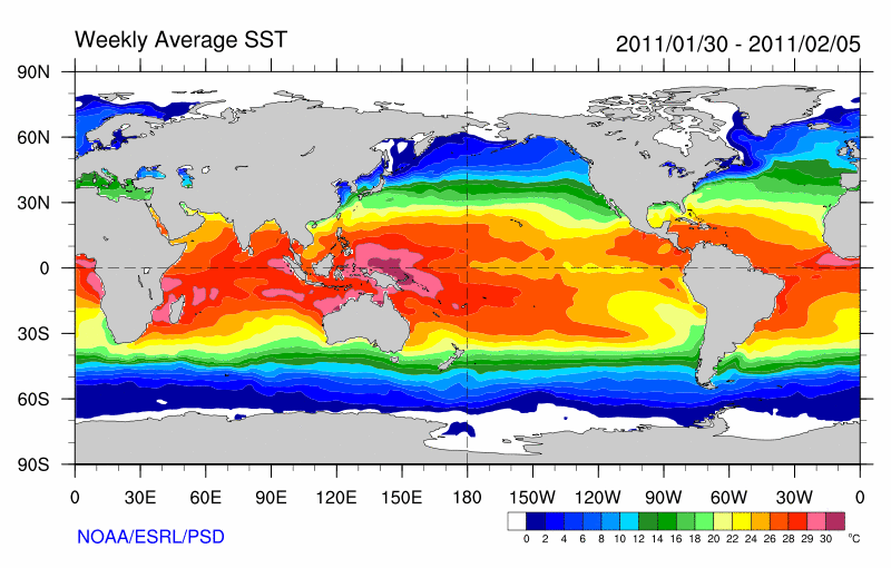
For the western Pacific, the mechanism for barrier layer formation is different. Along the equator, the eastern edge of the warm pool (typically 28 °C isotherm - see SST plot in the western Pacific) is a demarcation region between warm fresh water to the west and cold, salty,
Importance of BLT
Prior to
Limnological mixed layer formation
Formation of a mixed layer in a lake is similar to that in the ocean, but mixing is more likely to occur in lakes solely due to the molecular properties of
The study of limnology encompasses all inland water bodies, including bodies of water with salt in them. In saline lakes and seas (such as the Caspian Sea), mixed layer formation generally behaves similarly to the ocean.
Atmospheric mixed layer formation
The atmospheric mixed layer results from convective air motions, typically seen towards the middle of the day when air at the surface is warmed and rises. It is thus mixed by Rayleigh–Taylor instability. The standard procedure for determining the mixed layer depth is to examine the profile of potential temperature, the temperature which the air would have if it were brought to the pressure found at the surface without gaining or losing heat. As such an increase of pressure involves compressing the air, the potential temperature is higher than the in-situ temperature, with the difference increasing as one goes higher in the atmosphere. The atmospheric mixed layer is defined as a layer of (approximately) constant potential temperature, or a layer in which the temperature falls at a rate of approximately 10 °C/km, provided it is free of clouds. Such a layer may have gradients in the humidity, though. As is the case with the ocean mixed layer, velocities will not be constant throughout the atmospheric mixed layer.
References
- Mellor, G. L.; Durbin, P. A. (1975). "The structure and dynamics of the ocean surface mixed layer". Journal of Physical Oceanography. 5 (4): 718–728. .
- S2CID 122260276.
- S2CID 4308649.
- ^
Craik, A.D.D.; Leibovich, S. (1976), "A Rational model for Langmuir circulations", Journal of Fluid Mechanics, 73 (3): 401–426, S2CID 18089261
- ^ Gnanadesikan, A.; Weller, R.A. (1995), "Structure and variability of the Ekman spiral in the presence of surface gravity waves", Journal of Physical Oceanography, 25 (12): 3148–3171,
- ^ a b c Levitus, Sydney (December 1982). Climatological Atlas of the World Ocean (PDF). NOAA Professional Paper 13. Rockville, Md, USA: U.S. Department of Commerce, National Oceanic and Atmospheric Administration. p. 173. Archived from the original (PDF) on October 12, 2011. Retrieved 29 January 2020.
- .
- ^ Sprintall, J., and M. Tomczak, Evidence of the barrier layer in the surface-layer of the tropics, Journal of Geophysical Research: Oceans, 97 (C5), 7305-7316, 1992.
- .
- ^ Sato, K., T. Suga, and K. Hanawa, Barrier layers in the subtropical gyres of the world's oceans, Geophysical Research Letters, 33 (8), 2006.
- ^ Mignot, J., C.d.B. Montegut, A. Lazar, and S. Cravatte, Control of salinity on the mixed layer depth in the world ocean: 2. Tropical areas, Journal of Geophysical Research: Oceans, 112 (C10), 2007.
- .
- .
- .
- .
- .
- .
External links
- Lake effect snowfor a link to a NASA image from the SeaWiFS satellite showing clouds in the atmospheric mixed layer.
- See the Ifremer/Los Mixed Layer Depth Climatology website at Redirection for having access to up to date ocean Mixed Layer Depth Climatology, data, maps and links.
Further reading
- Wallace, John Michael; Hobbs, Peter Victor (2006). Atmospheric Science: an Introductory Survey (2nd ed.). Academic Press. p. 483. ISBN 9780127329512.