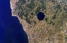
Monti Sabatini

The Monti Sabatini is a geologic region in
sedimentary base of the Sabatini complex lies buried under 200 m (660 ft) of volcanic ash and rocks
.
Background

The highest point is Monte Rocca Romana (a postcaldera
stratocone), at 612 m (2,008 ft).[citation needed
]
Other mountains in the area include
Monte Soratte, and more southwards, by the Monti Cornicolani.[citation needed
]
See also
References
- PMID 32457380.
External links
- Sabatini Volcanic Complex.
- Sabatini, Italy
- "Sabatini Complex". Global Volcanism Program. Smithsonian Institution. Retrieved 25 June 2021.

