
Montrose, Pennsylvania
This article needs additional citations for verification. (December 2021) |
Montrose, Pennsylvania | |
|---|---|
570 | |
| FIPS code | 42-50736 |
| GNIS feature ID | 1215614[3] |

Montrose is a borough in Susquehanna County, Pennsylvania, United States, 18.41 miles (29.63 km) south-southeast of Binghamton, New York and 31.39 miles (50.52 km) north by west of Scranton. The land is elevated approximately 1,400 feet (430 m) above sea level. It is the Susquehanna County seat.[5]
History
Montrose was laid out in 1812 in an area of Pennsylvania historically associated with the
The first courthouse was built a year later, and Montrose was incorporated as a borough from part of Bridgewater Township on March 29, 1824.
The traditional older industries included creameries and the manufacturing of cut glass, boxes, sawing machinery, lumber, etc. The area of Montrose is notable for its many quarry sites. A type of rock that is indigenous to this area is called
Montrose was incorporated as a town and seat of Susquehanna County in 1824, but families began immigrating to the area in the mid-18th century, primarily from areas along the
Montrose played a significant role in the Northern Trail of the Underground Railroad: "During the 1840s, the anti-slavery ideology prevailing in Susquehanna County took a decidedly radical turn. Abolitionists no longer content to limit their involvement to lectures and debates began helping slaves escape on the Underground Railroad. Of the eighty-two individuals identified as Underground Railroad agents, twenty-one came from Susquehanna County."[6]
Between the 1950s and 1990s, due to the declines in the
The population was 1,664 at the
The town's Sylvanus Mulford House, Silver Lake Bank, and Susquehanna County Courthouse Complex are listed on the National Register of Historic Places.[7] The Montrose Historic District was added in 2011.
Geography
Montrose is located at 41°49′59″N 75°52′38″W / 41.83306°N 75.87722°W (41.833064, -75.877190).[8]
According to the United States Census Bureau, the borough has a total area of 1.3 square miles (3.4 km2), all land.
Demographics
| Census | Pop. | Note | %± |
|---|---|---|---|
| 1830 | 415 | — | |
| 1840 | 632 | 52.3% | |
| 1850 | 917 | 45.1% | |
| 1860 | 1,168 | 27.4% | |
| 1870 | 1,463 | 25.3% | |
| 1880 | 1,722 | 17.7% | |
| 1890 | 1,735 | 0.8% | |
| 1900 | 1,827 | 5.3% | |
| 1910 | 1,914 | 4.8% | |
| 1920 | 1,661 | −13.2% | |
| 1930 | 1,909 | 14.9% | |
| 1940 | 1,977 | 3.6% | |
| 1950 | 2,075 | 5.0% | |
| 1960 | 2,363 | 13.9% | |
| 1970 | 2,058 | −12.9% | |
| 1980 | 1,980 | −3.8% | |
| 1990 | 1,982 | 0.1% | |
| 2000 | 1,664 | −16.0% | |
| 2010 | 1,617 | −2.8% | |
| 2020 | 1,296 | −19.9% | |
| 2021 (est.) | 1,293 | [9] | −0.2% |
| Sources:[10][11][12][4] | |||
As of the
There were 754 households, out of which 23.1% had children under the age of 18 living with them, 39.3% were married couples living together, 10.2% had a female householder with no husband present, and 47.1% were non-families. 42.3% of all households were made up of individuals, and 21.2% had someone living alone who was 65 years of age or older. The average household size was 2.14 and the average family size was 2.97.
In the borough the population was spread out, with 21.5% under the age of 18, 56.8% from 18 to 64, and 21.7% who were 65 years of age or older. The median age was 44.4 years.
The median income for a household in the borough was $37,125, and the median income for a family was $48,867. Males had a median income of $33,077 versus $26,174 for females. The
Transportation
Three Pennsylvania state highways meet in Montrose: Route 29, Route 167, and Route 706. The major highway in the area, Interstate 81, is located 10 miles to the east, and may be reached via Route 706. Montrose is also linked by road to Friendsville, Little Meadows, and South Montrose. Husky Haven Airport is located about three miles south of Montrose; it is used only for general aviation. The closest airports with commercial service are Greater Binghamton Airport, 30 miles to the north, and Wilkes-Barre/Scranton International Airport, around 60 miles to the south.
Montrose was also served by three rail operations: two railroads (the
Media
WPEL AM 800 and 96.5 FM have served the region for more than sixty years from studios at 251 High Street.
Notable people
- Emily C. Blackman (1826-1907), historian and schoolteacher
- Charles Martin Crandall, toymaker
- William Jessup, judge and abolitionist
- Edith May (pseudonym of Anne Drinker; 1827–1903), American poet
- J. Brewster McCollum, Chief Justice of the Supreme Court of Pennsylvania, 1900 - 1903
- Chris Snee, former offensive guard and two-time Super bowl Champion for New York Giants
- Rich Thompson, outfielder for the Tampa Bay Rays
- Jonathan Jasper Wright lived in Montrose as a youth and became the first African American to pass the Pennsylvania bar; went South with the American Missionary Association after the Civil War and served as head of the Freedmen's Bureau in Beaufort, South Carolina; and was elected associate justice of the South Carolina Supreme Court
References
- ^ a b "Bridgewater Township". Susquehanna County Historical Society. Archived from the original on 23 July 2014. Retrieved 10 March 2013.
- ^ "ArcGIS REST Services Directory". United States Census Bureau. Retrieved October 12, 2022.
- ^ a b U.S. Geological Survey Geographic Names Information System: Montrose, Pennsylvania
- ^ a b "Census Population API". United States Census Bureau. Retrieved Oct 12, 2022.
- ^ "Find a County". National Association of Counties. Retrieved 2011-06-07.
- ^ Kashatus, William. "Finding Sanctuary at Montrose" (PDF). Pennsylvania Heritage. p. 31.
- ^ "National Register Information System". National Register of Historic Places. National Park Service. July 9, 2010.
- ^ "US Gazetteer files: 2010, 2000, and 1990". United States Census Bureau. 2011-02-12. Retrieved 2011-04-23.
- ^ "City and Town Population Totals: 2020—2021". Census.gov. US Census Bureau. Retrieved August 5, 2022.
- ^ "Census of Population and Housing". U.S. Census Bureau. Retrieved 11 December 2013.
- ^ "U.S. Census website". United States Census Bureau. Retrieved 2008-01-31.
- ^ "Incorporated Places and Minor Civil Divisions Datasets: Subcounty Resident Population Estimates: April 1, 2010 to July 1, 2012". Population Estimates. U.S. Census Bureau. Archived from the original on 11 June 2013. Retrieved 11 December 2013.
- ^ "U.S. Census website". United States Census Bureau. Retrieved 2011-05-14.
External links
Municipalities and communities of Susquehanna County, Pennsylvania, United States | ||
|---|---|---|
| Boroughs | 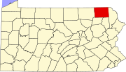 | |
| Townships |
| |
| Unincorporated communities | ||
| ||
| International | |
|---|---|
| National | |