
Moore, Oklahoma
Moore, Oklahoma | ||
|---|---|---|
 | ||
|
FIPS code 40-49200 | | |
| GNIS feature ID | 2411155[2] | |
| Website | cityofmoore.com | |
Moore is a city in
Located between Oklahoma City and Norman, the city has been the site of several devastating tornadoes, with those occurring in 1999 and 2013 receiving international attention. The 3 costliest tornadoes in Oklahoma history all occurred in Moore.[5]
History
The Moore post office was established May 27, 1889, during the
The city's history notes that the community before the post office may have been called "Verbeck" by the railroad.[6] However, other histories indicate that Verbeck was actually the original name of the nearby telegraph station "Oklahoma" which became the basis for the founding of Oklahoma City.[8]
The community remained small until 1961, when it annexed 21.6 square miles (56 km2), becoming a full-fledged city in 1962, which in turn increased its population from 1,221 in 1960 to 18,761 in 1970 and 55,081 in 2010.[6] Moore's 1961 annexation kept it an independent city at a time when Oklahoma City through annexations increased its size from 25 square miles (65 km2) to 643 square miles (1,670 km2) surrounding Moore on three sides (north, east, west). Norman forms its southern border.[9]
In 1966 the
The Moore post office turned into a branch of the Oklahoma City post office on January 7, 1972.[7]
In the 1970s the city launched a "Smile America" campaign in which giant red, white and blue smileys were painted on the town water towers. A smiley also adorns the city's official logo (as does a water tower).[10] Some of the water towers now have a sign that says, "Moore - Home of Toby Keith."[11][12]
On September 24, 2014, at the local Vaughan Foods food processing plant, one employee was beheaded with a knife and another coworker had her throat slit and was injured, but survived. The alleged attacker, 30-year-old Alton Nolen, who was on suspension from the plant prior to the attack due to interactions with the employee who survived the attack, was shot and wounded by company owner Mark Vaughan.[13][14] Nolen was convicted of murder and assault in October 2017. A jury recommended that he receive the death penalty,[15] and, on December 15, 2017, a judge sentenced Nolen to death by lethal injection.[16]
Geography
Moore is located just south of Oklahoma City and north of Norman, in central Oklahoma. According to the United States Census Bureau, the city has a total area of 22.2 square miles (57.4 km2), of which 21.8 square miles (56.5 km2) is land and 0.35 square miles (0.9 km2), or 1.52%, is water.[17]
The city lies in the Sandstone Hills region of Oklahoma, known for hills,
Climate
Moore has a
Tornado history
The Oklahoma City metropolitan area (of which Moore is a part) is located in Tornado Alley and is subject to frequent and severe tornadoes and hailstorms, making it one of the most tornado-prone major metropolitan areas in the world.
Moore itself has seen nine tornadoes between 1998 and 2015, three of them big enough to claim lives and cause catastrophic damage.[19] The city of Moore was damaged by significant tornadoes on October 4, 1998; May 3, 1999; May 8, 2003; May 10, 2010; and May 20, 2013, with weaker tornadoes striking at other times, notably May 31, 2013 and March 25, 2015. Moore is located in Tornado Alley, a colloquial term for the area of the United States where tornadoes are most frequent. About 20 tornadoes occurred in the immediate vicinity of Moore from 1890 to 2013.[20] The most significant tornadoes to hit Moore occurred in 1893, 1999, and 2013.
1999 tornado
During
2013 tornado


On May 20, 2013, parts of Moore and neighboring Newcastle and southern Oklahoma City, were affected by a violent tornado.[23] Classified as EF5 on the Enhanced Fujita scale, it had estimated wind speeds of 200–210 mph (320–340 km/h), a maximum width of 1.3 miles (2 km), and a path length of 17 miles (30 km).[24][25] Entire subdivisions were destroyed; the tornado struck Briarwood and Plaza Towers elementary schools in Moore while school was in session. The Oklahoma Medical Examiner's office reported that 24 people were killed, including 10 children. Over 140 patients, including at least 70 children, were treated at hospitals following the tornado.[26] It was the deadliest U.S. tornado since the Joplin, Missouri tornado that killed 158 people in 2011.[27]
Demographics
| Census | Pop. | Note | %± |
|---|---|---|---|
| 1900 | 129 | — | |
| 1910 | 225 | 74.4% | |
| 1920 | 254 | 12.9% | |
| 1930 | 538 | 111.8% | |
| 1940 | 499 | −7.2% | |
| 1950 | 942 | 88.8% | |
| 1960 | 1,221 | 29.6% | |
| 1970 | 19,761 | 1,518.4% | |
| 1980 | 35,063 | 77.4% | |
| 1990 | 40,318 | 15.0% | |
| 2000 | 41,138 | 2.0% | |
| 2010 | 55,081 | 33.9% | |
| 2020 | 62,793 | 14.0% | |
| U.S. Decennial Census[28] | |||
As of the
There were 14,848 households, out of which 41.8% had children under the age of 18 living with them, 60.4% were married couples living together, 13.3% had a female householder with no husband present, and 22.1% were non-families. 18.2% of all households were made up of individuals, and 5.1% had someone living alone who was 65 years of age or older. The average household size was 2.75 and the average family size was 3.13.
The city population age spread was 29.4% under 18, 9.3% from 18 to 24, .5% from 25 to 44, 21.5% from 45 to 64, and 7.2% who were 65 or older. The median age was 32 years. For every 100 females, there were 93.7 males. For every 100 females age 18 and over, there were 90.6 males.
The median income for a household in the city was $43,409, and the median income for a family was $47,773. Males had a median income of $33,394 versus $24,753 for females. The
Education
Higher education
The only
Primary and secondary schools
Moore Public Schools has three high schools: Moore, Southmoore, and Westmoore; six junior high schools: Brink, Central, Highland East, Highland West, Moore West, and Southridge; and 25 elementary schools: Apple Creek, Briarwood, Broadmoore, Bryant, Central, Earlywine, Eastlake, Fairview, Fisher, Heritage Trails, Houchin, Kelley, Kingsgate, Northmoor, Oakridge, Plaza Towers, Red Oak, Santa Fe, Sky Ranch, Sooner, South Lake, Southgate-Rippetoe, Timber Creek, Wayland Anders Bonds and Winding Creek.
On May 20, 2013, while classes were in progress, several of Moore's schools were damaged or destroyed by the 2013 Moore Tornado, most notably Plaza Towers Elementary, Briarwood Elementary and Highland East Junior High. However, these schools were rebuilt and reopened for the 2014–15 school year.
Libraries
Moore is served by the Moore Public Library, which is part of the Pioneer Library System.[30]
Media
Three media outlets focus on the Moore community. 19th Street Magazine publishes a free issue every month focusing on high school sports, community events and local businesses. Moore Monthly publishes a free monthly print publication while its website provides daily stories and videos about Moore, Norman and south Oklahoma City. The other media outlet is the Moore American.
Moore Veterans Memorial
The City of Moore has funded the construction of a memorial to honor America's veterans and their families. The city renamed JD Estates Park to Veterans Memorial Park, and a memorial was constructed at the park entrance.
The main feature of the memorial is a 15-foot (4.6 m) black granite
A committee was formed to plan the second phase of the Moore Veterans Memorial. A campaign to sell bricks to be placed in the memorial was completed in early 2009. Over 190 bricks were purchased by supporters from the community and surrounding areas. The bricks were placed in the Memorial Wall and Phase II was completed in May 2009.
The Soldiers' Memorial was dedicated on May 15, 2010. It consists of four carved wooden soldiers representing the four major wars since the end of World War I. They include World War II, Korea, Vietnam, and the Afghanistan/Iraq War.[31]
After being destroyed by the May 2013 tornado, the park won the title of "America's Favorite Park"[citation needed] in an online competition sponsored by Coca-Cola, beating out numerous other parks from around the country. First prize was a $100,000 grant, which was combined with other funds to cover the estimated $200,000 in rebuilding expenses. The first steps toward rebuilding began in November 2013, during a groundbreaking ceremony and the awarding of the grant to Mayor Glenn Lewis.[32] The park's playgrounds are now open to the public.
Notable people
- Kellie Coffey, country music artist
- Tom Cole, U.S. congressman
- Danny Cooksey, actor, singer, voice artist, comedian
- Michael Hinckley, former Major League Baseball pitcher for the Washington Nationals
- Jimmy Houston, professional fisherman and television host
- Jesse Jane, pornographic actress, graduated from high school in Moore
- Toby Keith, country music singer-songwriter, record producer, actor
- Randy Wayne, American actor, born and raised in Moore
References
- ^ "ArcGIS REST Services Directory". United States Census Bureau. Retrieved September 20, 2022.
- ^ a b c U.S. Geological Survey Geographic Names Information System: Moore, Oklahoma
- ^ United States Postal Service (2012). "USPS - Look Up a ZIP Code". Retrieved February 15, 2012.
- ^ "QuickFacts: Moore city, Oklahoma". U.S. Census Bureau, QuickFacts. Retrieved March 14, 2022.
- ^ Top Ten Costliest Oklahoma Tornadoes (1950-Present), National Weather Service Norman, Oklahoma
- ^ a b c "A Brief History of Moore". City of Moore. Archived from the original on June 7, 2013. Retrieved May 23, 2013.
- ^ ISBN 9780806120287. Retrieved May 23, 2013.
- ^ Kelley, E. H. "WHEN OKLAHOMA CITY WAS SEYMOUR AND VERBECK Archived 2013-10-04 at the Wayback Machine," Chronicles of Oklahoma. (accessed October 2, 2013)
- ^ "Explosive Growth".
- ^ "triptrivia.com". www.triptrivia.com. Archived from the original on April 8, 2018. Retrieved April 7, 2018.
- ^ "Toby Keith Expresses Sorrow Over Hometown Tornado Devastation". yahoo.com. May 21, 2013. Retrieved April 7, 2018.
- ^ "Page 3: Why Your City Sucks: Moore". thelostogle.com. March 25, 2010. Retrieved April 7, 2018.
- ^ "Oklahoma Woman Beheaded By Fired Coworker: Cops". Huffington Post. September 26, 2014.
- ^ "Quick Links". CNN.
- ^ "Jury recommends death penalty for Alton Nolen murder conviction". KOCO 5 News. October 12, 2017.
- ^ "Oklahoma man sentenced to death for beheading his co-worker". Fox News. December 15, 2017.
- ^ "Geographic Identifiers: 2010 Demographic Profile Data (G001): Moore city, Oklahoma". U.S. Census Bureau, American Factfinder. Archived from the original on February 20, 2015. Retrieved February 20, 2015.
- ^ Oklahoma Geography, NetState.com. (accessed October 1, 2013)
- ^ Jason Sickles (March 26, 2015). "Is Moore, Okla., the 'tornado alley of tornado alley'? - Yahoo News". News.yahoo.com. Retrieved March 28, 2015.
- ^ "Moore, Oklahoma Tornadoes (1890-Present)". noaa.gov. Retrieved April 7, 2018.
- .
- .
- ^ "Deadly tornado strikes near Oklahoma City". www.aljazeera.com. Retrieved April 7, 2018.
- ^ "NWSChat". NOAA. Retrieved May 21, 2013.
- ^ "Mile-wide tornado touches down near Oklahoma City, causing damage for second day in a row". Fox News. May 20, 2013.
- ^ "Hospitals treat more than 140 after Oklahoma tornado, including 70 children". New Haven Register. Associated Press. Retrieved May 21, 2013.
- ^ Gillam, Carey; Simpson, Ian (May 21, 2013). "Whole neighborhoods razed by Oklahoma tornado that killed 24". Reuters. Retrieved May 22, 2013.
- ^ "U.S. Decennial Census". Census.gov. Retrieved May 25, 2017.
- ^ "U.S. Census website". United States Census Bureau. Retrieved January 31, 2008.
- ^ Pioneer Library System Archived 2013-05-01 at the Wayback Machine (accessed May 24, 2013)
- ^ [1] Archived August 3, 2011, at the Wayback Machine
- ^ "Breaking Ground and Reopening Happiness in Moore, Okla". coca-colacompany.com. Retrieved April 7, 2018.
External links
- City website
- Moore Public Library
 Moore travel guide from Wikivoyage
- 2011 City map
- 2013 Oklahoma City Metro Map from Oklahoma Department Of Transportation
Municipalities and communities of Cleveland County, Oklahoma, United States | ||
|---|---|---|
| Cities | 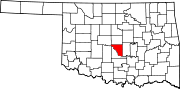 | |
| Towns | ||
Neighborhood | ||
| Footnotes | ‡This populated place also has portions in an adjacent county or counties | |
| ||
| International | |
|---|---|
| National | |
| Geographic | |