
Morton County, Kansas
Morton County | |
|---|---|
UTC−5 (CDT) | |
| Area code | 620 |
| Congressional district | 1st |
| Website | mtcoks.com |
Morton County is a
History
Early history
For many
19th century
In 1802, Spain returned most of the land to France, but keeping title to about 7,500 square miles. In 1803, most of the land for modern day Kansas was acquired by the United States from France as part of the 828,000 square mile Louisiana Purchase for 2.83 cents per acre.
In 1848, after the Mexican–American War, the territorial gain in the Treaty of Guadalupe Hidalgo with Mexico brought into the United States all or part of land for ten future states, including southwest Kansas.
From 1821 to late 1860s, the Santa Fe Trail was active across Morton County.
In 1854, the
20th century

.svg)
In the 1930s, the prosperity of the area was severely affected by its location within the Dust Bowl. This catastrophe intensified the economic impact of the Great Depression in the region. Morton County was the most devastated county in the Dust Bowl and lost almost one-half of its population in the 1930s. The U.S. government purchased some of the impacted and abandoned land and eventually incorporated it into the Comanche National Grassland.[5]
In 1961, the county seat was moved from Richfield to Elkhart.[4]
Geography
According to the
Major highways
 Kansas Highway 27
 Kansas Highway 51
- U.S. Highway 56
Adjacent counties
- Stanton County (north)
- Stevens County (east)
- Texas County, Oklahoma (south)
- Cimarron County, Oklahoma (southwest)
- Baca County, Colorado (west/Mountain Time border)
National protected area
- Cimarron National Grassland (part)
Demographics

| Census | Pop. | Note | %± |
|---|---|---|---|
| 1890 | 724 | — | |
| 1900 | 304 | −58.0% | |
| 1910 | 1,333 | 338.5% | |
| 1920 | 3,177 | 138.3% | |
| 1930 | 4,092 | 28.8% | |
| 1940 | 2,186 | −46.6% | |
| 1950 | 2,610 | 19.4% | |
| 1960 | 3,354 | 28.5% | |
| 1970 | 3,576 | 6.6% | |
| 1980 | 3,454 | −3.4% | |
| 1990 | 3,480 | 0.8% | |
| 2000 | 3,496 | 0.5% | |
| 2010 | 3,233 | −7.5% | |
| 2020 | 2,701 | −16.5% | |
| 2023 (est.) | 2,580 | [7] | −4.5% |
| U.S. Decennial Census[8] 1790-1960[9] 1900-1990[10] 1990-2000[11] 2010-2020[1] | |||
As of the
There were 1,306 households, out of which 36.60% had children under the age of 18 living with them, 64.20% were married couples living together, 6.80% had a female householder with no husband present, and 26.40% were non-families. 24.30% of all households were made up of individuals, and 9.20% had someone living alone who was 65 years of age or older. The average household size was 2.63 and the average family size was 3.15.
In the county, the population was spread out, with 29.30% under the age of 18, 8.00% from 18 to 24, 27.20% from 25 to 44, 21.50% from 45 to 64, and 13.90% who were 65 years of age or older. The median age was 36 years. For every 100 females there were 94.40 males. For every 100 females age 18 and over, there were 93.70 males.
The median income for a household in the county was $37,232, and the median income for a family was $43,494. Males had a median income of $31,875 versus $19,474 for females. The
Government
Morton County is usually won by the Republican candidate for president. Jimmy Carter almost carried the county in 1976, but Gerald Ford eventually won by .2%. The last time a Democrat won Morton County was Lyndon B. Johnson in 1964.
Presidential elections
| Year | Republican | Democratic | Third party | |||
|---|---|---|---|---|---|---|
| No. | % | No. | % | No. | % | |
| 2020 | 1,034 | 86.31% | 150 | 12.52% | 14 | 1.17% |
| 2016 | 995 | 82.92% | 147 | 12.25% | 58 | 4.83% |
| 2012 | 1,072 | 83.88% | 189 | 14.79% | 17 | 1.33% |
| 2008 | 1,153 | 82.24% | 229 | 16.33% | 20 | 1.43% |
| 2004 | 1,287 | 81.66% | 276 | 17.51% | 13 | 0.82% |
| 2000 | 1,203 | 77.26% | 321 | 20.62% | 33 | 2.12% |
| 1996 | 1,073 | 67.87% | 376 | 23.78% | 132 | 8.35% |
| 1992 | 915 | 54.79% | 398 | 23.83% | 357 | 21.38% |
| 1988 | 1,074 | 64.35% | 569 | 34.09% | 26 | 1.56% |
| 1984 | 1,533 | 81.80% | 322 | 17.18% | 19 | 1.01% |
| 1980 | 1,157 | 69.61% | 414 | 24.91% | 91 | 5.48% |
| 1976 | 738 | 48.91% | 735 | 48.71% | 36 | 2.39% |
| 1972 | 1,165 | 72.68% | 363 | 22.65% | 75 | 4.68% |
| 1968 | 770 | 51.03% | 475 | 31.48% | 264 | 17.50% |
| 1964 | 609 | 39.01% | 938 | 60.09% | 14 | 0.90% |
| 1960 | 918 | 60.67% | 586 | 38.73% | 9 | 0.59% |
| 1956 | 814 | 64.76% | 436 | 34.69% | 7 | 0.56% |
| 1952 | 893 | 69.93% | 362 | 28.35% | 22 | 1.72% |
| 1948 | 624 | 52.61% | 545 | 45.95% | 17 | 1.43% |
| 1944 | 617 | 62.51% | 367 | 37.18% | 3 | 0.30% |
| 1940 | 643 | 55.72% | 503 | 43.59% | 8 | 0.69% |
| 1936 | 636 | 41.81% | 876 | 57.59% | 9 | 0.59% |
| 1932 | 621 | 34.63% | 1,093 | 60.96% | 79 | 4.41% |
| 1928 | 1,010 | 78.78% | 259 | 20.20% | 13 | 1.01% |
| 1924 | 669 | 55.02% | 286 | 23.52% | 261 | 21.46% |
| 1920 | 783 | 72.97% | 266 | 24.79% | 24 | 2.24% |
| 1916 | 405 | 42.41% | 457 | 47.85% | 93 | 9.74% |
| 1912 | 120 | 33.99% | 144 | 40.79% | 89 | 25.21% |
| 1908 | 154 | 50.49% | 140 | 45.90% | 11 | 3.61% |
| 1904 | 53 | 54.08% | 44 | 44.90% | 1 | 1.02% |
| 1900 | 51 | 60.00% | 34 | 40.00% | 0 | 0.00% |
| 1896 | 52 | 58.43% | 36 | 40.45% | 1 | 1.12% |
| 1892 | 106 | 57.61% | 0 | 0.00% | 78 | 42.39% |
| 1888 | 333 | 58.01% | 205 | 35.71% | 36 | 6.27% |
Laws
The
Education
Unified school districts
Communities

List of townships / incorporated cities / unincorporated communities / extinct former communities within Morton County.[15]
Cities
Unincorporated community
Townships
Morton County is divided into six townships. None of the cities within the county are considered governmentally independent, and all figures for the townships include those of the cities. In the following table, the population center is the largest city (or cities) included in that township's population total, if it is of a significant size.
| Township | FIPS |
Population center |
Population | Population density /km2 (/sq mi) |
Land area km2 (sq mi) |
Water area km2 (sq mi) |
Water % | Geographic coordinates |
|---|---|---|---|---|---|---|---|---|
| Cimarron | 13350 | 67 | 0 (1) | 173 (67) | 0 (0) | 0% | 37°4′11″N 101°46′45″W / 37.06972°N 101.77917°W | |
| Jones | 35650 | 17 | 0 (0) | 140 (54) | 0 (0) | 0% | 37°1′4″N 101°56′56″W / 37.01778°N 101.94889°W | |
| Richfield | 59225 | 218 | 0 (1) | 649 (251) | 0 (0) | 0% | 37°14′37″N 101°42′36″W / 37.24361°N 101.71000°W | |
| Rolla | 60925 | Rolla | 650 | 2 (5) | 373 (144) | 0 (0) | 0% | 37°6′46″N 101°37′42″W / 37.11278°N 101.62833°W |
| Taloga | 69975 | Elkhart | 2,437 | 17 (44) | 142 (55) | 0 (0) | 0% | 37°0′22″N 101°53′42″W / 37.00611°N 101.89500°W |
| Westola | 77225 | 107 | 0 (1) | 412 (159) | 0 (0) | 0.01% | 37°14′19″N 101°58′40″W / 37.23861°N 101.97778°W |
See also
- Dry counties
- Cimarron National Grassland
- Community information for Kansas
- Kansas locations by per capita income
- List of counties in Kansas
- List of townships in Kansas
- List of cities in Kansas
- List of unincorporated communities in Kansas
- List of ghost towns in Kansas
References
- ^ a b c "QuickFacts; Morton County, Kansas; Population, Census, 2020 & 2010". United States Census Bureau. Archived from the original on August 18, 2021. Retrieved August 17, 2021.
- ^ "Find a County". National Association of Counties. Retrieved June 7, 2011.
- ^ "Kansas Newspapers History by County". Archived from the original on November 21, 2008. Retrieved April 17, 2010.
- ^ a b Morton County Facts; mtcoks.com
- ^ "Cimarron National Grassland". Natural Kansas. Retrieved July 15, 2023.
- ^ "US Gazetteer files: 2010, 2000, and 1990". United States Census Bureau. February 12, 2011. Retrieved April 23, 2011.
- ^ "Annual Estimates of the Resident Population for Counties: April 1, 2020 to July 1, 2023". United States Census Bureau. Retrieved April 3, 2024.
- ^ "U.S. Decennial Census". United States Census Bureau. Retrieved July 27, 2014.
- ^ "Historical Census Browser". University of Virginia Library. Retrieved July 27, 2014.
- ^ "Population of Counties by Decennial Census: 1900 to 1990". United States Census Bureau. Retrieved July 27, 2014.
- ^ "Census 2000 PHC-T-4. Ranking Tables for Counties: 1990 and 2000" (PDF). United States Census Bureau. Archived (PDF) from the original on March 27, 2010. Retrieved July 27, 2014.
- ^ "U.S. Census website". United States Census Bureau. Retrieved January 31, 2008.
- ^ "Dave Leip's Atlas of U.S. Presidential Elections".
- ^ "Map of Wet and Dry Counties" (PDF). Kansas Department of Revenue Alcoholic Beverage Control. December 30, 2019. Archived (PDF) from the original on November 4, 2020. Retrieved November 4, 2020.
- ^ a b "General Highway Map of Morton County, Kansas" (PDF). Kansas Department of Transportation (KDOT). June 2009. Archived (PDF) from the original on December 30, 2023.
Further reading
External links
- County
- Maps
- Morton County Maps: Current, Historic, KDOT
- Kansas Highway Maps: Current, Historic, KDOT
- Kansas Railroad Maps: Current, 1996, 1915, KDOT and Kansas Historical Society
Places adjacent to Morton County, Kansas | ||||||||||||||||
|---|---|---|---|---|---|---|---|---|---|---|---|---|---|---|---|---|
| ||||||||||||||||
Municipalities and communities of Morton County, Kansas, United States | ||
|---|---|---|
| Cities | 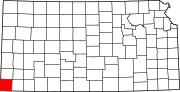 | |
| Unincorporated communities | ||
| Townships |
| |
| ||
| International | |
|---|---|
| National | |