
Murshidabad
This article needs additional citations for verification. (November 2013) |
Murshidabad | |
|---|---|
City | |
Murshidabad | |
| Website | murshidabad |
Murshidabad (
During the 18th century, Murshidabad was a prosperous city.
European companies, including the
The city's decline began with the defeat of the last independent Nawab of Bengal
Etymology
Murshidabad was named after its founder, Nawab
Geography


1mile
Gate
railway bridge
railway station
F: facility, H: historical site
Owing to space constraints in the small map, the actual locations in a larger map may vary slightly
Location
Murshidabad is located at 24°11′N 88°16′E / 24.18°N 88.27°E.
Hazarduari Palace and its associated sites in the Kila Nizamat area (forming the central area in the map alongside) is the centre of attraction in Murshidabad. Just a little away are Katra Masjid, Fauti Mosque, Jama Masjid and the Motijhil area. There is a group of attractions in the northern part of the town (as can be seen in the map alongside). Some attractions such as Khushbagh, Rosnaiganj, Baranagar, Kiriteswari Temple, Karnasuvarna and others are on the other side of the river and there are attractions in the neighbouring Berhampore area also (not shown in the map).[7]
Note: The map alongside presents some of the notable locations in Murshidabad city. Most of the places marked in the map are linked in the larger full screen map. A few, without pages yet, remain unmarked. The map has a scale. It will help viewers to find out the distances.
History


.jpg)
The area was part of the
During the 17th-century, the area was well known for sericulture. In 1621, English agents reported that large quantities of silk were available in the area. During the 1660s, it became a pargana of the Mughal administration, with jurisdiction over European companies in Cossimbazar.[9]
In the early 18th-century,
Murshid Quli Khan shifted the capital of Bengal from
The presence of the princely court, the
Murshid Quli Khan transformed Murshidabad into a capital city with an efficient administrative machinery for his successors. He built a palace and a caravanserai with a grand mosque, known as the Katra Masjid. The main military base was located near the mosque and formed the city's eastern gateway. The third Nawab Shuja-ud-Din Muhammad Khan patronized the construction of another palace and military base, a new gateway, the revenue office, a public audience hall (durbar), a private chamber, the treasury and a mosque in an extensive compound called Farrabagh (Garden of Joy) which included canals, fountains, flowers, and fruit trees.[9]
Nawab Siraj-ud-Daulah established a palace near the
The Nawabs of Bengal entered into agreements with numerous European trading companies allowing them to establish bases in the region. The French East India Company operated factories in Murshidabad and Dhaka. The British East India Company was based in Fort William. Murshidabad was a part of the Dutch Bengal Department. The Ostend Company of Austria established a base near Murshidabad. The Danish East India Company also set up trading posts in the Bengal Subah.
The last independent Nawab Siraj-ud-Daulah was overthrown in 1757. Despite receiving assurances of French support, the Nawab was betrayed by his commander Mir Jafar. The British installed Mir Jafar's family as a puppet dynasty and eventually reduced the Nawab to the status of a landlord (zamindar). The British continued to collect revenue from the area's factories. The merchant families continued to prosper under company rule in India.[10] In 1858, the British government gained direct control of India's administration.
Murshidabad was very badly affected by the Bengal Famine of 1770.[5]
Murshidabad was a district city of the
See also -
- Art of Murshidabad
-
 Two horsemen, Murshidabad style of painting
 -
 Woman playing the sitar, Murshidabad style of painting
 -
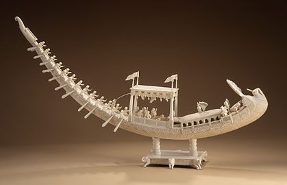 Ivory sculpture of a royal barge
 -
 Ivory sculpture of a royal barge
 -
 An elevated musicians' gallery where drums, flutes and Indian classical music would be played.


Economy

The city today is a center for agriculture, handicrafts and sericulture. The famous Murshidabad silk, much in demand for making saris and scarves, is produced here.[citation needed]
Demographics
As of
Educational institutes
Schools
Colleges
- Subhas Chandra Bose Centenary College
- Dumkal Institute of Engineering & Technology
- Government College of Engineering & Textile Technology, Berhampore
- Jakir Hossain Institute of Polytechnic, Hafania, Suti II
- Kandi Raj College
- Krishnath College
- Management Development Institute Murshidabad
- Murshidabad College of Engineering & Technology
- Murshidabad Institute of Technology
- Sripat Singh College
- Berhampore College
- Rani Dhanya Kumari College
- Berhampore Girls' College
- Bimal Chandra College of Law
- Murshidabad University
- Jangipur College
- Dukhulal Nibaran Chandra College
- Prof. Syed Nurul Hasan College
- Nur Mohammad Smriti Mahavidyalaya
Medical schools
Universities
Murshidabad Heritage Festival

The Murshidabad Heritage Festival aims at reviving the tangible and intangible heritage of Murshidabad along with those nearby heritage tows of Azimganj, Jiaganj and Cossimbazar. The festival aims at preserving the past and integrating it with the present and to bring Murshidabad back in the tourism, cultural and heritage map of India. It is an initiative of Murshidabad Heritage Development Society (MHDS). The festival began in 2011 and has been celebrated ever since. There are no fixed days for the festival but it is celebrated during the winter season, especially during January or February. The festival is complete with cultural performances, heritage walks, cruise along the Bagirati River and exotic food. The Food served during the festival is purely vegetarian, with special emphasis on Sheherwali cuisine.[12]
Notable residents
- Abdul Alim
- Abul Barkat
- Abul Hayat
- Abul Bashar
- Abul Hasan Quraishi
- Amiya Kumar Bagchi
- Arijit Singh
- Arup Chandra
- Atiul islam
- Babar Ali
- Basu Bhattacharya
- Farida Yasmin
- Govindadasa
- Iskander Mirza
- Karuna Bhattacharya
- Mahasweta Devi
- Manish Ghatak
- Mir Afsar Ali
- Murshid Kuli Khan
- Nabarun Bhattacharya
- Nirupama Devi
- Rakhaldas Bandyopadhyay
- Ramendra Sundar Tribedi
- Sarat Chandra Pandit
- Shreya Ghoshal
- Siraj ud-Daulah
- Syed Mustafa Siraj
- Nalini Bagchi
- Tapan Sinha
Notes
- ^ Earlier European spellings include Muxadavad, Murshedabud, Murshedabad, Murshedebad, Murshidabud, Murshidabad, Murshidebad, Mursedabad, Mursidabud, Mursidabad, Moorshedabud, Moorshedabad, Moorshedebad, Moorshidabad, Moorsedabad, Moorsidabad, Mourshedabad, Mourshedebad, Mourshidabad, Murschidabad, Murschedabad, Moorschedabad, and Moorschidabad, among others.[citation needed]
References
- ^ "Welcome to Murshidabad Municipality". Retrieved 25 November 2020.
- ^ a b "Census of India: Murshidabad". www.censusindia.gov.in. Retrieved 20 November 2019.
- ^ a b "Fact and Figures". Wb.gov.in. Retrieved 23 May 2019.
- ^ "52nd Report of the Commissioner for Linguistic Minorities in India" (PDF). Nclm.nic.in. Ministry of Minority Affairs. p. 85. Archived from the original (PDF) on 25 May 2017. Retrieved 23 May 2019.
- ^ ISBN 978-1-63557-395-4.
- ^ "Which India is claiming to have been colonised?". 31 July 2015.
- ^ "Offbeat Weekend in Murshidabad". Outskirts of Killa Nizamat (Northern part). Offbeat Weekend. Retrieved 20 July 2021.
- ^ "Company school | Indian art | Britannica". www.britannica.com. Retrieved 29 August 2022.
- ^ a b c d e f g "Murshidabad - Banglapedia". Banglapedia. Retrieved 26 August 2019.
- ^ a b c Silliman, Jael (28 December 2017). "Murshidabad can teach the rest of India how to restore heritage and market the past". Scroll.in. Retrieved 26 August 2019.
- ^ "Mango people of murshidabad". The Telegraph. India. 18 June 2015. Retrieved 22 October 2018.
- ^ Datta, Rangan (15 February 2023). "Murshidabad Heritage Festival 2023: A journey back to the days of the nawabs in Bengal". No. My Kolkata. The Telegraph.
External links
 Murshidabad travel guide from Wikivoyage
- District website
| |||||||||||
|---|---|---|---|---|---|---|---|---|---|---|---|
| Cities, municipal and census towns |  | ||||||||||
| Locations other than cities and towns |
| ||||||||||
| Neighbourhoods | |||||||||||
| Related topics | |||||||||||
Tourist attractions in Murshidabad | |
|---|---|
| Houses and Palaces |
|
| Kathgola |
|
| Graves, mosques and tombs | |
| Cannons | |
| Temples |
|
| Archaeological sites |
|
| Others |
|
| International | |
|---|---|
| National | |