Lhasa and Shigatse to the south, Ngari Prefecture to the west. As of the 2010 census, it had a population of 462,381.[1] Since its official establishment in 2018, it is the largest prefecture-level city by area in the world,[2] being slightly larger than Sweden and slightly less than twice the size of Victoria
.
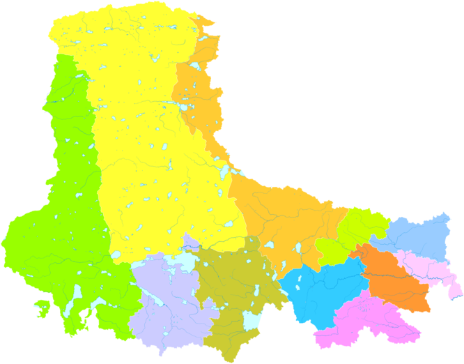
Nagqu contains 89 townships, 25 towns, and 1,283 villages. The
Amdo, Nyainrong and Xainza are other towns of note. Extremely rich in water resources, with 81% of Tibet's lakes, covering a total area of over 30,000 square kilometres (12,000 sq mi), it contains lakes such as Namtso, Siling Lake and rivers such as Dangqu
.
Every August (the sixth month in the Tibetan calendar), Nagqu hosts the Kyagqen Horse Race, a major event locally attracting tens of thousands of herdsmen to participate in horseracing and archery contests.
Etymology
Nagqu was once known as "Heihe" (Chinese: 黑河) which comes from that the Tibetan word means black river. It was named after Nagqu River which is the upper master stream of the Nu River running through the territory. In the Ming and Qing Dynasties, it was known as "Hala Wusu" (transliteration of the "Black River" in Mongolian). In modern times, Nagqu (the area around Nagqu Town) is called "Wu'erguxiong" (吾尔古雄) or "Seruxiangba" (色如襄巴).[1]
History
Nagqu appeared clearly in the earliest historical materials, it was part of the ancient Zhangzhung and it was called Yangtong (羊同) in Chinese historical records. In Tibetan historical records, the place was called "Zhuodai" (卓岱), meaning "nomadic tribe", and the inhabitants here were called "Zhuoba" (卓巴), meaning "nomads"; or "Qiangba" (羌巴), meaning "northerner"; or "Changri", it means the northern tribe. In the era of the ascendancy of Zhangzhung, as its inhabitants divided their territory into the inner, outer and middle three parts. The modern Nagqu roughly is the territories of middle Zhangzhung and outer Zhangzhung. The dzong architecture of Dangnuoqiong was the center of middle Zhangzhung, it was located round the lake of Tangra Yumco in the southwest of Nagqu. As the Zhangzhung Regime was weakened, its territory shrank to the west.[citation needed]
The earliest mosque was built in the 14th century.
Standard Tibetan: ཧོར, Chinese: 霍尔) formed Mongolian forces in northern Tibet. In 1731, the Qing Government placed the territory of 39 Tribes under the direct jurisdiction of the Amban
.
In 1751, Kanxiang Dzong (坎襄宗) in Nagqu was formed to the direct rule of the
Standard Tibetan
: བྱང་ཆུབ་སྤྱི་ཁྱབ་, Chinese: 绛曲基巧) was formed.
In 1951, the seat of Changchub Chikyab Prefecture was Nagqu (Heihe) Town, the prefecture administered the pasture land to the northern
dzongs
in Heihe area, the Conference Hall of Panchen Chamber (班禅堪布会议厅) administered Damusajia Dzong (达木萨迦宗). The prefecture of Changchub Chikyab had jurisdiction over 14 dzongs in 1954.
The former Nagqu Prefecture was approved for prefecture-level city status on October 2, 2017, by the State Council,[4] and it was officially established on May 7, 2018.[5]
Nagqu is extremely rich in water resources, with a total surface water resources of about 54 cubic kilometres (13 cu mi), groundwater resources of about 25.1 cubic kilometres (6.0 cu mi) and a further 8.8 cubic kilometres (2.1 cu mi) in glacial ice storage. The region contains 81% of Tibet's lakes, covering a total area of over 30,000 square kilometres (12,000 sq mi). There are 11 lakes with an area of over 100 square kilometres (39 sq mi) and 121 lakes with an area of more than 5 square kilometres (1.9 sq mi). Notable lakes include
Purugangri Glacier is located about 560 kilometres (350 mi) from Nagqu town within Qiangtang Nature Reserve, at 6,000 to 6,800 metres above sea level. Covering an area of 423 square kilometres (163 sq mi), it has been confirmed to be the world's third largest.[10]
Nagqu is a natural disaster-prone region, being affected by
cool semi-arid climate (BSk), with comfortable, humid summers and long, frigid, dry, windy winters. The differences between day and night are severe. It is not uncommon to have nights with temperatures below freezing after days with temperatures of 25 °C (77 °F) or days with temperatures above freezing in winter after night temperatures of −25 °C (−13 °F). Annual sunshine totals more than 2,886 hours. Nagqu town had an average annual rainfall of 477.1 mm (18.78 in) between 1956 and 2010.[8] The southeastern part of the prefecture is wetter, with annual precipitation exceeding 580 mm (23 in). while the northwestern part is driest with an average annual precipitation below 440 mm (17 in).[citation needed] The effects of global warming increasingly pose a problem in the region, with record highs in 2019.[9][11]
The Naqu City People's Government administrative headquarters is located at No. 3, Zhejiang West Road in the main town. It has 89 townships, 25 towns, and 1283 villages under its jurisdiction.[citation needed]
By 2009, 55 different minerals had been discovered in the region, with the largest mineral reserves being
rock salt and gypsum. There are significant reserves of oil, natural gas, oil shale and others, though Nagqu had long been severely backwards in energy production and usage to the point that at one stage only Nagqu Town had a 2 MW diesel power plant.[citation needed] Geothermal energy production began investigation in 1984.[15] Nagqu geothermal field lies 2.5 kilometres (1.6 mi) away from Nagqu Town, and covers an area of 4.5 kilometres (2.8 mi).[16]Jiagang Hydropower Station in Xainza County was built in the 1990s and as of 2008 serves about 20,000 nomadic households across the county.[17][18] In June 2019, Jinqiao Hydropower Station, the first hydropower station to be built with a rock-fill concrete gravity dam in Tibet, was inaugurated in Lhari County, serving some 30,000 local farmers and herdsmen in an area previously without electricity. The station and dam reportedly cost 1.4 billion yuan (about 202.7 million U.S. dollars) and has an annual power generation capacity of 357 million kilowatt-hours.[19]
With Nagqu being one of China's five biggest pastures, and possibly the highest in the world at 4,500 metres (14,800 ft) above sea level,[20] most counties rely on animal husbandry, and few counties are semi-agricultural and semi-animal husbandry areas.[8] As of 2017, the regional GDP in Nagqu was 11,982 million yuan (1,775 million US dollars), completed fixed assets investment 18,549 million yuan (2,747 million US dollars), urban and rural residents per capita disposable income reached 31,252 yuan (4,629 US dollars), 9,792 yuan (1,450 US dollars), total retail sales of social consumer goods 2,127 million yuan (315 million US dollars), tax revenue exceeded 1,000 million yuan (148 million US dollars).[21] Agriculture and animal husbandry accounted for 1.923 billion yuan. By 2015, the manufacturing industry was expected to be valued at 1.852 billion yuan, an increase of 23.4%. Production of medicines and Tibetan carpets have significantly increased in recent times. As of 2015 there were 5 scientific research institutions and 11 agricultural and animal husbandry science and technology-related institutions, employing 5,856 professional and technical personnel.[citation needed]
Culture
Nagqu contains a number of Tibetan Buddhist monasteries.
Every August (June in the Tibetan calendar), Nagqu hosts the Kyagqen Horse Race, a major event locally,[25] attracting tens of thousands of herdsmen who arrive in Nagqu on their horses and with goods. They set up camp in tents in the southern part of the main town and participate in horse racing, horsemanship and archery contests on August 10.[26] Hats, mostly made from lamb skins and artificial leather and an "antenna-like stripe of fabric at the top" are worn by women during the festival.[27]
In Baingoin County, the Qiduo Cave Paintings are significant, with one cave containing over 200 images of animals, characters and symbols.[28]
Wildlife
Nagqu contains a high biodiversity of wildlife. There are
ducks, swans, black-necked cranes, and red-crowned cranes. As of 2018 seven wildlife sanctuaries have been established in Nagqu.[citation needed] The 400,000 hectare Siling Co National Nature Reserve (also Selincuo Reserve or Xainza Nature Reserve) around Siling Lake was established in 1993 and contains significant populations of black-necked cranes and some 120 species of birds in total.[29][30] The Yalong Scenic Area, covering an area of 1,580 square kilometres (610 sq mi) was established in 1988 and is located in the middle reaches of the Yarlung Zangbo River in the vicinity of Zedang Town.[citation needed
]
Cordyceps sinensis is also valued for its effect on the lungs and kidneys,[citation needed] and is eaten as a delicacy in soups in restaurants in countries such as Singapore.[31]Snow Lotus and Musk, known for its central nervous system stimulating effect, are also grown.[citation needed] Due to the region being too cold for trees to grow, the Chinese government are considering using solar power to introduce new forested areas to Nagqu, though it is not believed to be economically sustainable.[citation needed
In 2015, 129 transportation projects were constructed, with a projected investment of 6.29 billion yuan, though only 2.422 billion yuan was completed.[
Chinese Writers Association, he published poetry and several novels, one of which won the 1994 Tibetan Literature newcomer's award.[citation needed
]
Shabdrung Rinpoche, (1997- in Lhari County), Buddhist monk, recognized as the reincarnation of the 22nd Shabdrung Living Buddha. In 2011 he opened the Tibet College of Buddhism in Lhasa.[33]
^United States. Foreign Broadcast Information Service (1994). Daily report: People's Republic of China. Distributed by National Technical Information Service. p. 51.


.jpg)