
Nallamala Hills
| Nallamala Hills | |
|---|---|
| The Nallamalas | |
 The Nallamalas Hills | |
| Highest point | |
| Peak | Bhairani Konda (Sikhareswaram) |
| Elevation | 3,608 ft (1,100 m) |
| Coordinates | 15°40′41″N 78°47′10″E / 15.67806°N 78.78611°E |
| Dimensions | |
| Length | 90 mi (140 km) north-south |
| Geography | |
 Nallamala Hills | |
| Country | India |
| Provinces/States | Andhra Pradesh and Telangana |
| Geology | |
| Age of rock | Proterozoic |
The Nallamalas (also called the Nallamalla Range) are a section of the
Geology
The rocks of the Nallamala ranges belong to the Kadapa system which is a series some 20,000 ft. thick.[3] The primary rocks are quartzite overlaid with an irregular slaty formation. Some sandstone is also to be found. The rocks here are very irregular and soft in texture thus rendering commercial exploitation impossible. These rocks are among the oldest in the world and have been formed as a result of large scale volcanic activity hundreds of millions of years ago. The evidence of the volcanic forces are evident in the foldings into which the rocks have been forced.[2]
Climate
The Nallamalas have a rather warm to hot climate throughout the year. Rainfall averages about 90 cm and is concentrated in the months of the Southwest monsoon (June–September). The fissured rocks prevent any water from percolating underground and hence most of the discharge runs off as mountain streams to join the Gundlakamma River, the largest river to arise in these hills. Winters are mostly cool and dry with the average temperature around 25 degrees Celsius. Summers are very hot, with temperatures as high as 45 degrees Celsius.
Gallery
-
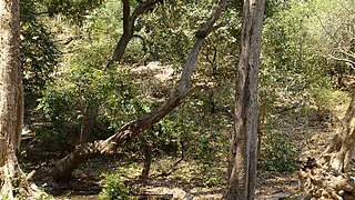 Nallamalla forests at Srisailam
 -
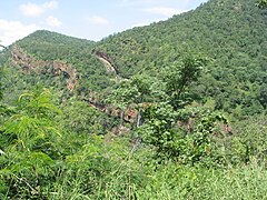
 The Nallamallas from a distance during the dry season
 -
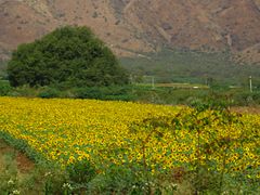 Sunflower cultivation at the foot of Cumbum at the Nallamalas
 -
 After noon in Nallamalla Forest
 -
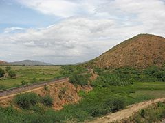 The railway curves into the Nallamalas at the Nandikamma Pass, Cumbum
 -
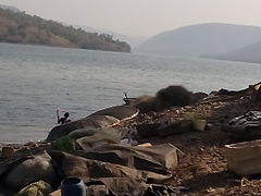
 A view of the Cumbum Lake
 -
 Nallamalla forests at Ahobilam
 -
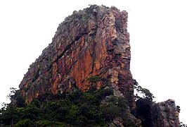 Ugra stambham rock at Ahobilam
 -
 Nallamalla hills on rainy day near Atmakur
 -
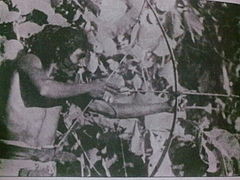 Chenchu tribal hunting picture from Nallamala Hills
 -
 Pre Historic Mid Krishna-Tungabhadra Valley sites
 -
 Morning in Nallamalla Forest
 -
 Tribals staying in Nallamalla Forest
 -
 view on Sun set time
 -
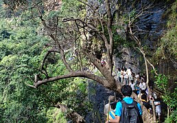 Trek to Ugra stambham at Ahobilam in Nallamala Forests
 -
 View From Boat Journey towards caves
 -
 Dirt road along Nallamala Forests near Ahobilam


Flora and fauna
These hills are almost completely covered with open jungle. Lack of water prevents the growth of large trees and the prevalent vegetation consists of
Population
The uneven terrain and the scarcity of water has prevented the growth of any large cities in this region.
Transport
A state highway and the Nallapadu-Nandyal line of the Guntur railway division pass through the hills. The railway was first built by the Madras and Southern Mahratta Railway and is a feat of engineering, having 2 tunnels at Bogada and Chelama and a few viaducts, the most famous being the now abandoned Dorabavi Viaduct. The railway enters the hills at the Nandikama Pass near Cumbum Lake. The highway follows a zig zag alignment and thus avoids any tunnels. The primary exports of this region are forest produce like timber waste, honey and molasses.
Places of interest
The Cumbum Lake is one of Asia's oldest man made lakes and dates back to the 15th century. It was built by the Gajapati kings of Orissa for irrigating about 420 km2 farmland by damming a narrow opening between two adjoining hills and later renovated by queen Vardarajamma of Vijayanagara kingdom in the 16th century.[5]
-
 Mahanandi Temple along the foothills of Nallamala
 -
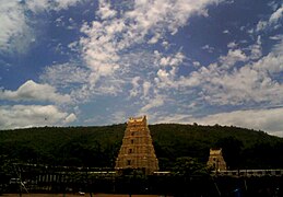
 Srisailam Entrance Gopuram
 -
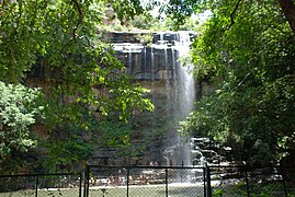 Mallelatheertham Waterfalls, Srisailam
 -
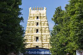
 Upper Ahobilam temple Gopuram


Notable incidents
On 2 September 2009, a Bell-430 chopper carrying the
See also
- Gundlakamma River
- Guntur railway division
- Nallamala Forest
- Prakasam District
References
- ^ Google Earth
- ^ a b "Imperial Gazetteer2 of India, Volume 18, page 346 -- Imperial Gazetteer of India -- Digital South Asia Library".
- ^ Kenneth Anderson: The Call of the Wild; The Black Panther of Sivanipalli
- ^ "Imperial Gazetteer2 of India, Volume 11, page 74 -- Imperial Gazetteer of India -- Digital South Asia Library".
- ^ "India News: Today's latest updates and breaking news from India, Live India News".
- ^ "Andhra Pradesh mourns death of YSR". ibnlive.in.com. Archived from the original on 5 September 2009. Retrieved 17 January 2022.
| Rivers |      | |
|---|---|---|
| Regions | ||
| Hills | ||
| Peaks | ||
| Waterfalls |
| |
| Parks & Reserves |
| |
States | ||
| International | |
|---|---|
| National | |