
Near Northeast (Washington, D.C.)
Near Northeast | |
|---|---|
Charles Allen | |
| Website | http://hstreet.org |
Near Northeast, also known as Néné, is a
History


Early history
It is believed that the general area was occupied as early in the Paleo-Indian period (10,000-8,000 B.C.) all the way to the Woodland period (1000 B.C. to the time of European Contact).[1] Several streams flowed throw the area feeding into Tiber Creek (also known as Goose Creek) making it an attractive area for settlements for Native tribes and hunting.[2][3][4]
Near Northeast started a patchwork of several different European landowners' claims. Most of the land belonged to Notley Young, under the name of Youngsboro[5] or Isherwood[2][3] or Mill Tract[3] by the 1790s. His property extended into what is today Trinidad. The other land owners were Daniel Carroll (who owned the hill on which the Capitol was built), George Walker and Abraham Young.[2]
The tract of land was included shortly thereafter in the original survey of land for the new national capital, and Young and a few other landowners gave the land to the Federal government in exchange for a promise that Congress would divide the land into lots and return half of those lots to the original landowners.
Once the capital was created, streets were laid out in the grid system that
19th century
In the 1830s, the
By the 1890s,
20th century
Near Northeast evolved into mixed neighborhood. It was a major center of black population in the first half of the 20th century as well as a significant neighborhood for immigrant populations from
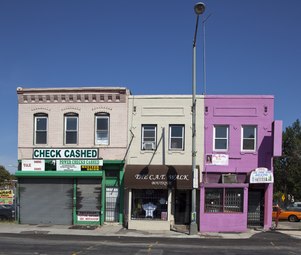
During this same period, a twelve-block strip of H Street (from 3rd Street to 15th) became one of the most important shopping corridors in Washington. It catered primarily to a working-class clientele, but was densely commercial, with restaurants, theaters, banks, grocery stores and clothing stores. It was the location of the very first
In addition, two of the most recognizable and popular locations were the whites-only
The neighborhood was devastated by the
Present day
H Street, so long the center of the neighborhood's life, is being structured as an arts district. In 2002, H Street Main Street, in partnership with the city and community members started breathing new life in the neighborhood.[15] Theaters, jazz clubs, performance spaces and exotic restaurants appeared in the neighborhood. In 2005 and 2006, more venues and bars opened in the H Street corridor. Business owners in that area are calling the area the Atlas District,[16] after the movie theater (now a dance and performance studio) that has been its most prominent landmark for half a century.
-
 800 block of H Street NE in 2009
 -
 Construction of the DC Streetcar's H Street NE/Benning Road Line in 2009
 -
 The intersection of H Street and 7th Street NE in 2010
 -
 The intersection of H Street and 14th Street NE in 2010


A new wave of residents has rapidly changed the area with sit-down restaurants, hip bars, more upscale retail establishments. The older residents note that this process has also made the neighborhood feel safer with more affluent residents investing in the community. This is a return to a more diverse community as it was before the 1968 riots when most white residents left.[17]
Neighborhood landmarks
Demolished landmarks
The Northeast Temple and Market
In 1897, The Northeast Temple and Market, an indoor marketplace and Lodge temple was built. These were the first buildings electrified on H Street NE. The Northeast Temple was located at 1119-1123 H Street NE and the Market was located next door from 1125 H Street NE to the corner of 12th Street NE.[18]
Apollo Theater

In 1913, the
Landmarks still standing
Home for the Aged Men and Women

In 1872, the
In 1977, the Little Sisters of the Poor moved out due to the construction of the Hopscotch Bridge under their windows. The building became vacant until 1979, when the National Children's Museum occupied it, moving out in 2004.[29] It was visited on January 22, 1990 by First Lady Barbara Bush to read Three Billy Goats Gruff to a group of children as part of her Foundation for Family Literacy.[30] It was purchased in 2005 and parts were demolished and replaced by a luxury apartment complex.[31][32]
Uline Arena
On January 28, 1941, the
Other theaters
Of the many movie theaters in Old City/Near Northeast, two of the most prominent still stand on H Street, although both are now used for different purposes. One, the old
-
 The Atlas Theater in 2012
 -
 The Plymouth Theater in 2012


Nomenclature
The neighborhood has taken on a variety of unofficial nicknames, most with little success.
Realtors tried to introduce the portmanteau SoFlo (a combination of South of Florida Avenue), hoping to attract an affluent, younger demographic. Residents and realtors also tried to popularize the term "Capitol Hill North," hoping to benefit from the higher market values of properties directly to the south on Capitol Hill.[43]
Businessmen attempting to revitalize the western section of Near Northeast tried to introduce the term Atlas District, a reference to the Atlas Theater. However, residents have been slow to embrace any of these terms and instead identify themselves as "living in Northeast", "living off H Street", or "from Near Northeast".
Infrastructure
Near Northeast is served by two stations on the
A modern streetcar runs from the back of Union Station down to Benning Road since February 27, 2016. It is the first in Washington, DC since the previous system was dismantled in 1962.[44]
As part of the city's Sustainability Plan,[45] DDOT has also added several bikes lanes running east to west on G Street NE and I Street NE as well as north to south on 4th Street NE and 6th Street NE. Multiple Capital Bikeshare stations have also been added in several key areas of the neighborhood.
Administration
Near Northeast is located in entirely in Ward 6 and represented locally by
Its citizens are represented by two Advisory Neighborhood Commissions depending on their location:
- ANC6C: western part from Union Station to 8th Street NE[46]
- ANC6A: eastern part from 8th Street NE to Starburst Plaza[47]
References
- ^ Archaeological Resources - Bureau of Alcohol, Tobacco and Firearms National Headquarters Building - Draft Environmental Impact Statement - 2000
- ^ a b c Faehtz, E. F. M., Pratt, F. W., Toner, J. M., Seibert, S. R. & Trill. (1792) Sketch of Washington in embryo: viz., previous to its survey by Major L'Enfant. [Washington, D.C.?: s.n] [Map] Retrieved from the Library of Congress, https://www.loc.gov/item/87694246/
- ^ a b c (1792) View of the city of Washington in. [Washington, D.C.?: s.n., 186-?] [Map] Retrieved from the Library of Congress, https://www.loc.gov/item/87694269/
- ^ Native Peoples of Washington, DC - https://www.nps.gov/articles/native-peoples-of-washington-dc.htm - National Park Service
- ^ Description of the Potomac Region - page 51 - A History of the National Capital Volume 1 by Wilhelmus Bogart Bryan - 1914
- ^ "Boundary Street No longer; it Will Be Known as Florida Avenue in the Future". The Washington Post. January 15, 1890. p. 8.
- ^ "New Depot at Washington," Baltimore American. Murphy, J Patrick, Laws and Ordinances Relating to the Baltimore and Ohio Railroad Company, 1850.
- ^ Image 61 of Sanborn Fire Insurance Map from Washington, District of Columbia, District of Columbia - http://hdl.loc.gov/loc.gmd/g3851gm.g01227003
- ^ Image 48 of Sanborn Fire Insurance Map from Washington, District of Columbia, District of Columbia - http://hdl.loc.gov/loc.gmd/g3851gm.g01227003
- ^ a b Hub, Home, Heart - Greater H Street NE Heritage Trail - https://www.culturaltourismdc.org/portal/c/document_library/get_file?uuid=c9ebb5a6-c0a8-459e-a25d-c84243bfc8b0&groupId=701982
- ^ "Neighborhoods". Jewish Historical Society of Greater Washington. Retrieved February 1, 2020.
- ^ "Virtual Jewish World: Washington, D.C." Jewish Virtual Library. Retrieved February 2, 2020.
- ^ Department of Transportation Headquarters: Environmental Impact Statement, GSA June 2000
- ^ "Growth of H Street: Where people used to 'run,' now they stay". WTOP.com. August 15, 2017. Retrieved January 10, 2018.
- ^ WTOP - Growth of H Street: Where people used to ‘run,’ now they stay
- ^ "Atlas District". Atlas-District.com. Retrieved January 10, 2018.
- ^ Schultz, David (March 6, 2012). "On H Street, gentrification not as simple as black and white". Retrieved January 10, 2018 – via www.WashingtonPost.com.
- ^ “Northeast’s New Market”, The Evening Times, March 20, 1897, page 2
- ^ "Building Permits", The Evening Star, April 2, 1913
- ^ New Apollo Movie Plan to Seat 2,500 - June 29, 1930 - The Washington Post - page R2
- ^ Deed recorded January 3, 1950 of the sale - DC Recorder of Deeds - Book 9117, page 510
- ^ "6th and History NE". November 14, 2013.
- ^ New Buick Showroom - November 19, 1966 - The Washington Post - page D9
- ^ Lease recorded on January 26, 1999 - DC Recorder of Deeds - Roll 1213, Frame 1417
- ^ "Luxury H Street Apartments". The Apollo. Retrieved December 31, 2021.
- ^ Alexandria Gazette and Virginia Advertiser - June 21, 1872
- ^ Temporary Exit - The Washington Post - March 12, 1977
- ^ The Little Sisters - The Evening Star - January 30, 1886
- ^ "[The 90's raw: Capital Children's Museum]". Media Burn Archive. Retrieved December 31, 2021.
- ^ First Lady Barbara Bush reads to Dominic Bines, 3, (on lap) and other children during a visit to the National Learning Center at Capitol Children's Museum
- ^ Urban Turf - H Street: A Place To Party, and To Settle Down - https://dc.urbanturf.com/articles/blog/h_street_a_place_to_party_and_to_settle_down/1446
- ^ "H Street DC Luxury Apartments for Rent". Senate Square. Retrieved December 31, 2021.
- ^ Ice-Capades Gets High Rank as Spectacle In Making Bow - Evening Star - January 29, 1941 - Page 25
- ^ "THE BEATLES AT WASHINGTON SPORTS ARENA". It All happened – A Living History of Live Music. Retrieved April 12, 2013.
- ^ Bob Dylan's Greatest Pic by Mark Jones - Boundary Stones - WETA's Local History Blog - https://blogs.weta.org/boundarystones/2012/11/28/bob-dylans-greatest-pic
- ProQuest 143125621.
- ProQuest 225533732.
- ^ Mann, Jim. "Coliseum Diary: 10-Hour Mixture of Ebullience, Boredom" Washington Post, May 8, 1971.
- REI. January 28, 2015. Retrieved February 2, 2015.
- ^ "Atlas Performing Arts Center - Atlas Performing Arts Center - Washington DC". www.AtlasArts.org. Retrieved January 10, 2018.
- ^ "H Street Playhouse". www.HStreetPlayhouse.com. Archived from the original on September 4, 2012. Retrieved January 10, 2018.
{{cite web}}: CS1 maint: unfit URL (link) - ^ Goldstein, Jessica (July 30, 2012). "H Street Playhouse moving to Anacostia". Retrieved January 10, 2018 – via www.WashingtonPost.com.
- ^ "Drawing the Line: Capitol Hill". UrbanTurf.com. Retrieved January 10, 2018.
- ^ Laris, Michael (February 27, 2016). "D.C. streetcar makes its first voyages on H Street. 'Is it really happening?'". Washington Post. Retrieved 2016-02-27.
- ^ "sustainable - Sustainable DC". Sustainable.DC.gov. Retrieved January 10, 2018.
- ^ ANC6C Website - http://anc6c.org
- ^ ANC6A Website - http://anc6a.org
External links
- Advisory Neighborhood Commissions 6A and 6C, respectively covering the eastern and western halves of Near Northeast, consider a wide range of policies and programs affecting the local neighborhoods, including traffic, parking, recreation, street improvements, liquor licenses, zoning, economic development, police protection, sanitation and trash collection, and the District's annual budget.
- H Street DC - A guide to the neighborhood's major commercial corridor
Places adjacent to Near Northeast (Washington, D.C.) | ||||||||||||||||
|---|---|---|---|---|---|---|---|---|---|---|---|---|---|---|---|---|
| ||||||||||||||||