
Neshoba County, Mississippi
Neshoba County | |
|---|---|
UTC−5 (CDT) | |
| Congressional district | 3rd |
| Website | www |
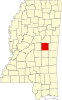
Neshoba County is located in the central part of the
The county is known for the Neshoba County Fair and harness horse races. It is home of the Williams Brothers Store, which has been in operation since the early 1900s.
In June 1964, civil rights workers James Chaney, Andrew Goodman, and Michael Schwerner were chased down, tortured, and murdered by members of the Ku Klux Klan. They were buried in an earthen dam on private property off of Highway 21; Goodman was still alive.[3] Initially treated as a missing persons case, their disappearance provoked national outrage and contributed significantly to the July enactment of the Civil Rights Act by President Johnson.[4]
The Mississippi Band of Choctaw Indians (MBCI), a federally recognized tribe, is based here and has developed one of the largest casino complexes in the state on their reservation, the Pearl River Resort.
History
At the time of European encounter, this was part of the territory of the historic
Neshoba was founded by European American settlers in 1833.
Descendants of the Choctaw who remained in the state continued to identify as Choctaw. They lived in relatively distinct communities and reorganized in the 1930s, gaining federal recognition as the Mississippi Band of Choctaw Indians. Even in the 1970s, eighty percent of their people continued to speak Choctaw.
Late 19th century to present
The white-dominated state legislature passed a
At various times, 76 post offices were established within the county. Around the turn of the 20th century, 40 small post offices were operating at the same time. By 1971, only the post offices in Philadelphia and Neshoba were still operational. Today, only the one in Philadelphia remains.[5]
Neshoba County is known as the site of the lynching murder of three young activists in July 1964 during
In 1980, Ronald Reagan launched his presidential campaign at the Neshoba County Fair to deliver a speech on economic policy and refer to states' rights. He was believed by some to be referring to southern conservative values, in an area associated with the 1964 murders and at a time when the Republican Party was attracting more white conservatives from the Democratic Party.[7][8]
Geography
According to the
Major highways
Adjacent counties
- Winston County (north)
- Kemper County (east)
- Newton County (south)
- Leake County (west)
Demographics
| Census | Pop. | Note | %± |
|---|---|---|---|
| 1840 | 2,437 | — | |
| 1850 | 4,728 | 94.0% | |
| 1860 | 8,343 | 76.5% | |
| 1870 | 7,439 | −10.8% | |
| 1880 | 8,741 | 17.5% | |
| 1890 | 11,146 | 27.5% | |
| 1900 | 12,726 | 14.2% | |
| 1910 | 17,980 | 41.3% | |
| 1920 | 19,303 | 7.4% | |
| 1930 | 26,691 | 38.3% | |
| 1940 | 27,882 | 4.5% | |
| 1950 | 25,730 | −7.7% | |
| 1960 | 20,927 | −18.7% | |
| 1970 | 20,802 | −0.6% | |
| 1980 | 23,789 | 14.4% | |
| 1990 | 24,800 | 4.2% | |
| 2000 | 28,684 | 15.7% | |
| 2010 | 29,676 | 3.5% | |
| 2020 | 29,087 | −2.0% | |
| 2023 (est.) | 28,789 | [10] | −1.0% |
| U.S. Decennial Census[11] 1790-1960[12] 1900-1990[13] 1990-2000[14] 2010-2013[1] | |||
2020 census
| Race | Num. | Perc. |
|---|---|---|
White
|
16,426 | 56.47% |
Black or African American
|
6,380 | 21.93% |
Native American
|
4,913 | 16.89% |
Asian
|
122 | 0.42% |
Other/Mixed
|
812 | 2.79% |
Latino
|
434 | 1.49% |
As of the
2000 census
As of the
There were 10,694 households, out of which 34.90% had children under the age of 18 living with them, 52.50% were married couples living together, 15.60% had a female householder with no husband present, and 27.60% were non-families. 24.70% of all households were made up of individuals, and 11.50% had someone living alone who was 65 years of age or older. The average household size was 2.63 and the average family size was 3.11.
In the county, the population was spread out, with 28.20% under the age of 18, 9.00% from 18 to 24, 27.00% from 25 to 44, 21.60% from 45 to 64, and 14.20% who were 65 years of age or older. The median age was 35 years. For every 100 females there were 91.10 males. For every 100 females age 18 and over, there were 88.30 males.
The median income for a household in the county was $28,300, and the median income for a family was $33,439. Males had a median income of $28,112 versus $19,882 for females. The
Communities
Cities
- Philadelphia (county seat)
Town
- Union (mostly in Newton County)
Census-designated places
- Bogue Chitto (partly in Kemper County)
- Pearl River
- Tucker
Unincorporated communities
Politics
| Year | Republican | Democratic | Third party | |||
|---|---|---|---|---|---|---|
| No. | % | No. | % | No. | % | |
| 2020 | 8,320 | 71.09% | 3,260 | 27.86% | 123 | 1.05% |
| 2016 | 7,679 | 72.77% | 2,715 | 25.73% | 159 | 1.51% |
| 2012 | 7,837 | 71.15% | 3,089 | 28.04% | 89 | 0.81% |
| 2008 | 8,209 | 72.00% | 3,114 | 27.31% | 79 | 0.69% |
| 2004 | 7,780 | 74.67% | 2,600 | 24.95% | 39 | 0.37% |
| 2000 | 6,409 | 70.69% | 2,563 | 28.27% | 94 | 1.04% |
| 1996 | 4,545 | 58.37% | 2,646 | 33.98% | 596 | 7.65% |
| 1992 | 6,135 | 61.09% | 3,090 | 30.77% | 817 | 8.14% |
| 1988 | 6,363 | 68.08% | 2,942 | 31.48% | 42 | 0.45% |
| 1984 | 6,715 | 71.71% | 2,630 | 28.09% | 19 | 0.20% |
| 1980 | 5,165 | 56.45% | 3,872 | 42.32% | 112 | 1.22% |
| 1976 | 3,859 | 49.35% | 3,891 | 49.76% | 69 | 0.88% |
| 1972 | 6,815 | 88.22% | 812 | 10.51% | 98 | 1.27% |
| 1968 | 531 | 6.79% | 867 | 11.09% | 6,417 | 82.11% |
| 1964 | 5,431 | 94.88% | 293 | 5.12% | 0 | 0.00% |
| 1960 | 580 | 14.02% | 1,840 | 44.49% | 1,716 | 41.49% |
| 1956 | 502 | 13.83% | 2,827 | 77.90% | 300 | 8.27% |
| 1952 | 1,081 | 23.26% | 3,567 | 76.74% | 0 | 0.00% |
| 1948 | 33 | 1.05% | 260 | 8.31% | 2,837 | 90.64% |
| 1944 | 131 | 4.15% | 3,025 | 95.85% | 0 | 0.00% |
| 1940 | 77 | 2.60% | 2,880 | 97.07% | 10 | 0.34% |
| 1936 | 67 | 1.88% | 3,495 | 98.04% | 3 | 0.08% |
| 1932 | 56 | 2.43% | 2,236 | 97.22% | 8 | 0.35% |
| 1928 | 516 | 21.30% | 1,906 | 78.70% | 0 | 0.00% |
| 1924 | 228 | 12.45% | 1,603 | 87.55% | 0 | 0.00% |
| 1920 | 182 | 13.74% | 1,088 | 82.11% | 55 | 4.15% |
| 1916 | 69 | 4.39% | 1,459 | 92.87% | 43 | 2.74% |
| 1912 | 22 | 2.43% | 806 | 88.96% | 78 | 8.61% |
Education
School districts include:[20]
Choctaw Tribal School System maintains Bogue Chitto Elementary School,[21] Pearl River Elementary School,[22] Tucker Elementary School,[23] Choctaw Central Middle School,[24] and Choctaw Central High School in the county.[25]
See also
- National Register of Historic Places listings in Neshoba County, Mississippi
- Neshoba (film)
- Iris Kelso
Footnotes
- ^ a b "State & County QuickFacts". United States Census Bureau. Archived from the original on June 7, 2011. Retrieved September 4, 2013.
- ^ "Find a County". National Association of Counties. Retrieved June 7, 2011.
- ^ "Murder in Mississippi | American Experience | PBS". www.pbs.org. Retrieved October 25, 2021.
- )
- ^ Sledge, Broox (May 29, 1985). "Neshoba County post offices---"gone with the wind."". The Union Appeal. Union, Mississippi. pp. 6–7. Retrieved December 18, 2021.
This is the story of the 76 small post offices which have served the people of Neshoba county down through the years. Only one of the 76 remains open today – Philadelphia.
- ^ "Civil Rights Movement – History & Timeline, 1964 (Freedom Summer)". www.crmvet.org. Retrieved November 8, 2021.
- ^ Jim Prince: "War over Reagan's Words." Madison County Journal (11/22/2007)
- ^ Montaldo, Charles. "The Mississippi Burning Case". Archived from the original on March 26, 2013.
- ^ "2010 Census Gazetteer Files". United States Census Bureau. August 22, 2012. Archived from the original on September 28, 2013. Retrieved November 6, 2014.
- ^ "Annual Estimates of the Resident Population for Counties: April 1, 2020 to July 1, 2023". United States Census Bureau. Retrieved April 5, 2024.
- ^ "U.S. Decennial Census". United States Census Bureau. Retrieved November 6, 2014.
- ^ "Historical Census Browser". University of Virginia Library. Retrieved November 6, 2014.
- ^ "Population of Counties by Decennial Census: 1900 to 1990". United States Census Bureau. Retrieved November 6, 2014.
- ^ "Census 2000 PHC-T-4. Ranking Tables for Counties: 1990 and 2000" (PDF). United States Census Bureau. Archived (PDF) from the original on March 27, 2010. Retrieved November 6, 2014.
- ^ "Explore Census Data". data.census.gov. Retrieved December 8, 2021.
- ^ "U.S. Census website". United States Census Bureau. Retrieved January 31, 2008.
- S2CID 60711423.
- ISBN 0-19-503794-4.
- ^ Leip, David. "Dave Leip's Atlas of U.S. Presidential Elections". uselectionatlas.org. Retrieved March 4, 2018.
- ^ "Home". Bogue Chitto Elementary School. Retrieved August 6, 2022.
13241 Highway 491 North Philadelphia, MS 39050
- ^ "Home". Pearl River Elementary School. Retrieved August 6, 2022.
470 Industrial Road Choctaw, MS 39350
- ^ "Home". Tucker Elementary School. Retrieved August 6, 2022.
126 East Tucker Circle Philadelphia, MS 39350
- ^ "Home". Choctaw Central Middle School. Retrieved August 6, 2022.
150 Recreation Road Choctaw, MS 39350
- ^ "Home". Choctaw Central High School. Retrieved August 6, 2022.
150 Recreation Road Choctaw, MS 39350
Further reading
- Carol V.R. George, One Mississippi, Two Mississippi: Methodists, Murder, and the Struggle for Racial Justice in Neshoba County. Oxford, England: Oxford University Press, 2015.
External links
- Mississippi Region Grapples with Legacy of Civil Rights Murders, a 40th anniversary story from All Things Considered
- Neshoba Democrat's 40th anniversary stories
Places adjacent to Neshoba County, Mississippi | ||||||||||||||||
|---|---|---|---|---|---|---|---|---|---|---|---|---|---|---|---|---|
| ||||||||||||||||
 | ||||
| Town | ||||
| CDPs | ||||
| Other communities | ||||
| Indian reservation | ||||
| Footnotes | ‡This populated place also has portions in an adjacent county or counties | |||
| ||||
| International | |
|---|---|
| National | |
| Other | |