
Nevado Sajama
| Nevado Sajama | |
|---|---|
Ultra | |
| Coordinates | 18°06′29″S 68°52′59″W / 18.10806°S 68.88306°W[1] |
| Naming | |
| Etymology | Aymara chak xaña, "west"[2] |
| Native name | Chak Xaña (Aymara) |
| Geography | |
 Nevado Sajama | |
| Country | Bolivia |
| Department | Oruro Department |
| Parent range | Cordillera Occidental (Andes) |
Nevado Sajama (
The mountain is covered by an
Geography and geomorphology
Nevado Sajama is located in the Sajama Province of the Oruro Department in Bolivia,[3] about 18.6 kilometres (11.6 mi) from the border with Chile. Cholcani volcano lies southeast of Sajama,[4] and another neighbouring volcano, Pomerape, resembles Sajama in its appearance.[5] A road runs along the southeastern flank of the volcano, with additional roads completing a circle around Sajama. The village of Sajama lies on its western foot, with the village of Caripe to the northeast of the mountain and Lagunas to the southwest, and there are a number of farms.[6]
In Bolivia, the Andes mountain chain splits into two branches separated by a 3,500–4,000 metres (11,500–13,100 ft) high plateau, the Altiplano. Nevado Sajama lies in the Western Andes of Bolivia[7] and in the western side of the Altiplano;[8] more specifically the mountain is located before the Western Cordillera.[9]
Nevado Sajama rises about 2.2 kilometres (1.4 mi) from the surrounding terrain to a height of 6,542 metres (21,463 ft) (earlier estimates of its height are 6,572 metres (21,562 ft)
The terrain is characterized by a continuous ice cover in the central sector of the mountain, exposures of bedrock, deposits and rock glaciers in some sites, alluvial fans and scree in the periphery of Sajama and moraines forming a girdle around the upper sector of Sajama.[16] The ground moraines are the most prominent moraines on Sajama, and have varying colours depending on the source of their component rocks. Vegetation and small lakes occur in their proximity, while other parts are unvegetated. They mostly occur within glacial valleys, but some appear to have formed underneath small plateau ice caps on flatter terrain.[17] At lower elevations the glaciers lead to lava flows and matorral and tolar vegetation, and finally to grassland at lower altitudes.[18]
A number of
Geology

Nevado Sajama is part of the
The mountain is a
Three major geologic lineaments occur in the region, the north-northwesterly trending Sajama lineament, a west-southwesterly one aligned with high topographical features and a west-northwesterly one. The west-southwesterly one played an important role in the development of Sajama volcano.[3]
Composition
The volcano has erupted rocks ranging from
Climate
At Cosapa on the foot of Sajama, annual mean temperatures are about 7.3 °C (45.1 °F)[16] while the town of Sajama sees annual temperatures of 4.3 °C (39.7 °F); precipitation there is about 327 millimetres per year (12.9 in/year). The daily temperature range approaches 40 °C (72 °F) there.[30]
Sajama is located between two climate regimes, a westerly one characterized by a dry climate and the
Summer precipitation is typically reduced during
Vegetation and animals
While the vegetation of the surroundings of Sajama is considered to be a dry
Up to 5 kilometres (3.1 mi) elevation


Glaciers

Above 5,600 metres (18,400 ft), Sajama is extensively
Sajama and neighbouring mountains featured much larger glaciers in the past.
Human interactions
Sajama is a
There are a number of archaeological sites on the mountain, including chullpa burials and pukara fortifications, distributed over various altitudes and connected through paths.[42] About 40 such sites have been found, most of them at low elevations[47] on the western and northern foot of Sajama.[48] Some of these sites have yielded ceramics. The archaeological sites demonstrate a direct link between the mountain and thir builders and with the resolution of local conflicts.[49]
During the second undisputed ascent on the mountain in 1946, one mountaineer disappeared and his body was never found.[50] In August 2001, two teams of Sajama villagers and Bolivian mountain guides played a football match on top of Mount Sajama in an effort to show that altitude itself is not a limitation to physical strain.[51] In 2015, a challenge to hold a political debate on the summit of Sajama was made by a candidate to an election.[52] The 50-boliviano Bolivian banknote launched in October 2018 shows Sajama on its reverse.[53]
See also
- Asu Asuni
- Jach'a Kunturiri
- K'isi K'isini
- Llisa
- Pomerape
- Sajama Lines
- Waña Quta
- List of volcanoes in Bolivia
References
- ^ cf. OSM or Bing Maps or Google Maps for coordinates
- ^ Tenorio Villegas, Celia; Ajacopa Pairumani, Sotero (2012). EL LÉXICO RITUAL DE LA WAXT'A EN AYMARA DE WARAQ'U APACHETA Y CHHUCHHULAYA DE LA TERCERA SECCIÓN DEL MUNICIPIO DE ACHOCALLA DEL DEPARTAMENTO DE LA PAZ (Thesis) (in Spanish). Universidad Mayor de San Andrés. Facultad de Humanidades y Ciencias de la Educación. Carrera de Lingüística e Idiomas. p. 76.
- ^ a b c d e f Galarza, Mauri, Iris Marcela (2004). "Geología y petrología del volcán Sajama: Provincia Sajama, departamento de Oruro" (in Spanish). La Paz: Higher University of San Andrés. Archived from the original on 20 May 2019. Retrieved 27 October 2018.
{{cite web}}: CS1 maint: multiple names: authors list (link) - ^ a b c d e f "Nevado del Sajama". Global Volcanism Program. Smithsonian Institution.
- ^ ISBN 9789562020541.
- S2CID 140194055.
- ^ Vuille 1999, p. 1579.
- ^ ISSN 0260-3055.
- ^ a b c d Jordan 1980, p. 303.
- ^ ISBN 9789990553444.
- ^ a b Vuille 1999, p. 1580.
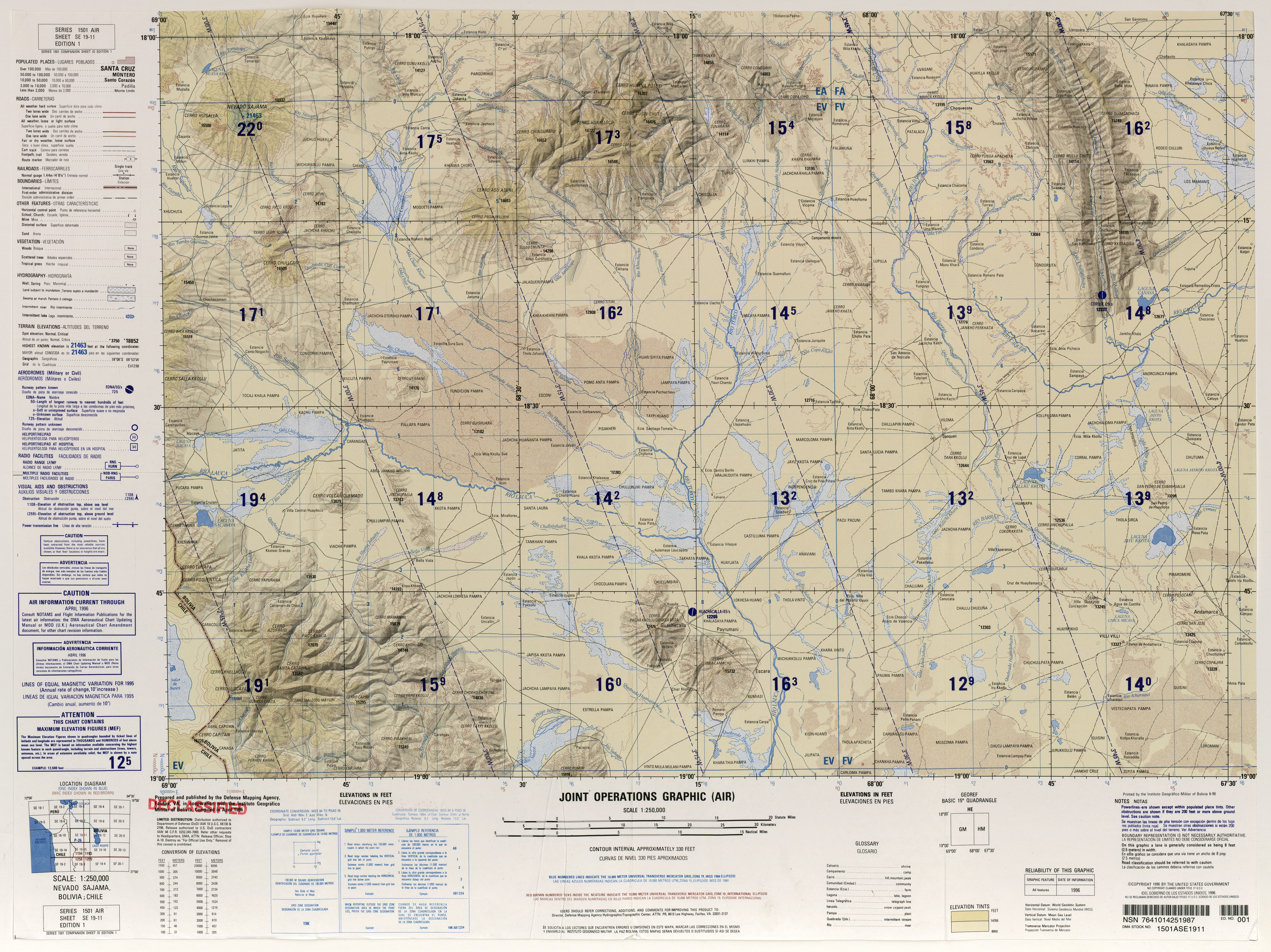
- ^ Defense Mapping Agency (1996). "Nevado Sajama, Bolivia; Chile"(Map). Latin America, Joint Operations Graphic (1 ed.). 1:250000.
- ^ a b "NEVADO SAJAMA, BOLIVIA 5839-IV H731 EDICION 1-IGM" (PDF). IGM Bolivia (in Spanish). Archived from the original (PDF) on 8 September 2017. Retrieved 27 October 2018.
- ^ Ahlfeld, F; Branisa, L (1960). Geologia de Bolivia. Boliviano Petróleo. pp. 192–193.
- ^ a b Smith, Lowell & Caffee 2009, p. 362.
- ^ a b c d e Smith, Lowell & Caffee 2009, p. 361.
- ^ Smith, Lowell & Caffee 2009, pp. 363–365.
- ^ a b Cruz 2023, p. 78.
- ^ Javier & Rafael 2011, p. 168.
- ^ Javier & Rafael 2011, p. 163.
- ^ a b International Atomic Energy Agency 1992, p. 142.
- ISSN 0003-004X.
- ^ Brockmann 1973, p. 5.
- ^ Brockmann 1973, p. 6.
- from the original on 2018-10-29. Retrieved 2018-10-29.
- from the original on 2018-11-12. Retrieved 2018-11-11.
- ^ International Atomic Energy Agency 1992, p. 149.
- ^ International Atomic Energy Agency 1992, p. 144.
- from the original on 2018-10-29. Retrieved 2018-10-29.
- ^ Javier & Rafael 2011, p. 165.
- ^ Vuille 1999, p. 1581.
- ^ Vuille 1999, p. 1582.
- ^ Vuille 1999, p. 1598.
- ^ Vuille 1999, p. 1599.
- ^ Jordan 1980, p. 304.
- ^ "ÁREAS PROTEGIDAS SUBNACIONALES EN BOLIVIA SITUACION ACTUAL 2012" (PDF). Dirección General de Biodiversidad y Áreas Protegidas (in Spanish). 2012. p. 10. Archived (PDF) from the original on 28 October 2018. Retrieved 28 October 2018.
- S2CID 37237853.
- ^ Smith, Lowell & Caffee 2009, p. 365.
- ISBN 3906151034.
- ^ Javier & Rafael 2011, p. 166.
- ^ Smith, Lowell & Caffee 2009, pp. 368, 371.
- ^ a b Cruz 2023, p. 77.
- ^ Alavi Mamani 2009, p. 134.
- ^ Ceruti, María Constanza (2013). "Mismi y Huarancante: nevados sagrados del Valle de Colca". Anuario de Arqueología, Rosario (2013), 5: 353. Archived from the original on 2018-10-29. Retrieved 2018-10-28.
- ^ Alavi Mamani 2009, p. 132.
- ISSN 0717-7356.
- ^ Cruz 2023, p. 81.
- ^ Cruz 2023, p. 82.
- ^ Cruz 2023, p. 105.
- ISBN 9781933056456.
- ^ Enever, Andrew (7 August 2001). "Bolivian footballers reach new high". BBC News. Archived from the original on 21 October 2007.
- ^ "Candidato boliviano reta a sus rivales a debatir en la cima de un nevado". Pulso Diario de San Luis. AP. 4 March 2015. Archived from the original on 31 October 2018. Retrieved 30 October 2018.
- Banco Central de Bolivia. 26 October 2018. Archivedfrom the original on 27 October 2018. Retrieved 27 October 2018.
Sources
- Alavi Mamani, Zacarias (May 2009). Una aproximación a las toponimias del Poopó y del Desaguadero (Report) (in Spanish).
- Brockmann, C.E. (1973). "Sketch on the structural geology and vulcanism in the Central High Plateau of the Bolivian Andes". NASA Technical Reports Server (in Spanish). Retrieved 29 October 2018.
- Cruz, Ramón Torrez (23 March 2023). "Áreas de encuentro ritual y convivencia pacífica, en torno a la deidad de la montaña Sajama durante el periodo intermedio tardío (1000 – 1450 d.c.)". Revista Patrimonio y Arqueología (in Spanish) (1): 75–107. ISSN 2959-2410.
- International Atomic Energy Agency (1992). "Geothermal investigations with isotope and geochemical techniques in Latin America".
- Javier, Santa Cecilia Mateos, Fernando; Rafael, Mata Olmo (2011-01-01). "Caracterización físiográfica de la Puna de Sajama, cordillera occidental de los Andes (Bolivia) = Puna Physiographic Characterization of Sajama (West Of The Andes Mountains)". Espacio Tiempo y Forma. Serie VI, Geografía (4–5): 159. doi:10.5944/etfvi.4-5.2011.13728.)
{{cite journal}}: CS1 maint: multiple names: authors list (link - Jordan, E. (1980). "Das durch Wärmemangel und Trockenheit begrenzte Auftreten von Polylepis am Sajama Boliviens mit dem höchsten Polylepis-Gebüschvorkommen der Erde". Deutsch. Geographentag (in German) (42): 303–305.
- Smith, Colby A.; Lowell, Thomas V.; Caffee, Marc W. (May 2009). "Lateglacial and Holocene cosmogenic surface exposure age glacial chronology and geomorphological evidence for the presence of cold-based glaciers at Nevado Sajama, Bolivia". Journal of Quaternary Science. 24 (4): 360–372. S2CID 128543043.
- Vuille, M. (30 November 1999). "Atmospheric circulation over the Bolivian Altiplano during dry and wet periods and extreme phases of the Southern Oscillation". International Journal of Climatology. 19 (14): 1579–1600. S2CID 18599470.
Bibliography
- Biggar, John (2020). The Andes: A Guide for Climbers and Skiers (5 ed.). Scotland: Andes Publishing. ISBN 978-0-9536087-6-8.
- Darack, Ed (2001). Wild Winds: Adventures in the Highest Andes. Cordee / DPP. ISBN 978-1884980817.
External links
- Climbing Sajama and Illimani
- "Nevado Sajama". Peakware.com. Archived from the original on 2016-03-04.
- Detailed description of the volcano