
New Jersey Route 162
| ||
|---|---|---|
| Location | ||
| Country | United States | |
| State | New Jersey | |
| Counties | Cape May | |
| Highway system | ||
| ||
Route 162 is an unsigned 0.70-mile (1.13 km) long
Route S4C was designated by the New Jersey Legislature in 1929 as a spur of Route 4 (now U.S. Route 9), beginning at Bennett and running south on Seashore Road and Broadway, past Sunset Boulevard to the Delaware Bay. Route S4C was never taken over by the state. However, when the United States Army Corps of Engineers built the Cape May Canal during World War II, Seashore Road was chosen as one of two roads to cross the canal. (The other was Route 4, now Route 109). The Army Corps built a low level bridge close to the pre-canal alignment. The New Jersey Department of Transportation (NJDOT) built a higher bridge in 1971 on a new alignment.
History
The Cape May Turnpike: the precedent to Seashore Road

Before 1854, the area based around Bridgeton was a strong business and legal section in Cape May County. The local residents there, however, wanted to have a strong banking industry, but a local named Richard Holmes along with several other locals turned to the strong type of enterprise, a turnpike company. Holmes and the locals began a local turnpike syndicate with other businessmen and began the Cape May Turnpike Company upon incorporation in 1854. The turnpike company, upon incorporation, was to build a toll road along roughly the U.S. Route 9 corridor. Progress in constructing the toll road was slow at first, with subscribers from Cape May County being hesitant to buy stock from the turnpike company. A friend of Richard Holmes, Wilmon Whilldin, owned a steamboat company in Cape May and apologized for not buying stock in the company. Citing the Panic of 1857 made it hard to convert securities to cash, Whilldin suggested that a steamboat would be more profitable than the turnpike. The money from the steamboat would go ahead and helped the financially depressed businesses in local communities.[2]
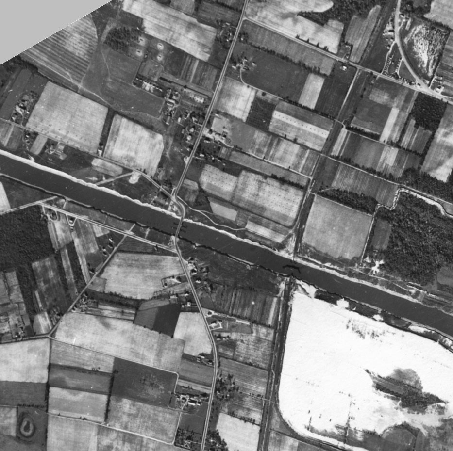
_just_north_of_Cape_May_County_Route_641_(Seashore_Road)_in_Lower_Township,_Cape_May_County,_New_Jersey.jpg)
Although local business owners and land owners held out hope that the turnpike company would pay off, the turnpike experienced problems. Richard Holmes and Henry Swain, the director of the turnpike company, were running into problems including failure to buy land from Elijah Hand's pasture and Samuel Hoffman's local residence for the turnpike route, because they kept land prices high. The farmers refused to the sell their rightful land, and locals started showing opposition due to the fact it would cost money to deliver important foods. One of those locals, John Tomlin from Goshen, soon after brought up the idea of the "Shunpike" – a free turnpike road to the west of the Cape May Turnpike. However, the turnpike company kept pushing forward, persuading Hand and Hoffman to sell land in 1857 and erecting two tollhouses in the route, one at the Court House (now Cape May Court House) and one near Cold Spring. Eventually, locals finally began to move towards support of the turnpike. In April 1858, John Wiley, who helped persuade Hand and Hoffman to sell, announced that in three weeks, the route would be complete as one continuous road from Cape Island to Cape May Court House.[2]

After completion of the turnpike in April–May 1858, the Cape May Turnpike did not receive much profits. Even with tolls being collected and stock being bought, these could not offset the costs of repairs and maintenance. The roadbed was commonly washed away in storms and it was becoming a less used route as the "Shunpike" (now Route 162/County Route 626) nearby was free to use, taking away traffic from the turnpike. Walters Miller, a big investor of the turnpike company, decided to leave the syndicate in favor of working towards railroads. Miller himself looked into the construction of railroads in the area, hiring William Cook, who engineered the
Businessmen in Cape May County believed the economy in the area was still unstable for quite an engineering project. An adviser to Richard Holmes suggested to be careful on future investments that he would take, including investing into the railroad company. The adviser believed that it would be "bad policy" to make such decisions. Debate continued about the railroad line for at least a decade, and the heads of the Camden and Atlantic Railroad put forth a proposal to build a portion of railroad from Absecon to Cape May along the
Route S4C and construction of Route 162
Route S4C | |
|---|---|
| Location | Cape May |
| Existed | 1927[3]–1953[4] |
In 1929, a route from the Delaware Bay just short of Sunset Boulevard (the former Cape Island Turnpike[2]) northward to U.S. Route 9 at Bennett Station via Broadway and Seashore Road was designated in the state legislature as State Highway Route S4C. The route was designated along County Route 626's length along with County Route 604 as a county-maintained highway,[5] remaining the same until January 1, 1953. On that day, State Highway Route S4C was decommissioned during the 1953 New Jersey state highway renumbering. No number was designated to replace the highway's former number.[4]
During the 1930s and 1940s, the proposal for a canal to supply ships with an evacuation route from
Route description

At the intersection with Bridge Road and CR 641, Route 162 officially begins though the county maintains the state numbered alignment of the road from this intersection to the beginning of the Relocated Seashore Road Bridge. The route heads northward from CR 641, paralleling both roads as it heads up the bridge approach and following the shoreline. From there, Route 162 reaches the
Major intersections
The entire route is in Cape May County.
| Location | mi[13] | km | Destinations | Notes | |||
|---|---|---|---|---|---|---|---|
CR 604 (Beach Avenue) | Southern terminus of County Route 626 | ||||||
| 0.09 | 0.14 | CR 627 west (Mt. Vernon Avenue) | Eastern terminus of CR 627 | ||||
CR 633 east (West Perry Street) | Eastern terminus of CR 606; western terminus of CR 633 | ||||||
| 0.53 | 0.85 | CR 635 west (Fourth Avenue) | Eastern terminus of CR 635 | ||||
CR 645 west (Stimpson Avenue) | Eastern terminus of CR 645 | ||||||
| State Route 162 begins at County Route 641 | |||||||
| 2.03 | 3.27 | CR 641 west (Seashore Road) | Southern terminus of Route 162, eastern terminus of CR 641, milepost 0.00 on Route 162 | ||||
| 2.56 | 4.12 | CR 603 north (Seashore Road) | Northern terminus of Route 162, southern terminus of CR 603; milepost 0.70 on Route 162 | ||||
| State Route 162 ends at County Route 603 | |||||||
| 2.73 | 4.39 | ||||||
| 2.94 | 4.73 | CR 648 west (Town Bank Road) | Eastern terminus of CR 648 | ||||
| 3.14 | 5.05 | CR 639 north (Fishing Creek Road) | Southern terminus of CR 639 | ||||
| 4.23 | 6.81 | CR 647 west (Tabernacle Road) | Eastern terminus of CR 647 | ||||
| 5.22 | 8.40 | CR 613 west (Breakwater Road) | Eastern terminus of CR 613 | ||||
| Middle Township | 6.77 | 10.90 | Northern terminus of County Route 626 | ||||
| 1.000 mi = 1.609 km; 1.000 km = 0.621 mi | |||||||
See also
 U.S. Roads portal
 New Jersey portal
References
- ^ a b "Route 162 Straight Line Diagram" (PDF). New Jersey Department of Transportation. March 2019. Retrieved March 17, 2020.
- ^ ISBN 978-0-8135-1784-1.
- ^ State of New Jersey, Laws of 1927, Chapter 319.
- ^ a b 1953 renumbering. New Jersey Department of Highways. Archived from the original on June 28, 2011. Retrieved July 31, 2009.
- ^ General Assembly, New Jersey (1929). ROUTE NO. S-4-C. Extending from Route 4 at Bennett Station, via Broadway in West Cape May, to Sunset boulevard, to the Delaware bay (1929 ed.). New Jersey State Legislature.
- Press of Atlantic City. July 27, 1992.
- New York Times. April 10, 1941. p. S8.
- New York Times. June 7, 1942. p. S3.
- ^ Lovejoy, Clarence E. (July 8, 1934). "Cape May Canal A Yachting Need". The New York Times. p. S8.
- ^ Framed image of the original Seashore Road bridge. Flight A, 16th Photo Squadron, US Army. October 30–31, 1944.
- ^ National Bridge Inventory (2008). Structure Number: ++++++++0513150 (2008 ed.). Washington D.C.: United States Department of Transportation.
- ^ Bing Maps - Overview map of County Route 626 and State Route 162 (Map). Microsoft Inc. 2009. Retrieved September 11, 2009.
- ^ "Cape May County Route 626 Straight Line Diagram" (PDF). New Jersey Department of Transportation. 2009. p. 1. Retrieved September 11, 2009.
External links
 Media related to New Jersey Route 162 at Wikimedia Commons
- New Jersey Highway Ends - 162