
Newell Highway
Newell Highway Gazetted | August 1928 (as Main Roads 56 and 229)[2] March 1938 (as State Highway 17)[3] | |
|---|---|---|
| Route number(s) |
| |
| Former route number |
| |
| Major junctions | ||
| North end | Goondiwindi, Queensland | |
| South end | Tocumwal | |
| Highway system | ||
Newell Highway is a
The highway is named in honour of H. H. Newell, the first Commissioner for Main Roads in New South Wales (1932–1941).[7] It is designated route A39 for its entire length.
Route
From its northern terminus at
The terrain that the highway traverses is generally flat to gently undulating, with long, straight sections joined by the occasional curved section. However, passing through the Warrumbungle Range, there are steeper grades and tighter curves than on the rest of the highway.[6]
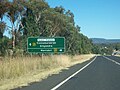
The Newell intersects the following highways: Bruxner (at Boggabilla), Carnarvon and Gwydir (at Moree), Kamilaroi (at Narrabri), Oxley (east) (north of Coonabarabran), Castlereagh and Oxley (west) (at Gilgandra), Golden and Mitchell (at Dubbo), Mid-Western (east) at Marsden), Mid-Western (west) at West Wyalong), Sturt (at Gillenbah) and Riverina (at Finley).
Newell Highway is located entirely west of the Great Dividing Range, running largely along the foot of the western slopes of the range, and as such crosses nine major rivers, all west-flowing from the Great Dividing Range. From north to south these rivers are the Macintyre (at Goondiwindi), the Gwydir (10 km north of Moree), the Mehi (at Moree), the Namoi (near Narrabri), the Castlereagh (at Coonabarabran and again at Gilgandra), the Macquarie (at Dubbo), the Lachlan (at Forbes), the Murrumbidgee (at Narrandera), and the Murray (at Tocumwal). Some sections of the Newell Highway are subject to periodic flooding from these rivers,[4] particularly north of Moree,[9] at Dubbo,[10] and south of Narrandera.[11][12]
Other than short four-lane lengths within some of the urban areas through which it passes, Newell Highway is a single carriageway, two-lane road, although there are many overtaking lanes, with further overtaking lanes under construction for the next four years from 2021.[13]
Traffic volumes along Newell Highway vary from around 1,200 to 4,000 vehicles per day in rural areas. In
History
Before its declaration, Newell Highway existed as a collection of unrelated roads, many gazetted as separate entities. The passing of the Main Roads Act of 1924
The Department of Main Roads, which had succeeded the MRB in 1932, later declared Trunk Road 72 from the intersection with State Highway 12 (Gwydir Highway) in Moree via Bellata to Narrabri (and continuing southeast via Boggabri to Gunnedah) and Main Road 338 from Moree to Boggabilla, on 18 July 1933;[18] the northern end of Main Road 126 was truncated to meet State Highway 11 (Oxley Highway) at Gunnedah. State Highway 17 was declared on 16 March 1938, from the intersection with State Highway 16 (later known as Bruxner Highway) at Boggabilla (which subsumed Trunk Road 63, declared on the same day[19]) to the intersection with Gwydir Highway at Moree (subsuming Main Road 338), then from Moree via Narrabri to the intersection with Oxley Highway near Coonabarabran, then from Gilgandra via Dubbo, Parks and Forbes to the intersection with Mid-Western Highway at Marsden, then from West Wyalong via Ardlethan to the intersection with Sturt Highway at Narrendera, then from Narrandera, Jerilderie and Finley to the state border with Victoria at Tocumwal, subsuming Main Road 229;[3] the northern ends of Trunk Roads 56 and 72 were truncated to meet State Highway 17 at Forbes and Narrabri respectively, Main Road 235 was truncated to meet State Highway 17 at Marsden, and Main Road 243 was truncated to meet State Highway 17 at Grong Grong, as a result.[3] State Highway 17 was named Newell Highway on 2 July 1941,[20] in honour of H. H. Newell, Commissioner for Main Roads 1932-41, following his death in office.[7]
At the time of the
Some sections of Newell Highway run concurrent along other highways. From north to south these are the Gwydir at Moree, the Kamilaroi at Narrabri, the Oxley (from 10 km north of Coonabarabran to Gilgandra), the Castlereagh through Gilgandra, the Mid-Western between Marsden and West Wyalong, and the Riverina (185 m through Finley). Previously, the declaration of Newell Highway was discontinuous, breaking where it shared concurrencies with these highways. As a consequence of its declaration as a National Highway in 1992, to simplify funding and administrative purposes, it was redeclared to form one continuous highway on 15 January 1993, breaking other highway declarations it shares concurrencies with.[21]
The passing of the Roads Act of 1993[22] through the Parliament of New South Wales updated road classifications and the way they could be declared within New South Wales. Under this act, Newell Highway today retains its declaration as Highway 17, from the state border with Queensland at Goondiwindi to the state border Victoria at Tocumwall.[23]
Newell Highway was signed National Route 39 across its entire length in 1965. The Whitlam government introduced the federal National Roads Act 1974,[24] where roads declared as a National Highway were still the responsibility of the states for road construction and maintenance, but were fully compensated by the Federal government for money spent on approved projects.[24]: S7 As an important interstate link between the capitals of Queensland and Victoria, Newell Highway was declared a National Highway in 1992, and was consequently re-allocated National Highway 39. With both states' conversion to the newer alphanumeric system between 2005 and 2013, its route number was updated to route A39 for the highway within Queensland in 2005, and eventually within New South Wales in 2013.[25]
Completion of the sealing of the full length of the highway occurred in 1972.
Town centre bypasses have been provided in Moree, Dubbo, Parkes and West Wyalong (heavy vehicle route). A town bypass at Ardlethan has also been constructed.
Major intersections
| State | LGA | Location | km[1] | mi | Destinations | Notes |
|---|---|---|---|---|---|---|
Rockhampton | Northern terminus of highway at roundabout National Highway A39 continues north along Cunningham Highway | |||||
| Marshall Street (west), to Yelarbon , Border Rivers Tourist Drive | ||||||
| 1 | 0.62 | Southern terminus of National Highway A39 | ||||
| State border | Queensland – New South Wales state border | |||||
| New South Wales | Macintyre River | Bridge over river | ||||
Boggabilla | Northern terminus of route A39 | |||||
| 8 | 5.0 | Bruxner Way – Yetman, Tenterfield, Northern Rivers coast | ||||
| Gwydir River | 122 | 76 | Bridge over river | |||
| Moree Plains | Collarenebri | Route B76 western concurrency terminus | ||||
| Mehi River | 133 | 83 | Bridge over river | |||
| Moree Plains | Moree | 133 | 83 | Warialda | Route B76 eastern concurrency terminus | |
Wee Waa, Walgett | ||||||
| Namoi River | 235 | 146 | Bridge over river | |||
| Narrabri | Narrabri | 236 | 147 | Gunnedah | Roundabout | |
Gunnedah | ||||||
Tooraweenah | ||||||
Dunedoo | Route B55 eastern concurrency terminus | |||||
| Castlereagh River | 442 | 275 | Jack Renshaw Bridge | |||
| Gilgandra | Gilgandra | 442 | 275 | Coonamble, Warren | Route B55 western concurrency terminus | |
| Talbragar River | 501 | 311 | Bridge over river | |||
Dunedoo, Muswellbrook | T-intersection | |||||
| Macquarie River | 507 | 315 | Emile Serisier Bridge | |||
| Dubbo | Dubbo | 508 | 316 | Narromine | ||
Narromine | ||||||
Condobolin | ||||||
| 627 | 390 | Grenfell Street (Henry Parkes Way) (east) – Orange | ||||
Cowra, and to Henry Lawson Way – Grenfell ) | Lachlan Valley Way northern concurrency terminus | |||||
| Lake Forbes | 660 | 410 | Oxley Bridge | |||
| Lachlan River | 661 | 411 | Bridge over river | |||
| Forbes | Bundaburrah | 665 | 413 | Condobolin | Lachlan Valley Way southern concurrency terminus | |
| Bland | Marsden | 726 | 451 | Route B64 eastern concurrency terminus | ||
Wyalong | 758 | 471 | ||||
West Wyalong | 763 | 474 | Route B64 western concurrency terminus | |||
| Coolamon | Mirrool Junction | 813 | 505 | Concurrency with route B94 | ||
Ardlethan | 831 | 516 | ||||
Grong Grong | 876 | 544 | Ganmain Road – Coolamon | |||
Narrandera | 898 | 558 | Irrigation Way – Griffith | |||
| Irrigation Canal | 898 | 558 | Bridge over the canal | |||
| Murrumbidgee River | 899 | 559 | Narrandera Bridge | |||
| Narrandera | Gillenbah | 900 | 560 | Wagga Wagga | Concurrency with route A20 | |
| 901 | 560 | |||||
| Jerilderie | Jerilderie Junction | 991 | 616 | |||
| Billabong Creek | 1,005 | 624 | Bridge over creek | |||
| Jerilderie | Jerilderie | 1,007 | 626 | Conargo Road – Conargo | ||
Deniliquin | Concurrency with route B58 | |||||
| 1,042.5 | 647.8 | Albury | ||||
Tocumwal | 1,057 | 657 | Southern terminus of Newell Highway | |||
| Murray River | Edward Hillson Bridge | |||||
| State border | 1,058 | 657 | New South Wales – Victoria state border | |||
Shepparton, Seymour | Northern terminus of Gouldburn Valley Highway, route A39 continues south | |||||
1.000 mi = 1.609 km; 1.000 km = 0.621 mi
| ||||||
Gallery
-
 Oxley Highway looking towards the Junction of Newell and Oxley Highways, just east of Coonabarabran, looking south-west.
 -
 National Route 39, the Newell Highway, in New South Wales, just south of West Wyalong, looking south.


See also
- Australian Roads portal
 New South Wales portal
- Highways in Australia
- List of highways in New South Wales
- List of highways in Queensland
- Bland Creek Bridge
References
- ^ a b c Google (16 February 2023). "Newell Highway" (Map). Google Maps. Google. Retrieved 16 February 2023.
- ^ a b c d e f g h i "Main Roads Act, 1924-1927". Government Gazette of the State of New South Wales. No. 110. 17 August 1928. pp. 3814–20. Archived from the original on 3 August 2022. Retrieved 1 August 2022 – via National Library of Australia.
- ^ a b c "Main Roads Act, 1924-1937". Government Gazette of the State of New South Wales. No. 58. National Library of Australia. 14 April 1938. pp. 1525–6. Archived from the original on 29 August 2022. Retrieved 29 August 2022.
- ^ a b "Roads Minister says duplicating Newell Highway is on state government's agenda". ABC News. Australia. 7 May 2014. Retrieved 23 March 2014.
- ^ a b "Newell Highway: History and Development". OzRoads. Retrieved 22 March 2015.[self-published source]
- ^ Roads & Maritime Services, Government of New South Wales. April 2014. pp. 8–9, 11. Retrieved 23 March 2015.
- ^ a b "JOURNAL OF THE DEPARTMENT OF MAIN ROADS, NEW SOUTH WALES" (PDF). Main Roads. 43 (2). Sydney: OpenGov NSW: 38–9. December 1977.
- ^ a b "Newell Highway: State Highway No. 17". OzRoads. Retrieved 22 March 2015.[self-published source]
- ^ "Heavy rain closes roads in NSW north-west". The Sydney Morning Herald. Australian Associated Press. 28 November 2011. Retrieved 23 March 2015.
- ^ Howe, Marc (12 May 2014). "NSW's Newell Highway Slated for Upgrade". Sourceable. Retrieved 23 March 2015.
- ^ "Travelling? Check road closures here". The Land. 19 March 2012. Retrieved 23 March 2015.
- Prime 7. 31 May 2011. Retrieved 23 March 2015.
- ^ "Newell Highway Program Alliance". Transport for NSW. 30 January 2023. Retrieved 16 February 2023.
- Roads & Maritime Services, Government of New South Wales. 2015. Retrieved 22 March 2015.
- ^ Brown, Emma (8 May 2014). "Draft Newell Highway Strategy released". ABC News. Australia. Retrieved 23 March 2014.
- ^ State of New South Wales, An Act to provide for the better construction, maintenance, and financing of main roads; to provide for developmental roads; to constitute a Main Roads Board Archived 11 August 2022 at the Wayback Machine 10 November 1924
- ^ State of New South Wales, An Act to amend the Main Roads Act, 1924-1927; to confer certain further powers upon the Main Roads Board; to amend the Local Government Act, 1919, and certain other Acts; to validate certain payments and other matters; and for purposes connected therewith. Archived 12 August 2022 at the Wayback Machine 8 April 1929
- ^ "Main Roads Act, 1924-1931". Government Gazette of the State of New South Wales. No. 119. National Library of Australia. 4 August 1933. p. 2882. Archived from the original on 17 October 2022. Retrieved 17 October 2022.
- ^ "Main Roads Act, 1924-1937". Government Gazette of the State of New South Wales. No. 46. National Library of Australia. 25 March 1938. pp. 1222–3. Archived from the original on 29 August 2022. Retrieved 29 August 2022.
- ^ "Main Roads Act, 1924-1939". Government Gazette of the State of New South Wales. No. 89. National Library of Australia. 11 July 1941. p. 2483. Archived from the original on 29 August 2022. Retrieved 29 August 2022.
- ^ "State Roads Act 1986". Government Gazette of the State of New South Wales. No. 5. National Library of Australia. 15 January 1993. p. 125. Archived from the original on 29 August 2022. Retrieved 29 August 2022.
- ^ State of New South Wales, An Act to make provision with respect to the roads of New South Wales; to repeal the State Roads Act 1986, the Crown and Other Roads Act 1990 and certain other enactments; and for other purposes. Archived 11 August 2022 at the Wayback Machine 10 November 1924
- ^ Transport for NSW (August 2022). "Schedule of Classified Roads and Unclassified Regional Roads" (PDF). Government of New South Wales. Retrieved 1 August 2022.
- ^ a b National Roads Act 1974 (Cth)
- Roads & Maritime Services. Government of New South Wales. 2012. Archived from the original(PDF) on 25 March 2016. Retrieved 7 November 2016.
External links
- "Draft Newell Highway Corridor Strategy" (PDF) (PDF). Roads & Maritime Services, Government of New South Wales. April 2014.