
Nortonville, Kansas
Nortonville, Kansas | ||
|---|---|---|
FIPS code 20-51525 [1] | | |
| GNIS ID | 478236 [1] | |
| Website | nortonvilleks.com | |
Nortonville is a city in Jefferson County, Kansas, United States.[1] As of the 2020 census, the population of the city was 601.[3]
History
Nortonville was platted in 1873.[4] It was named for L. Norton, Jr., a railroad employee.[5] The first post office in Nortonville was established in May 1873.[6]
In the 1900s, Nortonville was reported to be one of three sundown towns in the state, where African Americans were not allowed to reside.[7][8]
Geography
Nortonville is located at 39°25′3″N 95°19′54″W / 39.41750°N 95.33167°W (39.417496, -95.331626).[9] According to the United States Census Bureau, the city has a total area of 0.45 square miles (1.17 km2), of which, 0.44 square miles (1.14 km2) is land and 0.01 square miles (0.03 km2) is water.[10]
Demographics
| Census | Pop. | Note | %± |
|---|---|---|---|
| 1880 | 350 | — | |
| 1890 | 669 | 91.1% | |
| 1900 | 700 | 4.6% | |
| 1910 | 638 | −8.9% | |
| 1920 | 696 | 9.1% | |
| 1930 | 606 | −12.9% | |
| 1940 | 562 | −7.3% | |
| 1950 | 568 | 1.1% | |
| 1960 | 595 | 4.8% | |
| 1970 | 727 | 22.2% | |
| 1980 | 692 | −4.8% | |
| 1990 | 643 | −7.1% | |
| 2000 | 620 | −3.6% | |
| 2010 | 637 | 2.7% | |
| 2020 | 601 | −5.7% | |
| U.S. Decennial Census | |||
Nortonville is part of the
2020 census
The
Of the 219 households, 33.3% had children under the age of 18; 54.3% were married couples living together; 20.5% had a female householder with no spouse or partner present. 28.3% of households consisted of individuals and 14.6% had someone living alone who was 65 years of age or older.[12] The average household size was 2.7 and the average family size was 3.0.[16] The percent of those with a bachelor’s degree or higher was estimated to be 14.3% of the population.[17]
28.8% of the population was under the age of 18, 5.0% from 18 to 24, 24.1% from 25 to 44, 22.8% from 45 to 64, and 19.3% who were 65 years of age or older. The median age was 39.4 years. For every 100 females, there were 97.7 males.[12] For every 100 females ages 18 and older, there were 98.1 males.[12]
The 2016-2020 5-year
2010 census
As of the
There were 232 households, of which 37.1% had children under the age of 18 living with them, 63.4% were married couples living together, 7.3% had a female householder with no husband present, 4.7% had a male householder with no wife present, and 24.6% were non-families. 22.0% of all households were made up of individuals, and 13.3% had someone living alone who was 65 years of age or older. The average household size was 2.61 and the average family size was 3.05.
The median age in the city was 40.2 years. 27.2% of residents were under the age of 18; 5.7% were between the ages of 18 and 24; 23.1% were from 25 to 44; 22.5% were from 45 to 64; and 21.4% were 65 years of age or older. The gender makeup of the city was 49.0% male and 51.0% female.
2000 census
As of the
There were 233 households, out of which 32.6% had children under the age of 18 living with them, 57.9% were married couples living together, 7.3% had a female householder with no husband present, and 33.5% were non-families. 30.0% of all households were made up of individuals, and 21.5% had someone living alone who was 65 years of age or older. The average household size was 2.46 and the average family size was 3.10.
In the city, the population was spread out, with 26.0% under the age of 18, 6.9% from 18 to 24, 24.4% from 25 to 44, 16.5% from 45 to 64, and 26.3% who were 65 years of age or older. The median age was 40 years. For every 100 females, there were 87.9 males. For every 100 females age 18 and over, there were 80.7 males.
The median income for a household in the city was $38,281, and the median income for a family was $40,781. Males had a median income of $32,250 versus $18,500 for females. The
Education
The community is served by Jefferson County North USD 339 public school district. School unification consolidated Nortonville and Winchester schools forming USD 339. The Jefferson County North High School mascot is Jefferson County Chargers. Jefferson County North Elementary and Middle School is located in Nortonville.[24]
Nortonville High School was closed through school unification. The Nortonville High School mascot was Cardinals.[25]
References
- ^ a b c d e "Nortonville, Kansas", Geographic Names Information System, United States Geological Survey, United States Department of the Interior
- ^ "2019 U.S. Gazetteer Files". United States Census Bureau. Retrieved July 24, 2020.
- ^ a b "Profile of Nortonville, Kansas in 2020". United States Census Bureau. Archived from the original on November 12, 2022. Retrieved November 12, 2022.
- ^ Blackmar, Frank Wilson (1912). Kansas: A Cyclopedia of State History, Volume 2. Standard Publishing Company. pp. 376.
- ^ Kansas State Historical Society (1916). Biennial Report of the Board of Directors of the Kansas State Historical Society. Kansas State Printing Plant. pp. 209.
- ^ "Kansas Post Offices, 1828-1961 (archived)". Kansas Historical Society. Archived from the original on October 9, 2013. Retrieved June 11, 2014.
- ^ "The evening bulletin. [volume] (Maysville, Ky.) 1887-1905, August 16, 1902, Image 3". The Evening Bulletin. Maysville, Kentucky. August 16, 1902. p. 3 – via Chronicling America.
- ^ "Kansas Items". Fairview Enterprise. Fairview, Kansas. February 9, 1901. p. 3 – via Newspapers.com.
Nortonville and Howard are two Kansas towns where negroes are not allowed to live.
- ^ "US Gazetteer files: 2010, 2000, and 1990". United States Census Bureau. February 12, 2011. Retrieved April 23, 2011.
- ^ "US Gazetteer files 2010". United States Census Bureau. Archived from the original on January 25, 2012. Retrieved July 6, 2012.
- ^ "US Census Bureau, Table P16: HOUSEHOLD TYPE". data.census.gov. Retrieved January 3, 2024.
- ^ a b c d e "US Census Bureau, Table DP1: PROFILE OF GENERAL POPULATION AND HOUSING CHARACTERISTICS". data.census.gov. Retrieved January 3, 2024.
- ^ Bureau, US Census. "Gazetteer Files". Census.gov. Retrieved December 30, 2023.
- ^ "US Census Bureau, Table P1: RACE". data.census.gov. Retrieved January 3, 2024.
- ^ "US Census Bureau, Table P2: HISPANIC OR LATINO, AND NOT HISPANIC OR LATINO BY RACE". data.census.gov. Retrieved January 3, 2024.
- ^ "US Census Bureau, Table S1101: HOUSEHOLDS AND FAMILIES". data.census.gov. Retrieved January 3, 2024.
- ^ "US Census Bureau, Table S1501: EDUCATIONAL ATTAINMENT". data.census.gov. Retrieved January 3, 2024.
- ^ "US Census Bureau, Table S1903: MEDIAN INCOME IN THE PAST 12 MONTHS (IN 2020 INFLATION-ADJUSTED DOLLARS)". data.census.gov. Retrieved January 3, 2024.
- ^ "US Census Bureau, Table S2001: EARNINGS IN THE PAST 12 MONTHS (IN 2020 INFLATION-ADJUSTED DOLLARS)". data.census.gov. Retrieved January 3, 2024.
- ^ "US Census Bureau, Table S1701: POVERTY STATUS IN THE PAST 12 MONTHS". data.census.gov. Retrieved January 3, 2024.
- ^ "US Census Bureau, Table S1702: POVERTY STATUS IN THE PAST 12 MONTHS OF FAMILIES". data.census.gov. Retrieved January 3, 2024.
- ^ "U.S. Census website". United States Census Bureau. Retrieved July 6, 2012.
- ^ "U.S. Census website". United States Census Bureau. Retrieved January 31, 2008.
- ^ "Jefferson County North USD 339". USD 339. Retrieved January 4, 2017.
- ^ "Nortonville Wins No 11", The Atchison Daily Globe, 16 January 1952, p.7.
External links
- City of Nortonville
- Nortonville - Directory of Public Officials
- USD 339, local school district
- Nortonville City Map, KDOT
Municipalities and communities of Jefferson County, Kansas, United States | ||
|---|---|---|
| Cities | 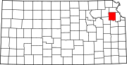 | |
| Unincorporated communities | ||
| Townships | ||
| Footnotes | †This community is designated a Census-Designated Place (CDP) by the United States Census Bureau. | |
| ||