
Palouse
Palouse | |
|---|---|
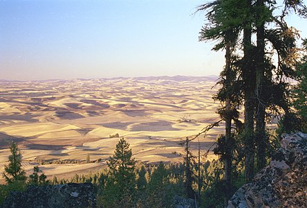
 Palouse hills near Steptoe Butte | |
 Palouse Location in the United States | |
| Coordinates: 46°44′N 117°10′W / 46.73°N 117.16°W |
The Palouse (/pəˈluːs/ pə-LOOSS) is a distinct geographic region of the northwestern United States, encompassing parts of north central Idaho, southeastern Washington, and, by some definitions, parts of northeast Oregon. It is a major agricultural area, primarily producing wheat and legumes. Situated about 160 miles (260 km) north of the Oregon Trail, the region experienced rapid growth in the late 19th century.
The Palouse is home to two land-grant universities: the University of Idaho in Moscow and Washington State University in Pullman. Just eight miles (13 km) apart, both schools opened in the early 1890s.
Palouse the town is located 65 miles (105 km) south of Spokane.
Geography and history

The origin of the name "Palouse" is unclear. One theory is that the name of the
Traditionally, the Palouse region was defined as the fertile hills and prairies north of the Snake River, which separated it from Walla Walla County, and north of the Clearwater River, which separated it from the Camas Prairie, extending north along the Washington and Idaho border, south of Spokane, centered on the Palouse River. This region underwent a settlement and wheat-growing boom during the 1880s, part of a larger process of growing wheat in southeast Washington, originally pioneered in Walla Walla County south of the Snake River.[2]
While this definition of the Palouse remains common today, the term is sometimes used to refer to the entire wheat-growing region, including Walla Walla County, the Camas Prairie of Idaho, the Big Bend region of the central
The community of
Nevertheless, the traditional definition of the Palouse region is distinct from the older Walla Walla region south of the Snake River, where dryland farming of wheat was first proved viable in the region in the 1860s. During the 1870s, the Walla Walla region was rapidly converted to farmland, while the initial experiments in growing wheat began in the Palouse region, which previously had been the domain of cattle and sheep ranching. When those trials proved more than successful, a minor land rush quickly filled the Palouse region with farmers during the 1880s. The simultaneous proliferation of railroads only increased the rapid settlement of the Palouse. By 1890 nearly all the Palouse lands had been taken up and converted to wheat farming.[4]
Unlike the Walla Walla Country, which was solidly anchored on the city of Walla Walla, the Palouse region saw the rise of at least four centers, all within several miles of each other: Colfax (the oldest), Palouse, Pullman, and on the Idaho side, Moscow. These four centers, along with at least ten lesser ones, resulted in a diffuse pattern of rural centers, relative to the centralized Walla Walla county.[5]
Cities along the borders of the Palouse, and by some definitions included within it, include
By 1910, although local terms like Palouse, Walla Walla Country, Big Bend, Umatilla Country, and Camas Prairie continued to be common, many people of the region began to regard themselves as living in the
Farming
Early
It was only when the Idaho Harvester Company in Moscow began to manufacture a smaller machine that combine harvesting became feasible. By 1930, 90% of all Palouse wheat was harvested using combines.[7]
The next step in mechanization was development of the tractor. As with the combines, the first steam engine and gasoline-powered tractors were too heavy and awkward for use on the steep Palouse hills. The smaller, general use tractors introduced in the 1920s were only marginally used. As a result, by 1930, only 20% of Palouse farmers used tractors.[7] Today, the Palouse region is the most important lentil-growing region in the USA.[8]
-
 Palouse fields fromKamiak Butte, early summer
 -
 Palouse fields fromKamiak Butte, fall


Geology
The peculiar and picturesque
Although superficially resembling sand or other types of dunes, the loess hills of the Palouse are of far different origin. Internally, they lack any evidence of cross-bedding or erosion of interbedded layers of loess and calcrete that characterize dunes formed by moving currents. Instead, these hills consist of alternating layers of loess and calcrete that are more or less concordant with the modern surface of these hills. This layering demonstrates that the Palouse hills loess accumulated from the airfall of wind-silt from suspension. In addition, the ubiquitous homogenization of the loess by innumerable plant roots and insect burrows as it accumulated further supports the conclusion drawn from numerous thermoluminescence and optically stimulated luminescence dates that individual layers of loess accumulated over an extended period of time in terms of thousands of years. Finally, the calcrete horizons are paleosols that represent the periodic cessation of loess accumulation for periods of thousands of years during which they formed within the surface of a loess layer.[12][13][14]
Environment
| Palouse grasslands | |
|---|---|
WWF | |
| Ecology | |
| Realm | Nearctic |
| Biome | Temperate grasslands, savannas, and shrublands |
| Borders | List
|
| Bird species | 199 Cold semi-arid (BSk) |
| Conservation | |
| Conservation status | Critical/Endangered [16] |
| Habitat loss | 26.3%[15] |
| Protected | 9.89%[15] |
Once an extensive
Lately, conversion of agricultural lands to suburban homesites on large plots invites a new suite of biodiversity onto the Palouse Prairie. University of Idaho wildlife professor J. Ratti documented changes in bird community composition over a 10-year period as he converted a wheat field into a suburban wildlife refuge. As of 1991, his 15-acre (61,000 m2) yard attracted 86 species of birds, an increase from 18 (Ratti and Scott 1991).
Ecological transformation
As population grew, towns and cities appeared changing the complexion of the area. By 1910, there were 22,000 people scattered in 30 communities across the Palouse Prairie.
Intensification of agriculture has affected both water quantity and quality. Agriculture has changed the hydrology, increasing peak runoff flows and shortening the length of runoff. The result is more intense erosion and loss of perennial prairie streams. As early as the 1930s soil scientists were noting significant downcutting of regional rivers (Victor 1935) and expansion of channel width. Higher faster runoff caused streams to downcut quickly, effectively lowering the water table in immediately adjacent meadows. On the South Palouse River, this process was so efficient that by 1900 farming was possible where it had been too wet previously (Victor 1935). Replacement of perennial grasses with annual crops resulted in more overland flow and less infiltration, which translates at a watershed level to higher peak flows that subside more quickly than in the past. Once perennial prairie streams are now often dry by mid-summer. This has undoubtedly influenced the amphibious and aquatic species.
Crop production increased dramatically (200–400%) after the introduction of fertilizer following World War II.

Since 1900, 94% of the grasslands and 97% of the wetlands in the Palouse ecoregion have been converted to crop, hay, or pasture lands. Approximately 63% of the lands in forest cover in 1900 are still forested, 9% are grass, and 7% are regenerating forestlands or shrublands. The remaining 21% of previously forested lands have been converted to agriculture or urban areas.
The impacts of domestic grazers on the grasslands of the Palouse and Camas Prairies was transitory because much of the areas were rapidly converted to agriculture. However, the canyonlands of the Snake and Clearwater rivers and their tributaries with their much shallower soils, steep topography, and hotter, drier climate, were largely unsuitable for crop production and were consequently used for a much longer period by grazing domestic animals (Tisdale 1986). There, intense grazing and other disturbances have resulted in irreversible changes with the native grasses largely replaced by annual grasses of the genus Bromus and noxious weeds, particularly from the genus Centaurea. The highly competitive plants of both of these genera evolved under similar climatic regimes in Eurasia and were introduced to the U.S. in the late 19th century.
With the adoption of
Fauna
The Palouse boasts a large number of animal species. Some animals in the region include both mule and white-tailed deer, coyotes, bobcats, California quails, yellow-bellied marmots, and red-tailed hawks.
Fires
While there is some debate over how frequently the Palouse prairie burned historically, there is consensus that
See also
- Palouse, Washington
- Spokane-Coeur d'Alene-Paloos War(Palouse War)
- Palus people
- Appaloosa
- Battle of the Palouse - college football rivalry game
- Okanagan Desert
- Steptoe Butte
- Palouse Falls
References
- ISBN 978-0-295-95158-4.
- ^ Meinig, p. 467.
- ^ "Palouse grasslands". Terrestrial Ecoregions. World Wildlife Fund.
- ^ Meinig, pg. 510.
- ^ Meinig, pg. 333.
- ^ Meinig, pg. 406.
- ^ a b c Williams, K.R. 1991. Hills of gold: a history of wheat production technologies in the Palouse region of Washington and Idaho. Ph.D. dissertation, Washington State University, Pullman.
- ^ St. George, Donna (1997-09-24). "National Origins: Washington-Idaho Border; America's Golden Land Of Lentils". The New York Times. Retrieved 2009-08-17.
- ^ Busacca, A.J., 1989. Long Quaternary record in eastern Washington, U.S.A., interpreted from multiple buried paleosols in loess. Geoderma. 45:105-122.
- ^ Busacca, AJ, and EV McDonald (1994) Regional sedimentation of late Quaternary loess on the Columbia plateau: sediment source areas and loess distribution patterns. Washington Division of Geology and Earth Resources Bulletin. 80:181-190.
- ^ Gaylord, DR, AJ Busacca, and MR Sweeney (2003) The Palouse loess and the Channeled Scabland: A paired Ice-Age geologic system. In Quaternary Geology of the United States, INQUA 2003 Field Guide Volume. DJ Easterbrook, ed., pp. 123-134. Reno, Nevada: Desert Research Institute.
- ^ .
- ^ Lewis, PF (1960) Linear Topography in the Southwestern Palouse, Washington-Oregon. Annals of the Association of American Geographers. 50(2):98-111.
- .
- ^ a b c d "The Atlas of Global Conservation". maps.tnc.org. Archived from the original on 2012-03-05. Retrieved 2020-11-12.
- ^ a b "Palouse grasslands | Ecoregions | WWF". World Wildlife Fund. Retrieved 2020-11-13.
- ^ "No Till : the Quiet Revolution" (PDF). Ars.usda.gov. Retrieved 2 January 2017.
References
- Chapter 10: Additional Figures - Biodiversity and Land-use History of the Palouse Bioregion: Pre-European to Present - Sisk, T.D., editor. 1998. Perspectives on the land-use history of North America: a context for understanding our changing environment. U.S. Geological Survey, Biological Resources Division, Biological Science Report USGS/BRD/BSR 1998-0003 (Revised September 1999)..
- Meinig, D.W. 1968. The Great Columbia Plains: A Historical Geography, 1805-1910. University of Seattle Press, Seattle (Revised 1995). ISBN 0-295-97485-0.
- Morgan, P., S.C. Bunting, A.E. Black, T. Merrill, and S. Barrett. 1996. Fire regimes in the Interior Columbia River Basin: past and present. Final Report, RJVA-INT-94913. Intermountain Fire Sciences Laboratory, USDA Forest Service, Intermountain Research Station, Missoula, Mont.
- Noss, R.F., E.T. LaRoe III, and J.M. Scott. 1995. Endangered ecosystems of the United States: a preliminary assessment of loss and degradation. U.S. National Biological Service. Biological Report 28.
- Ratti, J.T., and J.M. Scott. 1991. Agricultural impacts on wildlife: problem review and restoration needs. The Environmental Professional 13:263-274.
- Tisdale, E.W. 1986. Canyon grasslands and associated shrublands of west-central Idaho and adjacent areas. Bulletin No. 40. Forestry, Wildlife and Range Experiment Station, University of Idaho, Moscow.
- Victor, E. 1935. Some effects of cultivation upon stream history and upon the topography of the Palouse region. Northwest Science 9(3):18-19.
External links
- Palouse grasslands images at bioimages.vanderbilt.edu (slow modem version)
- A Palouse Bibliography, Compiled by David M. Skinner, Palouse Prairie Foundation bibliographies.
- Palouse River, The Columbia Gazetteer of North America. 2000.
- The Appaloosa Museum
- Photograph America: The Palouse, Washington
- The Luminous Landscape: The Palouse
- A photographic guide to the Palouse
- A Palouse Paradise Documentary produced by Idaho Public Television
- "Palouse grasslands (World Wildlife Fund)". Terrestrial Ecoregions. World Wildlife Fund.
- Eureka Flat: How glacial outburst floods started the dust engine of the Pacific Northwest, Textbook - Key Concepts in Geomorphology. The University of Vermont, Burlington, Vermont.
State of Washington | |||||||
|---|---|---|---|---|---|---|---|
Olympia (capital) | |||||||
| Topics |
| ||||||
| Society | |||||||
| Politics |
| ||||||
| Regions |
| ||||||
| Largest cities |
| ||||||
| Counties |
| ||||||