
Para District
Para District | |
|---|---|
UTC-3 | |
| ISO 3166 code | SR-PR |
Para is a district of northern Suriname. Para's capital city is Onverwacht, with other towns including Paranam, and Zanderij. Para has a population of 24,700 and an area of 5,393 km2.[1] The district is the mining and forestry centre of Suriname, with many large bauxite mining operations operating. The district is a mixture of forest and savannas.[2]
History
The northern part of Para is one of the oldest cultivated areas of Suriname, and has been home to sugar and tobacco plantation since the 17th century[2] which were mainly located along the Suriname River and the Para Creek.[3] The southern part of the district contained wood plantations,[2] and is still in use by logging companies.[4]: 139 In 1968, the District was established, and named after the Para Creek. In 1983, the District was quadrupled in size.[2]
The district used to be accessible only by boat. The discovery of gold in Brokopondo and Sipaliwini lead to the construction of the Lawa Railway and growth of the villages next to the railway line.[5] The railway line was decommissioned in 1986.[6]
During
The ruins of the city of
Para is home to several
Economy
The main part of the economy is the
Resorts

Para is divided into 5 resorts (ressorten):
Villages
Demographics
In the 2004 census, Para had 18,749 inhabitants. This rose in the 2012 census to 24,700 inhabitants, a 31.1% increase.[13]
See also
- Coropina Kreek
References
- ^ a b "Resorts in Suriname Census 2012" (PDF). Retrieved 26 May 2020.
- ^ a b c d e "Distrikt Para 1" (in Dutch). Retrieved 28 May 2020.
- ^ "Locatie: Parakreek". Suriname Plantages (in Dutch). Retrieved 10 January 2022.
- ^ "STRUCTUUR ANALYSE DISTRICTEN 2009-2013" (PDF). Planning Office Suriname (in Dutch). Retrieved 10 January 2022.
- ^ a b "Distrikt Para 2". Anda Suriname (in Dutch). Retrieved 28 May 2020.
- ^ Armand Snijders: De flop van Lely. Parbode, Surinames Magazine, 1 April 2008.
- ^ "Suriname in de Tweede Wereldoorlog". Werkgroup Caraïbische Letteren (in Dutch). Retrieved 28 May 2020.
- ^ "De Gids. Almanak voor Suriname 1937". Digital Library for Dutch Literature (in Dutch). 1936. Retrieved 13 May 2020.
- ^ "REGIONAAL PLAN BROKOPONDO" (PDF). Planning Office Suriname (in Dutch). Retrieved 13 May 2020.
- ^ "Marchano Stuger wint verkiezing dorpsbestuur Redidoti". De Boodschap.today (in Dutch). Retrieved 18 May 2020.
- ^ "Kamp Jodensavanne zwarte bladzijde". Straf Kolonie (in Dutch). Retrieved 18 May 2020.
- ^ a b c "Structuur Analyse" (PDF). Planning Office Suriname (in Dutch). Retrieved 28 May 2020.
- ^ "Suriname Districts". Statoids. Retrieved 28 May 2020.
Gallery
-
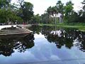
 Savannah near Powakka
 -
-
 Jodensavanna(c. 1860)
 -
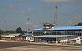
 Bauxite factory in Paranam (1947)
 -
-
 Amerindian village of Cabendadorp
.jpg)

,_RP-P-1909-1780.jpg)

.jpg)

| Brokopondo District |  | |
|---|---|---|
| Commewijne District | ||
| Coronie District | ||
| Marowijne District | ||
| Nickerie District | ||
| Para District | ||
| Paramaribo District | ||
| Saramacca District | ||
| Sipaliwini District | ||
| Wanica District | ||
| National | |
|---|---|
| Geographic | |