
Parsons Boulevard station
Parsons Blvd Q114 | ||||||||||||||||||||||||||||||||||||||||||||||||||||||||||||||||||||||||||||||||||||||||||||||||||||||||||||||||||||||||||||
|---|---|---|---|---|---|---|---|---|---|---|---|---|---|---|---|---|---|---|---|---|---|---|---|---|---|---|---|---|---|---|---|---|---|---|---|---|---|---|---|---|---|---|---|---|---|---|---|---|---|---|---|---|---|---|---|---|---|---|---|---|---|---|---|---|---|---|---|---|---|---|---|---|---|---|---|---|---|---|---|---|---|---|---|---|---|---|---|---|---|---|---|---|---|---|---|---|---|---|---|---|---|---|---|---|---|---|---|---|---|---|---|---|---|---|---|---|---|---|---|---|---|---|---|---|
| Structure | Underground | |||||||||||||||||||||||||||||||||||||||||||||||||||||||||||||||||||||||||||||||||||||||||||||||||||||||||||||||||||||||||||
| Platforms | 2 island platforms cross-platform interchange | |||||||||||||||||||||||||||||||||||||||||||||||||||||||||||||||||||||||||||||||||||||||||||||||||||||||||||||||||||||||||||
| Tracks | 4 | |||||||||||||||||||||||||||||||||||||||||||||||||||||||||||||||||||||||||||||||||||||||||||||||||||||||||||||||||||||||||||
| Other information | ||||||||||||||||||||||||||||||||||||||||||||||||||||||||||||||||||||||||||||||||||||||||||||||||||||||||||||||||||||||||||||
| Opened | April 24, 1937[2] | |||||||||||||||||||||||||||||||||||||||||||||||||||||||||||||||||||||||||||||||||||||||||||||||||||||||||||||||||||||||||||
| Accessible | not ADA-accessible; accessibility planned | |||||||||||||||||||||||||||||||||||||||||||||||||||||||||||||||||||||||||||||||||||||||||||||||||||||||||||||||||||||||||||
| Opposite- direction transfer | Yes | |||||||||||||||||||||||||||||||||||||||||||||||||||||||||||||||||||||||||||||||||||||||||||||||||||||||||||||||||||||||||||
| Traffic | ||||||||||||||||||||||||||||||||||||||||||||||||||||||||||||||||||||||||||||||||||||||||||||||||||||||||||||||||||||||||||||
| 2022 | 1,377,535[3] | |||||||||||||||||||||||||||||||||||||||||||||||||||||||||||||||||||||||||||||||||||||||||||||||||||||||||||||||||||||||||||
| Rank | 216 out of 423[3] | |||||||||||||||||||||||||||||||||||||||||||||||||||||||||||||||||||||||||||||||||||||||||||||||||||||||||||||||||||||||||||
| ||||||||||||||||||||||||||||||||||||||||||||||||||||||||||||||||||||||||||||||||||||||||||||||||||||||||||||||||||||||||||||
| ||||||||||||||||||||||||||||||||||||||||||||||||||||||||||||||||||||||||||||||||||||||||||||||||||||||||||||||||||||||||||||
| ||||||||||||||||||||||||||||||||||||||||||||||||||||||||||||||||||||||||||||||||||||||||||||||||||||||||||||||||||||||||||||
| ||||||||||||||||||||||||||||||||||||||||||||||||||||||||||||||||||||||||||||||||||||||||||||||||||||||||||||||||||||||||||||
| ||||||||||||||||||||||||||||||||||||||||||||||||||||||||||||||||||||||||||||||||||||||||||||||||||||||||||||||||||||||||||||


The Parsons Boulevard station is an express
This station opened on April 24, 1937 as part of an extension of the Independent Subway System's Queens Boulevard Line, and served as a terminal for F trains until the line was extended to 179th Street in 1950. Ridership at this station decreased sharply after the opening of the Archer Avenue lines in 1988.
History
Construction
The
The first section of the line opened on August 19, 1933 from the connection to the Eighth Avenue Line at
In April 1936, William Jerome Daly, the secretary of the New York City Board of Transportation, stated, in response to requests for a stop at 178th Street, that constructing a station at that location would prevent express service from operating past 71st Avenue. He said that with a final station at 169th Street, express trains could run to Parsons Boulevard, and that if the line was extended to Springfield Boulevard as planned, express service could be extended past 178th Street with a yard east of the new terminal.[18]
In August 1936, construction to Forest Hills was expected to be completed by the end of the year. While the tracks were installed all the way to 178th Street, the stops to the east of Union Turnpike still needed to be tiled, have stairways, turnstiles and lighting installed. Two additional contracts remained to be put up for bid, both the results of last minute changes. One of the changes concerned the line's eastern terminal. Initially, express trains were planned to terminate at a station at 178th Street. However, the plans were changed to terminate the express trains at Parsons Boulevard, requiring the installation of switches. Since construction of the tunnel was already completed in this section, a few hundred feet of the wall separating the eastbound and westbound train tracks had to be removed to fit the two switches.[19] In addition, a new tunnel roof and new side supports had to be constructed.[20] Since the line's new terminal would be at 169th Street, the tracks at 178th Street would be used to turn back trains. This change delayed the opening of the line from Union Turnpike to 169th Street,[20] and also led to protests from the Jamaica Estates Association because the 178th Street station had been eliminated.[19]
A 3.5-mile (5.6 km) extension from Roosevelt Avenue to
Opening

On April 9, 1937, Mayor
On December 15, 1940, F trains began running via the newly opened IND Sixth Avenue Line, also running express west of 71st Avenue. 169th Street and Parsons Boulevard were both used as terminal stations during this time, with the E terminating at 169th Street and the F at this station.[29] This setup was instituted to prevent congestion at both stations.[30]: 123
While 169th Street was the end of the line, F trains terminated at Parsons Boulevard because the 169th Street station provided an unsatisfactory terminal setup for a four-track line. There were no storage facilities provided at the 169th Street station, and since 169th Street was a local station, trains on the outer local tracks had to cross over to the inner express tracks to reverse direction. Therefore, the line was planned to be extended to 184th Place with a station at
In 1953, the platforms at several IND stations were lengthened to allow eleven-car trains; originally, service was provided with ten-car trains.[a][37] The lengthened trains began running during rush hour on September 8, 1953. Eleven-car trains would only operate on weekdays.[38]: 37–38 The extra car increased the total carrying capacity by 4,000 passengers.[37] The operation of eleven-car trains ended in 1958 because of operational difficulties. The signal blocks, especially in Manhattan, were too short to accommodate the longer trains, and the motormen had a very small margin of error to properly platform the train. It was found that operating ten-car trains allowed for two additional trains per hour to be scheduled.[39]
Changes


In 1976, Hillcrest High School students painted 12 murals in the station.[40] In the 1980s, this station was part of the Metropolitan Transportation Authority (MTA)'s Neighborhood Adopt-A-Station Program. According to a sign on the wall, the Parsons Boulevard station was adopted by students of Hillcrest High School.[41] Additionally, in 1983, improvements to the Parsons Boulevard station were scheduled as part of an MTA improvement program.[42]
Ridership at this station decreased following the opening of the parallel Archer Avenue lines on December 11, 1988,[43] which was expected to severely lessen congestion at the Sutphin Boulevard, Parsons Boulevard, and 169th Street stations. Ridership checks conducted before and after the opening of the new line showed that ridership at this station, between 5 and 10 a.m. on weekdays, decreased from 10,457 riders to 5,183 riders, a 50% decrease.[44]
In conjunction with the opening of the Archer Avenue lines, service patterns were changed. E trains were rerouted via the new line, running to
In 2003, MTA proposed closing 177 part-time token booths, later reduced to 62,[54] across the subway system and replace them with MetroCard Vending Machines and High-Entry/Exit Turnstiles to help cut the MTA's $1 billion deficit. The closure of booths began in August 2003.[55] The station's part-time token booth, which was staffed for 7+1⁄2 hours on weekdays, at 153rd Street was closed on August 17, 2003,[56] and automatic entrance to the 153rd Street exits was provided at all times. Access hours at these entrances were previously 6:15 a.m. to 10:40 p.m.[57][58]
Under the 2015–2019 MTA Capital Program, the station, along with thirty other New York City Subway stations, were scheduled to undergo a complete overhaul and would have been entirely closed for up to 6 months. Updates would have included cellular service, Wi-Fi, charging stations, improved signage, and improved station lighting.[59][60] However, these renovations are being deferred until the 2020–2024 Capital Program due to a lack of funding.[61] In December 2019, the MTA announced that this station would become ADA-accessible as part of the agency's 2020–2024 Capital Program.[62]
Station layout
| Ground | Street level | Exit/Entrance |
| Mezzanine | Fare control, station agent, MetroCard vending machines | |
| Platform level | Southbound local | ← |
| Island platform, doors will open on the left, right | ||
| Southbound express | ← | |
| Northbound express | | |
| Island platform, doors will open on the left, right | ||
| Northbound local | | |
This underground station has four tracks and two
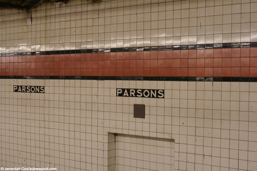
The platform and mezzanine columns are I-beams painted maroon-red and the wall tiles along the tracks have a vermilion trim-line with a black border and name tiles underneath them consisting of "PARSONS" in white lettering on a black background.[69][70] The tile band is part of a color-coded tile system used throughout the IND.[71] The tile colors were designed to facilitate navigation for travelers going away from Lower Manhattan. As such, a different tile color was originally used at Jamaica–179th Street, the next express station to the east. The red tiles used at the Parsons Boulevard station were also used at 169th Street, the only local station between Parsons Boulevard and 179th Street.[72][73] Some of the black columns separating the express tracks have white signs reading "Parsons" in black lettering.[74] There is a usually unstaffed signal tower on the southern end of the Manhattan-bound platform.[75]
Above the platforms is a full-length

Exits
The main entrance is at the north end of the station. It has a turnstile bank and a full-time token booth,[81] which had seven regular turnstiles as of 2007[update].[63] Two street stairs lead to either southern corner of Parsons Boulevard and Hillside Avenue, and a single staircase to the northwest corner.[4] This entrance formerly was the station's full-time entrance.[82][58]
The entrance at the south end is unstaffed; in 2007, it had three
Notes
- ^ The platforms at 75th Avenue and Sutphin Boulevard on the Queens Boulevard Line were lengthened to allow 11-car operation on the E and F routes. The subway cars on the IND were built to be 60 feet (18.3 m) long. These cars typically operated in 10-car trains, with an entire train length being 600 feet (182.9 m). When platforms at stations were lengthened to accommodate 11-car trains, the platforms had to be extended an additional car length, or 60 feet (18.3 m), making the platform at least 660 feet (201.2 m) long.[36]: 185
References
- ^ "Glossary". Second Avenue Subway Supplemental Draft Environmental Impact Statement (SDEIS) (PDF). Vol. 1. Metropolitan Transportation Authority. March 4, 2003. pp. 1–2. Archived from the original (PDF) on February 26, 2021. Retrieved January 1, 2021.
- ^ ISSN 0362-4331. Retrieved March 8, 2019.
- ^ "Annual Subway Ridership (2017–2022)". Metropolitan Transportation Authority. 2022. Retrieved November 8, 2023.
- ^ a b c "Parsons Boulevard Neighborhood Map" (PDF). mta.info. Metropolitan Transportation Authority. April 2018. Retrieved August 26, 2019.
- ^ See:
- Duffus, R.L. (September 22, 1929). "Our Great Subway Network Spreads Wider; New Plans of Board of Transportation Involve the Building of More Than One Hundred Miles of Additional Rapid Transit Routes for New York". The New York Times. ISSN 0362-4331. Retrieved August 19, 2015.
- Board of Transportation of the City of New York Engineering Department, Proposed Additional Rapid Transit Lines And Proposed Vehicular Tunnel, dated August 23, 1929
- Duffus, R.L. (September 22, 1929). "Our Great Subway Network Spreads Wider; New Plans of Board of Transportation Involve the Building of More Than One Hundred Miles of Additional Rapid Transit Routes for New York". The New York Times.
- ^ "Queens Lauded as Best Boro By Chamber Chief". The Brooklyn Daily Eagle. September 23, 1929. p. 40. Retrieved October 4, 2015.
- ISSN 0362-4331. Retrieved 2020-03-27.
- ISSN 0362-4331. Retrieved August 4, 2016.
- ^ "178th Street Subway Stop Now Assured. Place Is Designated for Station by Transportation Board" (PDF). Long Island Daily Press. December 1, 1930. p. 1. Retrieved April 25, 2019.
- ProQuest 1114650593.
- ^ a b "New Subway to Jamaica Ahead of Schedule Time". New York Daily News. September 17, 1933. Retrieved September 12, 2019.
- ISBN 978-0-7385-9785-0.
- ISSN 0362-4331. Retrieved December 11, 2016.
- The New York Sun. December 13, 1933. p. 47. Retrieved July 30, 2016.
- ^ a b "Trains Testing Jamaica Link Of City Subway". The Brooklyn Daily Eagle. April 10, 1937. p. 3. Retrieved April 24, 2018.
- ^ Neufeld, Ernest (August 23, 1936). "Men Toil Under Earth to Build Subway" (PDF). Long Island Daily Press. p. 2 (Section 2). Retrieved August 12, 2016.
- ^ See:
- "500 More Quit Subway Work On Boulevard: General Strike Order Issued Today; 72 Walk Out in Jamaica" (PDF). Long Island Daily Press. April 2, 1935. p. 2. Retrieved July 30, 2016.
- "Aldermen Probe Strike on Subway" (PDF). Long Island Daily Press. April 3, 1935. p. 4. Retrieved July 30, 2016.
- ^ "Last Jamaica Subway Stop May Be at 169th Street. Can't Have Expresses and Distance, Too, Official Says" (PDF). Long Island Sunday Press. April 26, 1936. p. 1. Retrieved April 25, 2019.
- ^ a b Neufeld, Ernest (August 23, 1936). "Men Toil Under Earth to Build Subway" (PDF). Long Island Daily Press. p. 2 (Section 2). Retrieved August 12, 2016.
- ^ a b c "Two Crews Rush to Finish Last 200 Feet of Subwav: Work Must End April 3 to Allow Time for Tests" (PDF). Long Island Daily Press. March 19, 1937. p. 1. Retrieved April 25, 2019.
- ISSN 0362-4331. Retrieved April 26, 2016.
- ^
- "Subway Link Opens Soon: City Line to Jamaica Will Start About April 24" (PDF). The New York Times. March 17, 1937. ISSN 0362-4331. Retrieved June 27, 2015.
- "Trial Run to Jamaica on Subway Tomorrow: Section From Kew Gardens to 169th Street Will Open to Public in Two Weeks" (PDF). The New York Times. April 9, 1937. ISSN 0362-4331. Retrieved June 30, 2015.
- "Subway Link Opens Soon: City Line to Jamaica Will Start About April 24" (PDF). The New York Times. March 17, 1937.
- ProQuest 1267763254.
- ISBN 978-0-915276-50-9.
- ProQuest 1222259975.
- ^ "Jamaica Will Greet Subway" (PDF). The New York Sun. April 23, 1937. p. 8. Retrieved April 24, 2018.
- ISSN 0362-4331. Retrieved August 4, 2016.
- ^ "LaGuardia Heads Speakers Marking Subway Opening Ceremonies Planned Saturday Celebrating Hillside Avenue Extension" (PDF). North Shore Daily Journal. April 23, 2017. p. 3. Retrieved November 19, 2017.
- ^ See:
- Linder, Bernard (December 2008). "Sixth Avenue Subway Service Changes". New York Division Bulletin. 51 (12). Electric Railroaders' Association: 2–4. Retrieved August 6, 2016.
- "New 6th Ave. Tube Will Be Boon to Queens Residents". The Brooklyn Daily Eagle. December 8, 1940. p. 10. Retrieved October 4, 2015.
- ^ .
- ISSN 0362-4331. Retrieved June 30, 2015.
- ^ See:
- "New Subway Link Opening in Queens" (PDF). The New York Times. December 12, 1950. ISSN 0362-4331. Retrieved June 30, 2015.
- "Subway Extension In Queens Is Voted" (PDF). The New York Times. August 2, 1946. ISSN 0362-4331. Retrieved June 30, 2015.
- "New Subway Link Opening in Queens" (PDF). The New York Times. December 12, 1950.
- ^ "All 'F' Trains Will Run to 179 Street". Long Island Star-Journal. Fultonhistory.com. October 4, 1951. p. 1. Retrieved 12 August 2016.
- ^ "Queens Subway Changes: Parsons Boulevard, 179th Street Stations Are Accepted" (PDF). New York Times. October 4, 1951. Retrieved January 25, 2016.
- ISBN 9780801879227.
- ^ ISSN 0362-4331. Retrieved January 25, 2016.
- ^ Report. New York City Transit Authority. 1953.
- ^ "16-Point Plan Can Give Boro Relief Now". Long Island Star–Journal. August 10, 1962. Retrieved April 24, 2018.
- ISSN 0362-4331. Retrieved 2019-12-25.
- ^ Cox, Jeremiah (January 3, 2012). "An old adopt a station sign for the Hillcrest High School for cleaning I suppose, don't think this program still exists". subwaynut.com. Retrieved August 26, 2019.
- ISSN 0362-4331. Retrieved 2019-12-25.
- ISSN 0362-4331. Retrieved July 5, 2009.
- ^ See:
- "New York City Transit Authority Committee Agenda February 1989". Flickr. New York City Transit Authority. February 17, 1989. p. K-1. Retrieved September 16, 2019.
- "New York City Transit Authority Committee Agenda February 1989". Flickr. New York City Transit Authority. February 17, 1989. p. K-2. Retrieved September 16, 2019.
- "New York City Transit Authority Committee Agenda February 1989". Flickr. New York City Transit Authority. February 17, 1989. p. K-7. Retrieved September 16, 2019.
- ISSN 0362-4331. Retrieved June 6, 2016.
- Urban Mass Transit Administration. May 1990. Retrieved August 13, 2016.
- ^ Archer Avenue Corridor Transit Service Proposal. New York City Transit Authority, Operations Planning Department. August 1988.
- ^ Polsky, Carol (December 11, 1988). "New Subway Line Finally Rolling Through Queens". Newsday.
- ^ "Archer Avenue Extension Opens December 11". Welcome Aboard: Newsletter of the New York City Transit Authority. 1 (4). New York City Transit Authority: 1. 1988.
- ^ a b "Service Change Monitoring Report Six Month Evaluation of F/R Queens Boulevard Line Route Restructure" (PDF). www.laguardiawagnerarchive.lagcc.cuny.edu. Metropolitan Transportation Authority. April 1993. Retrieved December 28, 2018.
- ^ "Service Changes September 30, 1990" (PDF). subwaynut.com. New York City Transit Authority. September 30, 1990. Archived from the original (PDF) on October 26, 2014. Retrieved May 1, 2016.
- ^ "Van Wyck Blvd Station" (PDF). www.laguardiawagnerarchive.lagcc.cuny.edu. Metropolitan Transportation Authority. May 1992. Retrieved December 28, 2018.
- ^ "October 1992 New York City Subway Map". Flickr. New York City Transit Authority. October 1992. Retrieved October 30, 2016.
- ^ "An Examination of the Finances of the Metropolitan Transportation Authority April 2003" (PDF). Office of the State Deputy Comptroller for the City of New York. April 2003. p. 35. Retrieved August 26, 2019.
- ^ Newman, Philip (August 6, 2003). "Closing of token booths draws near for borough". Queens Courier. Retrieved August 26, 2019.
- ^ Newman, Philip (August 13, 2003). "MTA to close token booths at 9 boro sites". Queens Courier. Retrieved August 26, 2019.
- ^ Markowitz, Michael (February 24, 2003). "Token Booth Closings". Gotham Gazette. Retrieved August 26, 2019.
- ^ a b c d "Parsons Boulevard Token Booth Closure" (PDF). mta.info. 2003. Archived from the original (PDF) on May 18, 2003. Retrieved August 26, 2019.
- ^ Whitford, Emma (January 8, 2016). "MTA Will Completely Close 30 Subway Stations For Months-Long "Revamp"". Gothamist. Archived from the original on August 1, 2016. Retrieved July 18, 2016.
- ^ "MTAStations" (PDF). governor.ny.gov. Government of the State of New York. Retrieved July 18, 2016.
- ISSN 0099-9660. Retrieved April 3, 2018.
- ^ "Press Release - MTA Headquarters - MTA Announces 20 Additional Subway Stations to Receive Accessibility Improvements Under Proposed 2020-2024 Capital Plan". MTA. December 19, 2019. Retrieved December 20, 2019.
- ^ a b c d "Chapter 17: Transit and Pedestrians". Jamaica Rezoning Final Environmental Impact Statement (PDF). New York City Department of City Planning. 2007. p. 17.4. Retrieved April 1, 2021.
- ^ OCLC 49777633 – via Google Books.
- ^ "F Subway Timetable, Effective August 28, 2023". Metropolitan Transportation Authority. Retrieved August 26, 2023.
- ^ "E Subway Timetable, Effective December 4, 2022". Metropolitan Transportation Authority. Retrieved August 26, 2023.
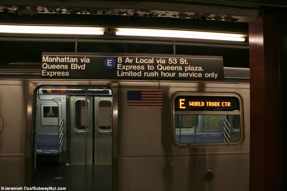
- ^ Cox, Jeremiah (January 3, 2012). "A limited rush hour service E train stopped on the express track beneath its sign". subwaynut.com. Archived from the original on August 15, 2017. Retrieved August 15, 2017.
- ^ "Subway Map" (PDF). Metropolitan Transportation Authority. September 2021. Retrieved September 17, 2021.
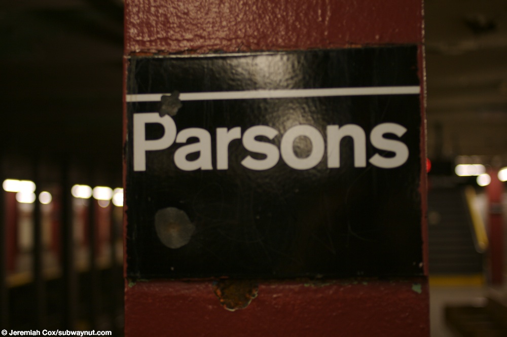
- ^ Cox, Jeremiah (June 2, 2008). "A close up of the 'parsons' text on a column at Parsons Blvd". subwaynut.com. Archived from the original on March 9, 2016. Retrieved August 15, 2017.
- ^ Cox, Jeremiah (June 2, 2008). "The orange wall trim that's three tiles wide and the 1/2 tile black border with Parsons letting one full tile below it along the local track walls at Parsons Blvd". subwaynut.com. Archived from the original on March 9, 2016. Retrieved August 15, 2017.
- from the original on July 1, 2022. Retrieved July 1, 2022.
- ^ Carlson, Jen (February 18, 2016). "Map: These Color Tiles In The Subway System Used To Mean Something". Gothamist. Retrieved May 10, 2023.
- ^ Gleason, Will (February 18, 2016). "The hidden meaning behind the New York subway's colored tiles". Time Out New York. Retrieved May 10, 2023.
- ^ Cox, Jeremiah (June 2, 2008). "Original, now very dirty, black lettering on a white background 'Parsons' signs are still intact along the columns between the express tracks". subwaynut.com. Retrieved August 26, 2019.
- ^ Cox, Jeremiah (February 9, 2004). "Looking down towards the very end of the Jamaica-bound platform at Parsons Blvd". subwaynut.com. Retrieved August 26, 2019.
- ^ a b Cox, Jeremiah (June 2, 2008). "A view down the mezzanine to the HEET exit to 153 Street at Parsons Blvd". subwaynut.com. Retrieved August 26, 2019.
- ^ Cox, Jeremiah (January 3, 2012). "This non-public area has been built in a portion of the middle of the mezzanine". subwaynut.com. Retrieved August 26, 2019.
- ^ Cox, Jeremiah (January 3, 2012). "The long out of fare control passageway to the 24 hour booth". subwaynut.com. Retrieved August 26, 2019.
- ^ Cox, Jeremiah (January 3, 2012). "There is a fenced off storage area at the Parson's Blvd end of the mezzanine". subwaynut.com. Retrieved August 26, 2019.
- ^ "August 8, 2007 Storm Report" (PDF). Metropolitan Transportation Authority. September 20, 2007. Archived from the original (PDF) on October 29, 2007. Retrieved October 27, 2007.
- ^ Cox, Jeremiah (January 3, 2012). "The one station token booth, the mezzanine is so wide it is just plopped in the middle of it". subwaynut.com. Retrieved August 26, 2019.
- ^ Cox, Jeremiah (January 3, 2012). "Exit to 153 St or the 24 hour booth, an old Standard font sign". subwaynut.com. Retrieved August 26, 2019.
External links
- nycsubway.org – IND Queens Boulevard Line: Parsons Boulevard (179th Street Branch)
- Station Reporter — F Train
- The Subway Nut — Parsons Boulevard Pictures
- Parsons Boulevard entrance from Google Maps Street View
- 153rd Street entrance from Google Maps Street View
- Platforms from Google Maps Street View