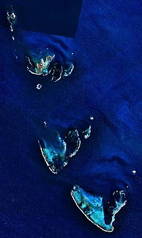
Pelsaert Island
Pelsaert Island is one of the islands of the Pelsaert Group, which is the southernmost of the three groups of islands that make up the Houtman Abrolhos island chain in Western Australia.
Nominally located at 28°54′S 113°54′E / 28.900°S 113.900°E,[1] it consists of a number of islands, the largest of which are Gun Island, Middle Island, and Pelsaert Island itself.
The group and island is named by the captain of HMS Beagle, which was charting the area, after the commodore Francisco Pelsaert of the Dutch East India Company trading fleet whose ship, the "Batavia" got wreched at sank at the Wallabi island group to the north. The captain saw a wreck on the island, mistakenly assumed it was the Batavia and named it after Pelsaert.[2][3]
The island is a significant bird site.[4][5][6]
The island and group contains the most southerly true
See also
References
- ^ "Pelsaert Group". Gazetteer of Australia online. Geoscience Australia, Australian Government.
- ISBN 978-1-875560-32-5)
{{citation}}: CS1 maint: multiple names: authors list (link) CS1 maint: numeric names: authors list (link - ISBN 978-1-86471-134-9
- ^ Australian Broadcasting Corporation. Radio National (5 June 2008), Abrolhos birds, Australian Broadcasting Corporation, retrieved 17 January 2016
- ISSN 1448-5540
- ISBN 978-0-7244-8590-1)
{{citation}}: CS1 maint: multiple names: authors list (link) CS1 maint: numeric names: authors list (link - ^ "Houtman Abrolhos". oceandots.com. Archived from the original on 23 December 2010. Retrieved 13 October 2007.


