
Plainwell, Michigan
Plainwell, Michigan | ||
|---|---|---|
FIPS code 26-64740[2] | | |
| GNIS feature ID | 0635077[3] | |
| Website | www | |
Plainwell is a city in
Plainwell is located on M-89 just east of its junction with US 131. The city of Otsego is about three miles (4.8 km) to the west. The city of Kalamazoo is about ten miles (16 km) to the south, and the city of Grand Rapids is about thirty-five miles (56 km) to the north. The Kalamazoo River flows through the center of the city and it is known as "The Island City".[5]
History
This part of Michigan was settled in the 1830s, after the removal of native people. Allegan County was organized in 1835, and the Plainwell area was settled soon after. It was on a stagecoach route from Kalamazoo to Grand Rapids, and later the Grand Rapids and Indiana Railroad was constructed along the same route. After the advent of the automobile, U.S. Route 131 was created and run through the town. In the 1960s, an improved 4-lane US-131 was built west of town to connect Kalamazoo and Grand Rapids, with an interchange on M-89 between Plainwell and Otsego. This allowed the town to become a kind of "bedroom community" for Kalamazoo or the southern part of Grand Rapids.
The city is home to a local
Geography
According to the United States Census Bureau, the city has a total area of 2.06 square miles (5.34 km2), of which 1.98 square miles (5.13 km2) is land and 0.08 square miles (0.21 km2) is water.[8] The nickname Island City has to do with a power canal which diverts a portion of the Kalamazoo River around the downtown area, causing it to be an island.
Major highways
 US 131 is a freeway that is located in the western portion of the city.
 M-43 follows M-89 for most of its route in Plainwell, but soon has a concurrency with U.S. 131 just before the city line.
 M-89 has a concurrency with M-43 for most of its route in Plainwell, but continues west alone into Otsego.
Demographics
| Census | Pop. | Note | %± |
|---|---|---|---|
| 1870 | 1,035 | — | |
| 1880 | 1,356 | 31.0% | |
| 1890 | 1,414 | 4.3% | |
| 1900 | 1,318 | −6.8% | |
| 1910 | 1,493 | 13.3% | |
| 1920 | 2,049 | 37.2% | |
| 1930 | 2,279 | 11.2% | |
| 1940 | 2,424 | 6.4% | |
| 1950 | 2,767 | 14.2% | |
| 1960 | 3,125 | 12.9% | |
| 1970 | 3,195 | 2.2% | |
| 1980 | 3,751 | 17.4% | |
| 1990 | 4,057 | 8.2% | |
| 2000 | 3,933 | −3.1% | |
| 2010 | 3,804 | −3.3% | |
| 2020 | 3,788 | −0.4% | |
| U.S. Decennial Census[9] | |||
2010 census
As of the
There were 1,561 households, of which 32.4% had children under the age of 18 living with them, 44.3% were married couples living together, 13.6% had a female householder with no husband present, 4.0% had a male householder with no wife present, and 38.1% were non-families. 33.1% of all households were made up of individuals, and 12.1% had someone living alone who was 65 years of age or older. The average household size was 2.33 and the average family size was 2.97.
The median age in the city was 38.7 years. 23.8% of residents were under the age of 18; 9.4% were between the ages of 18 and 24; 24.2% were from 25 to 44; 26.6% were from 45 to 64; and 15.9% were 65 years of age or older. The gender makeup of the city was 46.7% male and 53.3% female.
2000 census
As of the
There were 1,506 households, out of which 35.7% had children under the age of 18 living with them, 50.7% were married couples living together, 13.1% had a female householder with no husband present, and 32.4% were non-families. 26.8% of all households were made up of individuals, and 10.0% had someone living alone who was 65 years of age or older. The average household size was 2.48 and the average family size was 3.01.
In the city, the population was spread out, with 26.5% under the age of 18, 7.9% from 18 to 24, 30.2% from 25 to 44, 19.8% from 45 to 64, and 15.7% who were 65 years of age or older. The median age was 36 years. For every 100 females, there were 91.3 males. For every 100 females age 18 and over, there were 87.5 males.
The median income for a household in the city was $39,590, and the median income for a family was $44,519. Males had a median income of $35,785 versus $26,397 for females. The
Education
K-12 Students are served by the Plainwell School District. There are two high schools, Plainwell High School, and Renaissance High School. Renaissance is the alternative education high school. There is only one middle school, Plainwell Middle School. The school district has three elementary schools. They are Cooper Elementary, Gilkey Elementary, and Starr Elementary.
Michigan Career and Technical Institute is also located nearby.
Notable people
- Jack Conklin, American football offensive tackle
- Dave Coverly, syndicated cartoonist
- Mallory Comerford, competitive swimmer
- Ed Gale, actor and child predator
- Narada Michael Walden, singer, songwriter, musician, and record producer
See also
- Impact of the 2019–20 coronavirus pandemic on the meat industry in the United States
References
- ^ "2020 U.S. Gazetteer Files". United States Census Bureau. Retrieved May 21, 2022.
- ^ a b "U.S. Census website". United States Census Bureau. Retrieved 2008-01-31.
- ^ U.S. Geological Survey Geographic Names Information System: Plainwell, Michigan
- ^ "Plainwell city, Michigan - Census Bureau Profile". United States Census Bureau. Retrieved 11 February 2024.
- ^ "City of Plainwell official website". Retrieved 17 April 2012.
- Mlive.
- Mlive.
- ^ "US Gazetteer files 2010". United States Census Bureau. Archived from the original on 2012-01-25. Retrieved 2012-11-25.
- ^ "Census of Population and Housing". Census.gov. Retrieved June 4, 2015.
- ^ "U.S. Census website". United States Census Bureau. Retrieved 2012-11-25.
External links
Municipalities and communities of Allegan County, Michigan, United States | ||
|---|---|---|
| Cities | 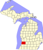 | |
| Villages | ||
| Charter township | ||
| General law townships | ||
| CDP |
| |
| Other communities |
| |
| Indian reservation | ||
| Footnotes | ‡This populated place also has portions in an adjacent county or counties | |
| ||
| International | |
|---|---|
| National | |