
Port of Kolkata
| Syama Prasad Mookerjee Port, Kolkata | |
|---|---|
Ministry of Ports, Shipping and Waterways, Government of India | |
| Type of harbour | Coastal breakwater, riverine, large seaport |
| Size | 4,500 acres (18 km2)[2] |
| No. of berths | 34 (Kolkata)[3] 17 (Haldia)[4] |
| No. of wharfs | 86 |
| Draft depth | Kolkata: 8.5 metres (28 ft) Haldia: 9 metres (30 ft) |
| Employees | 3,600[2] |
| Main trades | Automobiles, motorcycles and general industrial cargo including iron ore, granite, coal, fertilizers, petroleum products, and containers Major exports: Iron ore, leather, cotton textiles Major imports: Wheat, raw cotton, machinery, iron & steel |
| Stacking area | 134722 sqm |
| Water depth | 12.5 metres (41 ft) (KDS and HDC) |
| Statistics | |
| Vessel arrivals | 3670 (2017–18)[5][6] |
| Annual cargo tonnage | 66.4 million tonnes(2023–24)[7][8] |
| Annual container volume | 844,762 (2019–20)[9][10]TEUs[11] |
| Passenger traffic | 1,049 (2022–23)[12] |
| Annual revenue | ₹29.85 billion (US$370 million) (2022–23)[13][14][15] |
| Net income | ₹5.01 billion (US$63 million) (2023–24)[7][13][16] |
| Website www | |
Port of Kolkata or Kolkata Port, officially known as Syama Prasad Mookerjee Port (formerly Kolkata Port Trust or Port of Calcutta), is the only riverine major port in India,
In the 19th century, the Kolkata Port was the premier port in
It has a vast hinterland comprising the entire North East of India including
History
Early time
In the early 16th century, Since the arrival of the
Kolkata was a small river port inhabited by weavers and artisans before it was developed as a center for maritime trade by the
Company Rule: 1773–1857

In the early
In the 1820s, several plans were made to build floating docks in Kolkata and Diamond Harbour, but none of them materialised. When the disastrous cyclone of 1842 caused extensive damage to ships anchored in Kolkata harbour, the issue of dock construction came into discussion again. But modernization of the Port of Kolkata was overshadowed by a failed attempt to establish a new port (Port canning) on Matla River in the 1860s. Port canning scheme is formulated from an alternative thought of the entrepreneurs. From a business point of view, they believed that river silting problems would lead to the premature death of the Port of Kolkata, just as the Port of Saptagram on the Hooghly River had died three hundred years earlier.But Kolkata became a very important city for the British, so they abandoned the plan to establish a port on Matla River. To bring more efficiency to the management of the Port of Kolkata, the government was active in setting up the Port Trust, which provided a solid base for the British Empire's trade in India.[22]

After slavery was abolished in 1833, there was a high demand for labourers on sugar cane plantations in the British Empire. From 1838 to 1917, the British used this port to ship off over half a million Indians from all over India – mostly from the
British India: 1857–1947


As Kolkata grew in size and importance, merchants in the city demanded the setting up of a port trust in 1863. The disastrous cyclone of 1864 caused extensive damage to Kolkata port and the city of Kolkata. During this time ships anchored in Kolkata Harbor were damaged and destroyed. According to the then documents published by the British rulers, at that time the damage in the storm in the city of Kolkata alone exceeded 99 thousand rupees. Belvedere Estate, Judge's Court, European Lunatic Hospital, and many famous institutions of Calcutta were destroyed in the violence of nature. The Hooghly River was witnessing high tides up to a height of about 40 feet (12 m). After this incident there was a strong demand for the construction of a permanent dock. The colonial government formed a River Trust in 1866, but it soon failed, and administration was again taken up by the government. Finally, in 1870, the Calcutta Port Act (Act V of 1870) was passed, creating the offices of Calcutta Port Commissioners. At that time Calcutta port had only four jetties and one wharf for unloading cargo, which could berth 52 ships and had a total capacity of 48,000 tons. In 1871–72, the number of jetties had increased to 6, with a berth of 143 ships and a cargo capacity of 222,000 tons. The length of the wharf also increases significantly. Commodities such as crops, seeds and raw materials and mainly jute products were moved through this wharf. In the 1870s, rapidly increasing tea exports from Assam and North Bengal necessitated the construction of a warehouse on Strand Bank Island.[22]

A wet dock was set up at Kidderpore (Khidirpur) in 1892. This was the result of persistent demands by the merchant community of Kolkata. As cargo traffic at the port grew, so did the requirement of more kerosene, leading to the building of a petroleum wharf at Budge Budge in 1896. The Khidirpur Dock II was completed in 1902. During the twenty years before the World War I, a remarkable development was observed in the import-export sector through the Port of Kolkata. Coastal trade also developed significantly, particularly in the export of coal. After the partition of Bengal in 1905, the government of Eastern Bengal and Assam developed Port of Chittagong as a rival to Kolkata, but it was not very fruitful. In 1925, the Garden Reach jetty was added to accommodate greater cargo traffic.[22]
Although hampered by the Great Depression during the period between the two
India: 1947–present
The port facilities were devalued during the
The port is part of the 21st Century Maritime Silk Road that runs from the Chinese coast via the Suez Canal to the Mediterranean, there to the Upper Adriatic region of Trieste with its rail connections to Central and Eastern Europe.[27][28][29]
Dock systems
The Kolkata Port Trust (KoPT) manages two separate dock agglomerations, the Kolkata Dock System (KDS) and the Haldia Dock Complex (HDC). These two dock systems are located on the banks of the Hooghly River, giving the port the distinction of being India's only riverine major port.[30]
Kolkata Dock System

It is situated on the left bank of the
Vessels to enter Khidirpur Dock (KPD) and Netaji Subhash Dock (NSD) of the Kolkata Dock System first wait for tides at the anchorage at Nazirganj Flats, north of Garden Reach. 5 ships can be anchored together in this anchorage. When the water level of the river reaches the level of the Kolkata Dock System (KDS) water level due to tidal action, the ships waiting at the anchorage enter Khidirpur Dock (KPD) and Netaji Subhash Dock (NSD) through lock-gates.[30][32]
Kidderpore Dock (KPD)

Kidderpore Dock has a total of 18 berths, including 17 multipurpose berths and 1 berth for passenger ships including cargo; 6
Netaji Subhas Dock (NSD)

Netaji Subhas Dock (NSD) has a total of 10 berths, including 1 heavy lift berth, 4 dedicated container berths, 1 liquid cargo berth and 4 multipurpose berths; 2
Budge Budge River Moorings
Budge Budge River Mooring or Budge Budge Petroleum Wharves is one of the earliest cargo handling facilities built on the
Haldia Dock Complex
The Haldia Dock Complex is situated at around 60 kilometres (37 mi) away from the pilotage station. It is developed as a subsidiary port system of the Kolkata Dock System in Kolkata. It is better known as Haldia Port. The maximum water depth in this Dock Complex is 12.5 meters (41 ft), which provides the ability to anchor ships up to 277 meters (909 ft) long. It is connected to the deep sea by the Western Channel, with an average depth of 8.3 meters (27 ft); therefore, the dock area is capable of anchoring ships up to 230 meters (750 ft) long.
The complex consists of a dock, oil and barge jetty and Haldia anchorage. The dock complex has a total of 14 berths and 3 oil jetties; Berths are inside docks with lock-gate and jetties are located on the
The jetties on the
Dry Dock
| Dock | Dry Dock Number |
Size |
|---|---|---|
| Netaji Subhas Dock | 1 | 172.21 metres (565.0 ft) x 22.86 metres (75.0 ft) |
| 2 | 172.21 metres (565.0 ft) x 22.86 metres (75.0 ft) | |
| Kidderpore Dock | 1 | 160.02 metres (525.0 ft) x 19.5 metres (64 ft) |
| 2 | 142.95 metres (469.0 ft) x 19.5 metres (64 ft) | |
| 3 | 102.1 metres (335 ft) x 14.63 metres (48.0 ft) |
KoPT has the largest

There is a fully-fledged repair workshop including Diesel Engine Overhauling Unit, Structural Shop, Heavy and Light Machine Shop, Forging Shop, Electrical Shop and a Chain Testing/Repair Shop with 2500 KN capacity Tensile Compression Testing Machine to support various activities in the dry dock.[37] Electric Level Luffing Cranes of 5 tonne and 7 tonne capacities are used at Dry Dock No. 1 and No. 2 of Kiddirpore Dock respectively, operating area radius of which area 20 m (66 ft) and 25.42 m (83.4 ft) respectively. 4 cranes are used at Netaji Subhash Dock, which includes 1 Electric Level Luffing Crane and 3 Electric Cranes. The Electric Level Luffing Crane has a capacity of 25 tons and a operating area radius of 15.25 m (50.0 ft); on the other hand, 2 of the electric cranes have a capacity of 3 and 6 tons and the other is of 3 ton capacity.[37]
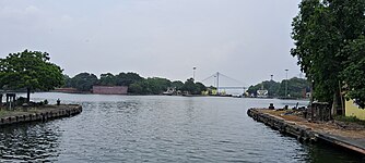
Port channel
.jpg)
The port has a 232 kilometers (144 mi) long
Port of Kolkata has two entrances from the sea, one is the Eastern Channel and the other is the Western Channel. At present the eastern channel is used for ships bound for Kolkata, while the western channel is used for navigation by ships bound for Haldia. The Eastern Channel is longer than the Western Channel (more than twice), so this channel has the most submerged Sandbars. Notable submerged Sandbars in the Eastern Channel are Sankrail Sandbar, Baj Baj Sandbar, Royapur Sandbar, Falta Sandbar, Nurpur Sandbar, Rangafala Sandbar, Korapara Sandbar, Bedford Sandbar (upper and lower) and Long Sandbar (upper and lower);[38][39] natural depth of water at Falta is 3 meters (9.8 ft). The Eastern Channel is divided into several smaller channels; smaller channels are mainly divided by submerged Sandbars.[39] The offshore portion of the Eastern Channel is known as the Gaspar Channel, which has a minimum natural depth of 7 meters (23 ft), and the portion of the Hooghly River that extends from the Sagar Road to Diamond Harbor is divided into two smaller channels – the Bedford Channel and the Rangafala Channel. The Western Channel is divided into three main smaller channels, namely Eden Channel, Upper and Lower Jellingham Channel and Haldia Channel.[38][39] Balari Channel is situated upstream of Haldia Channel.[39] The Balari Channel was formerly navigable, serving as a link between the Eastern Channel and the Western Channel; but in the latter part of the last century it was declared unnavigable and abandoned by the port authority due to excessive siltation.[39]
The depth of the channel depends on the flow of water in the
| Depth | Kolkata | Diamond Harbor | Sagar Road | Haldia | Sandheads | |
|---|---|---|---|---|---|---|
| Natural depth | Minimum | 3 metres (9.8 ft) | 5.2 metres (17 ft) | 6.4 metres (21 ft) | 4.3 metres (14 ft) | 50 metres (160 ft) |
| Depth during tides | Maximum | 8.5 metres (28 ft) | 9.5 metres (31 ft) | 10 metres (33 ft) | 9 metres (30 ft) | 50 metres (160 ft) |
| Average | 7.1 metres (23 ft) | 8.3 metres (27 ft) | 50 metres (160 ft) | |||
Pilotage

Due to the constraints of the river (like
All vessels approaching Sandhead in the vicinity of the Eastern Channel Light Vessels communicate with the pilot station at
A pilot vessel/station is maintained at Sagar Road. The river pilot takes over the ship from Middleton Point in the channel and proceeds up the river. On arrival at
Automatic Tide Gauges, and River Marks and Buoys
All Automatic Tide Gauges in the channel are operated and maintained by the port. These tide gauges are located near Garden Reach and Diamond Harbor on the east bank of the channel and Haldia on the west bank. For the round-the-clock recording of tidal data, which is used for the prediction of tides and preparation of tide tables by Survey of India.[43]
A total of 500 (of which 140 are lighted) River Marks and Buoys are maintained by the KoPT. These are extremely useful in facilitating night navigation, pilotage and dredging. These lights are operated either by grid electricity, by battery or by dissolved Marine Acetylene Gas. There is also 1 boat buoy, 30 lighted buoys and 72 unlit buoys marking the navigational channel from Sandheads to Kolkata. It has one of the longest navigational channels in the world.[43]
Lighthouse
- Sagar Lighthouse is situated at Middleton Point on the Sagar Island 1.5 kilometres (0.93 mi) inshore. It is visible from a distance of 28 kilometres (17 mi) in clear weather.[18]
- Dariapur Lighthouse is situated on the right bank of Hooghly River south of Rasulpur river and about 2.7 kilometres (1.7 mi) inshore. It is visible from a distance of 35 kilometres (22 mi) in clear weather.[18]
Light Vessels
There are five unmanned light vessels, located south of the Sagar lighthouse. These unmanned light-vessels help vessels navigating the channel safely from the sandheads to the Sagar. There are five unmanned light vessels on the south towards of the Sagar lighthouse are the U.G.L.F. located at 21°29′51″N and 88°06′36.5″E, L.G.L.F. located at 21°21'54" N and 088°09'34" E, Talent WK L.V. located at 21°21'54" N and 088°09'34" E, Eastern Channel L.V. located at 21°17'00" N and 088°11'25" E, and Western Channel L.V located at 21°05'002" N and 087°50'24.8" E.[32][43]
Semaphores
These are maintained at Akra, Moyapur, Hooghly Point, Balari, Gangra and Sagar for displaying rises of tide for the convenience of various vessels navigating, dredging and surveying in the River Hooghly. The semaphores used to display the tide level at these localities on a mast by the position of the meter and decimeter arms which were manually rotated with the rise and fall of every decimeter of tidal level. However these semaphores are no longer functional and instead, tidal levels are broadcast over VHF radio every half an hour from all the above stations except at Balari.[43]
Differential Global Positioning System
In the wide estuary, position fixing with reference to shore objects to be viewed from the deck of a vessel, is very difficult. In 1983 KoPT introduced the Electronic Position Fixing System "
Connectivity
Railway
Kolkata Dock System Railway (KDS Railway)
KDS Railway was set up to cater to the traffic needs for docks, warehouses in the vicinity and various public and private sidings located around the Kolkata docks system. It works as a terminal agent of Indian Railways and operationally under Sealdah Division of Eastern Railway. KDS Rly has a working Agreement with Eastern Railway and render services to the users on behalf of them. Though KDS railway initially had many interfaces with Eastern Railway/South Eastern Railway and covered a wide range of area including Chitpur, Shalimar, and Garden Reach, at present its operation is truncated in the dock area only with the sole marshalling yard at East Dock Junction (EJC). The total track length of KDS railway is about 18 km (11 mi).[44]
It is connected with Eastern Railway through the Majerhat railway station. Indian Railways bring traffic for KDS through full fledged goods trains (rakes) in the East Dock Junction (EJC), by their locomotives. Thereafter KDS railway, after necessary documentation and certain mechanical work, place the trains in the respective handling points (inside docks or private sidings), in full or installments as per operational feasibility. After completion of loading/unloading operation at Sheds/Docks/sidings etc, the rakes are hauled out and outward trains are formed at the marshalling yard (EJC). Again, after documentation, the outward rakes are dispatched by the locomotives provided by Eastern Railway.[44]
Haldia Dock Complex Railway (HDC Railway)
HDC Railway was established to cater to the traffic demand for warehouses and sidings of
Road
The Kolkata dock system (KDS) is connected to roads under the Kolkata Municipal Corporation. Major congestion and traffic jams are seen on the narrow roads for vehicular movement in and out of the KDS. KDP and NSD are located about 10 km from the junction of National Highway 16 and National Highway 19. The junction of National Highway 12 and Airport Road is about 25 km from the dock area. Diamond Harbor Road, Taratala Road and Garden Reach Road (Peripheral Road) are 4-lane, and have been strengthened and upgraded, but are often congested due to the simultaneous movement of local and cargo traffic.[30]
Haldia Dock Complex is directly connected to National Highway 116 (Old, NH-41). This National Highway connects with National Highway 16 (Old, NH-6) part of Golden Quadrilateral at Kolaghat, which making the dock complex accessible to other states of the country including Odisha, Jharkhand.[46]
Waterway
The Kolkata Dock System and Haldia Dock Complex are directly connected to National Waterway 1, which provides the port with waterway connectivity to North India. This waterway transports goods directly from Port of Kolkata to Varanasi and Sahebganj terminals. Besides, it is connected with the river ports of Bangladesh and North-Eastern Indian state of Assam through National Waterway 97.[46]
Statistics
In the
The average turn around time per vessel was 4.18 days for Kolkata Dock System and 3.37 for Haldia Dock Complex.[48][49]
| Category | 2014–15 | 2013–14 | 2012–13 | 2011–12 | Unit |
|---|---|---|---|---|---|
| Containers (number) | 630,094 | 562,020 | 600,426 | 552,241 | TEUs |
| Import Cargo | 36.25 | 27.42 | 27.02 | 27.97 | million metric tonnes |
| Export Cargo | 10.05 | 13.96 | 12.91 | 15.28 | million metric tonnes |
| Passenger Traffic | 39,552 | 42,514 | 40,349 | 52,239 | |
| Number of Ships Handled | 3,230 | 3,225 | N/A | N/A |
| Category | 2014–15 | 2013–14 | 2012–13 | 2011–12 | 2010–11 |
|---|---|---|---|---|---|
| Operating Income | ₹18.68 billion (US$230 million) | ₹18.96 billion (US$240 million) | ₹14.02 billion (US$180 million) | ₹16.93 billion (US$210 million) | ₹16.07 billion (US$200 million) |
| Operating Expenditure | ₹19.36 billion (US$240 million) | ₹19.66 billion (US$250 million) | ₹17 billion (US$210 million) | ₹15.55 billion (US$190 million) | ₹14.63 billion (US$180 million) |
| Net Surplus | ₹−685 million (US$−8.6 million) | ₹−702 million (US$−8.8 million) | ₹−2.98 billion (US$−37 million) | ₹1.38 billion (US$17 million) | ₹1.44 billion (US$18 million) |
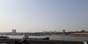
Gallery
-
 A Ship in the Hooghly River, the approache channel of the Port of Kolkata
 -
 Tidal Basin of Kidderpore Dock
 -
 View of Eastern part (KDP-2) of Kidderpore Dock
 -
 Kidderpore Dock of the Port of Kolkata
 -
 Clock Tower Kidderpore Dock
 -
 A ship berthing at the western part (KPD-1) of Kidderpore Dock.
 -
 Plaques of Indenture Memorial, Kidderepore


See also
- Farakka Port
- Ports in India
- Ports in West Bengal
- Sagar Port
- Tajpur Port
References
- ^ "UN/LOCODE (IN) India". www.unece.org. Retrieved 11 September 2020.
- ^ a b "Kolkata Port Trust to lease area as big as London Docklands". www.livemint.com. 26 February 2020. Retrieved 29 February 2020.
- ^ "BERTH PARTICULARS". Retrieved 21 December 2021.
- ^ "Terminals". Retrieved 21 December 2021.
- ^ "Top ports record marginal upswing in FY19 cargo handling at 699 MT". economictimes.indiatimes.com. 7 April 2019. Retrieved 7 January 2020.
- ^ "Kolkata Port Trust – Cargo Statistics". Kolkata Port Trust. Retrieved 13 June 2017.
- ^ a b "Kolkata Port profit jumps 65pc to Rs 501cr in FY'24, records all-time high cargo handling". The Economic Times. 4 April 2024. Retrieved 5 April 2024.
- ^ "Kolkata Port achieves all-time high cargo ( 65.66 MT) handling in 2022–23". www.indiablooms.com. India Blooms News Service. Retrieved 14 April 2023.
- ^ "SYAMA PRASAD MOOKERJEE PORT (SMP), KOLKATA ADMINISTRATIVE REPORT FOR THE YEAR 2019–2020". Retrieved 9 March 2021.
- ^ "Containers handled at major ports up 8% at 9.876 million TEUs in FY19". Business Line. 3 April 2019. Retrieved 7 January 2020.
- ^ "India's major ports see 6.7 percent growth in container volumes". JOC.co. 7 April 2015. Retrieved 27 June 2015.
- ^ a b "Passenger Traffic at Kolkata Port". Kolkata Port Trust. Retrieved 18 January 2019.
- ^ a b "Annual Accounts and Audit Report There On For 2022–2023". Retrieved 20 March 2024.
- ^ Ishita Ayan Dutt (4 April 2023). "Syama Prasad Mookerjee Port, India's oldest, posts highest cargo, surplus". www.business-standard.com. Kolkata: Business Standard. Retrieved 16 April 2023.
- ^ "Calcutta Port Trust posts 26% surplus hike". www.telegraphindia.com. 12 April 2021. Retrieved 25 April 2021.
- ^ "লাভের অঙ্ক বাড়ল হলদিয়া বন্দরের". www.anandabazar.com (in Bengali). Haldia: Anandabazar Patrika. 6 April 2023. Retrieved 16 April 2023.
- ^ "Business Portal of India : Infrastructure : National Level Infrastructure : Maritime Transport : Ports". archive.india.gov.in. Archived from the original on 1 July 2016. Retrieved 16 June 2020.
- ^ a b c d "Calcutta Port Trust – Brief History". Calcutta Port Trust. Archived from the original on 13 March 2007. Retrieved 11 February 2013.
- ^ Bhattacharya, Snigdhendu (5 May 2017). "Close to 150 years, country's oldest port staring at threats from proposed ports in Odisha and Bengal". Hindustan Times. Retrieved 4 April 2018.
- ^ a b Acharya, Shangkar (10 March 2018). "Kolkata Port plans upgrade to stave off competition". Kathmandu Post. Retrieved 4 April 2018.
- ^ "Kolkata Port Trust renamed after Syama Prasad Mukherjee, announces PM Modi". The Times Of India. 12 January 2020. Retrieved 31 March 2020.
- ^ a b c d e f g h i "Calcutta Port – Banglapedia". en.banglapedia.org. Retrieved 23 March 2024.
- ^ a b "Explained: The significance of the Kolkata port, renamed by PM Modi". The Indian Express. 13 January 2020. Retrieved 16 June 2020.
- ^ "76 years of Japanese bombing in Kolkata: How World War II almost destroyed the city". The Financial Express. 20 December 2018. Retrieved 16 June 2020.
- ^ "Farakka Barrage Project Farakka". Archived from the original on 28 April 2012.
- ^ ""Kolkata Port Trust Renamed As Dr Syama Prasad Mookerjee Port": PM Modi". NDTV.com. 12 January 2020. Retrieved 12 January 2020.
- ^ Kolkata – lone Indian link in China's mega Maritime Silk Road
- ^ The Great Maritime Game
- ^ India’s Take on China’s Silk Road: Ambivalence With Lurking Worries
- ^ a b c d e Rejuvenation of Kidderpore Docks on Public Private Partnership Basis – Detailed Feasibility Report (Report). Indian Ports Association. May 2020. Retrieved 24 March 2024.
- ^ "Kolkata Dock System (KDS)".
- ^ a b c d e f g h "Notice No.: SMPK/KDS/MARINE/RFQ/175 [Setting up of Floating Crane Facilities to increase lightening / topping up of cargo and Container at Diamond Harbour / other deep draft locations in the limit of Syama Prasad Mookerjee Port, Kolkata through PPP mode Design, Build, Finance, Operate (DBFO) (Corrigendum-I)]". Kolkata. 20 June 2022. Retrieved 9 April 2024.
- ^ Kumar 2022, p. 75.
- ^ a b Kumar 2022, p. 76.
- ^ Kumar 2022, p. 77.
- ^ a b "Terminals at Haldia Dock Complex-Kolkata Port Trust". smportkolkata.shipping.gov.in. Retrieved 23 March 2024.
- ^ a b c d e "Dry Docks at Kolkata Dock System". Retrieved 24 March 2024.
- ^ a b Kumar 2022, p. 47.
- ^ a b c d e "File:Admiralty Chart No 136 River Hugli, Published 1905 (composite).jpg". wikimedia. United Kingdom Hydrographic Office. Retrieved 23 March 2024.
- ^ a b Kumar 2022, p. 70.
- ^ "ESTMATED FRESH WATER DRAFT FORECAST FOR THE MONTH OF NOV'2023 FOR DIAMOND HARBOUR FOR VESSELS OF 12KTS. & OVER (SUBJECT TO ALTERATION)". Retrieved 23 March 2024.
- ^ a b c "Pilotage-Kolkata Port Trust". smportkolkata.shipping.gov.in. 19 May 2020. Retrieved 25 March 2024.
- ^ a b "Railway Facilities – Syama Prasad Mookherjee Port Trust, Kolkata". Retrieved 9 November 2021.
- ^ "HDC – Railway". Retrieved 30 March 2024.
- ^ a b "General information regarding access to Haldia Dock Complex". Retrieved 30 March 2024.
- ^ "Kolkata Port Trust – Cargo Statistics". Kolkata Port Trust. Archived from the original on 5 September 2013. Retrieved 17 December 2014.
- ^ a b c "Administrative Report 2014-15". Kolkata Port Trust. 2015. Retrieved 8 July 2016.
- ^ "Kolkata Port Trust – Performance Indicators". Kolkata Port Trust. Archived from the original on 11 February 2014. Retrieved 17 December 2014.
- ^ "Kolkata Port Trust – Container Statistics". Kolkata Port Trust. Archived from the original on 4 December 2013. Retrieved 11 February 2013.
- ^ "TRAFFIC HANDLED AT KOLKATA PORT". Kolkata Port Trust. Archived from the original on 17 December 2014. Retrieved 17 December 2014.
Works cited
- Kumar, Vinit (2022). ADMINISTRATIVE REPORT 2021-22 (Report). Syama Prasad Mookerjee Port, Kolkata. Retrieved 23 March 2024.
- Haranadh, P.L. (2023). ADMINISTRATIVE REPORT 2022-23 (Report). Syama Prasad Mookerjee Port, Kolkata. Retrieved 24 March 2024.