Prairie Dog State Park
| Prairie Dog State Park | |
|---|---|
 A prairie dog | |
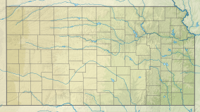
| Location | Norton, Kansas, United States |
| Coordinates | 39°48′25″N 99°57′05″W / 39.80694°N 99.95139°W |
| Area | 1,150 acres (4.7 km2) |
| Elevation | 2,352 ft (717 m)[1] |
| Established | Unspecified |
| Visitors | 191,972 (in 2022)[2] |
| Governing body | Kansas Department of Wildlife, Parks and Tourism |
Prairie Dog State Park is a state park located 4 miles west of Norton, Kansas, United States on Highway 261. Located in western Kansas, the Prairie Dog State Park is named after the creek that feeds into the Keith Sebelius reservoir, and had no prairie dog populations living there when it was established in 1967. Prairie dogs were introduced in the 1980s and the state park now holds a thriving colony of about 300.
Prairie Dog State Park is a 1,100-acre (450 ha) park that is located on the north shore of
Prairie Dog State Park has many recreation opportunities for campers to enjoy including a 1.4 mile nature trail, viewable prairie dog town, sand volleyball pit, disc golf course, regulation size basketball court, archery range, horse shoe pits, playground, swimbeach, fishing dock, 1886 one room school house, adobe home, and a 30'x70' Lake View shelter.
References
- ^ "Prairie Dog State Park". Geographic Names Information System. United States Geological Survey. October 13, 1978. Retrieved December 4, 2012.
- ^ Self, Matthew (August 18, 2023). "Top 5 most popular Kansas state parks revealed". KSNT.
External links
- "Prairie Dog State Park". Kansas Department of Wildlife, Parks and Tourism. Retrieved November 11, 2012.

