
Qiqihar
Qiqihar
齐齐哈尔市 Ch'i-ch'i-ha-erh, Tsitsihar | ||
|---|---|---|
License Plate 黑B | | |
| Administrative division code | 230200 | |
| Climate | Dwa | |
| Website | [1] | |
| Qiqihar | |
|---|---|
| Chinese name | |
Hanyu Pinyin | Qíqíhā'ěr |
| Wade–Giles | Ch'i2-ch'i2-ha1-erh3 |
Qiqihar
Close to Qiqihar are numerous wetlands and the Zhalong Nature Reserve, famous in China for being home to numerous red-crowned cranes.
Etymology
"Qiqihar" is a Dagur word meaning "border" or "natural pasture".[3] The name Qiqihar comes from Manchu: ᠴᡳᠴᡳᡥᠠᡵ, Möllendorff: Cicihar, Abkai: Qiqihar, IPA: /t͡ɕʰi.t͡ɕʰi.χar/.
History
Early history

Qiqihar is one of the oldest cities in the northeast of China. The region was originally settled by nomadic
Around 1700 it was a center for Russo-Chinese trade. A military depot with barracks and an arsenal was set up there, and many convicted criminals were exiled to the area. Heilongjiang Martial was domiciled in Qiqihar City in 1699.[3] Qing China had initially intended to keep the far-northern Heilongjiang province as a semi-pastoral area, separate from the wider Chinese agricultural economy, so it did not allow seasonal urban migrants, such as those from Hebei and Shandong who wished to participate in the Qiqihar fur trade, to own acres and transform the land.
After the
Second Sino-Japanese War

In 1931, Japan used a
Modern era

After the defeat of Japan, the Democratic Regime Qiqihar Municipal Government was established, under the administration of Nenjiang Province. Japanese forces in Northeast China surrendered to the Soviet Union while other Japanese forces in the rest of China surrendered to the United States.[11][12] From March to May, Soviet troops progressively withdrew from their positions, giving the People's Liberation Army more notice than the National Revolutionary Army so that the former could occupy more positions in the context of the Chinese Civil War.[13] Qiqihar was controlled by the Communists on April 24, 1946, along with other important regional cities like Changchun, Jilin City, and Harbin. Qiqihar was established as the capital of Heilongjiang Province after the foundation of People's Republic of China in 1949. However, since Songjiang Province was merged into Heilongjiang Province, the provincial capital was transferred to Harbin in 1954. During the first five-year plan of China from 1951 to 1956, many factories including Beiman Special Steel Co. and China First Heavy Industries were aid-constructed by the Soviet Union in Fularji District, making Qiqihar an important center of equipment manufacturing industry in Northeast China. In 1984, Qiqihar was designated to be one of the 13 Larger Municipalities in China by the General Office of the State Council.[14]
Geography
Qiqihar City sits on a land area of 42,289 square kilometers at an altitude of 100–500 meters, with an average elevation of 146 meters.
Border
Qiqihar is located along the middle and lower reaches of the Nen River and the hinterland of Songnen Plain, which is adjacent to the Greater Khingan Range and Hulunbuir Prairie. Bordering prefecture cities are:
- Baicheng, Jilin (S)
- Daqing (E)
- Heihe (N)
- Hulunbuir, Inner Mongolia (W)
- Suihua (NE)
- Hinggan League, Inner Mongolia (W)
The city's metro area is located 359 km (223 mi) from the provincial capital of Harbin, 282 km (175 mi) from Baicheng, 139 km (86 mi) from Daqing, and 328 km (204 mi) from Suihua. The total area under the city's jurisdiction is 42,289 km2 (16,328 sq mi). The region's elevation above sea level is generally between 200 m (660 ft) and 500 m (1,600 ft).[15]
Climate
Qiqihar has a cold, monsoon-influenced, humid continental climate (Köppen Dwa), with four distinct seasons. It has long, bitterly cold, but dry winters, with a 24-hour average in January of −18.1 °C (−0.6 °F). Spring and fall are mild, but short and quick transitions. Summers are very warm and humid, with a 24-hour average in July of 23.3 °C (73.9 °F). The average annual precipitation is 415 millimetres (16.3 in), with over two-thirds of it falling from June to August. The annual mean is 4.38 °C (39.9 °F). With monthly percent possible sunshine ranging from 56% in July to 73% in February, the city receives abundant sunshine, with 2,839 hours of bright sunshine annually. Extreme temperatures have ranged from −39.5 °C (−39 °F) to 42.1 °C (108 °F). Unusual for a place with such cold winters, it has never experienced a temperature of -40 degrees (C/F) or lower. [16]
| Climate data for Qiqihar (1991–2020 normals) | |||||||||||||
|---|---|---|---|---|---|---|---|---|---|---|---|---|---|
| Month | Jan | Feb | Mar | Apr | May | Jun | Jul | Aug | Sep | Oct | Nov | Dec | Year |
| Record high °C (°F) | 2.4 (36.3) |
12.8 (55.0) |
23.0 (73.4) |
30.9 (87.6) |
35.5 (95.9) |
40.8 (105.4) |
39.9 (103.8) |
37.5 (99.5) |
33.3 (91.9) |
26.9 (80.4) |
14.5 (58.1) |
6.9 (44.4) |
40.8 (105.4) |
| Mean daily maximum °C (°F) | −11.9 (10.6) |
−6.0 (21.2) |
3.1 (37.6) |
13.7 (56.7) |
21.6 (70.9) |
26.8 (80.2) |
28.5 (83.3) |
26.5 (79.7) |
21.0 (69.8) |
11.8 (53.2) |
−1.0 (30.2) |
−10.6 (12.9) |
10.3 (50.5) |
| Daily mean °C (°F) | −17.9 (−0.2) |
−12.6 (9.3) |
−3.2 (26.2) |
7.4 (45.3) |
15.6 (60.1) |
21.3 (70.3) |
23.8 (74.8) |
21.7 (71.1) |
15.3 (59.5) |
6.0 (42.8) |
−6.0 (21.2) |
−15.8 (3.6) |
4.6 (40.3) |
| Mean daily minimum °C (°F) | −22.9 (−9.2) |
−18.6 (−1.5) |
−9.3 (15.3) |
1.0 (33.8) |
9.5 (49.1) |
16.0 (60.8) |
19.4 (66.9) |
17.4 (63.3) |
10.2 (50.4) |
1.0 (33.8) |
−10.3 (13.5) |
−20.3 (−4.5) |
−0.6 (31.0) |
| Record low °C (°F) | −39.5 (−39.1) |
−34.5 (−30.1) |
−29.4 (−20.9) |
−14.0 (6.8) |
−7.4 (18.7) |
1.9 (35.4) |
9.9 (49.8) |
7.2 (45.0) |
−3.5 (25.7) |
−16.0 (3.2) |
−27.9 (−18.2) |
−35.0 (−31.0) |
−39.5 (−39.1) |
| Average precipitation mm (inches) | 2.2 (0.09) |
3 (0.1) |
6.2 (0.24) |
19.2 (0.76) |
32.1 (1.26) |
78.6 (3.09) |
137.8 (5.43) |
93.1 (3.67) |
45.8 (1.80) |
18.4 (0.72) |
5.2 (0.20) |
5.3 (0.21) |
446.9 (17.57) |
| Average precipitation days (≥ 0.1 mm) | 4.1 | 2.9 | 3.7 | 5.4 | 7.8 | 11.6 | 13.3 | 11.3 | 8.7 | 4.9 | 4.0 | 6.1 | 83.8 |
| Average snowy days | 6.4 | 4.2 | 5.4 | 2.5 | 0.2 | 0 | 0 | 0 | 0 | 1.9 | 5.6 | 8.1 | 34.3 |
| Average relative humidity (%)
|
65 | 57 | 48 | 44 | 47 | 62 | 71 | 73 | 64 | 56 | 59 | 66 | 59 |
| Mean monthly sunshine hours | 195.3 | 215.0 | 262.4 | 255.6 | 272.0 | 269.4 | 261.0 | 260.3 | 251.0 | 224.1 | 183.8 | 170.2 | 2,820.1 |
| Percent possible sunshine | 70 | 74 | 71 | 62 | 58 | 57 | 55 | 60 | 68 | 68 | 67 | 65 | 65 |
| Source: China Meteorological Administration[17][18][19] | |||||||||||||
Subdivisions


Qiqihar is divided into 16 divisions: 7
; xiànjí shì).| Map | ||||||
|---|---|---|---|---|---|---|
| # | Name | Hanzi
|
Hanyu Pinyin
|
Population (2010 est.) | Area (km2) | Density (/km2)[20] |
| 1 | Longsha District | 龙沙区 | Lóngshā Qū | 354,987 | 283 | 1,254 |
| 2 | Jianhua District | 建华区 | Jiànhuá Qū | 292,579 | 81 | 3,612 |
| 3 | Tiefeng District | 铁锋区 | Tiěfēng Qū | 331,951 | 695 | 478 |
| 4 | Ang'angxi District | 昂昂溪区 | Áng'ángxī Qū | 80,109 | 623 | 129 |
| 5 | Fularji District | 富拉尔基区 | Fùlā'ěrjī Qū | 256,159 | 375 | 683 |
| 6 | Nianzishan District | 碾子山区 | Niǎnzishān Qū | 72,151 | 290 | 249 |
| 7 | Meilisi Daur District | 梅里斯达斡尔族区 | Méilǐsī Dáwò'ěrzú Qū | 165,852 | 1,948 | 85 |
| 8 | Nehe City
|
讷河市 | Nèhé Shì | 625,892 | 6,664 | 94 |
| 9 | Longjiang County | 龙江县 | Lóngjiāng Xiàn | 572,764 | 6,197 | 92 |
| 10 | Yi'an County | 依安县 | Yī'ān Xiàn | 480,035 | 3,780 | 127 |
| 11 | Tailai County | 泰来县 | Tàilái Xiàn | 302,027 | 4,061 | 74 |
| 12 | Gannan County | 甘南县 | Gānnán Xiàn | 368,734 | 4,384 | 84 |
| 13 | Fuyu County | 富裕县 | Fùyù Xiàn | 276,537 | 4,335 | 64 |
| 14 | Keshan County | 克山县 | Kèshān Xiàn | 403,175 | 3,632 | 111 |
| 15 | Kedong County | 克东县 | Kèdōng Xiàn | 264,285 | 2,083 | 127 |
| 16 | Baiquan County | 拜泉县 | Bàiquán Xiàn | 519,766 | 3,569 | 146 |

Demographics
According to the
Economy
Qiqihar is a heavily industrialized city involved in manufacturing.
In 2009, the city's 95 large-scale equipment manufacturing enterprises, with total assets of 30.6 billion yuan, accounting for the city's industrial enterprises above designated size of 46.5% of total assets, the number of employees 5.2 million, accounting for the city's industrial enterprises above the size of 45.6% of the total number of employees. The main business income of 25.57 billion yuan, industrial added value of 8.05 billion yuan, profits of 1.96 billion yuan, 1.03 billion yuan of taxes, respectively, year on year growth of 2.9%, 3%, 19.6% and 22.3%, accounting for the city's industrial enterprises above designated size were 40.6%, 40%, 44.3% and 31.7%, respectively.
Hospitals
Qiqihar has 23 hospitals.
Companies
Companies conducting business in Qiqihar include RT-Mart, Walmart, GOME Electrical Appliances, and Suning Commerce Group.
Banks
Since Qiqihar is a large city, numerous banks work here. Some of the banks include Bank of China, China Construction Bank, Industrial and Commercial Bank of China, and Agricultural Bank of China.
Tourism
Qiqihar is very close to the Zhalong Nature Reserve. Also, there is the Longsha park.
Transportation
Airport
Qiqihar is served by its own domestic airport, Qiqihar Sanjiazi Airport.
Trains
Qiqihar is well-connected in terms of railway transportation. Trains from
The Harbin–Qiqihar intercity railway opened on 17 August 2015;[22][23] it provides frequent high-speed service to Harbin, as well as some direct trains to Beijing.[24]
River
The Nen River is used to transport material.
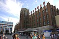
Gallery
-
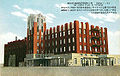 The old station building, now used for first class
 -
 The old station building
 -
 The new station building


Education
Numerous schools exist in the city. Four elementary schools feed into 8 city or county high schools.
There are two universities: Qiqihar University and its medical school.
Sister cities
 New Castle County, Delaware, United States
 Utsunomiya, Tochigi, Japan
 Gyeonggi, South Korea
 10th of Ramadan City, Egypt
 Krasnoyarsk, Russia[25]
Notable people from Qiqihar
- Wanrong- Princess consort to Puyi
- Ma Zhanshan - General
- Zhou Tienong - Vice chair of Standing committee of Congress of China
- Chen Yunlin - politician
- Zhai Zhigang - Astronaut
- Liu Boming- Astronaut
- Bai Xue - 10,000 meter runner
- Mao Buyi - singer-songwriter
- Li Yingying - Chinese female national volleyballer
References
- ^ a b "China: Hēilóngjiāng (Prefectures, Cities, Districts and Counties) - Population Statistics, Charts and Map".
- ^ "Qiqihaer China". Archived from the original on October 17, 2007. Retrieved December 29, 2009.
{{cite web}}: CS1 maint: unfit URL (link) - ^ a b "Survey of the City". Qiqihar Municipal Government. Archived from the original on October 17, 2007. Retrieved 18 August 2012.
- ^ 齐齐哈尔自然环境, Xinhua News, 2006-08-25, archived from the original on 2011-07-21, retrieved 2010-09-11
- ^ 卜奎清真寺, Qiqihar News, 2005-06-27, retrieved 2010-09-11
- ISBN 978-7-207-01417-7.
- ^ Shan, Patrick Fuliang (June 2006). "Ethnicity, Nationalism, and Race Relations: The Chinese Treatment of the Solon Tribes in Heilongjiang Frontier Society, 1900-1931". Asian Ethnicity. 7 (2): 185–187.
- ^ Matsuzaka, The Making of Japanese Manchuria, 1904-1932
- ^ "Mustard Gas Victims Prepare Case Against Japan", China.org.cn, 2004-06-28, retrieved 2010-09-11
- ^ "Diplomatic row over poison gas", The Guardian, 2003-08-13, retrieved 2010-09-11
- ISBN 0-415-36447-7. pg 338.
- ^ LTC David M. Glantz, "August Storm: The Soviet 1945 Strategic Offensive in Manchuria". Leavenworth Papers No. 7, Combat Studies Institute, February 1983, Fort Leavenworth Kansas.
- ^ Heinzig, Dieter (2004). The Soviet Union and Communist China, 1945-1950: The Arduous Road to the Alliance. M.E. Sharpe. p. 100.
- ^ 国务院关于批准唐山等市为"较大的市"的通知.[permanent dead link]
- ^ "Geography and Topography". Qiqihar Municipal Government. Archived from the original on October 17, 2007. Retrieved 18 August 2012.
- ^ 黑龙江省齐齐哈尔市地理位置及气候资源概况. 图骥网. Archived from the original on 2014-01-14. Retrieved 2014-01-13.
- ^ 中国气象数据网 – WeatherBk Data (in Simplified Chinese). China Meteorological Administration. Retrieved 12 August 2023.
- ^ 中国气象数据网 (in Simplified Chinese). China Meteorological Administration. Retrieved 12 August 2023.
- ^ 中国地面国际交换站气候标准值月值数据集(1971-2000年). China Meteorological Administration. Archived from the original on 2013-09-21. Retrieved 2010-05-25.
- ISBN 978-7-5037-6659-6.
- ^ 《齐齐哈尔市2010年第六次全国人口普查主要数据公报》. Qiqihar Municipal Bureau of Statistics
- ^ "Northernmost PDL opens in Heilongjiang". Railway Gazette. Railway Gazette. Retrieved 24 September 2022.
- ^ Xuefei, Tian; Huiying, Zhou. "High-speed rail to open after 6 years of challenges". China Daily. Retrieved 24 September 2022.
- ^ 哈齐客运专线更名哈齐高铁 成为我省首个高速铁路线路. 哈尔滨日报. 2015-07-30. Archived from the original on March 4, 2016. Retrieved July 30, 2015 – via huochepiao.com.
- ^ "Foreign Relations - Foreign Relations - Krasnoyarsk city administration official website". www.admkrsk.ru.
Notes
- ^ simplified Chinese: 齐齐哈尔; traditional Chinese: 齊齊哈爾; pinyin: Qíqíhā'ěr; IPA: [tɕʰǐtɕʰǐxáɤɻ]; Manchu: ᠴᡳᠴᡳᡥᠠᡵ, Möllendorff: Cicihar, Abkai: Qiqihar, IPA: [t͡ɕʰit͡ɕʰiχar]