
Quesnel, British Columbia
Quesnel | |
|---|---|
| City of Quesnel | |
.jpg) Aerial view of Quesnel in 2009 | |
|
672 | |
| Highways | |
| Waterways | Fraser River, Quesnel River |
| Website | quesnel |
Quesnel (/kwɪˈnɛl/; Kee-nel in French) is a city located in the Cariboo Regional District of British Columbia, Canada. Located nearly evenly between the cities of Prince George and Williams Lake, it is on the main route to northern British Columbia and the Yukon. Quesnel is located at the confluence of the Fraser River and Quesnel River. Quesnel's metropolitan area has a population of 23,146 making it one of the largest urban centers between Prince George and Kamloops.[2]
Quesnel is a
History
Long before the arrival of prospectors during the
Geography and climate
- Location: 52°58′47″N 122°29′37″W / 52.97972°N 122.49361°W
- Elevation: 474 m (1,555 ft)
- Average annual snowfall: 177.9 cm (70.0 in)
- Average annual rainfall: 540.3 mm (21.27 in)
- Total frost free days: 188
- Consecutive frost free days: 119
- Average winter temperature: −8.6 °C (16.5 °F)
- Extreme minimum temperature: −46.7 °C (−52.1 °F)
- Average summer temperature: 16.7 °C (62.1 °F)
- Extreme maximum temperature: 40.6 °C (105.1 °F)
- Time Zone: Pacific Time Zone
Climate
Considering it is located inland and around the 53rd parallel north, Quesnel's humid continental climate[4] (Dfb) is mild by Canadian standards, being subject to marine airflows from the Pacific. Overnight lows are still cool even in summer, but daytime temperatures average above 24 °C (75 °F) in that season according to Environment and Climate Change Canada.
The highest temperature ever recorded in Quesnel was 41.7 °C (107.1 °F) on 29 June 2021.[5] The coldest temperature ever recorded was −46.7 °C (−52 °F) on 31 December 1927 and 17 January 1950.[6][7]
| Climate data for Quesnel Airport, 1991-2020 normals, extremes 1892-present | |||||||||||||
|---|---|---|---|---|---|---|---|---|---|---|---|---|---|
| Month | Jan | Feb | Mar | Apr | May | Jun | Jul | Aug | Sep | Oct | Nov | Dec | Year |
| Record high °C (°F) | 16.1 (61.0) |
18.9 (66.0) |
22.3 (72.1) |
31.1 (88.0) |
36.5 (97.7) |
41.7 (107.1) |
40.6 (105.1) |
38.3 (100.9) |
36.1 (97.0) |
28.3 (82.9) |
24.4 (75.9) |
18.3 (64.9) |
41.7 (107.1) |
| Mean daily maximum °C (°F) | −2.7 (27.1) |
0.9 (33.6) |
6.9 (44.4) |
13.2 (55.8) |
19.0 (66.2) |
21.8 (71.2) |
24.5 (76.1) |
24.2 (75.6) |
18.6 (65.5) |
10.8 (51.4) |
2.8 (37.0) |
−2.1 (28.2) |
11.4 (52.5) |
| Daily mean °C (°F) | −6.8 (19.8) |
−4.1 (24.6) |
0.8 (33.4) |
6.1 (43.0) |
11.3 (52.3) |
14.7 (58.5) |
17.0 (62.6) |
16.4 (61.5) |
11.7 (53.1) |
5.5 (41.9) |
−0.8 (30.6) |
−5.8 (21.6) |
5.5 (41.9) |
| Mean daily minimum °C (°F) | −10.8 (12.6) |
−9.0 (15.8) |
−5.2 (22.6) |
−1.0 (30.2) |
3.6 (38.5) |
7.5 (45.5) |
9.5 (49.1) |
8.5 (47.3) |
4.8 (40.6) |
0.2 (32.4) |
−4.5 (23.9) |
−9.6 (14.7) |
−0.5 (31.1) |
| Record low °C (°F) | −46.7 (−52.1) |
−45.6 (−50.1) |
−38.9 (−38.0) |
−21.7 (−7.1) |
−11.1 (12.0) |
−7.8 (18.0) |
−1.1 (30.0) |
−2.6 (27.3) |
−11.1 (12.0) |
−28.4 (−19.1) |
−37.8 (−36.0) |
−46.7 (−52.1) |
−46.7 (−52.1) |
| Record low wind chill | −48.0 | −43.1 | −41.7 | −25.1 | −10.1 | −1.7 | 0.0 | −1.0 | −8.7 | −27.2 | −47.5 | −47.4 | −48.0 |
| Average precipitation mm (inches) | 42.0 (1.65) |
22.4 (0.88) |
27.1 (1.07) |
26.4 (1.04) |
37.0 (1.46) |
63.3 (2.49) |
67.6 (2.66) |
39.4 (1.55) |
45.7 (1.80) |
51.3 (2.02) |
44.8 (1.76) |
43.1 (1.70) |
510.1 (20.08) |
| Average extreme snow depth cm (inches) | 97 (38) |
112 (44) |
97 (38) |
43 (17) |
11 (4.3) |
0 (0) |
0 (0) |
0 (0) |
3 (1.2) |
20 (7.9) |
51 (20) |
74 (29) |
112 (44) |
| Average precipitation days (≥ 0.2 mm) | 13.4 | 10.5 | 11.0 | 10.8 | 12.0 | 15.9 | 14.8 | 12.2 | 13.2 | 14.8 | 12.6 | 13.1 | 154.3 |
| Average relative humidity (%) (at 15:00LST)
|
74.6 | 62.4 | 47.1 | 38.8 | 39.6 | 43.9 | 43.6 | 42.0 | 50.4 | 59.3 | 72.4 | 76.2 | 54.2 |
| Source: Environment Canada[8]
| |||||||||||||
| Climate data for Quesnel Airport, 1981–2010 normals, extremes 1892–present[a] | |||||||||||||
|---|---|---|---|---|---|---|---|---|---|---|---|---|---|
| Month | Jan | Feb | Mar | Apr | May | Jun | Jul | Aug | Sep | Oct | Nov | Dec | Year |
| Record high °C (°F) | 16.1 (61.0) |
18.9 (66.0) |
22.3 (72.1) |
31.1 (88.0) |
36.5 (97.7) |
41.7 (107.1) |
40.6 (105.1) |
38.3 (100.9) |
36.1 (97.0) |
28.3 (82.9) |
24.4 (75.9) |
18.3 (64.9) |
41.7 (107.1) |
| Mean daily maximum °C (°F) | −2.9 (26.8) |
1.3 (34.3) |
7.3 (45.1) |
13.5 (56.3) |
18.4 (65.1) |
21.7 (71.1) |
24.1 (75.4) |
24.1 (75.4) |
18.5 (65.3) |
10.8 (51.4) |
2.1 (35.8) |
−2.3 (27.9) |
11.4 (52.5) |
| Daily mean °C (°F) | −6.9 (19.6) |
−3.6 (25.5) |
1.3 (34.3) |
6.4 (43.5) |
11.1 (52.0) |
14.7 (58.5) |
16.8 (62.2) |
16.4 (61.5) |
11.5 (52.7) |
5.5 (41.9) |
−1.4 (29.5) |
−5.9 (21.4) |
5.5 (41.9) |
| Mean daily minimum °C (°F) | −10.8 (12.6) |
−8.3 (17.1) |
−4.7 (23.5) |
−0.8 (30.6) |
3.7 (38.7) |
7.6 (45.7) |
9.5 (49.1) |
8.6 (47.5) |
4.5 (40.1) |
0.2 (32.4) |
−5.0 (23.0) |
−9.6 (14.7) |
−0.4 (31.3) |
| Record low °C (°F) | −46.7 (−52.1) |
−45.6 (−50.1) |
−38.9 (−38.0) |
−21.7 (−7.1) |
−11.1 (12.0) |
−7.8 (18.0) |
−1.1 (30.0) |
−2.6 (27.3) |
−11.1 (12.0) |
−28.4 (−19.1) |
−37.8 (−36.0) |
−46.7 (−52.1) |
−46.7 (−52.1) |
| Average precipitation mm (inches) | 47.8 (1.88) |
22.7 (0.89) |
24.9 (0.98) |
24.5 (0.96) |
42.6 (1.68) |
66.4 (2.61) |
65.6 (2.58) |
46.2 (1.82) |
50.2 (1.98) |
52.6 (2.07) |
51.3 (2.02) |
41.6 (1.64) |
536.2 (21.11) |
| Average rainfall mm (inches) | 10.4 (0.41) |
6.7 (0.26) |
12.7 (0.50) |
21.2 (0.83) |
41.4 (1.63) |
66.4 (2.61) |
65.6 (2.58) |
46.2 (1.82) |
50.2 (1.98) |
46.3 (1.82) |
22.3 (0.88) |
4.9 (0.19) |
394.3 (15.52) |
| Average snowfall cm (inches) | 44.0 (17.3) |
19.0 (7.5) |
13.4 (5.3) |
3.6 (1.4) |
1.2 (0.5) |
0.0 (0.0) |
0.0 (0.0) |
0.0 (0.0) |
0.0 (0.0) |
6.7 (2.6) |
31.5 (12.4) |
42.8 (16.9) |
162.1 (63.8) |
| Average precipitation days (≥ 0.2 mm) | 12.8 | 9.7 | 9.7 | 9.8 | 12.1 | 15.8 | 14.2 | 12.0 | 12.4 | 14.8 | 14.0 | 13.4 | 150.7 |
| Average rainy days (≥ 0.2 mm) | 3.1 | 3.4 | 5.9 | 8.8 | 11.9 | 15.8 | 14.2 | 12.0 | 12.4 | 13.7 | 7.2 | 2.4 | 110.8 |
| Average snowy days (≥ 0.2 cm) | 11.3 | 7.1 | 5.4 | 2.2 | 0.7 | 0.0 | 0.0 | 0.0 | 0.0 | 2.4 | 8.8 | 11.8 | 49.7 |
| Average relative humidity (%) (at 15:00 LST)
|
74.3 | 62.0 | 46.9 | 37.9 | 40.0 | 44.8 | 44.4 | 42.9 | 49.4 | 59.0 | 72.6 | 75.7 | 54.2 |
| Source: Environment and Climate Change Canada[7][9] | |||||||||||||
Demographics
In the
The median household income in 2015 for Quesnel was $60,651, which is slightly below the British Columbia provincial average of $69,995.[12]
As of 2018, the population of Quesnel is estimated to be a little over 10,000 people living within the city, with roughly 13,000 people living outside the city limits but within the metro area.[13]
Ethnicity
| Panethnic group |
2021[14] | 2016[15] | 2011[16] | 2006[17] | 2001[18] | 1996[19] | 1991[20][21] | 1986[22][23][24]: 107 | |||||||||||
|---|---|---|---|---|---|---|---|---|---|---|---|---|---|---|---|---|---|---|---|
| Pop. | % | Pop. | % | Pop. | % | Pop. | % | Pop. | % | Pop. | % | Pop. | % | Pop. | % | ||||
| European[b] | 7,680 | 79.3% | 7,245 | 74.81% | 7,670 | 78.03% | 7,290 | 79.46% | 7,805 | 79.28% | 6,325 | 75.52% | 6,290 | 77.65% | 6,360 | 77% | |||
| Indigenous | 1,305 | 13.47% | 1,610 | 16.62% | 1,415 | 14.39% | 1,045 | 11.39% | 880 | 8.94% | 710 | 8.48% | 610 | 7.53% | 480 | 5.81% | |||
| South Asian | 295 | 3.05% | 510 | 5.27% | 485 | 4.93% | 555 | 6.05% | 830 | 8.43% | 1,150 | 13.73% | 1,040 | 12.84% | 1,130 | 13.68% | |||
| Southeast Asian[c] | 170 | 1.76% | 90 | 0.93% | 45 | 0.46% | 90 | 0.98% | 80 | 0.81% | 70 | 0.84% | 20 | 0.25% | 70 | 0.85% | |||
| East Asian[d] | 100 | 1.03% | 170 | 1.76% | 140 | 1.42% | 170 | 1.85% | 200 | 2.03% | 70 | 0.84% | 110 | 1.36% | 210 | 2.54% | |||
African
|
55 | 0.57% | 20 | 0.21% | 25 | 0.25% | 15 | 0.16% | 15 | 0.15% | 55 | 0.66% | 10 | 0.12% | 0 | 0% | |||
| Latin American | 45 | 0.46% | 20 | 0.21% | 25 | 0.25% | 10 | 0.11% | 40 | 0.41% | 0 | 0% | 10 | 0.12% | 5 | 0.06% | |||
| Middle Eastern[e] | 0 | 0% | 10 | 0.1% | 0 | 0% | 10 | 0.11% | 0 | 0% | 0 | 0% | 10 | 0.12% | 5 | 0.06% | |||
| Other/Multiracial[f] | 20 | 0.21% | 20 | 0.21% | 0 | 0% | 10 | 0.11% | 10 | 0.1% | 0 | 0% | — | — | — | — | |||
| Total responses | 9,685 | 97.94% | 9,685 | 98.04% | 9,830 | 98.23% | 9,175 | 98.38% | 9,845 | 98.02% | 8,375 | 98.9% | 8,100 | 98.68% | 8,260 | 98.83% | |||
| Total population | 9,889 | 100% | 9,879 | 100% | 10,007 | 100% | 9,326 | 100% | 10,044 | 100% | 8,468 | 100% | 8,208 | 100% | 8,358 | 100% | |||
| Note: Totals greater than 100% due to multiple origin responses | |||||||||||||||||||
Religion
According to the 2021 census, religious groups in Quesnel included:[14]
- Irreligion (6,050 persons or 62.5%)
- Christianity (3,260 persons or 33.7%)
- Sikhism (185 persons or 1.9%)
- Hinduism (70 persons or 0.7%)
- Buddhism (15 persons or 0.2%)
- Indigenous Spirituality(10 persons or 0.1%)
- Other (90 persons or 0.9%)
| Religious group | 2021[14] | 2011[16] | 2001[18] | 1991[20] | ||||
|---|---|---|---|---|---|---|---|---|
| Pop. | % | Pop. | % | Pop. | % | Pop. | % | |
| Christian | 3,260 | 33.66% | 4,200 | 42.73% | 5,230 | 53.15% | 4,525 | 55.86% |
| Sikh | 185 | 1.91% | 355 | 3.61% | 695 | 7.06% | 970 | 11.98% |
| Hindu | 70 | 0.72% | 55 | 0.56% | 100 | 1.02% | 50 | 0.62% |
| Buddhist | 15 | 0.15% | 30 | 0.31% | 70 | 0.71% | 0 | 0% |
Indigenous spirituality
|
10 | 0.1% | 20 | 0.2% | N/A | N/A | N/A | N/A |
| Muslim | 0 | 0% | 0 | 0% | 20 | 0.2% | 0 | 0% |
Jewish
|
0 | 0% | 0 | 0% | 0 | 0% | 20 | 0.25% |
| Other religion | 90 | 0.93% | 100 | 1.02% | 40 | 0.41% | 15 | 0.19% |
| Irreligious | 6,050 | 62.47% | 5,060 | 51.48% | 3,690 | 37.5% | 2,515 | 31.05% |
| Total responses | 9,685 | 97.94% | 9,830 | 98.23% | 9,840 | 97.97% | 8,100 | 98.68% |
Economy
Quesnel is a city known for its forestry, particularly the production of pulp and lumber. Forestry is the single biggest employer in Quesnel.[25] Quesnel is home to a Bleached Chemi-ThermoMechanical Pulp (BCTMP) mill that was built in 1981, and a NBSK (Northern Bleached Softwood Kraft) pulp mill that started production in 1972. The BCTMP mill is currently 100% owned by West Fraser Timber, and the NBSK mill is a 50/50 joint venture between West Fraser and Mercer International. There is also a large sawmill, a plywood mill, and a MDF plant all owned and operated by West Fraser Timber. West Fraser started in Quesnel in the 1950's, and is now the largest manufacturer of wood products in North America, with operations also in Europe.[citation needed]
Administration
Quesnel's city government consists of a seven-member council, that is one mayor and six Councillors. The current city council, elected in 2022 for a four-year term, is composed of Mayor Ron Paul and Councillors Scott Elliott, Tony Goulet, Debora McKelvie, Laurey-Anne Roodenburg, Martin Runge, and Mitch Vik.[26][27]
Education
Quesnel is part of School District 28, which contains several elementary schools, as well as a Junior and a Senior Secondary School (Quesnel Junior High School and Correlieu Senior Secondary School respectively). Also, within the school district is McNaughton Centre which is an Alternate High school. For post secondary education, Quesnel has the College of New Caledonia and University of Northern British Columbia shared campus, which offers several programs, including four year nursing and social work degrees, foundation or apprenticeship-level trades certification, health sciences, human services, academic upgrading, or industry and continuing education courses. The Quesnel CNC Campus also offers students the chance to start arts or sciences degrees and then, transfer to university.
Transportation

Quesnel is served by the
Healthcare
Quesnel is served by GR Baker Memorial Hospital.[28]
A new emergency section was added to the hospital on April 14, 2023.[29] This increased the overall size of the hospital as well as making it easier for patients to move from building to building.
Tourism

Quesnel's tourism industry is largely based on the city's access to nature, with hunting and guiding outfitters, fishing, hiking, canoeing.[3] The Rocky Mountaineer, a rail-tour train also travels through and stops overnight in Quesnel at the Pacific Great Eastern Railway Station.
Quesnel's history as a gold-rush town is also reflected, as there are over 30 heritage sites around the city.[30] Quesnel is home to the world's largest gold pan,[31] measured at 5.5 m in diameter and weighing 1400 kg, although this is disputed by Nome, Alaska. The gold pan currently resides in its new controversial location near the local Visitor Center and Museum.[32] Quesnel is also the closest city to Barkerville, the largest historic site western North America, and epicenter of the Cariboo Gold Rush.[33]
Troll Ski Resort, or simply Troll, is located 44 kilometers (27 miles) east of the city.[34] Quesnel is also home to Hallis Lake Cross Country Skiing Facility, a 75 kilometer network of trails maintained by the Cariboo Ski Touring Club for cross-country skiing and snowshoeing.[35] In addition, Ten Mile Lake Provincial Park, Pinnacles Provincial Park, and Dragon Mountain Provincial Park are also located just outside the city.
Quesnel Museum is home to numerous artifacts, including Mandy, a "
Culture
There are twenty-three decorated fire hydrants in the streets of Quesnel. This work was sponsored by the local businesses in the vicinity of the hydrants.[38]
-
 "Pilot", Carson Avenue and Kinchant Street
 -
 "Can Can Girl", McLean Street and Shepherd Avenue
 -
 McLean Street and St Laurent Avenue
 -
 "BX Cook", Shepherd Avenue and Kinchant Street
 -
 "Engineer", Legion Drive, Cariboo Highway, and Carson Avenue
 -
 "Cyclist", Barlow Avenue and Vaughan Street
.jpg)
.jpg)
.jpg)
.jpg)
.jpg)
.jpg)
Sports
Quesnel is home to the Central Interior Hockey League's Quesnel Kangaroos Senior AA hockey team. The team plays at the West Fraser Centre in Quesnel. The city was formerly home to the Quesnel Millionaires, a BCHL team, before they relocated to Chilliwack as the Chilliwack Chiefs in 2011.
Quesnel also has
Notable people
- Brett Festerling – former National Hockey League Player (Anaheim Ducks & Winnipeg Jets)
- Aaron Gagnon – former National Hockey League Player (Dallas Stars & Winnipeg Jets)
- Bob Gassoff – former National Hockey League player (St. Louis Blues)
- Brad Gassoff – former National Hockey League player (Vancouver Canucks)
- Arjun Gill – Wrestling Gold Medalist at the 2014 Commonwealth Games
- Rory MacDonald – Mixed martial artist currently with Bellator MMA in the Welterweight division
- Marco Marra - Professor, Medical Genetics, University of British Columbia
- Jim Marsh – former World Hockey Association player (Birmingham Bulls)
- Errol Rausse – former National Hockey League player (Washington Capitals)
- Bob Simpson - former provincial MLA for Cariboo North and former mayor of Quesnel.
Neighbourhoods and nearby communities
- West Quesnel
- Uplands
- Riverview
- West Riverside
- South Quesnel
- Southhills
- Red Bluff
- Dragon Lake
- Rich Bar
- North Quesnel
- Carson Sub
- Johnston Sub
Nearby communities, not part of the City of Quesnel, include:
- Moose Heights
- Ten Mile Lake (also locally referred to as Parkland)
- Barlow Creek
- West Fraser / Narcosli
- Cottonwood
- Nazko
- Bouchie Lake
- Kersley
Images
-
 Fraser River walking bridge
 -
 Looking down St Laurent Ave; Rotary Clock in the foreground
 -
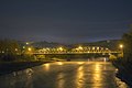 Bridge over the Quesnel River
 -
 Quesnel Station
 -
 Quesnel River from Red Bluff.


Sister city
Notes
- ^ Climate data was recorded at Quesnel from November 1892 to April 1970 and at Quesnel Airport from February 1946 to present.
- ^ Statistic includes all persons that did not make up part of a visible minority or an indigenous identity.
- ^ Statistic includes total responses of "Filipino" and "Southeast Asian" under visible minority section on census.
- ^ Statistic includes total responses of "Chinese", "Korean", and "Japanese" under visible minority section on census.
- ^ Statistic includes total responses of "West Asian" and "Arab" under visible minority section on census.
- ^ Statistic includes total responses of "Visible minority, n.i.e." and "Multiple visible minorities" under visible minority section on census.
References
- ^ "Short commutes, affordable housing: Quesnel rebrands itself to attract disenchanted Lower Mainland residents". CBC News British Columbia. 17 January 2017. Retrieved 25 April 2019.
- ^ "Population and dwelling counts, 2016 Census". Statistics Canada. 8 February 2017. Retrieved 28 October 2019.
- ^ a b "Explore Quesnel – It's in our nature". www.tourismquesnel.com. Retrieved 30 October 2017.
- ^ "Quesnel, British Columbia Climate Summary". Weatherbase. Retrieved 22 October 2015.
- ^ "Daily Data Report for June 2021". Canadian Climate Data. Environment and Climate Change Canada. 18 September 2023. Retrieved 30 September 2023.
- ^ "Daily Data Report for December 1927". Canadian Climate Data. Environment and Climate Change Canada. 31 October 2011. Retrieved 21 December 2016.
- ^ a b "Quesnel A". 1981–2010 Canadian Climate Normals. Precipitation, rain, snow, humidity 1981-2010. Environment and Climate Change Canada. 24 February 2024. Retrieved 24 February 2024.
- Environment Canada-Canadian Climate Normals 1991-2020. Retrieved 24 February 2024.
- ^ "Quesnel". Canadian Climate Data. Environment and Climate Change Canada. 31 October 2011. Retrieved 20 December 2016.
- ^ "Population and dwelling counts: Canada, provinces and territories, and census subdivisions (municipalities), British Columbia". Statistics Canada. 9 February 2022. Retrieved 20 February 2022.
- ^ "Population and dwelling counts: Canada, provinces and territories, census metropolitan areas and census agglomerations". Statistics Canada. 9 February 2022. Retrieved 22 February 2022.
- ^ "Census Profile, 2016: Quesnel". Statistics Canada. 8 February 2017. Retrieved 28 October 2019.
- ^ "BC Stats Has Released Population Numbers For The Cariboo". My Cariboo Now. Retrieved 13 December 2019.
- ^ a b c Government of Canada, Statistics Canada (26 October 2022). "Census Profile, 2021 Census of Population". www12.statcan.gc.ca. Retrieved 11 November 2022.
- ^ Government of Canada, Statistics Canada (27 October 2021). "Census Profile, 2016 Census". www12.statcan.gc.ca. Retrieved 8 March 2023.
- ^ a b Government of Canada, Statistics Canada (27 November 2015). "NHS Profile". www12.statcan.gc.ca. Retrieved 8 March 2023.
- ^ Government of Canada, Statistics Canada (20 August 2019). "2006 Community Profiles". www12.statcan.gc.ca. Retrieved 8 March 2023.
- ^ a b Government of Canada, Statistics Canada (2 July 2019). "2001 Community Profiles". www12.statcan.gc.ca. Retrieved 8 March 2023.
- ^ Government of Canada, Statistics Canada (4 June 2019). "Electronic Area Profiles Profile of Census Divisions and Subdivisions, 1996 Census". www12.statcan.gc.ca. Retrieved 8 March 2023.
- ^ a b Government of Canada, Statistics Canada (29 March 2019). "1991 Census Area Profiles Profile of Census Divisions and Subdivisions - Part B". www12.statcan.gc.ca. Retrieved 8 March 2023.
- ^ Government of Canada, Statistics Canada (29 March 2019). "Data tables, 1991 Census Population by Ethnic Origin (24), Showing Single and Multiple Origins (2) - Canada, provinces and territories, census divisions and census subdivisions". www12.statcan.gc.ca. Retrieved 8 March 2023.
- ^ Government of Canada, Statistics Canada (27 June 2019). "Data tables, 1986 Census Census Profile for Canada, Provinces and Territories, Census Divisions and Census Subdivisions, 1986 Census - Part A". www12.statcan.gc.ca. Retrieved 8 March 2023.
- ^ Government of Canada, Statistics Canada (27 June 2019). "Data tables, 1986 Census Census Profile for Canada, Provinces and Territories, Census Divisions and Census Subdivisions, 1986 Census - Part B". www12.statcan.gc.ca. Retrieved 8 March 2023.
- ^ Government of Canada, Statistics Canada (3 April 2013). "Canada's aboriginal population by census subdivisions from the 1986 Census of Canada". www12.statcan.gc.ca. Retrieved 8 March 2023.
- ^ Sointio, Jon; Rankin, Anna; van Aert, Mike (2006). "Biofilm Activated Sludge process at Quesnel River Pulp installation" (PDF). Environmental Science & Engineering Magazine.
- ^ "Quesnel City Council". City of Quesnel. 8 February 2017. Retrieved 28 October 2019.
- ^ "B.C. municipal election 2022: Quesnel results - BC". Global News. 16 October 2022. Retrieved 28 November 2022.
- ^ "GR Baker Memorial Hospital | Northern Health".
- ^ "New emerg department, ICU open at Quesnel's GR Baker Hospital". Quesnel Cariboo Observer. 14 April 2023. Retrieved 8 February 2024.
- ^ "Quesnel". www.hellobc.com/quesnel.aspx. Retrieved 30 October 2017.
- ^ "BC's Biggest Attractions Are Often in the Smallest Places". BC Lodging & Campgrounds Association. Retrieved 28 October 2019.
- ^ "Quesnel gold pan moved to new downtown location sometime overnight". caribooobserver.com.
- ^ "Visit Us – Barkerville Historic Town & Park".
- ^ "Things to do and see". britishcolumbia.com.
- ^ "Hallis Lake". quesnel.ca.
- ^ "Mandy The Haunted Doll". quesnelmuseum.ca.
- ^ "Mandy The Haunted Doll". Huffpost.com.
- ^ "Painted Fire Hydrant Walking Tour". City of Quesnel. 8 March 2017. Retrieved 7 March 2020.
- ^ "Arts and Recreation: Shiraoi House". City of Quesnel. March 2017. Retrieved 25 April 2019.
External links
- Official website

 Quesnel travel guide from Wikivoyage
Subdivisions of British Columbia | |
|---|---|
| Subdivisions | |
| Communities | |
| Metro areas and agglomerations |
|
| Cities |
|