
Rangeland
This article needs additional citations for verification. (March 2014) |

Rangelands are
Rangelands are distinguished from
Grazing is an important use of rangelands but the term rangeland is not synonymous with grazingland. Livestock grazing can be used to manage rangelands by harvesting forage to produce livestock, changing plant composition, or reducing fuel loads.
Fire is also an important regulator of range vegetation, whether set by humans or resulting from
Types of rangeland
The United States Environmental Protection Agency defines rangeland as "lands on which the native vegetation (climax or natural potential plant community) is predominantly grasses, grass-like plants, forbs, or shrubs suitable for grazing or browsing use."[2] The EPA classifies natural grassland and savannas as rangeland, and in some cases includes wetlands, deserts, tundra, and "certain forb and shrub communities."[2] The primary difference between rangeland and pasture is management; rangelands tend to have natural vegetation along with a few introduced plant species, but all managed by grazing, while pastures have forage that is adapted for livestock and managed, by seeding, mowing, fertilization and irrigation.[2]
Prairie
.Grasslands
Steppe
Steppe, in physical geography, refers to a biome region characterized by grassland plain without trees apart from those near rivers and lakes. The prairie (especially the shortgrass and mixed prairie) is an example of a steppe, though it is not usually called such. It may be semi-desert, or covered with grass or shrubs or both, depending on the season and latitude. The term is also used to denote the climate encountered in regions too dry to support a forest, but not dry enough to be a desert.
Pampas
Shrubland
Woodland
Woodland is a low-density forest forming open habitats with plenty of sunlight and limited shade. Woodlands may support an understory of shrubs and herbaceous plants including grasses. Woodland may form a transition to shrubland under drier conditions or during early stages of primary or secondary succession. Higher densities and areas of trees, with largely closed canopy, provide extensive and nearly continuous shade are referred to as forest.
Savanna
Desert
Tundra
North America
Canada
Rangeland is a prominent feature of rural Canada. A provincial jurisdiction, administration and policy regarding range use varies across the country. As in many other Commonwealth countries, public tenures on crown land for the purpose of range activities are common in geographically compatible areas. Reconciling the economic needs of ranchers and the need for environmental conservation is one of the primary themes in modern range discourse.
In western Canada, both grassland and forested range are significant. In British Columbia, 70 percent of grassland range is privately owned and 60 percent of the total annual livestock forage requirement is provided by grazing on Crown rangeland (34 million hectares), 80 percent of which is forested range.[15] Grassland range predominates in much of the prairie provinces’ ranching area; however, forested range is particularly important in the boreal region.[16][17]
Certain rangelands are preserved as provincially-protected areas similar to parks, others are managed as community resources. For example, in Alberta since 2003 there has been legislation allowing the creation of "Heritage Rangelands" within the parks system.
United States

Of the land within the
Historically much of the land in the western United States was used for grazing and much of some states still is. In many of those states, such as Arizona, an
North American rangelands - grasslands
- Tall Grass Prairie
- Mixed Grass Prairie
- Short Grass Prairie
- Pacific Bunchgrass
- Annual Grasslands
North American rangelands - shrublands
- Sagebrush Steppe
- Salt Desert Shrublands
- Desert Shrublands
Elsewhere
The different types of rangeland together form about 70% (excluding Antarctica)[citation needed] of the Earth's surface.

Australia
Australia’s rangelands extend from tropical savannas in the north dominated by summer rainfall, though large areas of desert in central Australia to the southern rangelands dominated by winter rainfall. They cover approximately 80 per cent of the Australian continent and equate broadly with the ‘Outback’. However, rangelands also occur in higher rainfall areas where limitations other than rainfall restrict use to management of the natural landscape. The rangelands are where values and societal benefits are based primarily on natural resources. They are areas which have not been intensively developed for agriculture but extensive livestock production is a major land use, accounting for 55 per cent of the rangelands.[25] Conservation reserves utilise around 11 per cent of the rangelands and the rangelands have areas of significant biodiversity and natural attractions on a world scale. Although mining and petroleum extraction uses a very small percentage of the rangelands, it economically contributes most to Australia’s Gross Domestic Product compared with other rangeland industries (cattle, sheep and goat production, tourism, harvesting of native products). Indigenous land tenures of various types cover around 59 per cent of the rangelands and overlap with grazing and conservation uses.[25] Although rangelands cover 80 per cent of Australia’s land mass, at the 2016 Census, they were home to just over two per cent of the population (394,000 people), with 28 per cent of rangeland residents identifying as being Indigenous.[25]
South America
Rangelands in South America are located in regions with climate ranging from arid to sub-humid. Annual precipitation in these areas ranges from approximately 150 to 1500 mm (6–60 inches). Within South America, rangelands cover about 33% of the total land area. South American rangelands include; grasslands, shrublands, savannas, and hot and cold deserts. Rangelands in South America exclude hyperarid deserts. Examples of the South American rangelands include the Patagonian Steppe, the Monte, the Pampas, the "Llanos" or "Cerrado," the "Chaco" and the "Caatinga." The change in the intensity and location of tropical thunderstorms and other weather patterns is the driving force in the climates of southern South America.
Africa
In Kenya, rangelands make up for 85% of the land surface area, and are largely inhabited by nomadic pastoralists who are largely dependent on livestock. This movement often brings along an incursion of different diseases with the common one being the rinderpest virus in the Kenyan wildlife population from the Somali ecosystem.
Asia
In the past, rangelands in western China supported a pastoral economy and large wildlife populations. Now the rangelands have shrunk due to population growth, economic, government, and social factors. Rangeland types in China include; Semi-desert, Dry Alpine Grasslands, Alpine Dwarf Shrub, Wetland types.
Uses of rangeland
Rangelands produce a wide variety of goods and services desired by society, including livestock forage (
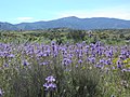
Gallery
-
 Palouse Hills of Washington
 -
 Sonoran Desert
 -
 Konza Prairie
 -
 Buffalo grazing on rangeland in Crook County, Wyoming.
 -
 Triodia Hummock Grasslands
 -
 Savannah in southern Africa
 -
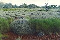
 Caliente Peak, California
 -
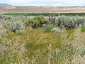 Lake Swan, Nevada


See also
- Applied ecology
- Coastal plain
- Coastal prairie
- Experimental range
- Field
- Forage
- Grassland
- Grass valley
- Holistic management
- Meadow
- Pasture
- Potrero
- Plain
- Prairie
- Range condition scoring
- Savanna
- Steppe
- Veld
References
- ^ Micropaedia: The New Encyclopædia Britannica. Vol. 9 (15th ed.). 2010.
- ^ a b c "Pasture, Rangeland, and Grazing Operations". U.S. Environmental Protection Agency. Retrieved 12 September 2015.
- ^ NASA Earth Observatory webpage
- ^ "Chapter 12 Scrub Management". Natural England.[dead link]
- ^ Merriam-Webster's Collegiate Dictionary, 11th Edition (2003).
- ISBN 978-0-632-03199-3.
- ^ What is a desert?
- ^ According to What is a desert?, the 250 mm threshold definition is attributed to Peveril Meigs.
- ^ "desert". Encyclopædia Britannica online. Retrieved 2008-02-09.
- ISBN 978-0-471-85008-3. Retrieved 2008-05-21.
- ^ Glossary of Meteorology. Megathermal Climate. Retrieved on 2008-05-21.
- ^ Aapala, Kirsti. "Tunturista jängälle". Kieli-ikkunat. Archived from the original on 2006-10-01. Retrieved 2009-01-19.
- ^ a b "The Tundra Biome". The World's Biomes. Retrieved 2006-03-05.
- ^ "Terrestrial Ecoregions: Antarctica". Wild World. National Geographic. Archived from the original on 2011-08-05. Retrieved 2009-11-02.
- ^ British Columbia Ministry of Forest, Mines and Lands. 2010. The state of British Columbia’s forests. 3rd Ed. "Archived copy" (PDF). Archived from the original (PDF) on 2016-08-04. Retrieved 2015-09-10.
{{cite web}}: CS1 maint: archived copy as title (link) - ^ Government of Saskatchewan. Forested rangeland grazing. "Grazing Forested Rangeland - Agriculture -". Archived from the original on 2015-12-22. Retrieved 2015-09-10.
- ^ Range management fact sheet for northern Alberta’s boreal region. Forest grazing. "Archived copy" (PDF). Archived from the original (PDF) on 2016-03-05. Retrieved 2015-09-10.
{{cite web}}: CS1 maint: archived copy as title (link) - ^ Landals, Archie (2003). "Heritage Rangelands: A Bold Step to Preserve a Legacy" (PDF). Alberta Wilderness Association. Retrieved 21 July 2013.[permanent dead link]
- ^ "Management & Land-use - Legislation & Regulations". Alberta Tourism Parks and Recreation. Retrieved 2013-06-30.
- ^ "Provincial Grazing Reserves". Alberta Ministry of Environment and Sustainable Resource Development. 27 October 2006. Archived from the original on 19 August 2013. Retrieved 22 July 2013.
- ^ "Community Pasture Program". Agriculture and Agri-Food Canada. 2013-06-21. Retrieved 2013-06-30.
- ^ Agriculture and Agri-Food Canada. Transfer of grazing pastures. http://www.agr.gc.ca/eng/?id=1414430742263
- ^ a b "What is Range". Cnr.uidaho.edu. Archived from the original on 2011-07-18. Retrieved 2010-12-22.
- ^ "Arizona Rethinking Open Range Laws" article by Marc Lacey in The New York Times October 11, 2010. Retrieved October 13, 2010.
- ^ S2CID 199631304.
External links
- Rangelands 1979-2003 archive - freely available volumes published by The Society For Range Management
- Society for Range Management
- Bureau of Land Management
- USDA Forest Service
- University of Idaho - Rangeland Ecology and Management
- Information about Australian Rangelands
- "Home Page | Global Rangelands Knowledge System". globalrangelands.org. Retrieved 2016-02-24.
- "WELCOME TO RANGELANDS WEST | Global Rangelands Knowledge System". globalrangelands.org. Retrieved 2016-02-24.
- "Wrangle". wrangle.org. Retrieved 2016-02-24.
| Air |
| ||||
|---|---|---|---|---|---|
| Energy | |||||
| Land | |||||
| Life |
| ||||
| Water |
| ||||
| Related |
| ||||
| National | |
|---|---|
| Other | |