Rednitz
| Rednitz | |
|---|---|
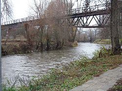
 canoe course and old railway bridge in Fürth-Weikershof | |
 | |
| Location | |
| Country | Germany |
| Physical characteristics | |
| Mouth | |
• location | Regnitz |
• coordinates | 49°29′11″N 10°59′12″E / 49.48639°N 10.98667°E |
| Length | 46.4 km (28.8 mi) [1] |
| Basin size | 2,118 km2 (818 sq mi) [1] |
| Basin features | |
| Progression | Regnitz→ Main→ Rhine→ North Sea |
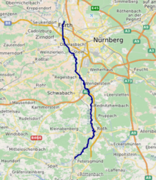
The Rednitz (German pronunciation: Pegnitz to form the Regnitz in Fürth.
Sources
Franz X. Bogner: Rednitz und Regnitz. Eine Luftbildreise von Weißenburg bis Bamberg. Luftbildband. Verlag Fränkischer Tag, Bamberg 2007
ISBN 978-3-936897-47-0
See also
References
- ^ a b Complete table of the Bavarian Waterbody Register by the Bavarian State Office for the Environment (xls, 10.3 MB)
