
Redstone, Colorado
Redstone, Colorado | |
|---|---|
MDT) | |
| ZIP Code[4] | 81623 |
| Area code | 970 |
| GNIS feature[2] | Redstone CDP |
Redstone is an
Zip Code 81623) serves Redstone postal addresses.[4]
The village is listed on the
historic district and includes several properties that are also separately listed on the National Register.[5][6][7]
History
Redstone was established in the late 19th century by industrialist
Cleveholm
A dominant feature of Redstone is Cleveholm Manor, commonly called "Redstone Castle," an opulent 42-room
Osgood Castle and Osgood Gamekeeper's Lodge, respectively. As of 2004, the Castle still contained 75 percent of its original furnishings.[7]
The historic inn in Redstone, which is independently listed on the National Register as Redstone Inn, is now operated as a resort inn, offering year-round accommodations.[6]
Geography
The Redstone CDP has an area of 280 acres (1.134 km2), all land.[1]
Climate
Redstone has a humid continental climate (Koppen: Dfb). Summers are warm with cool nights and winters are cold with extremely heavy snowfall averaging 170 inches (430 cm) annually.[10]
| Climate data for REDSTONE, COLORADO | |||||||||||||
|---|---|---|---|---|---|---|---|---|---|---|---|---|---|
| Month | Jan | Feb | Mar | Apr | May | Jun | Jul | Aug | Sep | Oct | Nov | Dec | Year |
| Mean daily maximum °F (°C) | 33.1 (0.6) |
36.2 (2.3) |
42.7 (5.9) |
51.1 (10.6) |
60.5 (15.8) |
71.8 (22.1) |
76.4 (24.7) |
74.6 (23.7) |
67.0 (19.4) |
55.3 (12.9) |
39.2 (4.0) |
31.5 (−0.3) |
53.3 (11.8) |
| Mean daily minimum °F (°C) | 7.7 (−13.5) |
11.5 (−11.4) |
17.3 (−8.2) |
24.5 (−4.2) |
31.9 (−0.1) |
39.4 (4.1) |
44.2 (6.8) |
43.8 (6.6) |
36.7 (2.6) |
28.0 (−2.2) |
17.5 (−8.1) |
9.0 (−12.8) |
26.0 (−3.4) |
| Average precipitation inches (mm) | 1.78 (45) |
2.41 (61) |
3.09 (78) |
2.04 (52) |
2.30 (58) |
1.48 (38) |
2.23 (57) |
1.67 (42) |
2.98 (76) |
3.02 (77) |
2.64 (67) |
2.03 (52) |
27.67 (703) |
| Average snowfall inches (cm) | 26.0 (66) |
29.9 (76) |
32.4 (82) |
12.1 (31) |
5.3 (13) |
0.5 (1.3) |
0 (0) |
0 (0) |
0.5 (1.3) |
6.9 (18) |
26.4 (67) |
29.5 (75) |
170.4 (433) |
| Source: The Western Regional Climate Center [11] | |||||||||||||
Demographics
The United States Census Bureau initially defined the Redstone CDP for the 2010 United States census.
| Year | Pop. | ±% |
|---|---|---|
| 2010 | 130 | — |
| 2020 | 127 | −2.3% |
| Source: United States Census Bureau | ||
See also
- Colorado
- Outline of Colorado
- Bibliography of Colorado
- Geography of Colorado
- History of Colorado
- Colorado statistical areas
- Glenwood Springs, CO Micropolitan Statistical Area
- List of counties in Colorado
- List of places in Colorado
- Protected areas of Colorado
References
- ^ a b c "State of Colorado Census Designated Places - BAS20 - Data as of January 1, 2020". United States Census Bureau. Retrieved December 26, 2020.
- ^ a b c "U.S. Board on Geographic Names: Domestic Names". United States Geological Survey. Retrieved December 26, 2020.
- ^ a b United States Census Bureau. "Redstone CDP, Colorado". Retrieved April 13, 2023.
- ^ a b "Look Up a ZIP Code". United States Postal Service. Retrieved December 26, 2020.
- ^ About Redstone, Redstone Community Association website, accessed March 28, 2010
- ^ a b c d The Historic Redstone Inn website, accessed March 28, 2010
- ^ a b Colorado: Transfer of Ownership of Redstone Castle, Redstone, Advisory Council on Historic Preservation, June 1, 2004
- ^ a b History of Redstone, Redstone Community Association website, accessed March 28, 2010
- ^ Redstone Castle Archived 2010-02-12 at the Wayback Machine, AllAspen.com website, accessed March 28, 2010
- ^ "REDSTONE 4 W, COLORADO - Climate Summary". wrcc.dri.edu. Retrieved May 25, 2020.
- ^ "REDSTONE 4 W, COLORADO (056970)". Retrieved December 18, 2015.
External links
Redstone, Colorado at Wikipedia's sister projects
 Definitions from Wiktionary
 Media from Commons
 News from Wikinews
 Quotations from Wikiquote
 Texts from Wikisource
 Textbooks from Wikibooks
 Resources from Wikiversity
- Redstone Community Association
- Redstone Historical Society
- Redstone @ History Colorado
- Redstone @ WesternMiningHistory.com
- Redstone @ Colorado.com
- Redstone @ UncoverColorado.com
- Redstone Castle
- Pitkin County website
Municipalities and communities of Pitkin County, Colorado, United States | ||
|---|---|---|
| City | 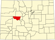 | |
| Towns | ||
| CDPs | ||
| Unincorporated communities | ||
Ghost towns | ||
| Footnotes | ‡This populated place also has portions in an adjacent county or counties | |
| ||
| International | |
|---|---|
| National | |