
Reichsautobahn


The Reichsautobahn system was the beginning of the
Hitler performed the first ceremonial shoveling of dirt on 23 September 1933, at Frankfurt, and work officially began simultaneously at multiple sites throughout the Reich the following spring. The first finished stretch, between Frankfurt and Darmstadt, opened on 19 May 1935, and the first 1,000 km (620 mi) were completed on 23 September 1936. After the annexation of Austria, the planned network was expanded to include the "Ostmark",[clarification needed] and a second soil-breaking ceremony for the first Reichsautobahn on formerly Austrian territory took place near Salzburg on 7 April 1938. When work ceased in 1941 because of World War II, 3,819.7 km (2,373.5 mi) had been completed.
History
Background
Two controlled-access highways had been built prior to the Nazi era. The 10 km (6.2 mi) long
Corporations were also formed and plans drawn up for motorized highways between Mannheim and Heidelberg, between Munich and Berlin via Leipzig, between Munich and Lake Starnberg, between Leipzig and Halle, and between Cologne and Aachen, in addition to plans for networks totaling 15,000 km (9,300 mi) or 22,500 km (14,000 mi) in length. In 1930 the Ministry of Transportation became involved in trying to establish guidelines for the building of a highway network.[8] Most notably, the organization known as HaFraBa or HAFRABA (an acronym for Verein zur Vorbereitung der Autostraße Hamburg–Frankfurt–Basel - Association for the preparation of the motorway Hamburg [later Hansestädte, Hanseatic cities, after Lübeck and Bremen were added] – Frankfurt – Basel), was founded in 1926 at the instigation of Willy Hof, who had been inspired by the Italian highways, and projected a north–south highway to be expanded into a network. Detailed engineering specifications were prepared, bound in 70 volumes, and this planning would form the basis of the Reichsautobahn network.[9][10]
However, HAFRABA was never able to surmount the logistical problems of building a highway through many different jurisdictions,
Planning and construction

After the Nazis came to power at the end of January 1933, their position changed rapidly. Fritz Todt produced a report arguing for the building of highways, Straßenbau und Straßenverwaltung, known as the "Brown Report" (Braune Denkschrift or Brauner Bericht),[14] and in a speech at the Berlin Motor Show on 11 February, Hitler presented it as a necessity and as the future measure of a people, as railroads had been in the past.[15] A law establishing the Reichsautobahn project under that name was passed on 27 June 1933, and the Gesellschaft Reichsautobahnen (Reichsautobahns Association) was founded on 25 August as a subsidiary of the Reichsbahn, thereby removing its objections.[16] Todt was named Generalinspektor für das deutsche Straßenwesen (Inspector-General for the German Road System) on 30 June. HAFRABA and other organizations were folded into the planning arm, known as GEZUVOR (Gesellschaft zur Vorbereitung der Reichsautobahn, Society for the Preparation of the Reichsautobahn).[17][18] The Chairman of the Board of HAFRABA, Dr. Ludwig Landmann, the Mayor of Frankfurt, was Jewish, which provided the Nazis with a reason to take it over.[19] The autobahn was presented to the German public as Hitler's idea: he was represented as having sketched out the future network of highways while in Landsberg Prison in 1924.[20] They were to be "the Führer's roads", a myth promoted by Todt himself, who coined the phrase and warned close associates not to "in any way [let] the impression arise that I built the autobahns. They are to be reckoned as simply and solely the Führer's roads."[21] Hof, an enthusiastic party member, resigned on 22 December 1934; the editor of the HAFRABA magazine, Kurt Kaftan, had caused a political problem by presenting Hof as the originator of the idea, or jointly responsible for it with Hitler.[18] The overlapping responsibilities of the Gesellschaft Reichsautobahnen (in charge of construction) and of Todt's office (in charge of planning but also of all roads in the Reich) exemplified the growth of central authorities in the Third Reich and inevitably led to conflicts, but only on 1 January 1941 was the Gesellschaft Reichsautobahnen removed from the Reichsbahn and placed directly under Todt.[22]
On 5 August 1933, a radio play by Peter Hagen and Hans Jürgen Nierenz, Wir bauen eine Straße ("We are Building a Road"), was broadcast throughout the Reich.[23] On 23 September 1933, the first 720 unemployed marched to the Frankfurt Stock Exchange, where they were ceremonially invested with shovels as Reichsautobahn workers, then from there accompanied by SA men, marched behind Todt and Jakob Sprenger, the Reichsstatthalter of Hesse, to the bank of the Main. There after further speeches, Hitler was to inaugurate work on the autobahn system with the first ceremonial shoveling of dirt to form the base of an embankment. However, as Todt described the scene in an illustrated album published in 1935, "again and again his shovel plunged into the mound [of dirt]. This was no symbolic shoveling; this was real construction work!" Two of the workers "sprang ... to help him", and they worked "until the mound had been dealt with in an orderly fashion and ... the first drops of sweat were dripping from his brow onto the earth."[24] The image of Hitler shoveling was used many times in propaganda, including superimposed on the workers' march in Heinrich Hoffmann's poster urging Germans to ratify the Nazi government in the November 1933 Reichstag election.[25] The location was marked with a park and a commemorative stone.[26]

Preparatory work at several sites was done over the following winter, but full-scale construction officially began on 21 March 1934, as the showpiece of the opening of the Arbeitsschlacht ("work battle"), which also included construction of dams and residences and agricultural work. Autobahn work sites had been established at 22 locations, governed by 9 regional work divisions (which became 15 by mid-1934), distributed throughout the Reich for maximum public visibility, and work was ceremonially initiated at 15 of the sites. At Unterhaching, Hitler made a short speech ending with the command, "Fanget an!" ("Begin!") This was broadcast nationwide on the radio, after which his representatives opened work with the first shoveling of dirt at the other 14 locations: Hermann Göring at Finowfurth near Berlin, for example.[27] A monument in the highway median at Unterhaching later commemorated the event: it took the form of a cylinder inscribed with Hitler's command and the date and surmounted by shovels in the manner of weapons on a military monument.[28][29] 15,000 workers were now engaged; however, at several of the work sites, the men were immediately sent home because mechanized excavations and other preparation had to be done first. According to a Sopade report in April–May 1934, only 6,000 workers on a 67 km (42 mi) stretch between Frankfurt and Heidelberg and 700 on a 7 km (4.3 mi) stretch between Munich and the border were actually active.[30] GEZUVOR presented its 788 volumes of plans to Todt on 1 June 1934.[31]
Despite initial promises that the first segment would open in September 1934, to coincide with the one-year anniversary of the ground-breaking and with the 7th International Road Congress, this did not happen until 19 May 1935, when the 22 km (14 mi) stretch between Frankfurt and Darmstadt was opened.
Working conditions were hard and the pay very low, because it was based on the lowest local wage and unlike unemployment payments did not include an allowance for living expenses. There was also no payment until winter 1938 for bad weather days when work could not take place. Workers were initially housed in barracks, barns, industrial buildings, and tents, and complained about the work, the conditions, and the pay. On 18 October 1934, the workers on the Hamburg-Bremen segment of the autobahn at
As the economy improved and the rearmament effort accelerated, it became impossible to find enough workers; they were for a while brought in from the big cities where unemployment remained highest, primarily Hamburg and Berlin, but in 1937 full employment was achieved, and armaments factories offered far superior pay and working conditions. The policy of minimizing the use of machinery was reversed and pay was increased, those unemployed who refused assignment to the autobahn were punished by suspension of benefits for up to 12 weeks, and after the annexation of Austria and of the Sudetenland, workers from there were almost immediately put to work on the autobahn, but increasingly the project used
The Reichsautobahn network as it was ultimately conceived was to extend into most of the planned Lebensraum in the conquered territories;[54] along with a trio of eastward and southward extensions of the extreme broad-gauge Breitspurbahn rail system, the highways were intended to provide the main connections for the "settlement strings" of German immigrant Wehrbauer communities to be located in conquered Soviet territory.[55] The addition of Austria to the Reich in 1938 resulted in an extension of the previously Vienna-centered road system and major planning and construction efforts in the Alpine regions. The West Autobahn between Vienna and Salzburg was started within weeks with much publicity, but only a few kilometers around Salzburg were finished by 1942.[7]
-
 Reichsautobahn work site near Berlin, April 1936
 -
 A workers' barrack
 -
 Bunk room in workers' camp, 1934


World War II

After the war began in September 1939, a further 560 km (350 mi) of autobahn were completed, bringing the total to 3,870 km (2,400 mi), before work ceased almost entirely in late 1941 with the worsening of the war situation in Russia.
In July 1941, Dieter Wisliceny, the Judenberater for Slovakia, invited Slovak government officials to tour several Reichsautobahn camps in Upper East Silesia. During the trip, the Reichsautobahn made inquiries about the use of Slovak Jews on its construction projects. However, Izidor Koso, president of the Interior Ministry, commented that the Germans' methods were "un-Christian and inhumane" and Slovakia would have to find another way.[60] The visitors understood that Jews in Poland lived under conditions that would eventually cause mass death.[61]
A speed limit of 100 km/h (62 mph) had been imposed in May 1939 to save fuel;[62] during the war this was lowered to 80 km/h (50 mph), and private cars were allowed on the autobahns only in exceptional circumstances. (By 1943, traffic was so low that bicycles were permitted.[7]) Other than official traffic, which picked up toward the end of the war, the autobahns were used for some deliveries of tank parts and finished U-boats and motor-boats, and as runways for fighter planes, including in one case for final assembly and test flights of Messerschmitt Me 262s after the factories in Augsburg and Regensburg were bombed.[63] As the war progressed, vehicles were at risk of strafing by Allied aircraft.[64] However, most damage to the autobahns was caused late in the war by the retreating Wehrmacht, which blew up numerous bridges in an effort to slow the Allied advance;[37] on 19 March 1945, Hitler ordered the destruction in retreat of "all military, transportation, news, industrial, and provisions facilities".[7][65]
Post-war
After the war, the Reichsautobahns were declared national property of the various post-war states (for example Bundesvermögen, federal property, under Article 90 of the
-
 Debris from the original Drachenloch Bridge below the reconstructed bridge, at theSwabian Alps
 -
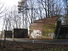 Bridge abutments for Hamburg - Berlin autobahn left incomplete, nearGDR
 -
 Stretch of the "Berlinka" Berlin - Königsberg autobahn near Elbląg in Poland (formerly Elbing, East Prussia) in 2006; this segment has since been upgraded as part of Expressway S22
 -


.jpg)
_2006.jpg)

Technical specifications and financing
The specifications for the autobahns were based on those developed by HAFRABA. They were designed as four-lane limited-access highways, with a central median, road surfaces in each direction normally 24 m (79 ft) wide (widened on some major segments immediately before the war), surfaced in concrete. There were no shoulders. In addition to having no intersections, the route was to limit
The network as planned had three east–west highways (between the
When construction was stopped, of the 3,870 km (2,400 mi) of completed highway segments, approximately 80% was surfaced in concrete, approximately 10% paved, and the remaining 10% surfaced with asphalt. This compared to approximately 565 km (351 mi) of concrete-surfaced roads in the Reich in 1933.[76] Some stretches were only completed in one direction; in some low-traffic areas, particularly in Thuringia and Silesia, this was planned.[77]
The Reichsautobahn was initially to be financed by a road use tax, but in 1936 this was rejected and instead fuel taxes were raised and car owners taxed.[78] In addition, the Reichsbahn and the national bank provided loans. However, approximately 60% of the financing came from the Reichsanstalt für Arbeitsvermittlung und Arbeitslosenversicherung, the government employment department. At the end of the war, total costs were 6.5 billion Reichsmarks (equivalent to €26 billion in 2021), of which 4.6 billion RM was still owed, almost 74% to the employment department.[14][46] Costs were inflated by the aesthetic requirements, by shortages of raw materials, by the need to repair work that had been performed poorly under time pressure, and by the initial failure to include in the cost estimates connector roads between the autobahns and existing roads.[79] In post-war Germany, opinions of the Reichsautobahn included recognizing that it had been a white elephant.[80]
Objectives
Employment

Reduction of unemployment was presented as the main reason for the Reichsautobahn project, and propaganda both used the autobahn to represent the Arbeitsschlacht and Nazi reduction of unemployment in general and emphasized the project's role. This included misleading graphs and exaggerated statistics.[81] For the first two years of construction, mechanization was avoided so far as possible in order to create more work (although lack of machinery was also a factor).[82] Numerous celebrations all over the Reich kept the project in the public eye.[83] It was therefore logical from the point of view of the regime that the majority of funding came from the employment department.[46] Todt had foreseen the creation of at least 600,000 jobs. However, autobahn employment peaked in 1936 at 124,483 directly employed in construction and a similar number in the supply chain, so that the autobahn never directly or indirectly employed more than 250,000 workers.[14][84][85] Rearmament was responsible for a far greater share of unemployment reduction,[86] and the peak years of autobahn employment came long after the first two years of Nazi rule, when the need for jobs was most urgent.[87]
Motorization and military applications

Another important reason for building highways was to motorize Germany. This accorded with the Nazis' self-presentation as modernizers. On 11 February 1933, at the Berlin Motor Show, Hitler had already presented promotion of motoring as an important objective, and named an extensive road-building program as the third on his list of four means of realizing it.
Motorization clearly had a military application, providing trucks and drivers that could be used by the military. In addition, Todt's report cited troop transportation as a reason to develop highways: he stated that using 100,000 requisitioned vehicles, it would be possible to transport 300,000 shock troops the width of the Reich in two nights. A second memorandum written six months later by Gottfried Feder also stressed military uses.[97] The military disagreed. Georg Halter, professor of road construction and railroads at the Technical University of Munich and a Nazi Party member, wrote several pieces beginning in fall 1933 in which he contested Todt's report, with respect to strategic applications pointing out that road vehicles had less than a third of the weight capacity of railroad freight wagons, in addition to which the steel wheel-rims and treads of armored vehicles would severely damage the roadway. He also regarded the light-colored concrete that was to be used for the roadways as a guide for enemy aircraft (beginning in 1937, the surface was tinted black for this reason, which distressed Hitler)[98] and the planned large viaducts as tempting targets, "like honey to wasps". Border segments that could have been useful at the start of the war had not been completed because of earlier fears that enemies would use them to invade, and weight testing was not performed until March 1939. The German military rarely used the autobahns for troop movements (one of the exceptions being transporting flak units); they were used much more extensively at war's end by the advancing Allies, who did indeed damage them in the process.[37][99] In fact as the war continued, fuel shortages led the German military to make increasing use of horses rather than motorized transportation.[100]
It was once common to consider military applications as having been the true main reason the Nazis constructed autobahns, but historians now generally agree that this was an exaggeration.[101][102][103] Foreigners suggested a covert military purpose for the Reichsautobahns as early as 1934, but a 1946 British Intelligence report noted that sections that would have been militarily useful were not completed and that some completed sections were not apparently used during the war.[104] The project did, however, develop logistical skills and technology that were used for military purposes, notably in the building of the Westwall under Todt's supervision, and it disguised the development of those resources.[105]
Aesthetics
A purpose for the project that increasingly came to the fore was to unify Germany, by enabling Germans to explore it and appreciate its beauty;[106][107] including the new territories that had been added to the Reich under the Nazis;[108] Albert Speer stated that the autobahns were uniform in design to express the unity of the Reich.[109] In 1933 Todt hired Alwin Seifert, a landscape architect, as his deputy on the Reichsautobahn project and gave him the title Reichslandschaftsanwalt (Reich supervisor of landscape protection). Seifert called for architects, rural planners, plant sociology experts and ecologists to contribute to the effort, and maps were made of the native vegetation with the intention of preserving it and providing a "genuine" experience of the landscape.[110] A Landschaftsanwalt (counsel for the landscape) was appointed in each construction district to ensure minimum harm, and in 1935 Hitler temporarily stopped work on the Berlin - Munich autobahn near Bayreuth because of harm to the landscape.[111]
Nonetheless, the first completed segments were based on the HAFRABA plans and thus consisted of straightaways 4 to 5 km (2.5 to 3.1 mi) long joined by curves that were arcs of circles, as in railroads;[112] the minimum radius of the curves was defined in planning documents (2,000 m (2,200 yd), less in mountainous terrain, down to 400 m (440 yd)).[113] A debate spearheaded by Seifert, who argued that straight stretches were "unnatural"[114] and moreover would lead to accidents through highway hypnosis,[115] led to increasing dominance of the view that the autobahns should provide, as Emil Maier-Dorn put it in 1938, "not the shortest but, rather, the most sublime connection between two points".[116] By 1939 and possibly earlier, sinuous forms predominated.[117] Although Todt had hired Seifert and his landscapers in order to ensure the "German character" of the autobahn, he initially favored the railroad engineers' views on layout; the decisive factor was cost, namely the reduction in the number of embankments and bridges needed.[118]
The showpiece aesthetic stretch of the Reichsautobahn was the Irschenberg on the autobahn from Munich to the Austrian border, where instead of passing through the valley, the highway was routed in a curving path up the hill to the summit, from which there was a full view of the Alps to the south. A rest stop was located there.[119] (The Irschenberg autobahn segment was one of those that limited the usefulness of the highways for freight transport, and with the increase in traffic after the war it became a notorious bottleneck and accident site. Many such segments have been straightened and in some cases the highway has been relocated.) In 1936 Otto Illauer's view of this stretch of highway won first prize in the photography contest Die schöne Straße in Bau und unter Verkehr (the beautiful road under construction and in use);[120] the only criticism of the picture was that the contrast between the light-colored road and the landscape was too harsh, illustrating the strong desire for harmony between the highway and its surroundings.[121] In fact this entire 125 km (78 mi) segment epitomizes planning to maximize aesthetic appreciation of the landscape. Todt, who was credited with choosing the route, described it as an orchestrated experience culminating in the surprise view of the Chiemsee, where "[a]nyone who has a proper feel for this landscape ... turns off the motor and silently glides down the three-kilometer-long slope to the southern shore of the lake, where a bathing beach, parking places, or the [inn] invite you to stay and rest"; and according to Seifert, of the 13 possibilities for the continuation from the Chiemsee down to the Salzburg plain, the engineers had selected the only one that "[made] the impossible possible" by "continu[ing the sequence of landscape beauty] ... on another level".[122]
Both the hilltop rest stop at the Irschenberg and the rest stop at the Chiemsee were in accordance with general practice on the Reichsautobahn: the highway detoured from the direct route to provide access to cultural sights and views, and rest stops and filling stations were constructed at these points to facilitate leaving the car to appreciate them.
Mitigating damage to the environment was a concern, as part of creating an authentic experience of the landscape, which was to unroll like a movie from the motorist's perspective. The
From the 1950s through the 1970s there was a broad-based movement in West Germany to remove trees from beside the autobahns as a danger, greatly changing their appearance.[129]
All advertising was banned on the Reichsautobahn. Instead of advertising signs, noticeboards to be used to alert drivers to telephone messages were placed on the median near exits.
-
 Bridge over the Saale between Hirschberg, Thuringia and Rudolphstein, Upper Franconia, with viewing platform visible in foreground
 -
 Neville Chamberlain (center, between Herbert von Dirksen and Joachim von Ribbentrop) at the Chiemsee rest stop on September 15, 1938, returning from his meeting with Hitler at the Obersalzberg that led to the Munich Agreement
 -
 Motorway exit signpost (traced). The hand-painted panels made of wood and plywood had the basic color of blue shade RAL 32 h. This corresponds to today's RAL 5002.


Monumental function

Autobahn propaganda
Probably most importantly, the autobahns were created as a monument to the Third Reich, both internally and internationally;[139] in the words of historian Thomas Zeller, "to symbolize power and the conquest of space".[140] Todt insisted that they always be referred to as the Reichsautobahns, never simply "autobahns", and sought to eliminate use of the rival term Kraftfahrbahn (motor route).[141]
They were frequently classed as a wonder of the modern world and especially compared to the Egyptian pyramids. For example, Emil Maier-Dorn wrote: "The Reichsautobahn must become, like the Great Wall of China, like the Acropolis of the Athenians, [and] like the pyramids of Egypt, a tower[ing presence] on the landscape of history, [it] must stand like a duke in the parade of human achievements."[142][143]
One aspect of this was the sheer size of the project, which was constantly presented to the public not only by ceremonies starting work on and opening segments, but by radio broadcasts (including at least two dramas as well as informational broadcasts and coverage of ceremonies), posters, postcards, stamp issues, calendars, board games, etc., and a major exhibition, Die Straße (The Road), which opened in Munich in 1934 and in which the autobahns were presented in artworks as the culmination of the history of human roadbuilding. This exhibition was subsequently shown in Berlin and Breslau, and other exhibitions occurred later in, for example, Prague (1940) and Budapest (1942).[144][145]
The Reichsautobahn was also prominently represented in the 1937 exhibition celebrating the first four years of the regime's achievements, Gebt mir vier Jahre Zeit (Give Me Four Years, a slogan of Hitler's).[146] In addition, Todt commissioned official artists, particularly Ernst Vollbehr, and photographers, particularly Erna Lendvai-Dircksen, to depict the construction of the autobahns in heroic terms.[147]
Full-length movies called Fahrzeuge und Straßen im Wandel der Zeiten (Vehicles and Roads Throughout Time; scripted in 1934) and Die große Straße (The Great Road; to have been directed by
Bridges, the autobahn's monuments

As Ernst Bloch wrote in 1937, the autobahns, despite their magnitude, were "rather flat". Photomontages attempted to impress upon the public the sheer volume of earth moved and materials used to build them,[150] but the primary means of demonstrating the monumentality of the achievement were bridges and sculpture.
Because it had no intersections, the autobahn required a huge number of bridges and underpasses. These were initially purely utilitarian in design, but after inspecting the first completed stretch, Todt sought to give them a more unified and aesthetic appearance. Paul Bonatz, who was hired in 1934 to oversee bridge design on the Reichsautobahn, wrote a few months before that they should be as unnoticeable as possible, minimal in mass and in obstruction of view. Like the rest stops, they were also designed to reflect local building styles and materials. One exception that proved the rule was the bare steel bridges spanning the Dessauer Rennstrecke high-speed section, which expressed its high-tech purpose and also alluded to the Junkers aircraft company that was headquartered in Dessau.[151]
The relatively few large bridges were major design statements; Todt wrote in 1937 that they "should not be [designed] for 1940, nor yet for 2000, but ... should extend their dominating presence, like the cathedrals of our past, into future millennia."[152] The first of these was the Mangfall Bridge at Weyarn, a girder bridge designed by German Bestelmeyer that spanned the valley on two double pylons of reinforced concrete. Built in 1934–36, this served as the model for several subsequent autobahn bridges, and a model of one of the huge pylons dominated the Reichsautobahn exhibit at the Gebt mir vier Jahre Zeit exhibition.[146][153]
Subsequently, the preferred style for the large bridges evolved away from this modern form toward viaducts derived from Roman bridges, which had a more imposing mass, allowed the reflection of regional building styles in their use of stone and brick, and embodied the Nazi claim to be the heirs to the great builders of ancient times. These included the Holledau Bridge by Georg Gsaenger (1937–38) and the bridges over the Saale at Hirschberg, Thuringia, and Jena; in 1938 Friedrich Tamms designed a huge imitation Roman viaduct for the Werra valley at Hedemünden.[154][155] Another factor in this change in style was the shortage of steel caused by the policy of autarky and by rearmament and war; there was also a near failure of a continuously welded bridge, which had to be quietly reinforced and led to mistrust of steel construction.[156] Many later bridges had a reinforced concrete core clad in stonework or brick.[71]
However, with the bridges the shift was never as complete as it was in other aspects of Reichsautobahn architecture: in 1940–41, along the Rhine, a stone bridge was under construction at Frankenthal and at the same time at Rodenkirchen in Cologne, an ultra-modern suspension bridge by Bonatz.[71] In addition to the self-image of modernity, another reason for this was the enormous cost of stone construction in man-hours and in material; so much masonry construction was carried out in the Third Reich that shortages occurred. Hence many of the viaducts were in simplified, modernized form, for example the series at the Drackensteiner Hang by Paul Bonatz and the bridge over the Lahn valley at Limburg, by Bonatz and Gottwalt Schaper.[157]
Sculptures
In addition, the Reichsautobahn was to have had a large amount of monumental sculpture. The viewing platforms from which travelers could admire the bridges often had obelisks or columns topped with eagles and swastikas. In addition to the large signs on the bridges immediately before the exit to a city—often including the heraldic animal or complete coat of arms—imposing sculptures were planned for many such exits, usually involving eagles towering above the road, as in Bestelmeyer's sketch for the entrance to Heidelberg and Speer's 1936 design for a dramatic gateway at the border near Salzburg.[158]
Bridges sometimes constituted dramatic gateways in themselves, such as the "Gateway of Thuringia" at
Unfinished routes
Route 24 Hamburg - Hanover. This route was based on the planning of the HaFraBa association. However, the route between Hamburg and Hanover was not continued after the war as planned between Schwarmstedt and Buchholz, eastwards past Negenborn in a south-south-westerly direction to today's Bundesautobahn A2 near Garbsen, but instead was routed eastwards past Hanover as Bundesautobahn 7 .[163][164]
Route 46 Fulda - Würzburg. After the Second World War, a different route was chosen. There are almost a dozen unfinished structures on the old route, most of them in the forest. In Rupboden, a district road crosses under the overgrown route, which is still clearly visible today. Near Gräfendorf, an unfinished pillar now serves as a climbing rock for alpinists. Although protected as a monument, apart from signs against damage to property, even today there is no memorial plaque commemorating the Reichsautobahn route, which ended as a ruin and was completely suppressed for many years.
Route 145. During the German occupation of Denmark, earthworks for a Reichsautobahn "Route 145" were started from the ferry port of Rødbyhavn to Majbølle on the Guldborgsund in September 1941. Some crossing bridges are still in use today. In the 1950s, this motorway was completed and has been part of the European Route 47 (Europastraße 47, Vogelfluglinie) since 1963.
Influence
Foreign visitors reported generally favorably on the autobahns, particularly the foreign press in Germany for the 1936 Olympics; in October 1937 it was noted that an English visitor had remarked on the "real democracy" at an autobahn work site,[165] and in September 1936 the former British Prime Minister David Lloyd George visited Hitler partly to discuss the autobahns, and returned home calling him a "great man".[166] But they were also regarded as inhumane. Frederick Law Olmsted Jr. described their version of the parkway design as "a horrid clash of nature and technics."[167] In his critical book on Nazi Germany, The House That Hitler Built, historian Stephen Henry Roberts described them as "needlessly grandiose but most impressive. Efficiently made and more efficiently managed, they somehow reduce the individual to insignificance."[168] Walter Dirks may also have intended veiled criticism when he wrote in the Frankfurter Zeitung in 1938 of autobahn driving as overwhelmingly passive: "It is a mark of how passive we are, of how much the sweep of road affects our senses, that the relationship between driver and road seems to be reversed. The road takes the active role, moving toward us quickly and smoothly, ... sucking the car inexorably into itself."[169]
After the war, with the exception of the parkway aesthetic, the Reichsautobahn became the model for highways in other countries, and the practical experience gained—in logistics, mechanized construction, and bridge-building—was also used by others.[37]
See also
- Borovsko Bridge near Prague, meant to be part of a Reichsautobahn to Prague
References
- ^ subjective *need quotation
- ISBN 978-386153117-3, pp. 31-32 (in German).
- ISBN 9783922561125, pp. 22–47, p. 22 (in German).
- ^ a b Schütz and Gruber, pp. 32–33.
- ^ Schütz and Gruber, p. 51.
- ^ Kunze and Stommer, p. 24.
- ^ ISBN 9783593391571, pp. 194–202 (in German).
- ^ Kunze and Stommer, pp. 23–24.
- ^ Kunze and Stommer, pp. 24–25.
- ^ Schütz and Gruber. pp. 29-31, 35; also pp. 14–15, quoting Heinrich Brüning in his memoirs concerning the Nazi government "taking the plans that we had prepared out of [a] drawer".
- ^ ISBN 978-1-84545-309-1, p. 49.
- ^ a b Kunze and Stommer, p. 25.
- ^ a b Schütz and Gruber, p. 34.
- ^ a b c Schütz and Gruber, p. 11.
- ^ Kunze and Stommer, pp. 26–27.
- ^ Schütz and Gruber, pp. 16–17.
- ^ Kunze and Stommer, pp. 25–26.
- ^ a b Schütz and Gruber, p. 37.
- ^ Schütz and Gruber, p. 33.
- ^ Schütz and Gruber, particularly pp. 36–37, quoting Kurt Kaftan saying exactly that in 1935; Zeller, Driving Germany, p. 63.
- ^ Schütz and Gruber, p. 18.
- ^ Zeller, Driving Germany, pp. 55–57.
- ^ Schütz and Gruber, p. 40.
- ^ Schütz and Gruber, p. 43; full passage, Kunze and Stommer, p. 44.
- ^ Schütz and Gruber, pp. 43–44.
- ^ Schütz and Gruber, p. 45.
- ^ Schütz and Gruber, pp. 11, 46–48.
- ^ Meinhold Lurz, "Denkmäler an der Autobahn—die Autobahn als Denkmal", in: Reichsautobahn: Pyramiden des Dritten Reichs, pp. 154–92, pp. 154, with photograph, 159.
- ^ Photograph, Schütz and Gruber, p. 48.
- ^ Schütz and Gruber, pp. 48-49.
- ^ a b Schütz and Gruber, p. 56.
- ^ Schütz and Gruber, pp. 49–51.
- ^ Schütz and Gruber, p. 61.
- ^ Schütz and Gruber, p. 12.
- ^ a b Kunze and Stommer, p. 30.
- ^ Zeller, Driving Germany, p. 59.
- ^ a b c d e f g Kunze and Stommer, p. 31.
- ^ Schütz and Gruber, p. 82.
- ^ Schütz and Gruber, pp. 68, 70, 72.
- ^ Schütz and Gruber, pp. 74–76.
- ^ Kunze and Stommer, p. 35, quoting Die Straße, 1937.
- ^ Schütz and Gruber, pp. 76–77.
- ^ Schütz and Gruber, p. 78.
- ^ James D. Shand, "The Reichsautobahn: Symbol for the Third Reich", Journal of Contemporary History 19.2 (April 1984) 189–200, p. 193.
- German Labor Front.
- ^ a b c d Kunze and Stommer, p. 29.
- ^ Schütz and Gruber, p. 80.
- ^ Schütz and Gruber, p. 81.
- ^ Schütz and Gruber, p. 71; cited excerpt from Die Straße, 1936, quoted fully at Kunze and Stommer, p. 34.
- ^ Schütz and Gruber, pp. 50–51, 52.
- ^ Schütz and Gruber, pp. 58, 81, 84.
- ^ Zeller, Driving Germany, p. 61.
- ^ Schütz and Gruber, pp. 84, 86–87.
- ISBN 9780393055092, p. 356.
- ISBN 9783892446231, p. 418(in German).
- ^ According to Schütz and Gruber, p. 91, 3,819 km (2,373 mi).
- ^ Schütz and Gruber, p. 64.
- ^ Schütz and Gruber, p. 65.
- ^ Schütz and Gruber, pp. 90–91.
- ISBN 978-3-11-036500-9, (in German), pp. 18–45, p. 30.
- ^ Hutzelmann, pp. 30–31.
- ISBN 9780674050914, pp. 51–56.
- ^ Schütz and Gruber, p. 91.
- ^ Schütz and Gruber, p. 92.
- ^ Schütz and Gruber, p. 93.
- ^ Photograph, Dieter Mayer-Gürr, "Autobahnruinen", in: Reichsautobahn: Pyramiden des Dritten Reichs, pp. 135–53, p. 137.
- ^ "Wiederaufbau der zerstörten Autobahnbrücke bei Sachsenvorwerk", Bundesgrenzschutz 1963 (pdf) (in German).
- ^ Photographs, Mayer-Gürr, pp. 144–45.
- ^ Photographs of incomplete bridge and unused stone, Mayer-Gürr, pp. 150–51.
- ^ Wommen Viaduct, Structurae.
- ^ a b c Schütz and Gruber, p. 97.
- ^ a b Schütz and Gruber, p. 101.
- Gleiwitz(now Gliwice, Poland) and Aachen.
- ISBN 9780091793944, p. 395.
- ^ Schütz and Gruber, pp. 86–87.
- ^ Matzke, p. 57 and n. 111.
- ^ Matzke, p. 58.
- ^ In 1936 the tax on a liter of gasoline was 40 pfennigs, approximately half the hourly wage of a skilled worker - Matzke, p. 52.
- ^ Matzke, p. 53.
- ^ Zeller, Driving Germany, p. 238.
- ^ Schütz and Gruber, pp. 56-58.
- ^ Schütz and Gruber, p. 67.
- ^ Schütz and Gruber, pp. 58–60.
- ^ Kunze and Stommer, p. 28.
- ^ However, Shand, p. 191, states that by 1936 direct employment on Reichsautobahn construction was 130,000, plus 270,000 in ancillary occupations such as materials, and credits the project with significant contributions to alleviating unemployment.
- ^ Schütz and Gruber, pp. 38–39.
- ^ Schütz and Gruber, p. 57.
- ^ Schütz and Gruber, p. 14.
- ISBN 9780804743266, pp. 202–03. One analyst has suggested the underlying impetus behind the goal of motorization and the building of the autobahns was simply that Hitler preferred driving over flying and taking trains: Spotts, pp. 387–88.
- ^ Schütz and Gruber, p. 142.
- ^ Zeller, Driving Germany, p. 52, note 15, p. 73.
- ISBN 9780805074529, p. 170.
- ^ Angela Schumacher, "'Vor uns die endlosen Straßen, vor uns die lockende, erregende Ferne ...': 'Vom Tanken und Rasten auf Entdeckerfahrt durch deutsche Lande'", in: Reichsautobahn: Pyramiden des Dritten Reichs, pp. 77–90, pp. 86–87 (in German).
- ^ Schütz and Gruber, pp. 54, 143–45.
- ^ Schivelbusch, p. 172.
- ^ On the motorization objective, see also Rieger, pp.48–50.
- ^ Schütz and Gruber, p. 12; Zeller, Driving Germany, pp. 54, 56.
- ^ Spotts, pp. 394–95.
- ^ Schütz and Gruber, pp. 12, 20-21, 88-90.
- ^ Zeller, Driving Germany, p. 56.
- ^ Zeller, Driving Germany, p. 56 and note 25, p. 74.
- ^ Schivelbusch, pp. 171, 176.
- ISBN 9783486575705, p. 8(in German).
- ^ Shand, pp. 196–97.
- ^ Schütz and Gruber, pp. 82, 89–90.
- ^ Michaud, pp. 17, 203.
- ^ Shand, p. 195.
- ^ Schütz and Gruber, pp. 62, 99, 134.
- ^ Albert Speer in Neue deutsche Baukunst 13, quoted in Spotts, p. 99.
- ISBN 9783000130731, pp. 52–65 (in German).
- ^ Shand, p. 196.
- ^ Zeller, Driving Germany, pp. 129–31, and Fig. 6.1 showing an aerial view of the Frankfurt - Darmstadt autobahn.
- ^ Zeller, Driving Germany, p. 134.
- ISBN 9780585342467, pp. 218–38, p. 224.
- ^ Zeller, Driving Germany, pp. 133–34.
- OCLC 72237939, pp. 736-7 (in German), quoted in Schütz and Gruber, p. 101; quoted in translation in Schivelbusch, p. 175.
- ^ Zeller, Driving Germany, p. 135.
- ^ Zeller, "The Landscape's Crown", pp. 224, 226.
- ^ Zeller, Driving Germany, p. 138 and Fig. 6.2.
- ^ Kurt H. Lang and Rainer Stommer, "'Deutsche Künstler—an die Front des Straßenbaues!': Fallstudie zur nationalsozialistischen Bildgattung 'Autobahnmalerei'", in Reichsautobahn: Pyramiden des Dritten Reichs, pp. 91–110, p. 117 (in German).
- ^ Schütz and Gruber, pp. 115–17.
- ^ Zeller, Driving Germany, pp. 138–40.
- ^ Schumacher, p. 83.
- ^ Lurz, pp. 169–70.
- ^ Schütz and Gruber, pp. 130-32.
- ISBN 978-0-8214-1767-6, pp. 35–58, pp. 42–43.
- ^ Schivelbusch, pp. 176, 178.
- ^ Zeller, "The Landscape's Crown", p. 229.
- ^ Zeller, Driving Germany, pp. 218–23.
- ^ Schütz and Gruber, p. 105.
- ^ Schumacher, pp. 88–89.
- ^ Schumacher, p. 88.
- ^ Matzke, p. 105.
- ^ Schumacher, pp. 78–80.
- ^ Spotts, pp. 319, 392.
- ^ Schumacher, pp. 80–83.
- ^ Schütz and Gruber, p. 99.
- ^ Schütz and Gruber, p. 134.
- ISBN 9780143113201, pp. 45–46, 59–60.
- ^ Zeller, Driving Germany, p. 62.
- ^ Zeller, Driving Germany, p. 55.
- ^ Maier-Dorn, "Die kulturelle Bedeutung der Reichsautobahn", p. 736, quoted in Schütz and Gruber, p. 94.
- ^ See also Michaud, p. 213.
- ^ Schütz and Gruber, pp. 105,108–09, 112, 114.
- ^ Lang and Stommer, p. 97.
- ^ a b Rainer Stommer, "Triumph der Technik: Autobahnbrücken zwischen Ingenieuraufgabe und Kulturdenkmal", in: Reichsautobahn: Pyramiden des Dritten Reichs, pp. 49–76, p. 61 (in German).
- ^ Schütz and Gruber, pp. 112-16; see also Lang and Stommer.
- ^ Schütz and Gruber, pp. 103, 109, 118–20; Zeller, Driving Germany, p. 63; Edward Dimendberg, "The Will to Motorization: Cinema, Highways, and Modernity: For Wolf Donner, in Memoriam", October 73, Summer 1995, pp. 90–137, p. 99.
- ^ Schütz and Gruber, pp. 109–12.
- ^ Schütz and Gruber, p. 95.
- ^ Schütz and Gruber, pp. 99, 101.
- ^ Fritz Todt, "Der Sinn des neuen Bauens", Die Straße 4.21, 1937, 1–3, p. 3, quoted in Schütz and Gruber, p. 93.
- ^ Schütz and Gruber, pp. 97–98.
- ^ Schütz and Gruber, pp. 95, 103.
- ^ Stommer, p. 73.
- ^ Stommer, p. 63.
- ^ Stommer, pp. 70–71.
- ^ Lurz, pp. 163, 164.
- ^ Schütz and Gruber, p. 100.
- ^ Lurz, p. 162.
- ^ Lurz, pp. 161, 162.
- ^ Schütz and Gruber, p. 63, describing it as four figures.
- ^ Karte 1:100.000 Sheet N.4 HANNOVER, British War Office and Air Ministry, 1955.
- ^ Grube, Michael (19 June 2007). "Die vergessene Autobahn bei Hannover". geschichtsspuren.de. Retrieved 4 June 2022.
- ^ Schütz and Gruber, pp. 59, 60.
- ^ Spotts, p. 386.
- ^ Frederick Law Olmsted Jr., "Roadside Plantings on Hitler's Highways: An Inquiry from Germany and an American Answer", Landscape Architecture 30, July 1940, pp. 179–82, and "The Nazi Autobahnen", Landscape Architecture 35, July 1945, p. 157, quoted in Davis, p. 43.
- OCLC 2494201, p. 240, quoted in Schivelbusch, p. 181.
- ^ Schivelbusch, pp. 179–82.
- ^ Why President Dwight D. Eisenhower Understood We Needed the Interstate System, US Department of Transportation, Federal Highway Administration, retrieved 12 December 2013.
Further information
- Ernst Vollbehr. Arbeitsschlacht: fünf Jahre Malfahrten auf den Bauplätzen der "Strassen Adolf Hitlers". Berlin: Zeitgeschichte, 1938. OCLC 3931593(in German)
- Max K. Schwarz. "Tankstellen, Straßenmeistereien und Raststätten—Betriebsorganismen an der Reichsautobahn". Die Straße 6 (1939) 660– . (in German)
- Kurt Kaftan. Der Kampf um die Autobahnen. Geschichte und Entwicklung des Autobahngedankens in Deutschland von 1907–1935 unter Berücksichtigung ähnlicher Pläne und Bestrebungen im übrigen Europa. Berlin: Wigankow, 1955. OCLC 19828379(in German)
- Karl Lärmer. Autobahnbau in Deutschland 1933 bis 1945: zu den Hintergründen. Forschungen zur Wirtschaftsgeschichte 6. Berlin: Akademie, 1975. OCLC 2492185(in German)
- Hansjoachim Henning. "Kraftfahrzeugindustrie und Autobahnbau in der Wirtschaftspolitik des Nationalsozialismus 1933–1936". Vierteljahrschrift für Sozial- und Wirtschaftsgeschichte 65 (1978) 217–42 (in German)
- Richard J. Overy. "Cars, Roads, and Economic Recovery in Germany, 1932–1938". In: War and Economy in the Third Reich. Oxford: Clarendon / New York: Oxford University, 1994. ISBN 9780198202905. pp. 68–89
- Erhard Schütz. "'Verankert fest im Kern des Bluts': Die Reichsautobahn—mediale Visionen einer organischen Moderne im 'Dritten Reich'". In: Faszination des Organischen: Konjunkturen einer Kategorie der Moderne. Ed. Hartmut Eggert, Erhard Schütz, and Peter Sprengel. Munich: Iudicium, 1995. ISBN 9783476013071. pp. 123–45 (in German)
- Arend Vosselman. Reichsautobahn: Schönheit, Natur, Technik. Kiel: Arndt, 2001. ISBN 9783887410445(in German)
- Benjamin Steininger. Raum-Maschine Reichsautobahn: zur Dynamik eines bekannt/unbekannten Bauwerks. Kaleidogramme 2. Berlin: Kulturverlag Kadmos, 2005. ISBN 9783865990020(in German)
Film
- Hartmut Bitomsky. Reichsautobahn. Germany, 1985. 92 mins. OCLC 48078430
- Hermann G. Abmayr. Mythos Autobahn. Tatsachen und Legenden. Germany, OCLC 312979930. (in German)
External links
- Fritz Todt, "Zum Bau der Reichsautobahnen", 1933 filmed presentation (in German)
- Reichsautobahnatlas, Dresden: Meinhold-Mittelbach-Karten, 1938, at Landkartenarchiv.de (in German)
- Autobahngeschichte.de (in German)
- Erhard Schütz, "'Jene blaßgrauen Bänder' oder 'Anmut, Härte und Zielstrebigkeit'. Die Reichsautobahn in Literatur und anderen Medien des 'Dritten Reiches'", Internationales Archiv für Sozialgeschichte der deutschen Literatur 18.2, 1993, pp. 76–120, online at IASL online archive (in German)
- Richard Vahrenkamp, "Die Autobahn als Infrastruktur und die Autobahnbau 1933–1943 in Deutschland", Working Papers in the History of Mobility 3/2001, revised 15 February 2008, archived at the Internet Archive 13 August 2011 (pdf), (in German)
- Grigorios Petsos, "Reichsautobahn—Ästhetik und Zweckbestimmung", seminar paper, Humboldt University of Berlin, 1995/96 (in German)
- Volker Wichmann, Die Reichsautobahnen (in German)
- Volker Wichmann, "Vom Bau der Reichsautobahn München - Landesgrenze, heutige A8, Inbetriebnahme 1938", text by Friedrich Doll, Straßenbauer und Straßenbenutzer (1935). 19 February 2005 (in German)
- Walter Brummer, Zur Geschichte der Autobahn: Die Rolle der Autobahn—Ansichten und Einsichten: gestern und heute, 3 June 2004 (in German): then and now views
- Thomas Noßke, Autobahnbau in Deutschland: Vorgeschichte und Baubeginn and following pages: history of Reichsautobahn construction, with period illustrations and photographs (in German)
- Miscellaneous sites 2, Third Reich in Ruins: views of Reichsautobahn bridges, unfinished work, and a service station
- Documents and clippings about Reichsautobahn in the 20th Century Press Archives of the ZBW