Vienna Ring Road

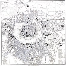
The Vienna Ring Road (German: Ringstraße, pronounced [ʁɪŋˌʃtʁaːsə] ⓘ, lit. ring road) is a 5.3 km[1] (3.3 mi) circular grand boulevard that serves as a ring road around the historic Innere Stadt (Inner Town) district of Vienna, Austria. The road is located on sites where medieval city fortifications once stood, including high walls and the broad open field ramparts (glacis), criss-crossed by paths that lay before them.
It was constructed after the dismantling of the city walls in the mid-19th century. From the 1860s to 1890s, many large public buildings were erected along the Ringstrasse in an eclectic
Because of its architectural beauty and history, the Vienna Ringstrasse has been called the "lord of the ring roads" and is designated by UNESCO as part of Vienna's World Heritage Site.[3][4]
History

This grand boulevard was built to replace the

In 1850, the suburbs or
Since the Ringstraße had always been meant primarily for show, a parallel Lastenstraße (cargo road) was built on the outside of the former glacis. This street is commonly known as 2-er Linie, named after the number "2" in the identifiers of the various streetcar or tram lines which used it. It is still an important traffic thoroughfare.
After some disputes about competence between the government and the municipality, a "City Extension Fund" was created, which was administered by the government. Only the city hall was planned by the city.
During the following years, a large number of opulent public and private buildings were erected. Both the nobility and the plutocracy rushed to build showy mansions and palaces along the boulevard. One of the first buildings was the Heinrichshof, owned by the
One of the earliest art historians to study the Ringstraße is Renate Wagner-Rieger, a professor and alumnus at the University of Vienna.
Famous admirers
- Sigmund Freud was known to take a daily recreational walk around the Ring.
- Adolf Hitler was supposed to be a great admirer of the architecture of this area and that influenced Nazi architecture.[7]
Buildings


Many of the buildings that line the Ringstraße date back to the time before 1870. The following are some of the more notable buildings:
- Vienna State Opera (formerly K.u.K. Hofoper) in neo-romantic style by August Sicard von Sicardsburg and Eduard van der Nüll
- Academy of Fine Arts Vienna
- Palace of Justice
- Theophil Freiherr von Hansen,
- style by Friedrich Schmidt,
- Karl Freiherr von Hasenauer,
- neo-renaissancestyle (a reference to the beginnings of the university system in northern Italy),
- Heinrich Freiherr von Ferstel
- Wiener Börse (Vienna Stock Exchange)
- Urania observatory
- Österreichische Postsparkasse (Postal Savings Bank), in Jugendstil by Otto Wagner
- Museum für Angewandte Kunst(Museum of Applied Arts) in neo-renaissance style by Heinrich Freiherr von Ferstel
- Hotel Imperial (formerly Palais Württemberg)
- Palais Schey von Koromla
- Palais Ephrussi
The only sacred building on the boulevard is the Votivkirche, which was built in dedication after Emperor Franz Joseph had survived an assassination attempt in 1853.
The Winter Palace or
The construction ended only in 1913 with the completion of the Kriegsministerium (Imperial and Royal Ministry of War). At that time, the Ringstraßenstil was already somewhat outdated, as is shown by the Art Nouveau (Jugendstil) inspired Postsparkassengebäude (Postal Savings Society Building) by Otto Wagner opposite the ministry building, which was built at the same time.
The Ringstraße was also generously planned with green spaces and trees, the most notable parks being the
The biggest catastrophe was the fire of the Ringtheater in 1881, in which several hundred people died. It was subsequently demolished and replaced by the emperor's charity building, the Sühnhof, which was built in memory of the more than 300 victims, and inaugurated by Emperor Franz Joseph I. It was destroyed during the bombing of Vienna in 1945; today the municipal police-headquarters is there.
Other buildings that were destroyed or heavily damaged during World War II was the Opera House, the opposite building Heinrichshof which was replaced in the 1950s with the Kärtnerhof. The Urania observatory, the Kriegsministerium and the Parliament building were heavily damaged, and the Burgtheater burned down. The famous Hotel Metropole, which was located at the Franz-Joseph-Kai, was completely destroyed and replaced with a monument to the victims of Nazism.
Sections

The Ringstraße has several sections. It surrounds the central area of Vienna on all sides, except for the northeast, where its place is taken by the Franz-Josephs-Kai, the street going along the Donaukanal (a branch of the Danube). Starting from the Ringturm at the northern end of the Franz-Josephs-Kai, the sections are:
- Schottenring (named after the Schottenstift)
- Universitätsring (university), formerly Dr.-Karl-Lueger-Ring (Karl Lueger)
- Dr.-Karl-Renner-Ring (Karl Renner), formerly Parlamentsring
- Burgring (Hofburg)
- Opernring (Vienna State Opera)
- Kärntner Ring (named after Kärntner Straße, the road that led south to Carinthia)
- Schubertring (Franz Schubert)
- Parkring (Wiener Stadtpark)
- Stubenring (named after the Stubenbastei fortification, part of Vienna's city walls since 1156)
See also
- Vienna Beltwayin the outer districts
Notes
- ^ Vienna's Ringstrasse. Vienna: Sightseeing. Retrieved 2022-07-14.
- ^ "Historicism – the architectural style of the Ringstrasse". The World of the Habsburgs. Retrieved 6 May 2014.
- ^ Malathronas, John (24 April 2015). "Vienna's Ringstrasse: Lord of the ring roads celebrates 150 years". CNN. Retrieved 29 July 2018.
- ^ "Historic Centre of Vienna". UNESCO World Heritage Centre. Retrieved 29 July 2018.
- ISBN 978-1-85828-709-6.
- ^ "From fortification to promenade". The World of the Habsburgs. Retrieved 6 May 2014.
- ^ "Hitler's Vienna". 30 March 2011.
