
Douro
| Douro Duero ( Soria, Castile and León, Spain | |
|---|---|
| • coordinates | 42°0′38″N 2°52′49″W / 42.01056°N 2.88028°W |
| • elevation | 2,157 m (7,077 ft) |
Norte, Portugal | |
• coordinates | 41°8′36″N 8°40′10″W / 41.14333°N 8.66944°W |
• elevation | 0 m (0 ft) |
| Length | 897 km (557 mi) |
| Basin size | 98,400 km2 (38,000 sq mi) |
| Discharge | |
| • location | Porto |
| • average | 700 m3/s (25,000 cu ft/s) |
| • maximum | 17,000 m3/s (600,000 cu ft/s) |
| Discharge | |
| • location | Pocinho |
| • average | 442 m3/s (15,600 cu ft/s) |
| Basin features | |
| Tributaries | |
| • left | |
The Douro (
The scenic
Name
The
The possible origin is the
A folk-etymological derivation suggests that the name comes from the Portuguese or Spanish for "golden".[9][10]
History

In Roman times, the river was personified as a god, Durius.
Part of the drainage basin might have been severely depopulated in the 8th century. According to Claudio Sánchez-Albornoz this was a deliberate act by Alfonso I of Asturias for the defence of his Kingdom, which led the area to be named Repoblación.
The Douro vinhateiro (vine-land) of the
In the 1960s and 1970s, dams with locks were built along the river, allowing river traffic into the upper regions in Spain and along the border.
In 1998,
Geography


It is the third-longest river in the Iberian Peninsula after the
In its Spanish section, the Douro crosses the great
.The most important tributaries in this region are the
The
For 112 kilometres (70 mi), the river forms part of the national border line between Spain and Portugal, in a region of narrow
The Douro fully enters Portuguese territory just after the confluence with the
Human geography

Major Spanish riverside towns include
. The most populous cities along the Douro River are Valladolid and Zamora in Spain, and Porto and Vila Nova de Gaia in Portugal. The latter two are located at the mouth of the Douro at the Atlantic Ocean.In Portugal, the Douro flows through the districts of
Economy

These reaches of the Douro have a
Recently, a prosperous tourist industry has developed based on river excursions from Porto to points along the Upper Douro valley.
The
Pocinho is near the very small city of Foz Côa, which is close to
Dams
Fifteen dams have been built on the Douro to regulate the water flow, generate
The Douro's last five dams are in Portugal, and allow for navigation:
Gallery
-
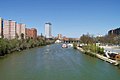
 The Douro inZamora (Spain)
 -
 ThePisuerga River (tributary to the Duero) in Valladolid
 -
 The Upper Douro valley where Port wine grapes grow
 -
 The typical rabelo boat and Porto historical district in background
 -
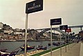 Port wine signs by the Douro River
 -
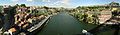
 Panoramic view ofOporto
 -
 The river between Porto and Vila Nova de Gaia
 -
 The river nearRégua, Portugal
 -
 Douro Internacional near Miranda do Douro
 -
 Arribes del Duero near Aldeadávila
 -
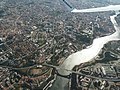
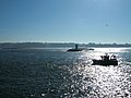
 The river mouth in Porto
 -
 Over Porto
 -
 Douro Estuary
 -
 Looking across the river mouth from Foz do Douro to Vila Nova de Gaia (Atlantic Ocean on the right)
 -
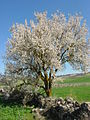 Typical almond tree, mostly seen along the river in Portugal
.jpg)

.jpg)


.jpg)


See also
References
- ^ "Douro". The American Heritage Dictionary of the English Language (5th ed.). HarperCollins. Retrieved March 31, 2019.
- ^ "Douro". Collins English Dictionary. HarperCollins. Retrieved March 31, 2019.
- ^ "Douro" (US) and "Douro". Lexico UK English Dictionary. Oxford University Press. Archived from the original on 2020-07-30.
- ^ "Douro". Merriam-Webster.com Dictionary. Retrieved March 31, 2019.
- S2CID 245777871.
- ^ Robert Ferguson (1862). The River-names of Europe. Williams & Norgate. pp. 26–.
- ^ a b Xavier Delamarre, Dictionnaire de la langue gauloise, Éditions Errance, 2003, p. 151 - 152
- ^ a b Albert Dauzat, Gaston Deslandes et Charles Rostaing, Dictionnaire étymologique des noms de rivières et de montagnes en France, Klincksieck, Paris, 1978, p. 41b.
- ^ Nick Timmons, Portugal (1994), p. 99: "The Douro... the Golden River (d'ouro means 'of gold')..."
- ^ DK Eyewitness Travel Guide Portugal (2016), p. 239: "...the Douro or "Golden River" weaves its scenic path through deep-cleft gorges..."
- ^ "Spanish-Portuguese Albufeira Convention". United Nations. Retrieved 18 February 2015.
- ^ a b "Rivers in Spain". www.iberianature.com. Retrieved 12 August 2017.
- ^ a b "Guide to Spain CO-CU". www.iberianature.com. Retrieved 12 August 2017.
- . Retrieved 6 January 2023.
External links
- DouroValley.eu Main tourism website
- IPTM – Instituto Portuário e dos Transportes Marítimos, Delegação do Norte e Douro
- Rio Douro Sound Map
| International | |
|---|---|
| National | |
| Geographic | |