
River Orwell
| River Orwell | |
|---|---|
 | |
| Location | |
| Country | England |

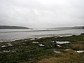
The River Orwell flows through the
The large Orwell Bridge carries the A14 trunk road over the estuary to the south of Ipswich.
Name
In the name Orwell, Or- comes from an ancient river-name—probably pre-Celtic; but -well probably indicates an Anglo-Saxon naming.[2] In A tour through England and Wales, written in 1722, Daniel Defoe calls the river "Orwel" (though he does this inconsistently).[3] He also mentions that "a traveller will hardly understand me, especially a seaman, when I speak of the River Stour and the River Orwell at Harwich, for they know them by no other names than those of Maningtre-Water, and Ipswich-Water". The writer Eric Blair chose the pen name under which he would later become famous, "George Orwell," because of his love for the river.[4][5] A few miles north of the Orwell is another Suffolk river, the Ore, and Orfordness, the village port of Orford with its historic castle.
Estuary
The estuary flows through different sections as it makes its way down from Ipswich to the sea:[6]
Cliff Reach
Freston Reach
Redgate Hard is located here. This hard is probably post medieval.[7]
-
 April 2008 showing remains of Redgate Hard
 -
 January 2008


Downham Reach
A whale was beached on Downham Reach around 1816.
-
 Beached whale as recorded by George Frost
.jpg)
Potters Reach
-
 Potters Reach, August 2009

Buttermans Bay
Long Reach
Lower Reach
At this point the Stour flows into the Orwell by Shotley Point.[6]
Sailing
The Orwell provides a popular venue for
Since the 1970s marinas have opened at
Ipswich Barrier
Ipswich has in the past been affected by flooding, both fluvial flooding from water passing down the river Gipping, and tidal flooding from tidal surges passing up the estuary of the Orwell, with the river becoming much narrower near to the entrance to Ipswich Docks. In order to reduce this risk, the Environment Agency implemented a programme of works expected to cost a total of £58 million to improve the flood defences on both banks of the tidal river and of the Port of Ipswich. The work included the construction of the Ipswich tidal barrier, and because the work affected the right of navigation on the New Cut, the section of the Orwell immediately above the barrier site, it required an order to be issued under the Transport and Works Act 1992. The Ipswich Barrier Order was issued by the Secretary of State for the Environment, Food and Rural Affairs in August 2012.[8]
The barrier consists of a rising sector gate, 66 feet (20 m) wide and 30 feet (9 m) high, located just to the west of the entrance to the wet dock. In November 2014, a contract for £28 million was awarded to VBA, a joint venture between VolkerStevin, Boskalis Westminster and Atkins, for construction of the barrier and associated flood defences on the banks of the river. The barrier is designed to prevent tidal surges passing further up stream, and to enable downstream fluvial flows to be controlled. It provides better flood protection to some 1,500 homes and 400 business properties. The river at the barrier site was 180 feet (55 m) wide, but in order to allow the construction of the barrier and the commissioning of the gate, a large cofferdam, 98 feet (30 m) square, extending 20.6 metres (68 ft) downwards into the chalk bed of the river, was formed against the east bank. This left a much narrower channel to allow the river flows to reach the estuary and boats to continue to access the river above the barrier site.[8]
The sector gate was designed by the German firm IRS, and was manufactured in Holland by Hollandia. Once assembled, it was floated across the North Sea, and lifted into the concrete support structure by a 600 tonne crane. The position of the gate is moved by two hydraulic cylinders, and it can be positioned to prevent a tidal surge passing up stream, or to regulate the downstream flow of the river. The concrete structure was tied in to the eastern bank early in the project, but ties to the western bank had to wait until the gate had been commissioned. At that point, both the flow of the river and boats could pass through the new structure, and the side channel could be blocked off.[8] The new barrier was officially opened in early February 2019 by Therese Coffey, Floods Minister at the Department for Environment, Food and Rural Affairs, by which time the cost of the project had risen to £67.4 million. While most of the funding came from the Environment Agency, some was also provided by Ipswich Borough Council, the New Anglia Local Enterprise Partnership, the Regional Flood and Coastal Committee, and UK Power Networks.[9]
The Yangtse Incident
The 1957 film
Bibliography
- VBA (1 October 2017). "Ipswich Tidal Barrier Project (2017)". Water Projects online. Archived from the original on 10 May 2021.
References
- ^ White, William (1844). History, gazetteer, and directory of Suffolk, and the towns near its borders. R. Leader. pp. 62–63.
- ^
A D Mills: A dictionary of British place-names. Oxford: Oxford University Press, 2003. ISBN 0-19-852758-6
- ^ Daniel Defoe, A tour through England and Wales, J.M. Dent and Sons Ltd, London (1959) Available online here
- ^ "George Orwell Biography". Archived from the original on June 21, 2006. Retrieved 2006-07-09.
- ISBN 0-671-02811-1.
- ^ a b WashingtonEdmund George Irving (1966). Admiralty Chart No 2693 Approaches to Harwich. London: Admiralty.
- ^ "WHR 053 - Redgate Hard -". Suffolk Heritage Explorer. Suffolk County Council. Retrieved 19 February 2023.
- ^ a b c VBA 2017.
- ^ "£67.4 million Ipswich tidal flood barrier officially opened". Government Press Release. 8 February 2019. Archived from the original on 23 July 2019.
- ^ "The Yangtse Incident:the story of HMS Amethyst". British Lion Films. British Lion Holdings Ltd. Archived from the original on 7 August 2016. Retrieved 27 April 2016.