
Saigon River
| Saigon River | |
|---|---|
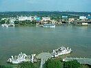
 View of the Saigon River in downtown Ho Chi Minh City in 2013 | |
 | |
| Native name | Sông Sài Gòn (Vietnamese) |
| Location | |
| Country | Vietnam |
| Province | Bình Phước, Tây Ninh, Bình Dương, Ho Chi Minh City |
| Physical characteristics | |
| Source | Tonlé Chàm |
| • location | Lộc Ninh district |
Nhà Bè River | |
• location | District 7, Ho Chi Minh City |
• coordinates | 10°44′38″N 106°45′33″E / 10.74389°N 106.75917°E |
| Length | 251 km (156 mi) [1] |
| Basin size | 4,788 square kilometres (1,849 sq mi)[1] |
The Saigon River (
During 1981–1985, a dam was constructed across the river, just north of the town of Dầu Tiếng, to form the Dầu Tiếng Reservoir for irrigation purposes. Saigon River is joined, southeast of downtown Ho Chi Minh City (formerly named Saigon) by the Đồng Nai River. The river is important to Ho Chi Minh City as it is the main water supply as well as the host of Saigon Port, with a total cargo volume loaded and outloaded of more than 35 million metric tons in 2006.
The
The Saigon River Tunnel running under the river, connecting District 1 in the west to the Thủ Thiêm New Urban Area in the east, was opened to traffic on November 20, 2011. Since its completion, it has been the longest cross-river tunnel in Southeast Asia.[2] The river is also crossed by the Thu Thiem Bridge, Ba Son Bridge, and Phu My Bridge.[3]
The Saigon Waterbus service launched in 2017, connecting District 1 with Thu Duc District.[4]
-
 View of the river in early 20th century
 -
 The Thủ Thiêm ferry crossing on Saigon river, which stopped operating in 2012
 -
 Port of Saigon in District 4, Ho Chi Minh City
 -
 View of the river in Bình Thạnh district, with the Landmark 81 in the center
 -
 Saigon River and the Thanh Da Canal
 -
 View of the river in Ho Chi Minh City
 -
 View of the river at the border of Thủ Dầu Một and Củ Chi district
 -
 The river in Thủ Dầu Một
 -
 The river in Củ Chi district, next to the site of the Bến Dược Memorial Temple
 -
 View of the Dầu Tiếng Reservoir


.jpg)
.jpg)
.jpg)

.jpg)
.jpg)
See also
- Bé River
- Đồng Nai River
- Dầu Tiếng Reservoir
- Nhà Bè River
References
- ^ a b "Quyết định số 1989/QĐ-TTg ngày 01 tháng 11 năm 2010 của Thủ tướng Chính phủ về việc ban hành Danh mục lưu vực sông liên tỉnh".
- ^ "The longest cross-river tunnel in southeast Asia" Archived 2013-10-22 at the Wayback Machine 2011 Thanh Nien News
- ^ "Ho Chi Minh City's $133mn Thu Thiem 2 Bridge opened to traffic". Tuoi Tre News. 2022-04-28. Retrieved 2022-08-31.
- ^ "Finding Fun and Revelation Aboard Saigon's Wayward Waterbus | Saigoneer". saigoneer.com. Retrieved 2022-08-31.
External links
- "Photos of the Saigon River - View from District 2 (An Phu and Thao Dien Wards)". SaigonNezumi.com. Archived from the original on 1 October 2011. Retrieved 4 August 2013.
- Toàn cảnh sông Sài Gòn River
| International | |
|---|---|
| National | |
| Other | |