
Salmas
Salmas
سلماس | ||
|---|---|---|
City | ||
| Salmas | ||
ZIP code 58811 ≤ 58XXX ≤ 58991 | ||
| Area code | 44 | |
Salmas (
At the 2006 census, its population was 79,560 in 19,806 households.[6] The following census in 2011 counted 88,196 people in 23,751 households.[7] The latest census in 2016 showed a population of 92,811 people in 27,115 households.[2] According to the 2019 census, the city's population is 127,864.[8] The majority of the population is composed of Azerbaijanis and Kurds[9] with some Armenians, Assyrians, and Jews.[10]
Etymology
The original name of Salmas was Dilman, which is probably related to the Daylamites who sometimes controlled the region. In the 20th-century, it was known as Shapur.[11]
History

Salmas is located in the historic Azerbaijan region.[11] Its archaeological relics, which date as far back as the Urartian kingdom (860 BC–590 BC), attest to its long human habitation.[11] Salmas was part of the Armenian province of Nor Shirakan (also known as Persarmenia),[11][12] which was inhabited by Armenians.[12] A rock relief erected during the reign of the Sasanian monarch Ardashir I (r. 224–242) is located in the Khan-Takhti village near Salmas. This rock relief illustrates two akin scenarios in which a standing man receives a ring from a man riding a horse.[13]
The standing men's names are subject to interpretation, but the horsemen are typically considered to be Ardashir I and his son and heir,
Two archeological sites showing inhabitation during the Sasanian era has been found near Salmas. One of them is known as Haftan Tepe, which contains Sasanian-era pottery akin to those found in
Salmas is described by the 10th-century Islamic geographers
Salmas was in ruins during the lifetime of the Muslim scholar Yaqut al-Hamawi (died 1229), but according to the geographer Hamdallah Mustawfi (died after 1339/40), it was once again thriving in the middle of the 14th-century. The vizier Khwaja Taj al-Din Ali Shah Tabrizi had rebuilt the town's 8,000-steps long wall during the reign of Ilkhanate ruler Ghazan (r. 1295–1304), and Salmas's revenues—presumably those of the entire district—amounted to 39,000 dinars, a large amount.[11]
Another mention of the city was made in 1281, when its Assyrian bishop made the trip to the consecration of the
In the Battle of Salmas on 17–18 September 1429, the
However, the area was retaken by the Kara Koyunlu in 1447 after the death of Shah Rukh.In March 1915 Cevdet Bey ordered 800 Assyrians of Salmas to be killed.[19] Mar Shimun, the Patriarch of the Assyrian Church of the East was murdered by the Kurdish chieftain Simko Shikak in Salmas in March 1918.[20][21][22]
Around the advent of the 1910s,
Geography
Salmas in early atlases
The atlases below are some of the earliest maps to have been ever sketched to show the territory and originality of the name of Salmas and are some of the strongest documents providing proofs to some basic facts about the city including its existence and identity.
-
![Salmas in 1724[24] Homann Map of "Persian Empire" at the Time of Safavid dynasty • Modified by Hassan Jahangiri](//upload.wikimedia.org/wikipedia/commons/thumb/7/7c/Salmas_in_Circa1700-Circa1720_Homann_Map_of_%22Persian_Empire%22_-_Jomann_Imperium_Periscum.jpg/281px-Salmas_in_Circa1700-Circa1720_Homann_Map_of_%22Persian_Empire%22_-_Jomann_Imperium_Periscum.jpg) Salmas in 1724Persian Empire" at the Time of Safavid dynasty• Modified by Hassan Jahangiri
Salmas in 1724Persian Empire" at the Time of Safavid dynasty• Modified by Hassan Jahangiri -
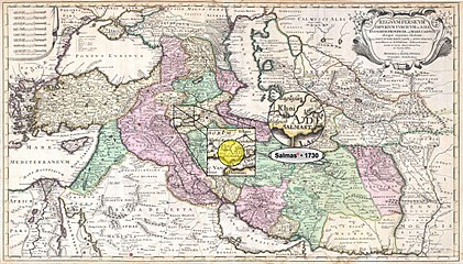 Salmas in 1730Persian Empire" at the Time of Safavid dynasty• Modified by Hassan Jahangiri
 -
 Salmas in 1747Persian Empire" at the Time of Afsharid dynasty• Modified by Hassan Jahangiri
 -
 Salmas in 1814Persian Empire" at the Time of Qajar dynasty• Modified by Hassan Jahangiri
 -
 Salmas in 1818 Pinkerton Map of "Turkey in Asia, Iraq, Syria, and Palestine" (Concurred with the Time of Qajar dynasty) • Modified by Hassan Jahangiri
![Salmas in 1724[24] Homann Map of "Persian Empire" at the Time of Safavid dynasty • Modified by Hassan Jahangiri](/File:Salmas_in_Circa1700-Circa1720_Homann_Map_of_%22Persian_Empire%22_-_Jomann_Imperium_Periscum.jpg)


Climate
Under the Köppen climate classification, using the 0 °C (32 °F) isotherm, Salmas features a continental climate (Dsa), and is thus one of the few cities in the Middle East and one of the 6 in the country with this categorization.
| Climate data for Salmas (Weather Station Located in Khoy Airport) [1987-2017] | |||||||||||||
|---|---|---|---|---|---|---|---|---|---|---|---|---|---|
| Month | Jan | Feb | Mar | Apr | May | Jun | Jul | Aug | Sep | Oct | Nov | Dec | Year |
| Record high °F (°C) | 49 (9) |
61 (16) |
73 (23) |
90 (32) |
92 (33) |
99 (37) |
106 (41) |
109 (43) |
102 (39) |
93 (34) |
74 (23) |
67 (19) |
109 (43) |
| Mean daily maximum °F (°C) | 30.6 (−0.8) |
34.0 (1.1) |
45.3 (7.4) |
58.1 (14.5) |
68.4 (20.2) |
78.4 (25.8) |
86.9 (30.5) |
86.4 (30.2) |
79.0 (26.1) |
64.8 (18.2) |
50.9 (10.5) |
37.0 (2.8) |
60.0 (15.5) |
| Daily mean °F (°C) | 21.6 (−5.8) |
24.6 (−4.1) |
36.1 (2.3) |
48.0 (8.9) |
56.8 (13.8) |
65.1 (18.4) |
73.0 (22.8) |
72.1 (22.3) |
64.6 (18.1) |
52.7 (11.5) |
40.6 (4.8) |
28.4 (−2.0) |
48.6 (9.2) |
| Mean daily minimum °F (°C) | 12.7 (−10.7) |
14.9 (−9.5) |
26.6 (−3.0) |
37.4 (3.0) |
44.8 (7.1) |
51.1 (10.6) |
58.6 (14.8) |
57.6 (14.2) |
49.1 (9.5) |
40.3 (4.6) |
30.4 (−0.9) |
20.1 (−6.6) |
37.0 (2.8) |
| Record low °F (°C) | −18 (−28) |
−21 (−29) |
−17 (−27) |
−8 (−22) |
13 (−11) |
40 (4) |
52 (11) |
47 (8) |
37 (3) |
20 (−7) |
−7 (−22) |
−17 (−27) |
−21 (−29) |
| Average rainfall inches (mm) | 1.22 (31) |
1.45 (37) |
2.07 (53) |
3.54 (90) |
6.47 (164) |
4.84 (123) |
2.44 (62) |
1.71 (43) |
2.13 (54) |
2.2 (56) |
1.54 (39) |
1.22 (31) |
30.83 (783) |
| Average snowfall inches (cm) | 3.45 (8.8) |
2.35 (6.0) |
2.32 (5.9) |
0 (0) |
0 (0) |
0 (0) |
0 (0) |
0 (0) |
0 (0) |
0 (0) |
0 (0) |
1.96 (5.0) |
10.08 (25.7) |
| Average rainy days | 7.9 | 9.1 | 11.8 | 12 | 13.1 | 8.4 | 3.9 | 3.3 | 5.3 | 5.9 | 6.5 | 7.3 | 94.5 |
| Average snowy days | 2.75 | 2.25 | 1.75 | 0 | 0 | 0 | 0 | 0 | 0 | 0 | 0 | 2.25 | 9 |
| Average relative humidity (%)
|
75.0 | 64.3 | 55.8 | 48.6 | 43.3 | 38.4 | 37.0 | 36.0 | 39.8 | 47.0 | 52.9 | 66.4 | 50.4 |
| Mean monthly sunshine hours | 147.6 | 202.8 | 239.8 | 311.2 | 352.6 | 343.4 | 356.3 | 355.6 | 276.9 | 202.6 | 150.8 | 153.2 | 3,092.8 |
| Source: "Weather Trends 360".[25] Weatherbase[26] "World Weather Online".[27] | |||||||||||||
| Year | Population | ±% |
|---|---|---|
| 1930 | ~8000 | — |
| 1934 | ~7000 | — |
| 1956 | 13,161 | — |
| 1966 | 21,703 | +64.9% |
| 1976 | 27,638 | +27.3% |
| 1986 | 50,573 | +83.0% |
| 1996 | 65,416 | +29.3% |
| 2006 | 89,617 | +37.0% |
| 2011 | 97,060 | +8.3% |
| 2016 | 101,441 | +4.5% |
| 2021 | N/A | — |
| Note: The data presented of 1976 and earlier (1956–1976) are from the censuses before Iranian Revolution and the data of 1986 and later (1986–2016) are from the censuses after it. The data for the years 1920 and 1924 are not of any censuses. Sources: "Population and Housing Census". Statistical Center of Iran. (used for censuses of 2006 and later), "An Analysis to the Urban System of West Azerbaijan Province During the Years 1956 till 2006". Urban Ecology Researches. (used for censuses of 1996 and earlier; the amounts are obtained from the data given in "Real Population" columns!), "Location and Geography of the City". Salmas County Municipality.[permanent dead link] (used for data of the years 1920 and 1924) | ||
Notable people
- Catholicosof the Armenian Apostolic Church
- Chaldean Catholicbishop of Salmas
- Patriarch of Babylon of the Chaldeans
- Raffi (1835–1888) – Armenian novelist
- Paul Bedjan (1838–1920) – Chaldean Catholic priest and orientalist
- Abraham Guloyan (1893–1983) – Politician
- Murad Kostanyan (1902–1989) – Actor
- Fenerbahce SK) and in a European league
- Ardeshir Ovanessian (c. 1905–1990) – Communist leader
- Timur Lakestani (1915–2011) – aka Father of Iranian Electrical Industry
- Jafar Salmasi (1918–2000) – weightlifter
- Emmanuel Agassi (1930–2021) – boxer and father of Andre Agassi
- Hadi Asghari (b. 1981) – football player
Gallery
-
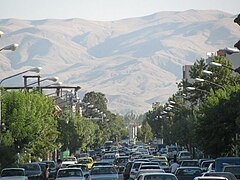 Overall View of Imam St. and Shahrdari Sq.
 -
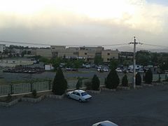
 Islamic Republic Blvd., Near Panahi Technical School
 -
 Khan Takhti-Rd near Salmas
 -
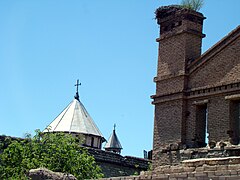 The Haftvan Church
 -
 Chaldean Catholic Church in Salmas
 -
-
 Salmas
 -
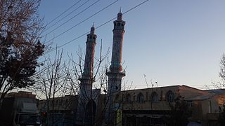 An angled front view of Salmas Imam Khomeini Prayer House, 2017
 -
 A view of Nation Park in a Winter night, 2016


See also
References
- ^ OpenStreetMap contributors (16 February 2024). "Salmas, Salmas County" (Map). OpenStreetMap. Retrieved 16 February 2024.
- ^ a b "Census of the Islamic Republic of Iran, 1395 (2016)". AMAR (in Persian). The Statistical Center of Iran. p. 04. Archived from the original (Excel) on 30 August 2022. Retrieved 19 December 2022.
- ^ "List of all entries". Assyrian Languages. Retrieved 14 March 2020.
- ^ Habibi, Hassan (7 July 1369). "Approval of the organization and chain of citizenship of the elements and units of the country divisions of West Azerbaijan province, centered in the city of Urmia". Lamtakam (in Persian). Ministry of Interior, Council of Ministers. Archived from the original on 20 December 2023. Retrieved 20 December 2023.
- .
- ^ "Census of the Islamic Republic of Iran, 1385 (2006)". AMAR (in Persian). The Statistical Center of Iran. p. 04. Archived from the original (Excel) on 20 September 2011. Retrieved 25 September 2022.
- ^ "Census of the Islamic Republic of Iran, 1390 (2011)". Syracuse University (in Persian). The Statistical Center of Iran. p. 04. Archived from the original (Excel) on 20 January 2023. Retrieved 19 December 2022.
- ^ "2016 Population and Housing Census". Statistical Center of Iran. Retrieved 20 May 2017.
- ^ "..:: شهرداری سلماس ::". Archived from the original on 26 December 2014. Retrieved 26 December 2014.
- ^ http://thegraduatesocietyla.org/images/author-padia-others.pdf [bare URL PDF]
- ^ a b c d e f g h Bosworth 1995.
- ^ a b Ghodrat-Dizaji 2010, p. 75.
- ^ a b Shavarebi 2014, p. 115.
- ^ Shahinyan 2016, pp. 194–195.
- ^ Ghodrat-Dizaji 2007, p. 90.
- ^ a b Peacock 2017.
- ISBN 90-04-09796-1
- ISBN 90-04-09796-1
- S2CID 198820452.
- ISBN 978-90-04-09793-3.
- ISBN 0-415-94766-9
- ISBN 0-7864-1375-1
- ^ a b Atabaki 2006, p. 70.
- ^ "Imperii Persici in omnes suas provincias nova tabula geographica". Library of Congress.
- ^ "Weather Trends 360". Weather Trends International, Inc. Retrieved 26 February 2017.
- ^ "Salmas, Iran". Weatherbase. Retrieved 6 December 2020.
- ^ "World Weather Online". Data provided by WorldWeatherOnline.com. Retrieved 6 June 2017.
Sources
- ISBN 978-1860649646.
- ISBN 978-90-04-09834-3.
- Ghodrat-Dizaji, Mehrdad (2007). "Administrative Geography of the Early Sasanian Period: The Case of Ādurbādagān". Iran: Journal of the British Institute of Persian Studies. 45 (1): 87–93. S2CID 133088896.
- Ghodrat-Dizaji, Mehrdad (2010). "Ādurbādagān during the Late Sasanian Period: A Study in Administrative Geography". Iran: Journal of the British Institute of Persian Studies. 48 (1): 69–80. S2CID 163839498.
- Peacock, Andrew (2017). "Rawwadids". Encyclopædia Iranica, online edition. New York.
{{cite encyclopedia}}: CS1 maint: location missing publisher (link) - Shahinyan, Arsen (2016). "Northern Territories of the Sasanian Atropatene and the Arab Azerbaijan". Iran and the Caucasus. 20 (2): 191–203. .
- Shavarebi, Ehsan (2014). "A Reinterpretation of the Sasanian Relief at Salmās". .
External links
| Capital | |||||||||||||||||
|---|---|---|---|---|---|---|---|---|---|---|---|---|---|---|---|---|---|
| Districts |
| ||||||||||||||||